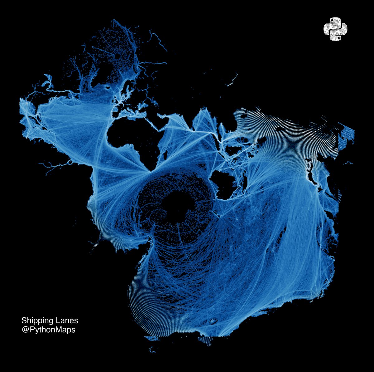
Here is an old favourite. Shipping lanes. This time drawn using the Spilhaus projection, which centers the map on Antartica and presents the worlds oceans as one continuous body. Created by Athelstan F. Spilhaus, a South African-American geophysicist and oceanographer in 1942
English