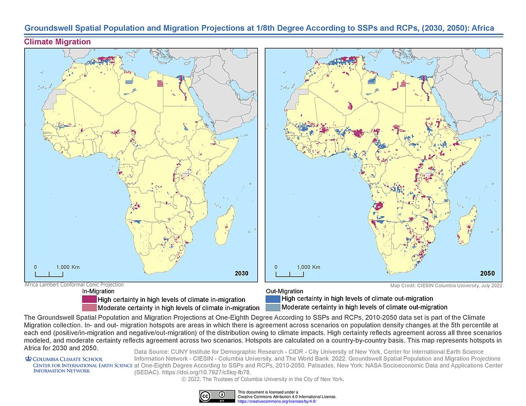
CIESIN

2.9K posts

CIESIN banner
CIESIN

CIESIN

@ciesin

Transdisciplinary research+data center of @columbiaclimate studying human-environment interactions. Free data, map svcs+tools. Our main program is NASA SEDAC.

Palisades NY-Lamont Campus Beigetreten Kasım 2008
168 Folgt1.7K Follower
CIESIN retweetet
NASAEarthdata
NASAEarthdata@NASAEarthData·
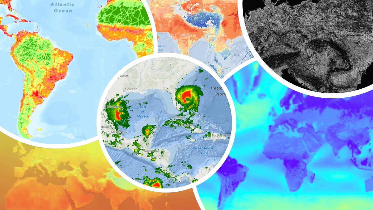
Data from NASA's Socioeconomic Data and Applications Center reveal what Earth observations mean for the lives of people and communities on our planet. Read how socioeconomic data put the who into the scientific questions of what, where, when, why, and how: go.nasa.gov/45bmNhb
NASAEarthdata tweet media
English
0
3
19
1.8K
CIESIN retweetet
NASAEarthdata
NASAEarthdata@NASAEarthData·
#VIIRS Version 2 Land Surface Temperature and Emissivity data are here! VNP21s, and the new NOAA-20 VJ121s come in various temporal and spatial resolution options. VIIRS LST is shown here over Sudan and South Sudan. Visit NASA’s #LPDAAC to learn more: bit.ly/3PCW9th
NASAEarthdata tweet media
English
0
9
40
3.4K
CIESIN retweetet
SDGs Today
SDGs Today@sdgstoday·
Thanks again to @JamesGib7 for joining today's session of the Eco Ambassadors summer program! James shared the #geospatial analyses and data visualizations used at @CIESIN, and inspired our students to begin working with #GIS to work towards the UN's #SDGs 💻
SDGs Today tweet media
English
1
3
5
419
CIESIN retweetet
SDGs Today
SDGs Today@sdgstoday·
Today the Eco Ambassadors learned #AGOL basics & how @JamesGib7 from @CIESIN uses GIS & data visualization for #SDG indicators🗺️ Our students have started developing ideas for their very own #StoryMaps that will showcase these new #geospatial data viz skills and creativity!
SDGs Today tweet mediaSDGs Today tweet mediaSDGs Today tweet media
English
2
8
10
1.9K
CIESIN retweetet
NASAEarthdata
NASAEarthdata@NASAEarthData·
Webinar on 6/21: Increasing NASA Earth Science Data Accessibility with GIS Join us to learn about #GIS initiatives, services, and capabilities by NASA’s Earth Science Data Systems (ESDS) program to improve your data workflow. To register: go.nasa.gov/3MQkn07
NASAEarthdata tweet media
English
1
21
53
6.2K
CIESIN retweetet
NASAEarthdata
NASAEarthdata@NASAEarthData·
GLanCE has grown! The Global #LandCover Mapping and Estimation product now covers Europe. This product includes seven land classes or a greenness index as shown in this image over Venice, Italy. Visit NASA’s #LPDAAC to learn more: bit.ly/3I8cjXB
NASAEarthdata tweet media
English
0
6
28
3.4K
CIESIN
CIESIN@ciesin·
@ciesin’s #NASAsedac Hazards Mapper displays near-real-time data on fires, earthquakes, air quality+for the U.S., flood+tornado warnings. It can also estimate population in proximity to a hazardous event and identify nearby facilities at risk. sedac.ciesin.columbia.edu/data/collectio…
English
0
0
0
177
CIESIN retweetet
Extreme Temperatures Around The World
Brutal heat in Sub Saharan Africa with temperatures up t 46/47C these days. Today the highest was 46.4C at Podor in Senegal. Hottest April day on records at Akjoujt in Mauritania with 45.3C. This station had already beaten its record for March.
Extreme Temperatures Around The World tweet media
English
1
218
343
51.6K
CIESIN retweetet
Columbia Climate School
Columbia Climate School@columbiaclimate·
This Saturday May 6 2-6pm ET, join our Climate Imaginations Network for inaugural Spring Festival (at Lenfest Plaza/The Forum at Columbia) to build connections, engage with climate stories and art, and cultivate joy and strength. Learn more/register today! climateimaginations.org/festival
Columbia Climate School tweet media
English
0
5
8
1.4K