
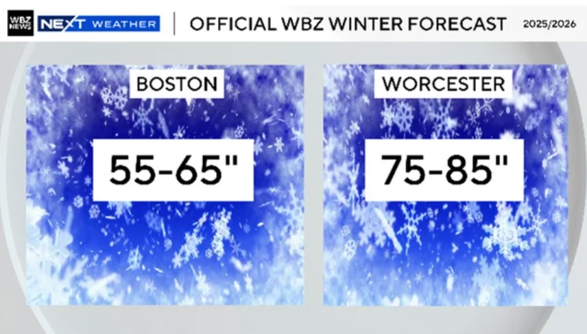
Hatteras 54
1.9K posts

TRENDING: #Eagles first-round wide receiver Makai Lemon has gone viral for his interview after he was drafted.
Lemon was originally projected to be a top 10 pick, but fell significantly due to his attitude and the way he portrayed himself in public.
👀
English


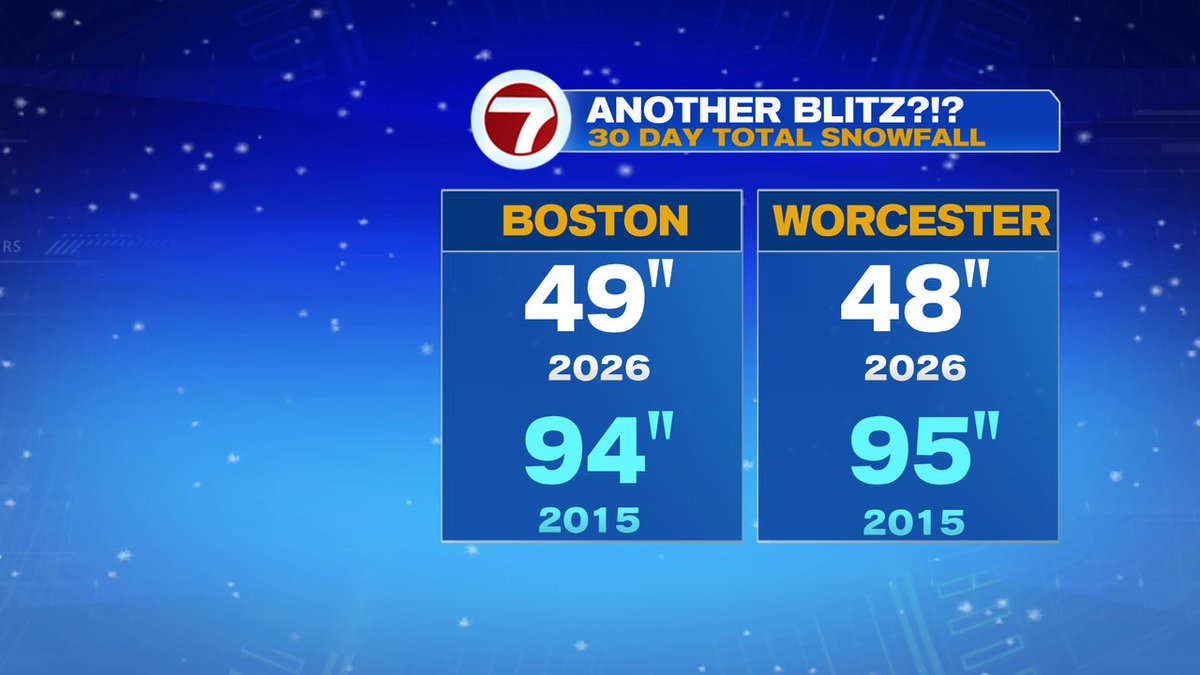
Might just retire from winter outlooks after this year
Colder than avg ✅
Snowfall ✅
Coldest month vs avg being December ✅


English
@ericfisher It’s almost peeper season. I love the sound they make
English
If you have feeders out, you should notice many more feathered friends arriving Sunday into next week
Rounds of southwesterly winds this time of year are prime for migration 🐦⬛
English
@growingwisdom Once we change the clocks ahead we should leave them there .
English


@BradyBGWX You have been money this winter . I trust your forecast more then many professional mets.
English

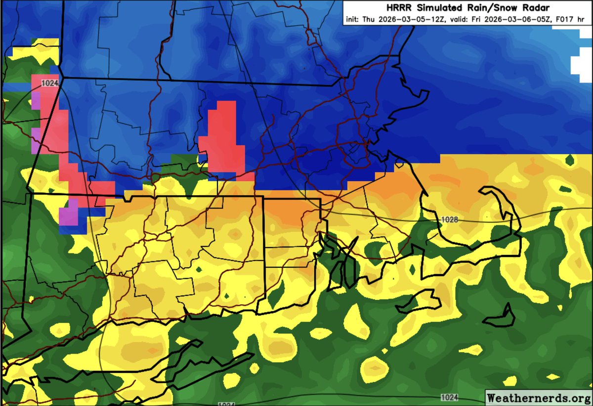
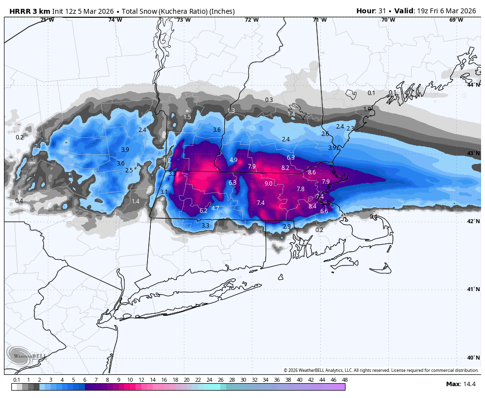
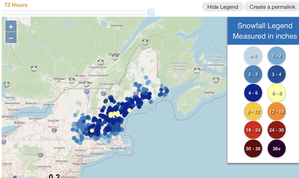
Not technically an “official” snow map grade(whatever that means lol) but overall satisfied with the thoughts we put out.
Especially picking up on the burst of snow across NE PA, S CT, SE Mass, N NJ, and HV(that didn’t make it to the NWS reports but saw from many of u on social media.
No official map grade but I would’ve went A- to A range(not A+).
Again if it wasn’t great as u all know I still likely would revisit just to try to be accountable.
More to track now
BGWX@BradyBGWX
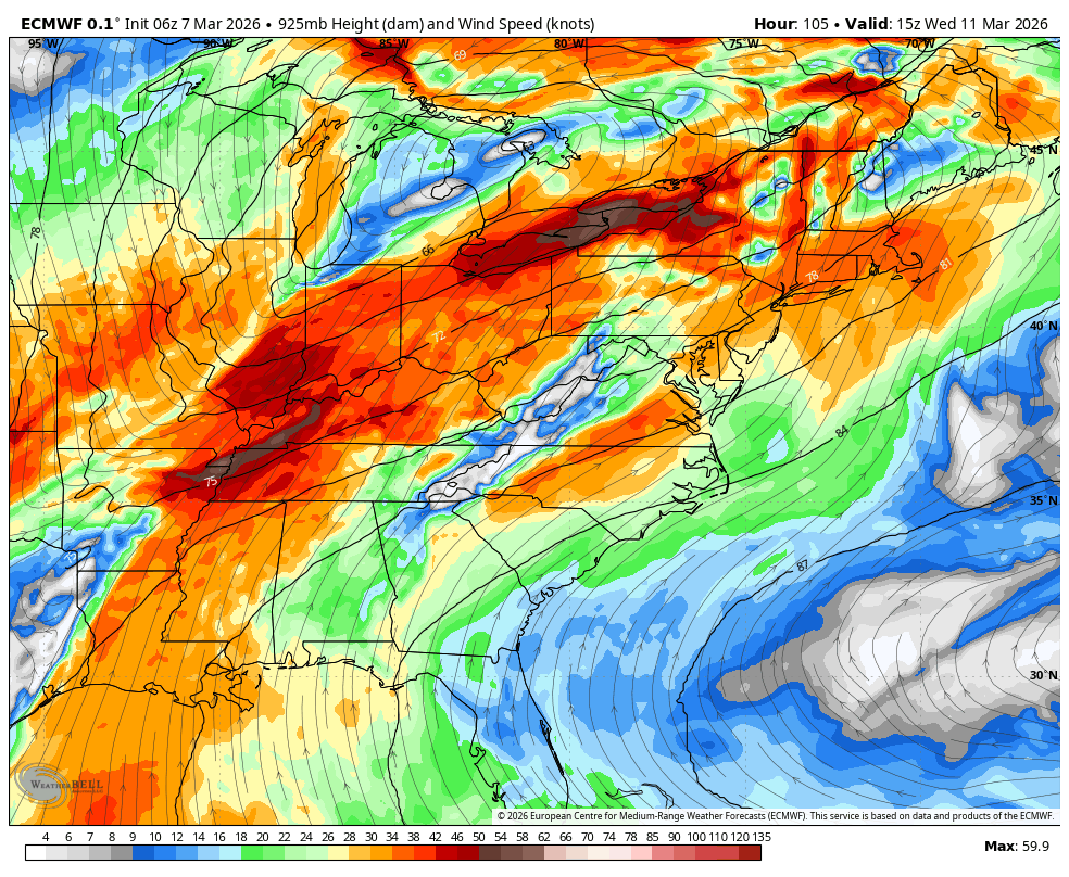
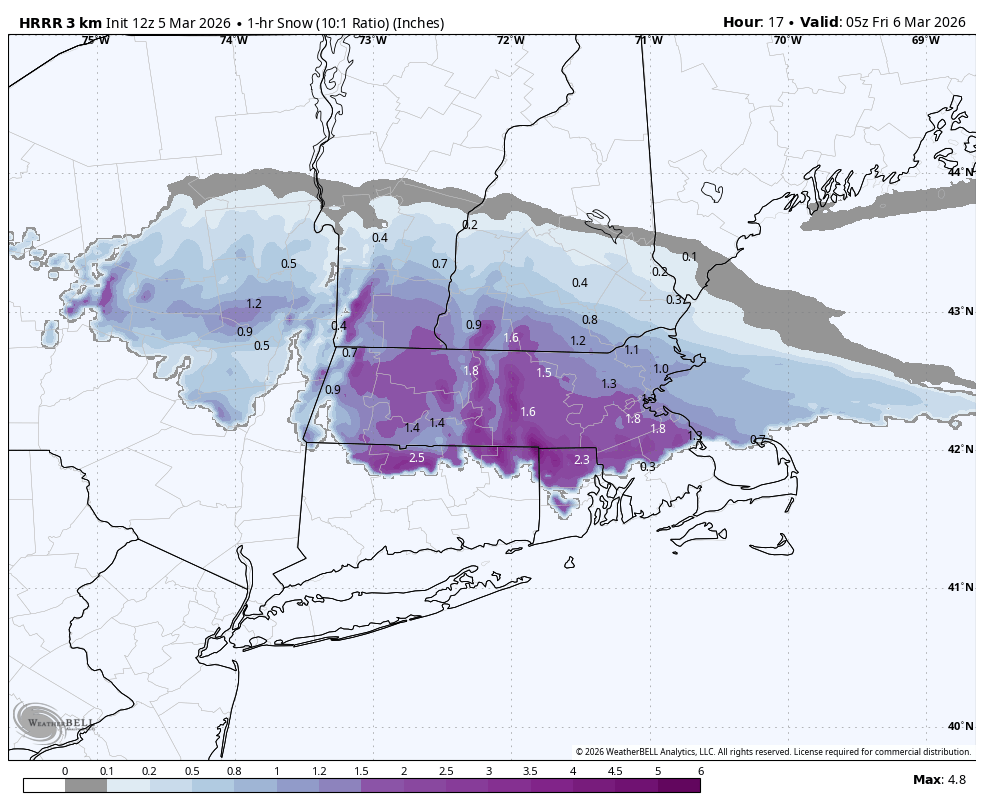
Some rough thoughts for tomorrow. Don’t mind the mess. Close margins between dynamic cooling and surface temps will make a notable difference in terms of specifics for snow and ice(but more so ice). Mixed bag setup with all precip types on the table(snow and ice favored for the interior). Expecting early dismissals, delays and closures as a result. This will be a pasty snow too btw. Check pinned(will be posted shortly) for YouTube video breakdown of the setup and my thoughts beyond as well.
English
@BostonWxConsult @JayB7897 @PeterLovasco @mike61400 that sun angle at it again, not letting it accumulate on pavement 😆
English
You gotta appreciate the cyclical nature of weather
Had a couple cold snowy winters in 2013-14 & 2014-2015, followed by a big El Nino developing for the following year
Doing it again 11 years later
Eric Webb@webberweather
This year’s El Niño will very likely become a strong event. Yet another series of strong westerly wind bursts over the central Pacific will trigger a new downwelling Kelvin wave that further suppresses the thermocline in the East Pacific a few months now.
English
@KevinBoston25 @boston25 Are you staying in the area or moving out of state?
English

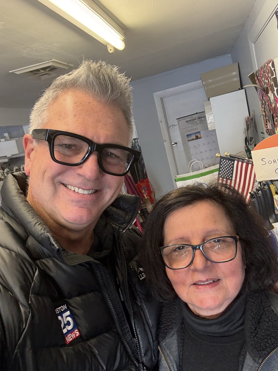
I’m going to miss this young lady! I’ve been going to M & M Cleaners in Dedham near @boston25 for many years. She is the sweetest! All my tailoring and shirts were done perfectly. I won’t be coming anymore after this week, so Thank you!
English
@PeterLovasco @mike61400 @JayB7897 @AntsMAGAweather @derek_adesso @MESNOWman1 @JimCantore Yes i am. It could snow in July and i would love it
English

@54Hatteras @mike61400 @JayB7897 @AntsMAGAweather @derek_adesso @MESNOWman1 @JimCantore U batshit crazy! 🤣🤣
English
Lol. @JayB7897 @AntsMAGAweather @mike61400 @derek_adesso @MESNOWman1 @JimCantore enough right guys! Oh hey Jay waving the white flag for ya buddy. Lol.

English
@mike61400 @PeterLovasco @JayB7897 @AntsMAGAweather @derek_adesso @MESNOWman1 @JimCantore Ne we need a few more good ones
English
English
@jreineron7 I know it sounds carzy. But it does not seem like we had that amount in that time period. The graphic surprised mr
English

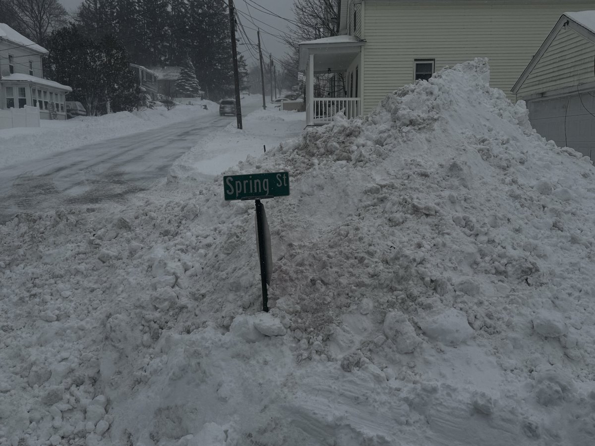
Quite the run of snow these past 30 days. Boston picking up its average SEASONAL amount of 49" in those 30 days. 2015 says Child, please. #7news
English
@BostonWxConsult Good one last grand finally of winter them bring on spring
English

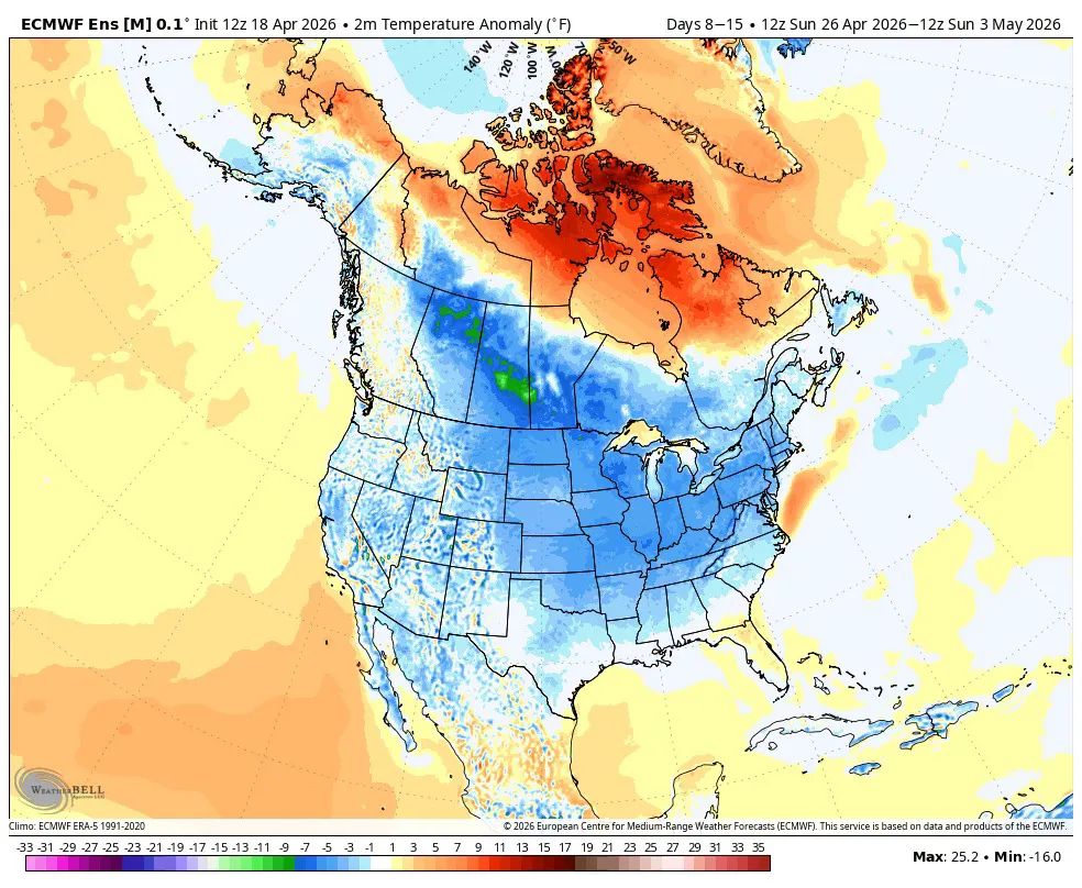
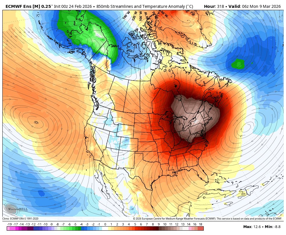
Next 10-12 days look cold & possibly snowy, but after that it looks like we finally warm up for a bit. 2nd week of March shown:
English
@KassyAkiva If these machines had chains on the tires that would not happen
English

Definitely comes and goes in booms and busts
MR🚀EL🌟ON🇺🇸@elonX3799
@ericfisher It seems to me, and maybe I'm wrong, but winters such as this one, as well as 2014-15, and other notable winters in my memory, such as 2010-11, and some of the winters here in the 90s, we seem to "lock in", and it snows easily. Other years, we can't seem to "buy a snowflake."
English