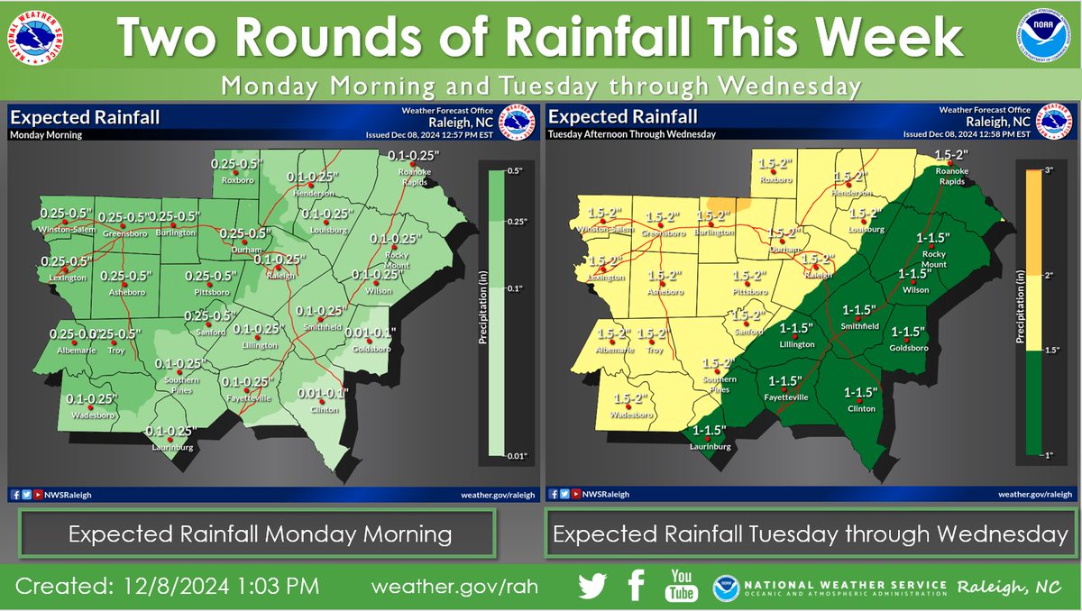
With heavy rain moving across parts of North Carolina today and tomorrow, be extremely cautious when driving through flooded roadways and make sure to avoid distractions! It only takes a small amount of water on the roads to create very dangerous conditions. #TurnAroundDontDrown
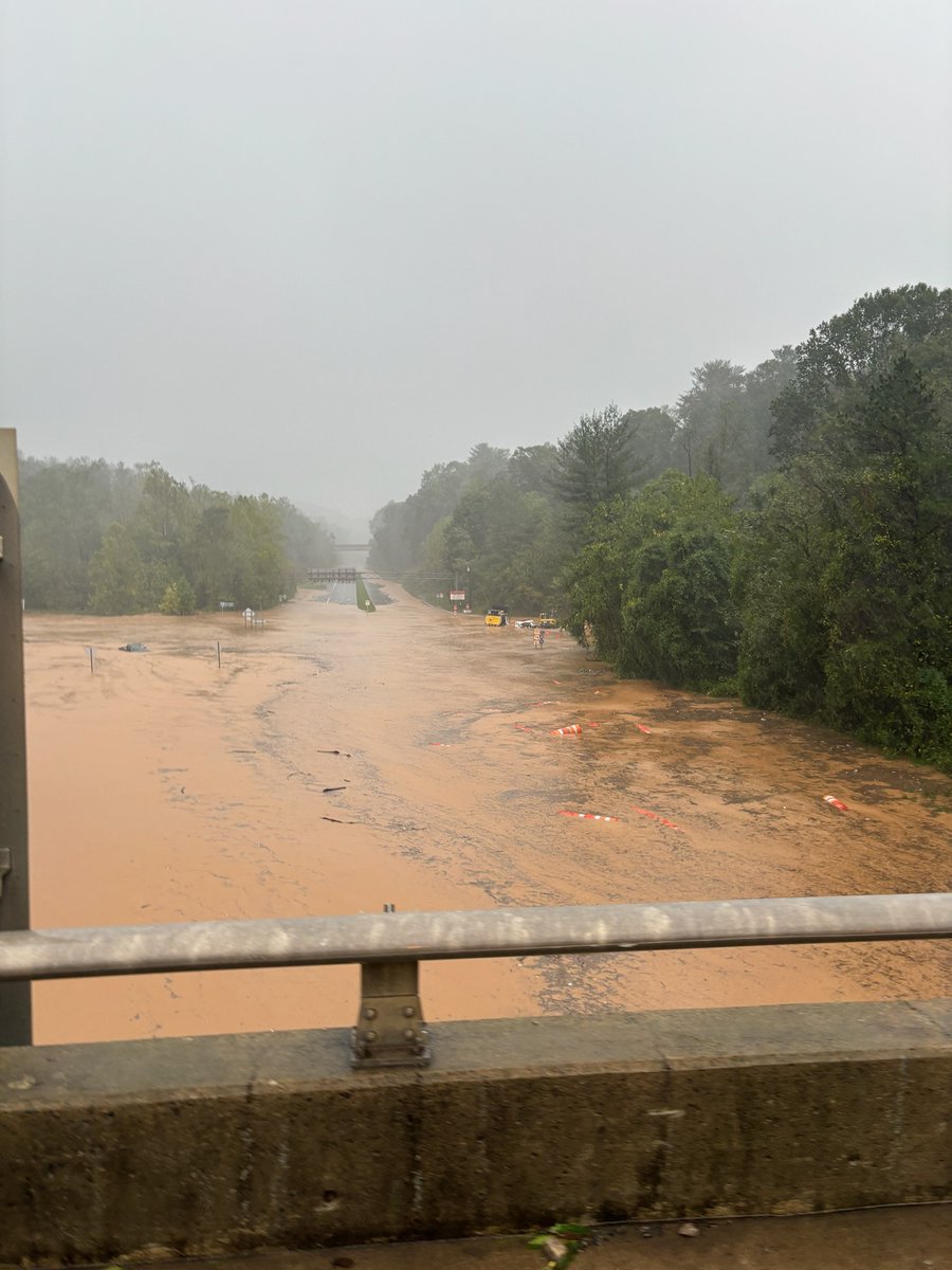
⬇️ You're standing on I-40, looking down at U.S. 74.
❗ The Blue Ridge Parkway bridge is in the distance.
⚠️ Don't go out today. It's not safe.
#Helene#ncwx
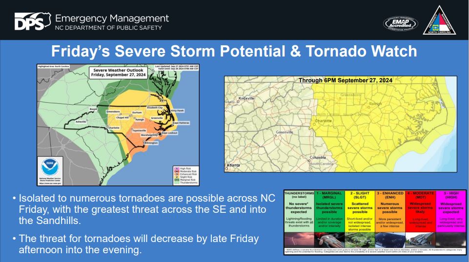
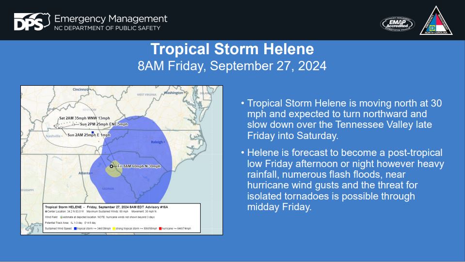
• The SPC has placed portions of NC under an Enhanced Risk with much of NC under a Slight Risk for tornadoes through Friday. Rain bands from Helene will continue to move through NC into the afternoon hours. The threat for tornadoes will begin to decrease by late afternoon.
Friday Morning Hazardous #ncwx Update
A historic rainfall event is underway for portions of the NC mountains. Widespread catastrophic flooding expected. Heavy rainfall, tropical storm force wind gusts and the threat for tornadoes will remain as #Helene travels northward.
*URGENT MESSAGE*
This will be one of the most significant weather events to happen in the western portions of the area in the modern era. Record flooding is forecasted and has been compared to the floods of 1916 in the Asheville area.
Today, Governor Roy Cooper declared a State of Emergency ahead of Hurricane Helene as North Carolina prepares for severe weather impacts that could threaten life and property across North Carolina through Saturday morning. Read the full release ➡️ ncdps.gov/news/press-rel…
NHC's experimental forecast cone for 🌀#Helene shows the wide expanse of inland areas, beyond the cone itself, that are at risk of hurricane- and tropical-storm-force winds.
What do you think of this new graphic? We want your feedback: surveymonkey.com/r/ExpInlandWWo…
Additional info on this new product: noaanhc.wordpress.com/2024/08/12/nhc…
🌧️ Scattered showers/storms today will become increasingly likely through the afternoon hours.
🌩️ A band of heavy rain will spread into the southern half of central North Carolina early Friday morning and bring several risks to our area as #Helene approaches. #NCwx
State Farm agents in eastern North Carolina work tirelessly to help families by connecting them with child seat inspections, providing food, and assisting nonprofits. It was great to meet with local agents and learn about their positive impact on our economy and community. Their contributions are truly invaluable.
Good Monday morning! We're looking at one last afternoon and evening of showers and thunderstorms, a few which may produce damaging wind gusts. Once this round passes, cooler and drier weather settles over the region for the rest of the work week.
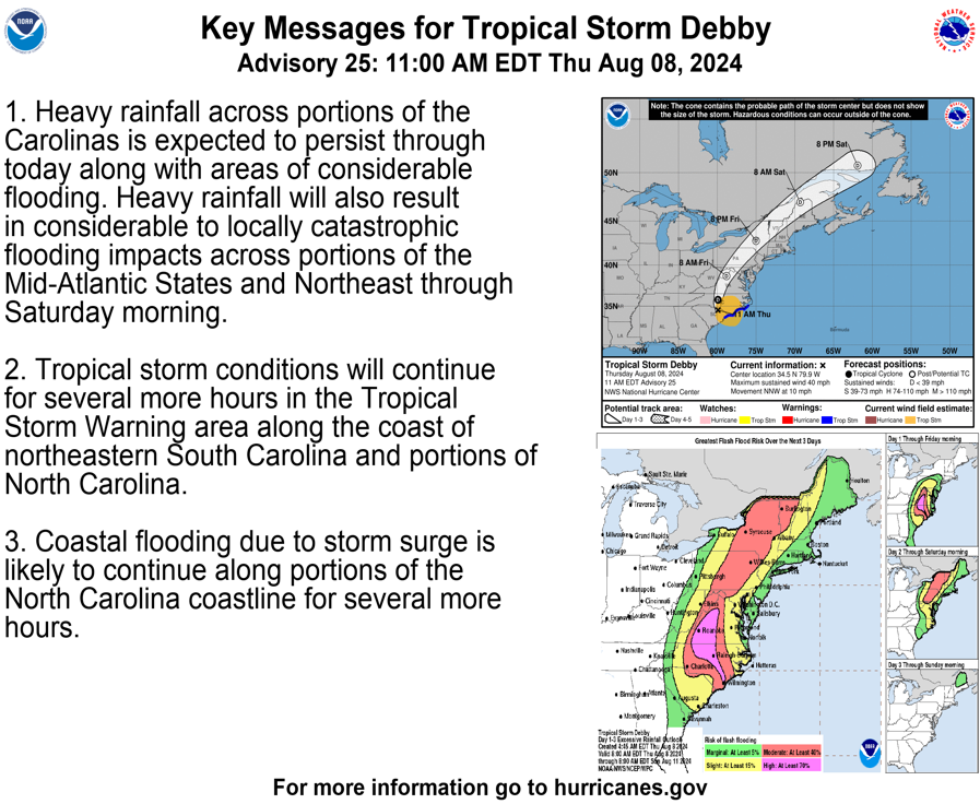
11am EDT Tropical Storm #Debby Key Messages. The most significant threat with Debby continues to be flash flooding from heavy rainfall...worst today across portions of North Carolina and Virginia, and Friday farther north in the Mid-Atlantic & Northeast U.S.