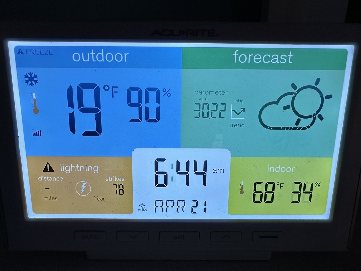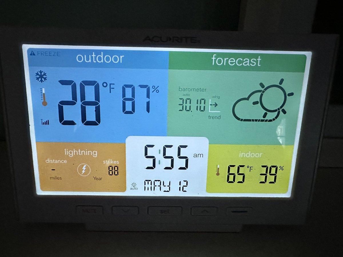
Hard to tell the difference between upstate New York and Reykjavík, Iceland, this weekend. #NYwx


Oneonta, NY 🇺🇸 English
Brian Donegan
37.3K posts
@WxBrianD
Meteorologist based in upstate New York | Husband | Dad | M.S., geosciences @msstate | B.S., meteorology @sunyoswego | Country music fan
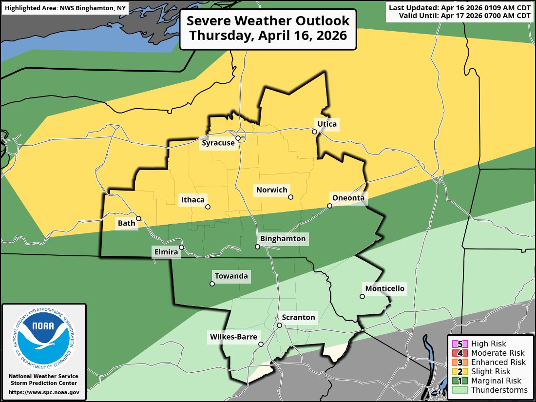
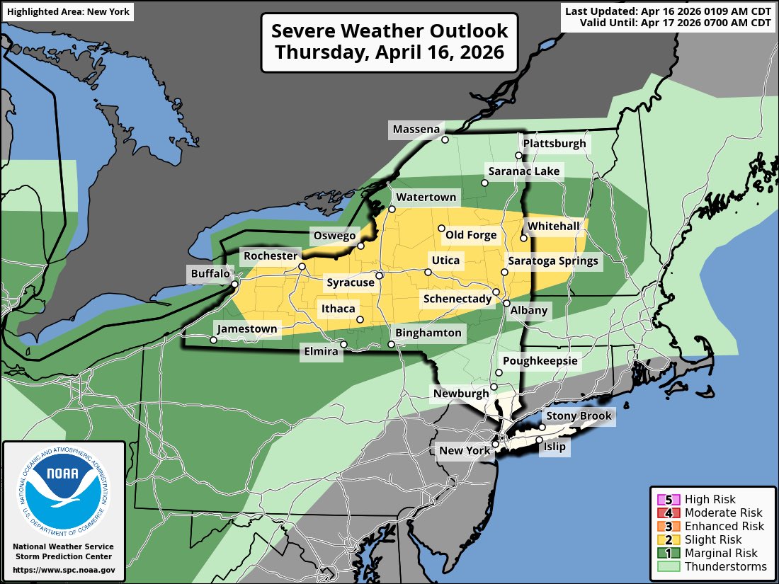
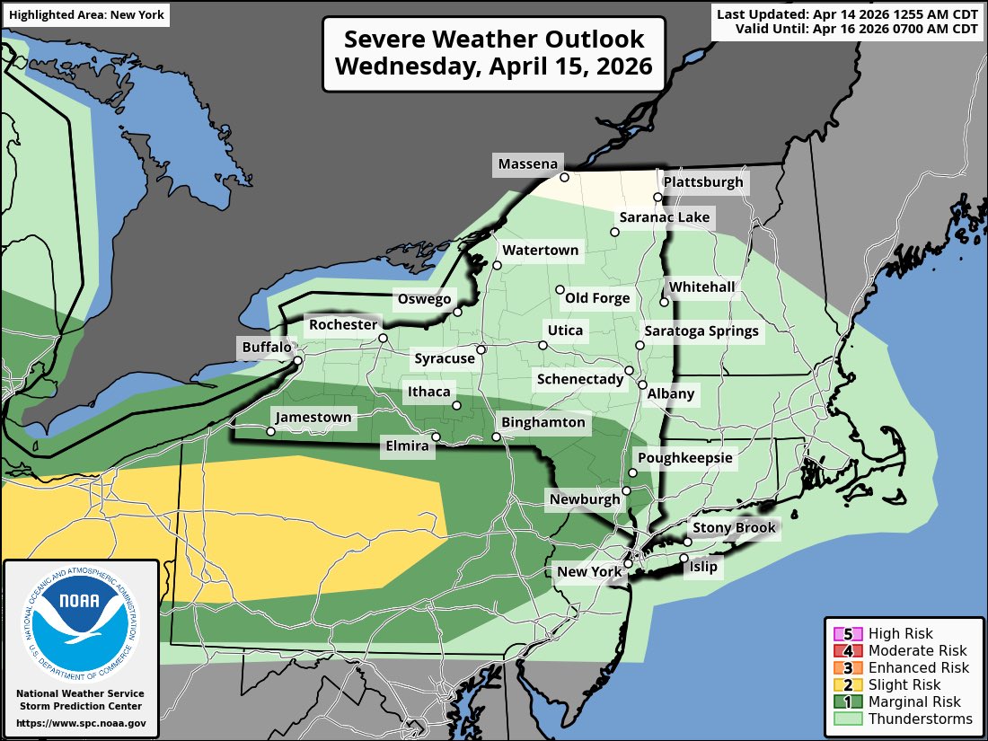
Good evening! A cool, rainy Saturday is ahead. 🌧️ Rain moves SW to NE through the day (see map for timing). Expected Rainfall: Central NY: 0.5"–1" NE PA: 0.5"–1.5" Highs in the upper 40s to mid-50s (near 60° north). Details: weather.gov/bgm


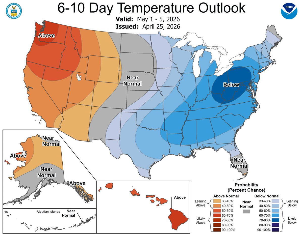
Good morning! Cool and mainly cloudy weather will continue today along with a few isolated showers. For those who like warmer weather, temperatures will significantly warm-up the second half of the upcoming weekend, and especially the beginning of next week. #NYwx #PAwx