@hansakwast@qgisnl@qgis Super resultaat, en bereikt in zo'n korte tijd. Voornamelijk dankzij onze bedrijfsleden die laten zien dat stabiliteit en doorontwikkeling van QGIS hen wat waard is! Dank daarvoor! 🙏👍
#QGIS folks, I am looking for an pyqgis example of exporting a layer as geopackage that uses the taskmanager to avoid freezing QGIS. I know I saw one last friday, but now I don't find it anywhere... Not even using the browser history 😭
I had to dig out some old #openstreetmap#dataviz this morning and forget how impactful the build-up of v1 contributions are. Watch additions sparkle in this Europe version, I'll post more throughout the week for those who may have missed it the first time round. #map#animation
I'll be in Nairobi next week from 16-23 September to teach a workshop. If anyone on my TL will be around in Kenya - I'd love to meet up for a coffee. Do DM me and we can figure out a time/place.
I want to export a list of parameters from QGIS (I know how to do this), but I want to format the export as a nice table I can just copy/paste in a Word document.
I want to use PYQGIS, so I am thinking some way to produce a DOCX file per export from JSON or XML maybe.
Ideas?
@antoniolocandro img = QImage(100, 100, QImage.Format_ARGB32_Premultiplied)
QApplication.clipboard().setImage(img)
(Please ask such QGIS questions somewhere else than on twitter, cause the answers get lost here)
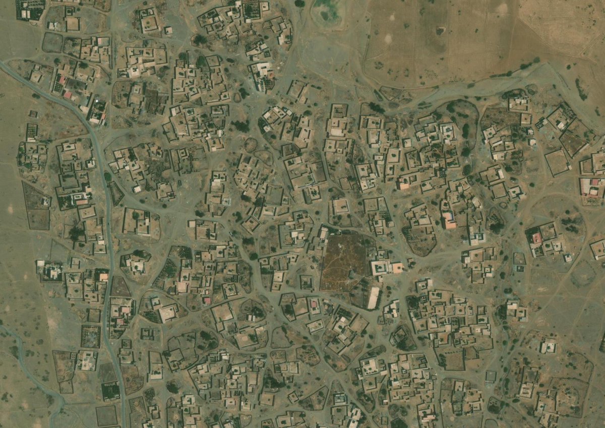
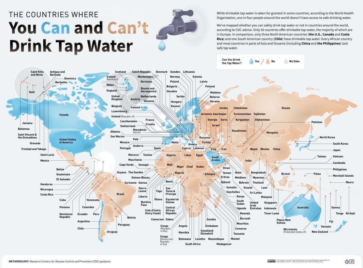
People affected by the Morocco #earthquake are not on the map. See satellite image of epicentre of earthquake, showing homes. The map is blank. Map here: #description" target="_blank" rel="nofollow noopener">tasks.hotosm.org/projects/15468… @hotosm@TheMissingMaps
@justb4@geoinformatie De gemeente- en woonplaatsgrenzen in de BAG zitten inderdaad vol met dit soort fouten doordat de polygonen niet topologisch maar individueel (want per gemeente) en met verschillende software zijn bewerkt. Dit is irritant, maar ook erg lastig om nog op te lossen.
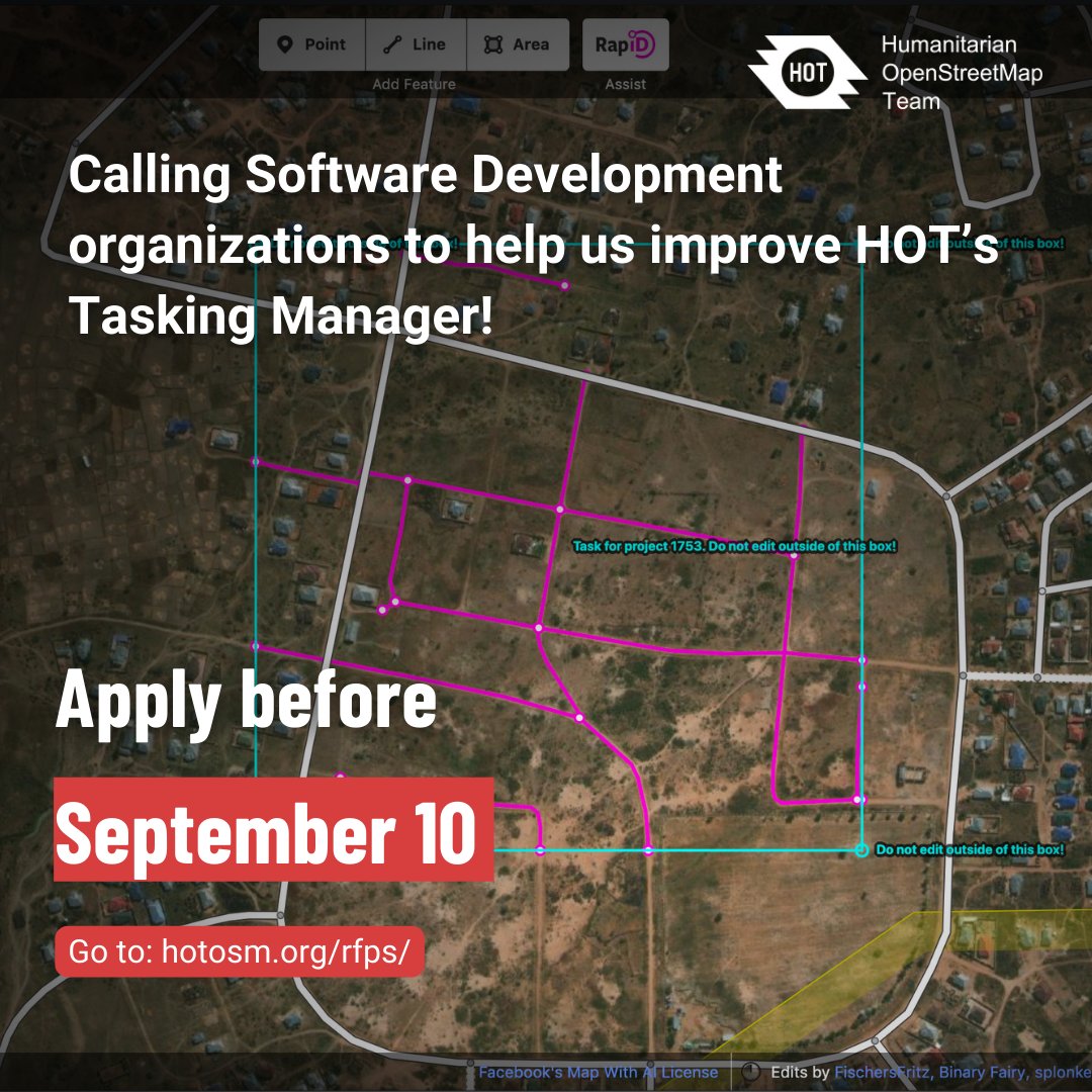
🌍 🔍 We're looking for Software Development Organizations to collaborate with us in taking the HOT Tasking Manager to the next level!
Proposals are open until September 10, 2023.
Full terms of reference here 👇🏽hotosm.org/rfps/software-…
De Nederlandse foss4g.nl wordt dit jaar gehouden in Middelburg, op de schitterende locatie van de provincie.
De provincie Zeeland heet iedereen welkom, organisatie is in handen van de stichting OSGeoNL. Samen met jou maken we hier een geweldige opengeodag van.
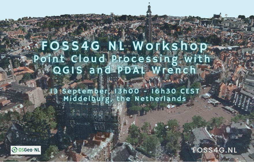
Already registered for the @foss4gnl 2023 conference on 13 & 14 September in Middelburg? There are workshops and presentations in Dutch & English. I'll give a workshop on the latest #pointcloud processing tools in #qgis. Programme & registration: foss4g.nl@osgeonl
De planning voor de workshops en de talks voor de FOSS4GNL staan nu online en zijn hier te vinden:
Workshop: foss4g.nl/workshops/
Talks: foss4g.nl/conference/
We zijn super blij met het programma wat we hebben staan en hopen dat er wat leuks bij zit voor iedereen!