Dustin Carlino

728 posts

Dustin Carlino banner
Dustin Carlino

Dustin Carlino

@CarlinoDustin

Speculative cartographer at @turinginst and @activetraveleng. Creating A/B Street & other software to build towards places with more sustainable transportation

London انضم Ağustos 2019
335 يتبع904 المتابعون
Dustin Carlino
Dustin Carlino@CarlinoDustin·
@robinlovelace In case you're using it in Scotland, try out cnt.scot -- it's got extra contextual layers and prioritisation metrics for picking neighbourhoods
English
0
0
6
72
Robin Lovelace
Robin Lovelace@robinlovelace·
It's been many months since I last tried out the Low Traffic Neighbourhood (LTN) design tool developed by Dustin Carlino, and I'm blown away, it's on another level 🤯 Responsive, informative, intuitive, accessible, fully open. See for yourself here: a-b-street.github.io/ltn
Robin Lovelace tweet media
English
1
2
15
1.1K
Jean-David Génevaux (TFC)
@CarlinoDustin Thank you! Sometimes, I wonder how many prototypes you have on the back burner :D. Instead of the building footprint, one might also use a cadastre (if there's a digital one available). (anyway, do you also have an alt account on bsky ?)
English
1
0
0
14
Jean-David Génevaux (TFC)
@CarlinoDustin Hey Dustin. I was wondering if a tool that auto measure the minimal width of each street using OSM exists. Would you know? It would allow to immediatly know what types of infrastructure is possible. I think that OSM has all the info required, no?
English
1
0
0
13
Dustin Carlino
Dustin Carlino@CarlinoDustin·
@_TFCx_ I'll keep you posted if I end up working on this idea more, and if you find any other methods, I'd love to hear about them!
English
1
0
1
4
Dustin Carlino
Dustin Carlino@CarlinoDustin·
@_TFCx_ And then plug into something like streetmix.net to figure out the required width of something you want to build. The building footprints (or other "obstacles") probably have to be somewhat accurate for this to work well, and it only makes sense in an urban area
English
1
0
1
4
Dustin Carlino أُعيد تغريده
Anna Zanchetta
Anna Zanchetta@AnnaZanke·
🗺️ HOT Global Telemapathon 2024 🎉 Join us for a 24-hour livestream event on December 4th (12 2-hour sessions), celebrating open mapping to drive humanitarian impact. Register for the event here tinyurl.com/telemapathon24 (with @aleesteele) #OpenStreetMap @hotosm
Anna Zanchetta tweet media
English
0
4
5
582
Dustin Carlino
Dustin Carlino@CarlinoDustin·
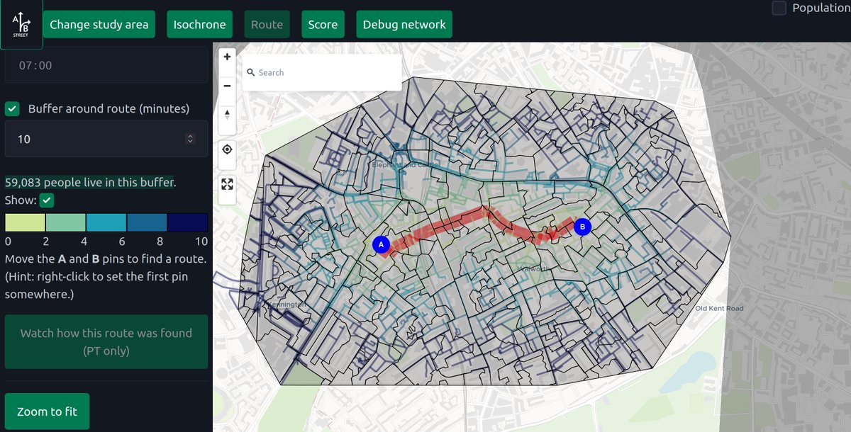
How much traditional #GIS analysis can happen totally in the browser, using #flatgeobuf, #rust, #wasm, #openstreetmap, and a new @turinginst project for collating census data? This is output area-level population counts intersected with a 10min walking buffer around the red route
Dustin Carlino tweet media
English
2
6
52
2K
Joe Lane
Joe Lane@joeAlane·
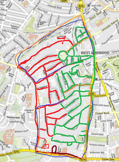
West Norwood LTN - Red access from Leigham Court - Green from Norwood Road/Knights Hill New eg driving routes in blue and orange. Think it would need improved bus routes eg From Leigham Court Road down to Brixton @LambethLivingSt @MalcolmClark77
Joe Lane tweet media
English
15
1
7
1.5K
Robin Lovelace
Robin Lovelace@robinlovelace·
This could be handy for anyone developing applications for citizen science involving collecting geo data.
Kyle Walker@kyle_e_walker

New in the dev version of #rstats {mapgl}: support for the @Mapbox Draw plugin, allowing you to draw points, lines, and polygons on your map In Shiny, the plugin returns an sf object that you can pass to downstream analyses on a custom area Check out the video for a preview!

English
1
6
28
2.3K
Dustin Carlino
Dustin Carlino@CarlinoDustin·
@rupestrecampos Thanks, good idea! I'm using an r-tree and union find to build up sets of polygons that should get dissolved, but then during the actual unioning, not doing any pruning to find pairs of merge yet. An rtree or grid should help
English
0
0
0
42
Ky
Ky@rupestrecampos·
@CarlinoDustin try creating a grid with a reasonable square size and intersect each feature with grid keeping a grid ID. Then merge polygons on the same grid ID only
English
1
0
0
50
Dustin Carlino
Dustin Carlino@CarlinoDustin·
@maeool @idoklein1 I don't know; I've not worked with RAPTOR before. With the above approach, I think I was seeing around 100ms for longer routes across London. I'll try and clean it up in the next few weeks and get a demo online
English
0
0
1
19
Maël
Maël@maeool·
@CarlinoDustin @idoklein1 How much time would it take to compute a routing request e.g. in London with RAPTOR in the browser ?
English
1
0
0
15
Dustin Carlino
Dustin Carlino@CarlinoDustin·
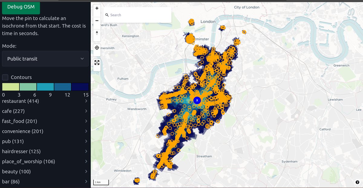
Shortest paths and isochrones using #openstreetmap walking and #GTFS public transit data, directly in the browser with #Rust, #WASM, #MapLibre. The accessible areas when you're right on a tube or major bus line look very different than a transit desert (relatively, for London)
Dustin Carlino tweet mediaDustin Carlino tweet media
English
4
12
95
11K
Dustin Carlino
Dustin Carlino@CarlinoDustin·
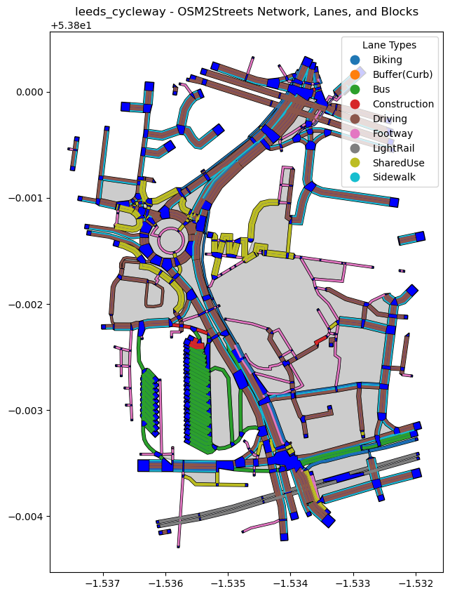
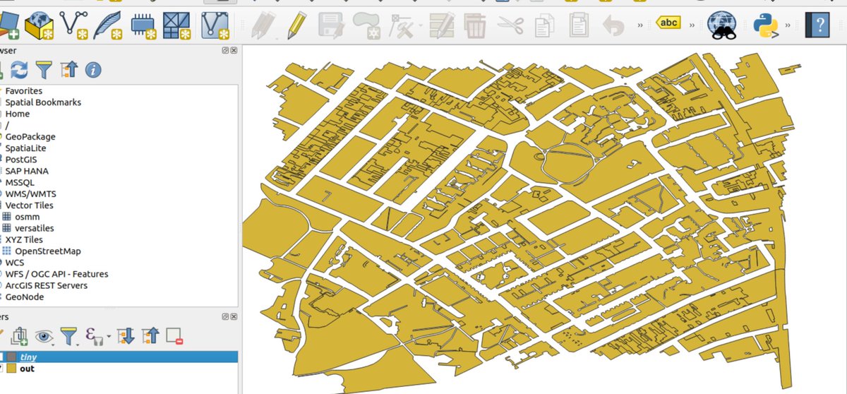
@kayvezk 2) This is proprietary OS data. In some places, there are more openly licensed road / sidewalk polygons available, so having a general method could be handy
English
0
0
0
31
Dustin Carlino
Dustin Carlino@CarlinoDustin·
@kayvezk Thanks for the idea! I tried this, but sadly 1) The road network layer doesn't really line up with the polygon centers too well. It could still maybe work to calculate width from this, even without good centering
Dustin Carlino tweet media
English
1
0
0
63