@WinterStorm2050 can i rub you up and down with a giant stick of butter and then fry you to a crisp golden brown to my enjoyment
English
cg15wx
739 posts

@cycloneguy15
Wx enthusiast from the UK, mainly interested in tropics & severe with a focus (here) on the former.


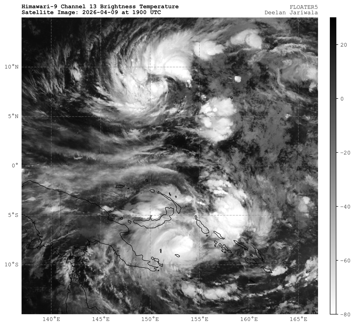
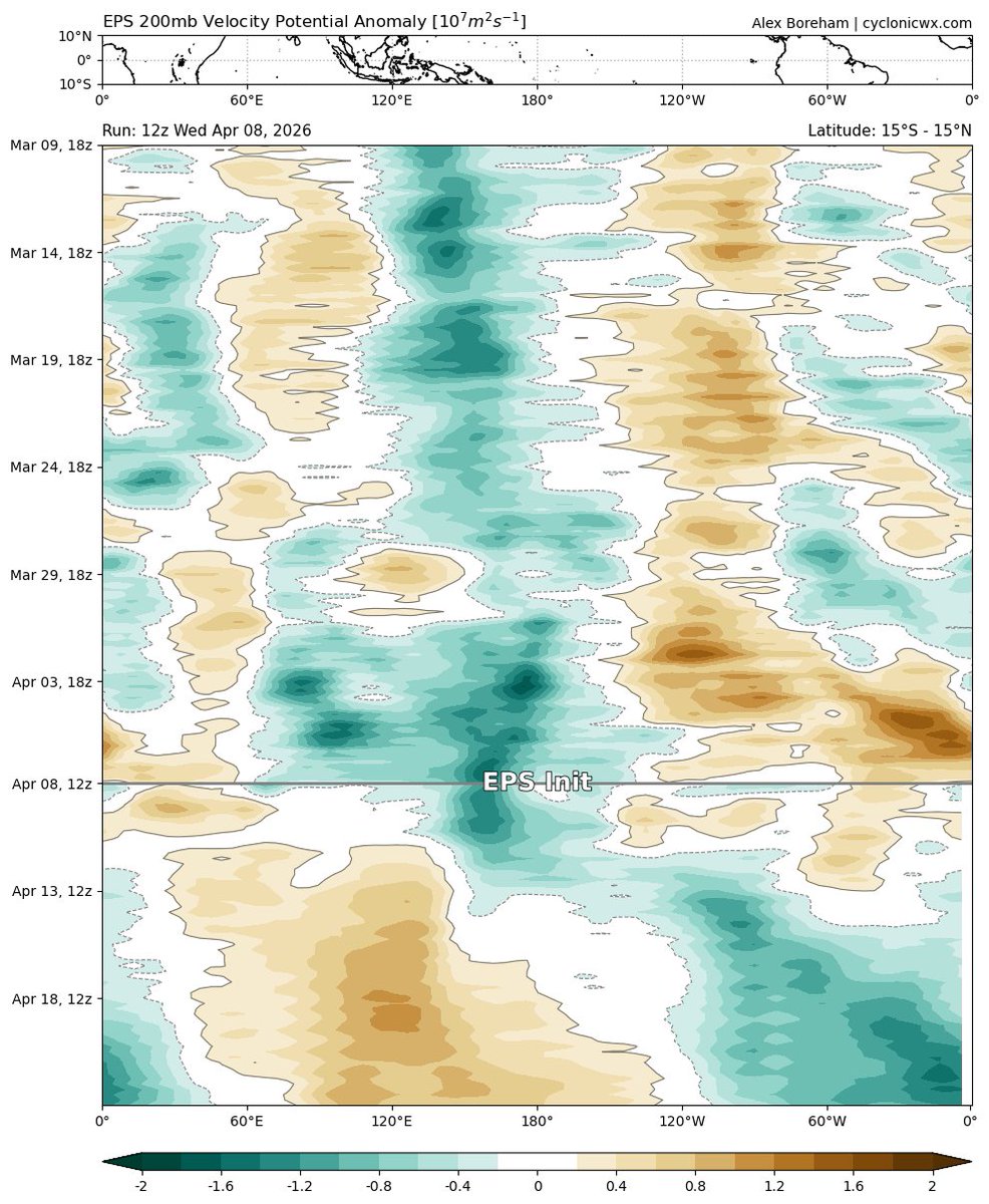


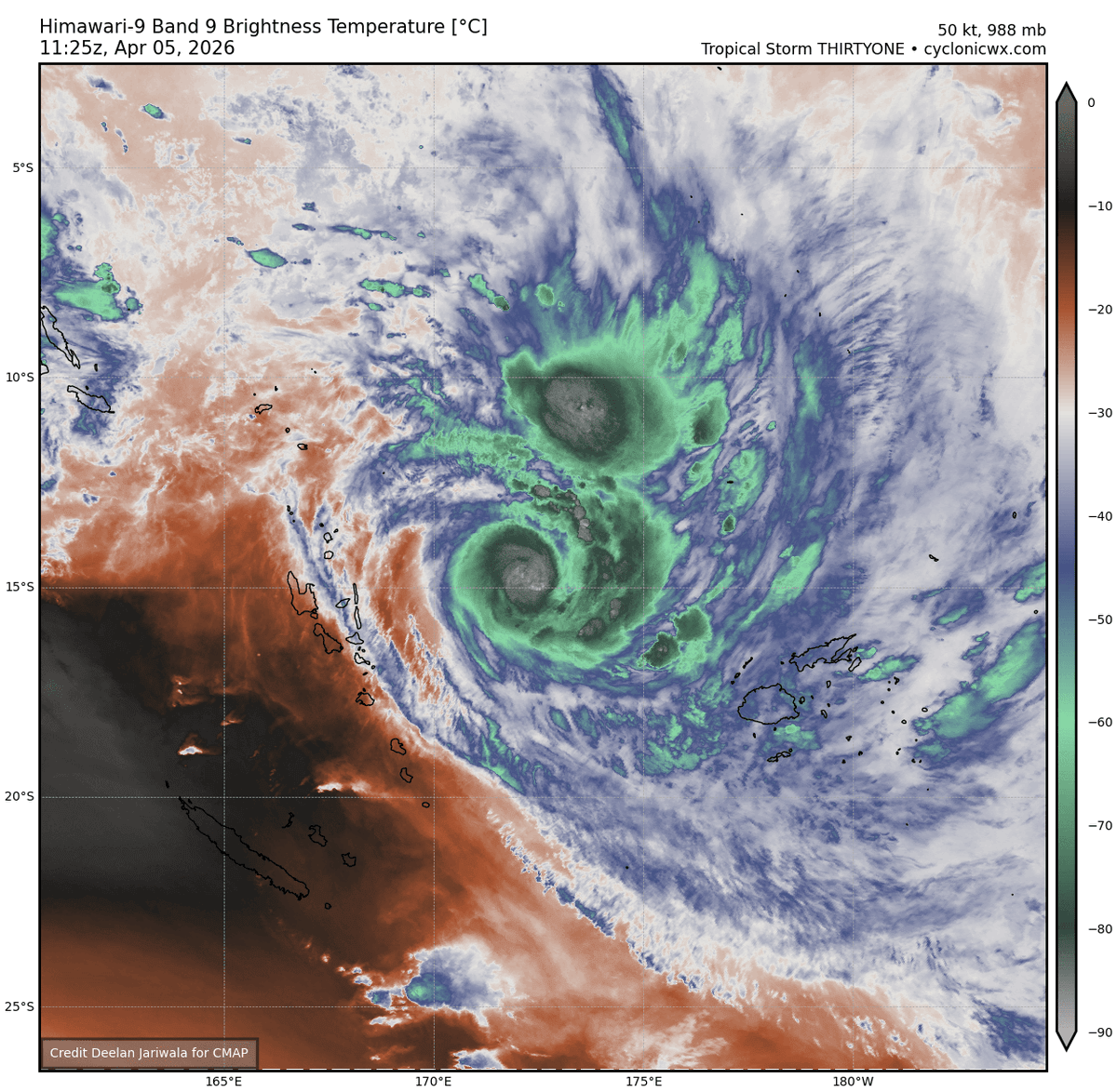


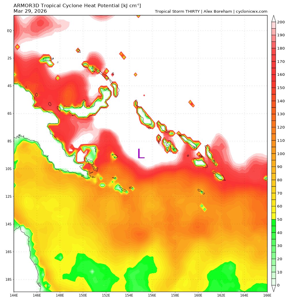
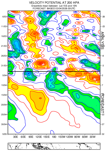
Despite battling moderate VWS, recently-named Maila exhibits structural changes indicative of a budding RI phase. For one, convective organization has markedly improved w/ ''curling'' convection outlining a robust curved band. The subsequent environmental modification and...