Here's 14 minutes of HD tornado footage condensed into a 30-second timelapse. Edited in DaVinci Resolve, honestly the best quality I’ve ever seen from my footage of this mesmerizing tornado.
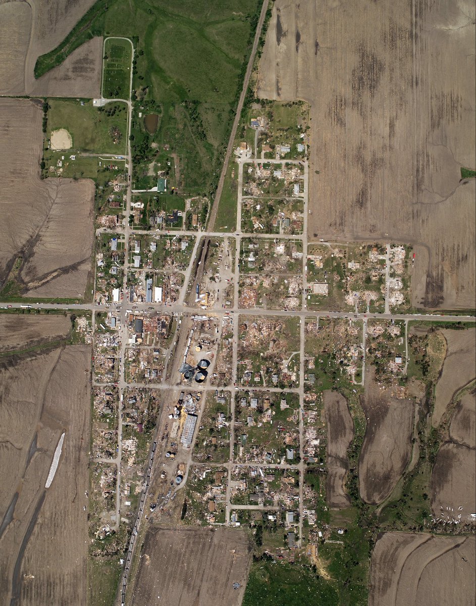
Recently, I began a detailed analysis of the May 25, 2008 Parkersburg–New Hartford, Iowa EF5 tornado using Google Earth Pro imagery, official NWS data, and other sources.
What initially appeared to be a single long-track tornado quickly turned into something much more complex… 🧵
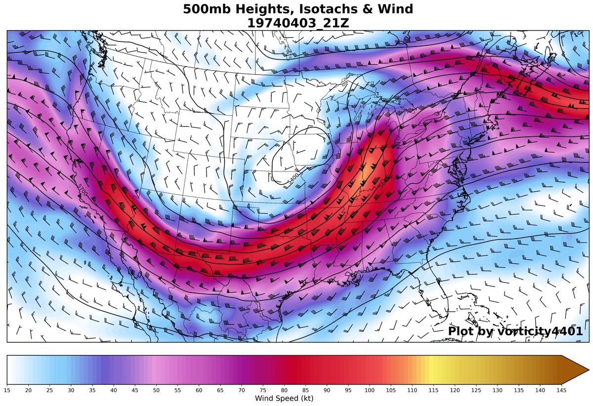
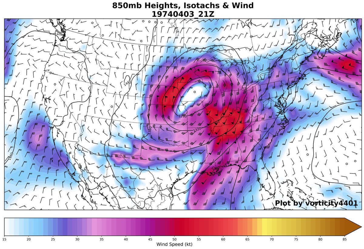
Today marks 52 years since the infamous widespread and destructive 1974 Superoutbreak across the Eastern US.
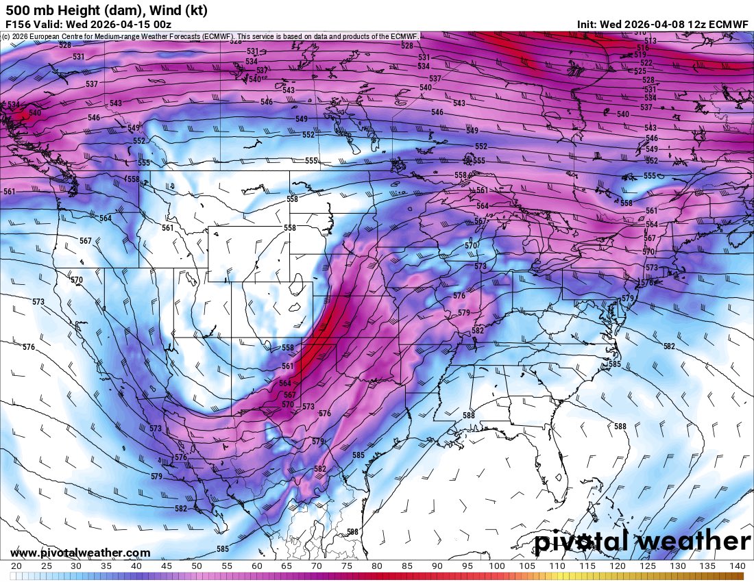
Synoptics like this are generational. Massive longwave trough w/ deep LP + explosive thermodynamics supported several F4-F5 tornado corridors. 🧵⬇️ #wxtwitter
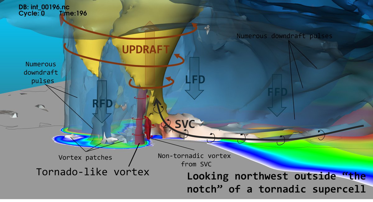
Stripping away "the cloud" to visualize a supercell's anatomy, there are several take aways...
1. Downdrafts are not steady state features!
2. SVCs can contribute to *LLMC* enhancement
3. RFD surges may "collect" & converge vortex patches beneath the LLMC
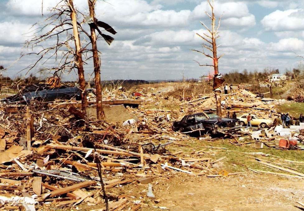
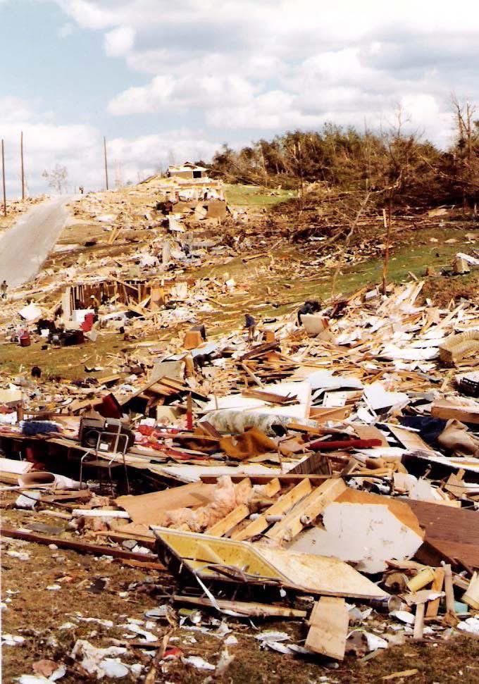
ON THIS DATE IN 1977: A large, violent F5 tornado began around 3 pm CST, 4 miles northwest of Birmingham near U.S. 78, and then traveled northeast for 15 miles at 60 mph, crossing the Smithfield Estates neighborhood and then I-65.
At its widest point, the tornado was 3/4 of a mile wide. Over 150 homes were damaged with almost 50 destroyed. A total of 22 people were killed with over 130 injured.
The famous Dr. Theodore Fujita followed this massive tornado and supercell thunderstorm from an airplane. After tracking the storm, Dr. Fujita surveyed the damage and toyed with the idea of rating the Smithfield tornado an F6.
Daniel Payne College near U.S. Highway 78 sustained heavy damage from this massive tornado with estimates over $1 million dollars. The college, opened in 1880, later closed its doors in 1977, likely a result of the enormous cost and amount of damage. There were six other tornadoes on this day including five F2 tornadoes and an F3 tornado across North and Central Alabama.
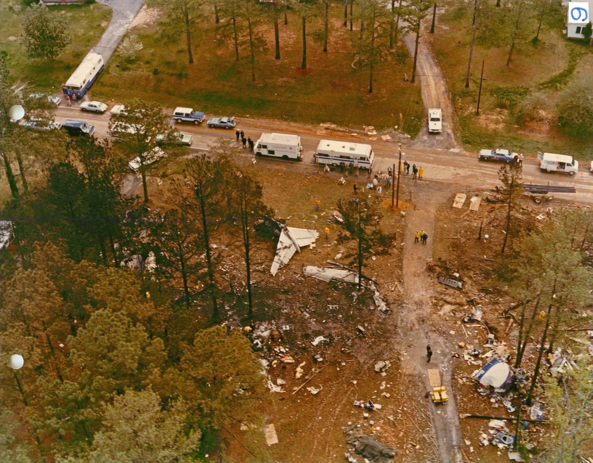
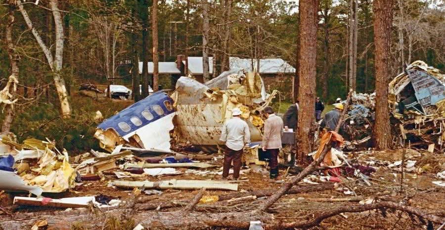
Soon after the F5 tornado tore through the northern part of Birmingham, the same thunderstorm complex was responsible for the crash of Southern Airways Flight 242 in Georgia.
It was a flight from Huntsville to Atlanta. The passenger jet went down after suffering hail damage and losing thrust on both engines; 63 people on the aircraft (including the flight crew) and nine people on the ground died including a family of seven. Twenty passengers survived, as well as the two flight attendants. One of the initial survivors succumbed to his injuries several weeks later.
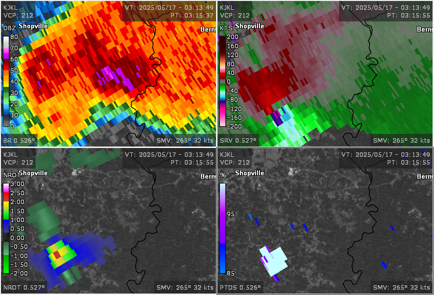
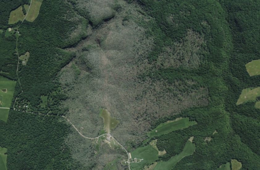
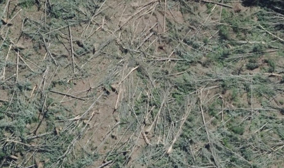
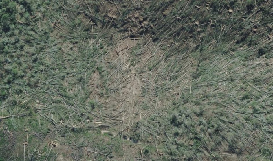
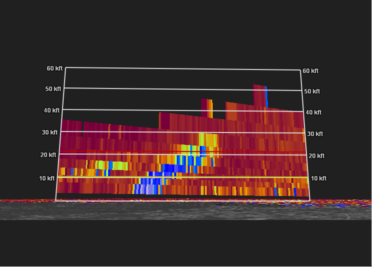
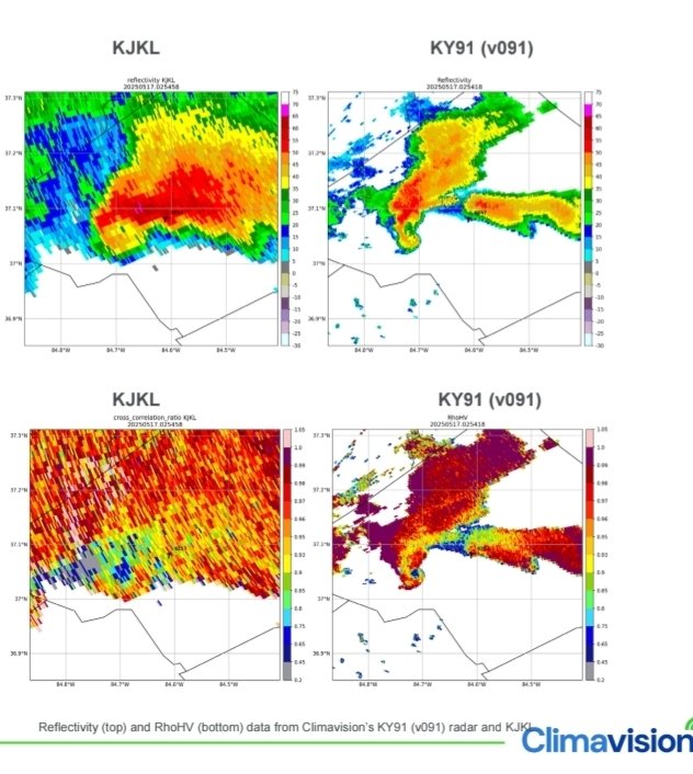
Tree damage/radar from the London KY EF4 last year, this is imagery taken just after. Some of the worst tree damage ive ever seen!
The % of destroyed trees and vrot matches other very high end tornadoes. Had this been over a populated area the rating of this may of been higher!
Here is precisely the best way to nearly die in a tornado. Sheltering in a chicken farm structure in dixie against a wedge that previously did EF4 damage and taking the strongest segment of the tornado. Credit to Mando Cruz on Tiktok for the footage. This structure was rated 140.
I still have more work to do, but here’s a preliminary map of the March 10, 2026 tornado paths based on high-resolution Gray Sky imagery. Analysis of both radar data and the imagery supports my initial suspicion that the EF3 was actually two separate tornadoes, with no continuous damage path connecting them. While there are some damage indicators in the DAT within that gap, they are likely the result of RFD.
A satellite tornado also occurred, taking a deviant path and knocking down a few trees, likely at EF0-EF1 intensity.
Questions or comments are welcome.