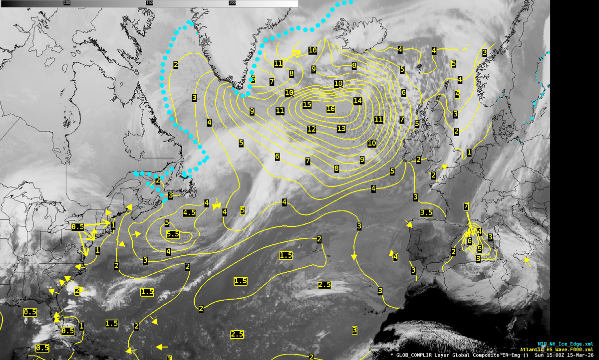
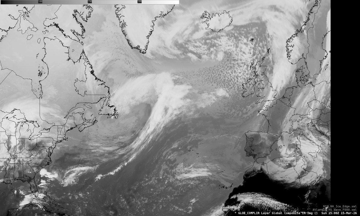
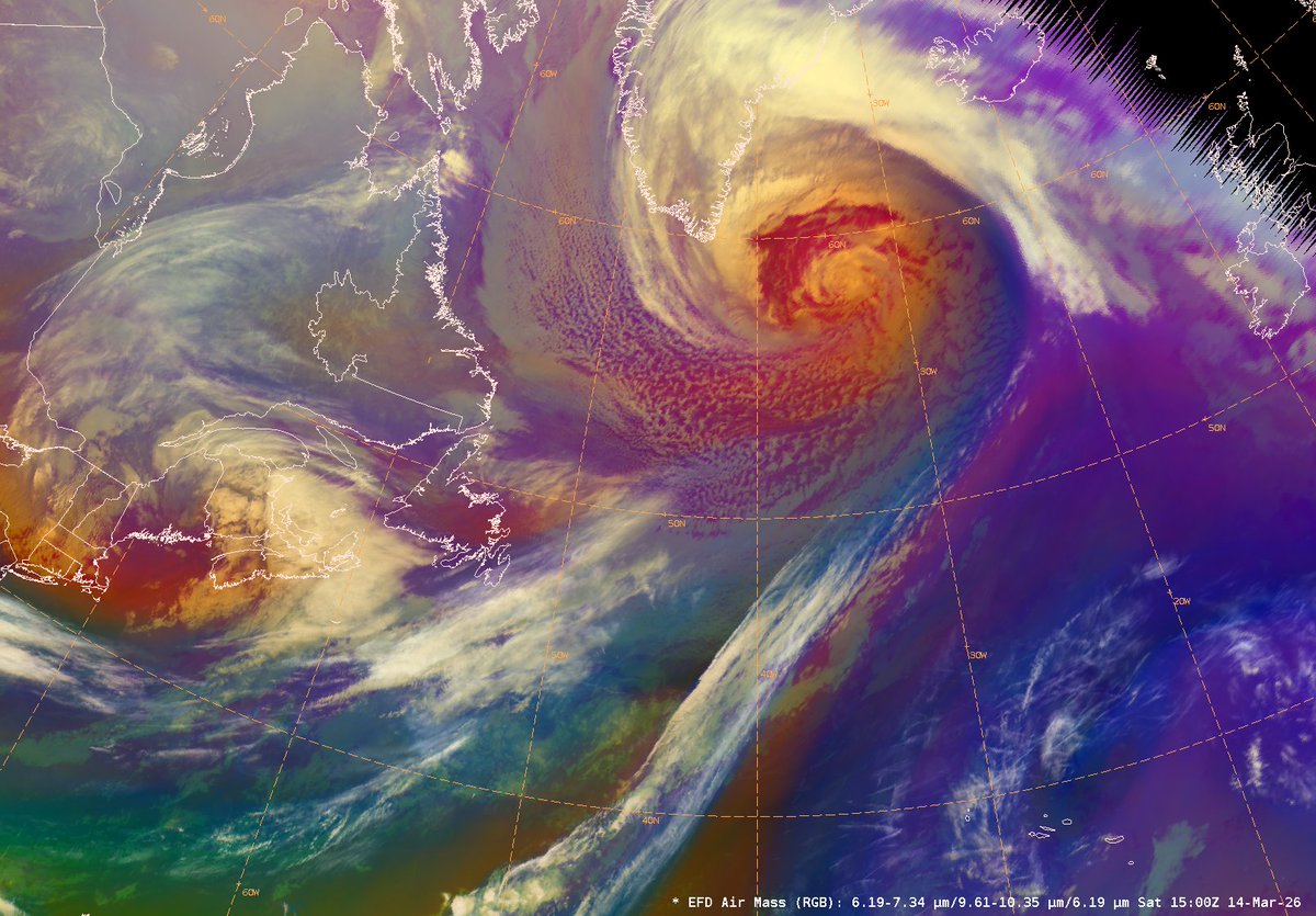
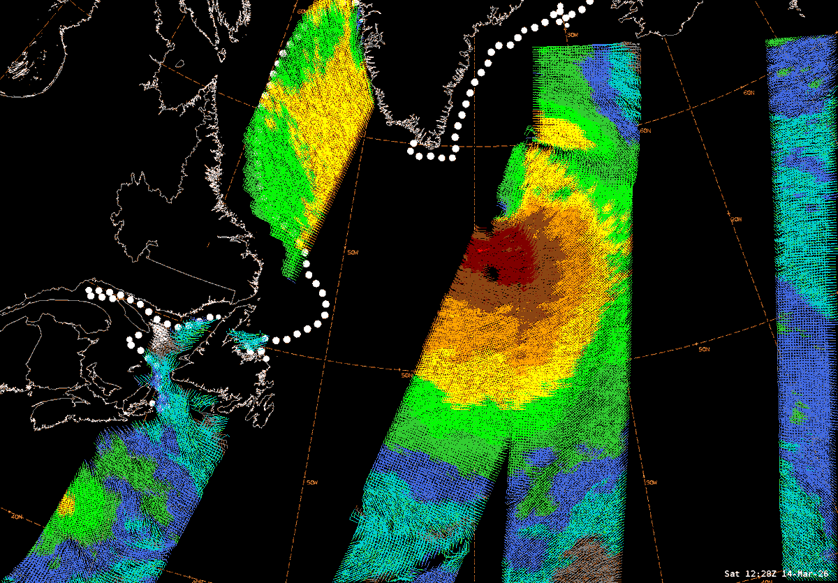
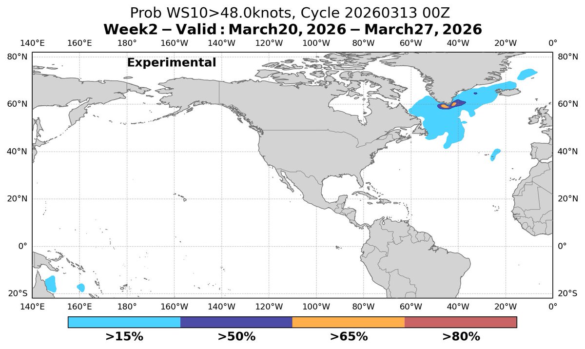
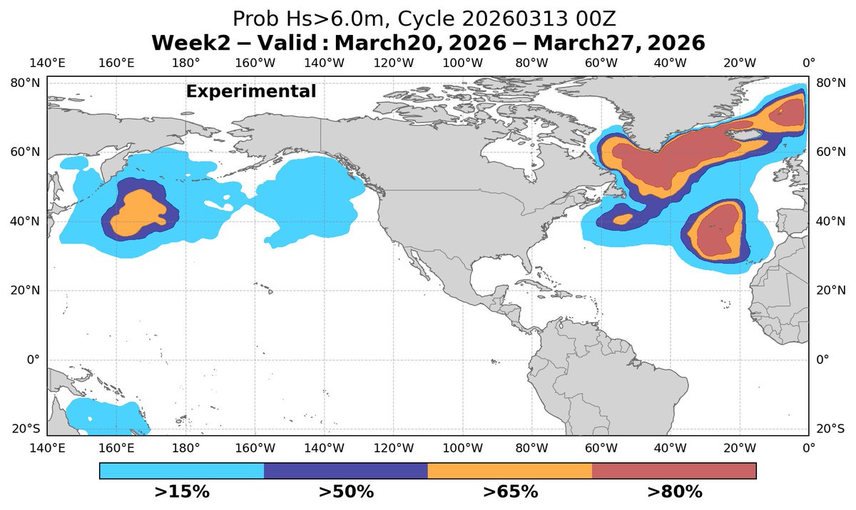
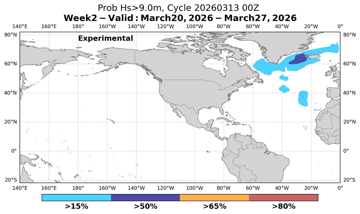
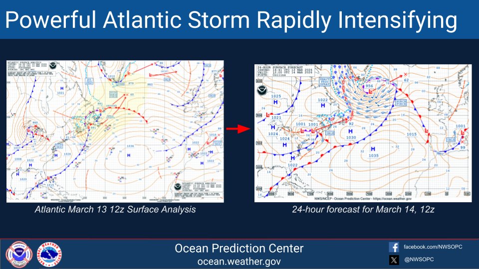
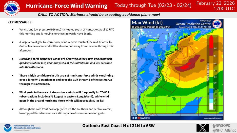
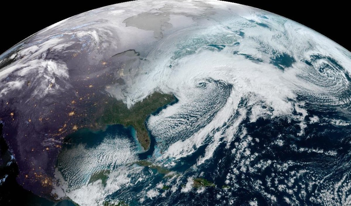
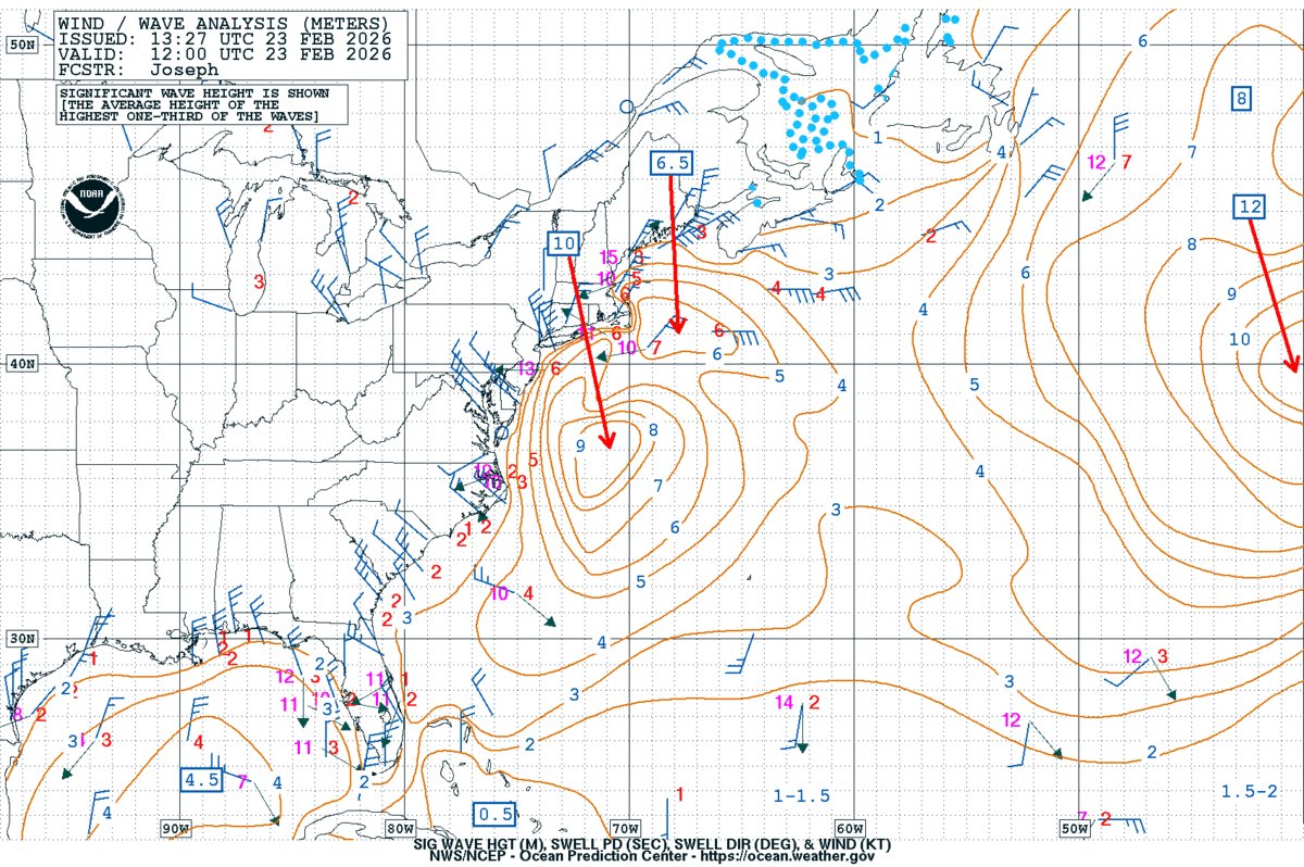
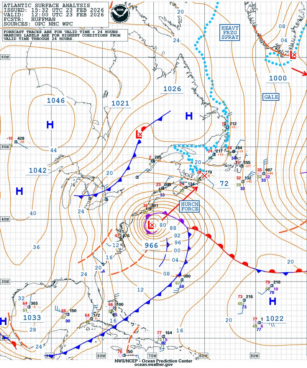
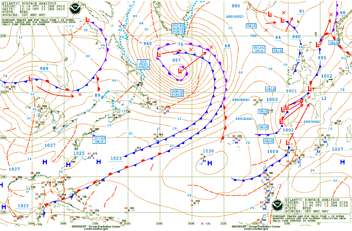
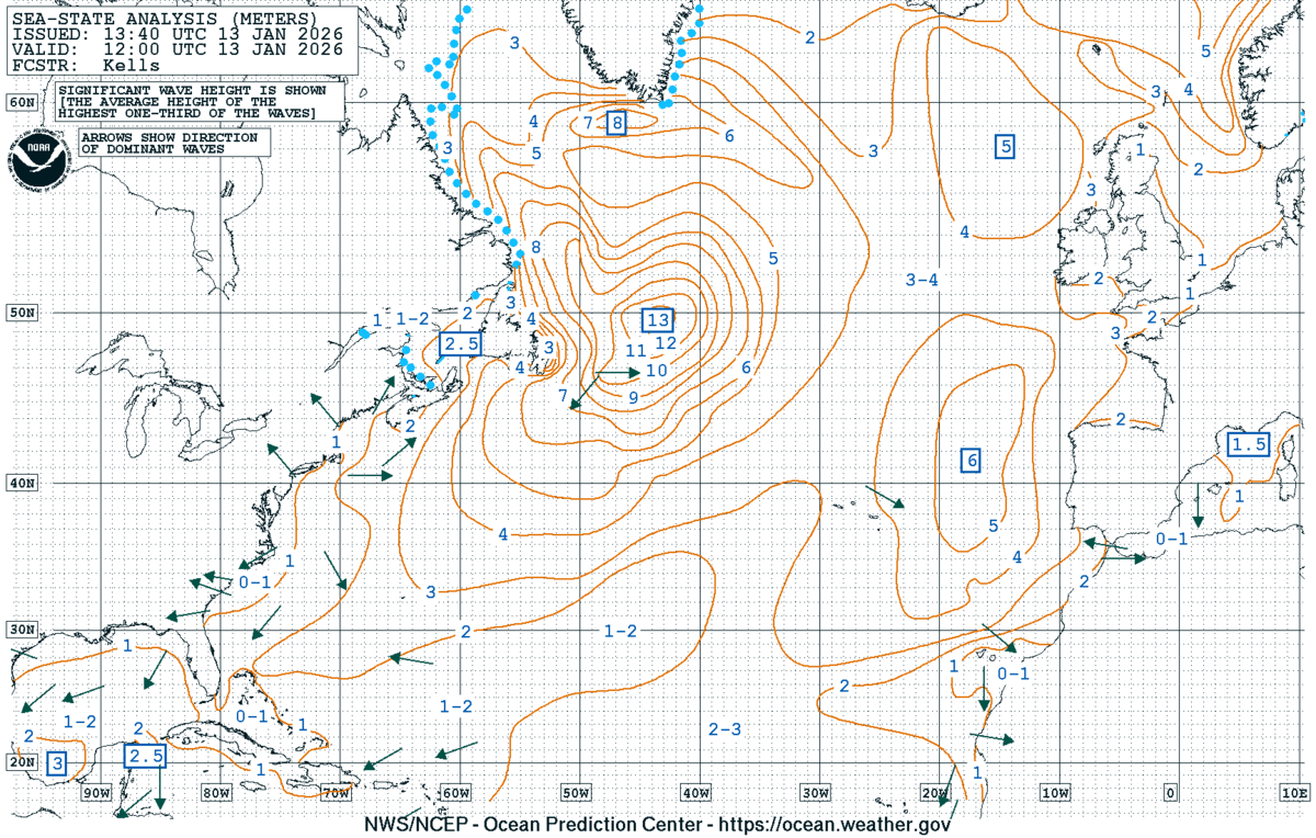
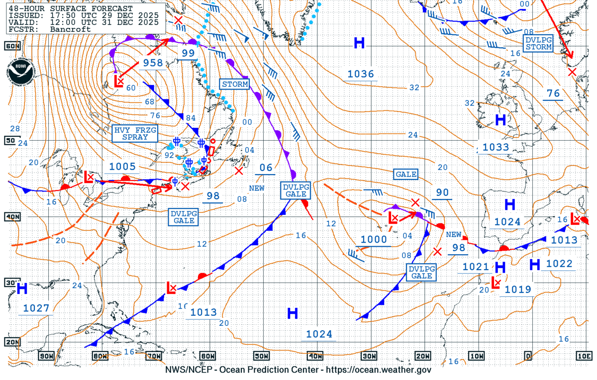
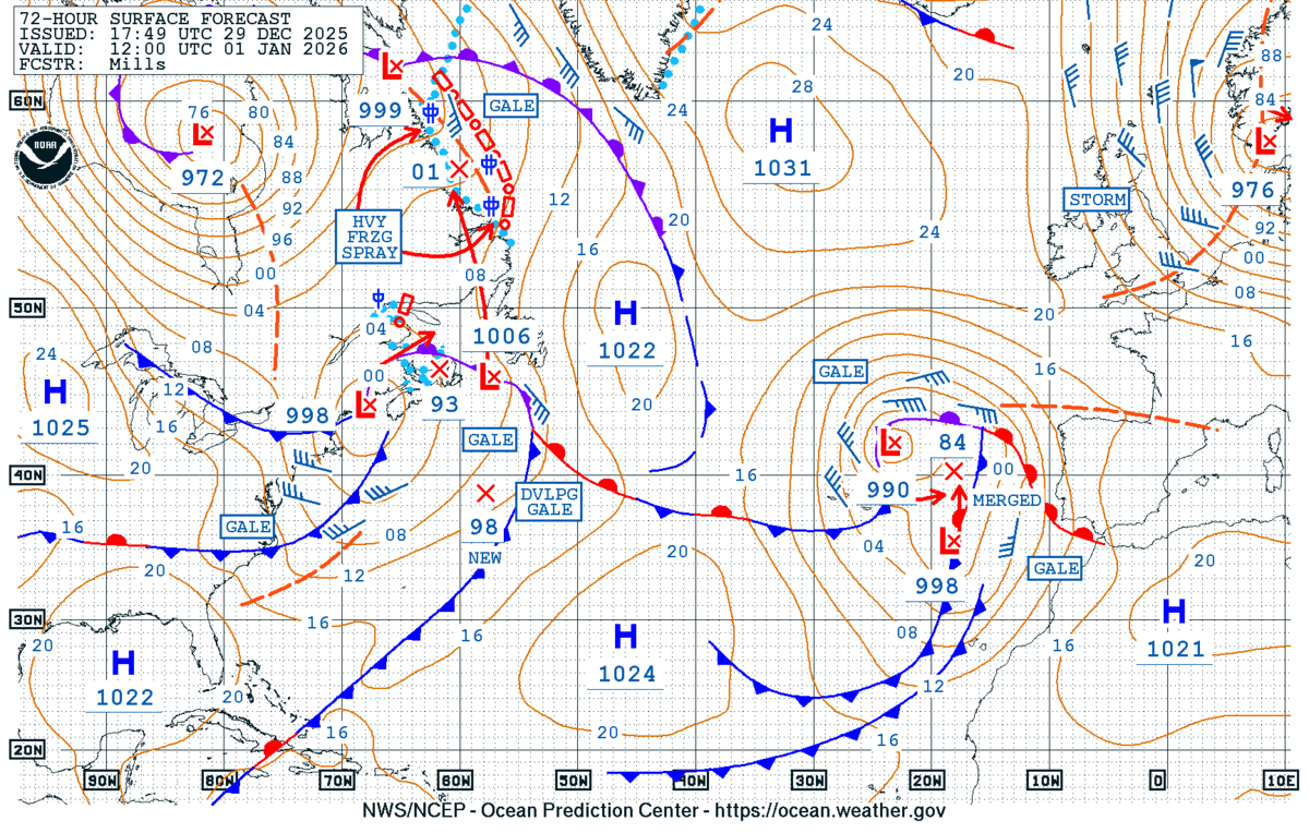
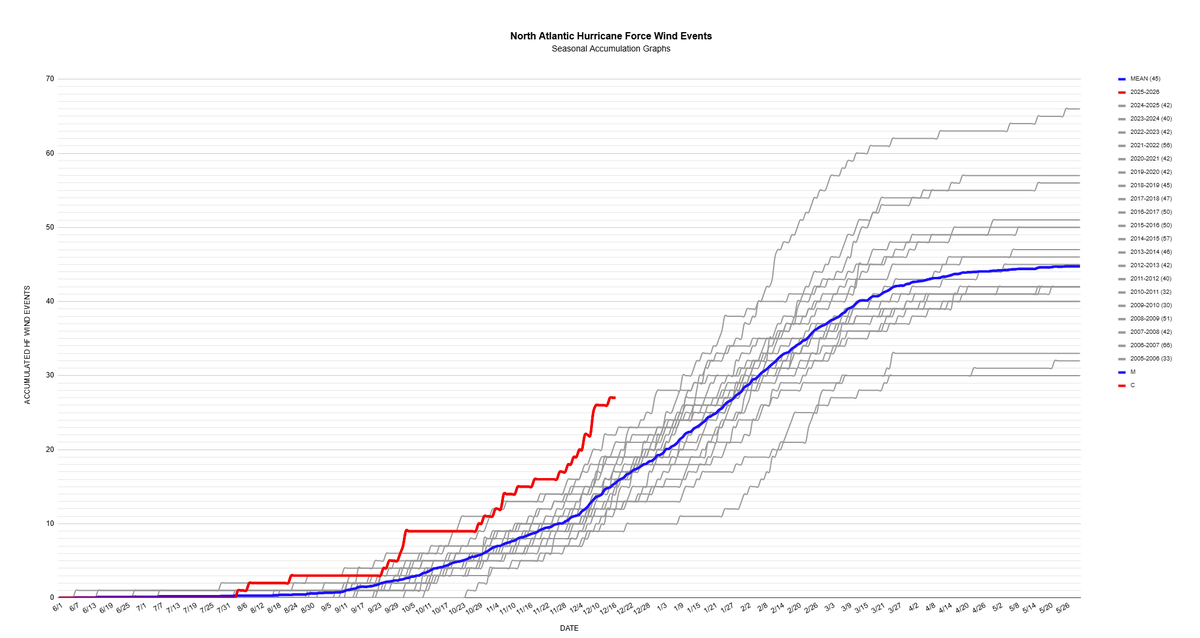
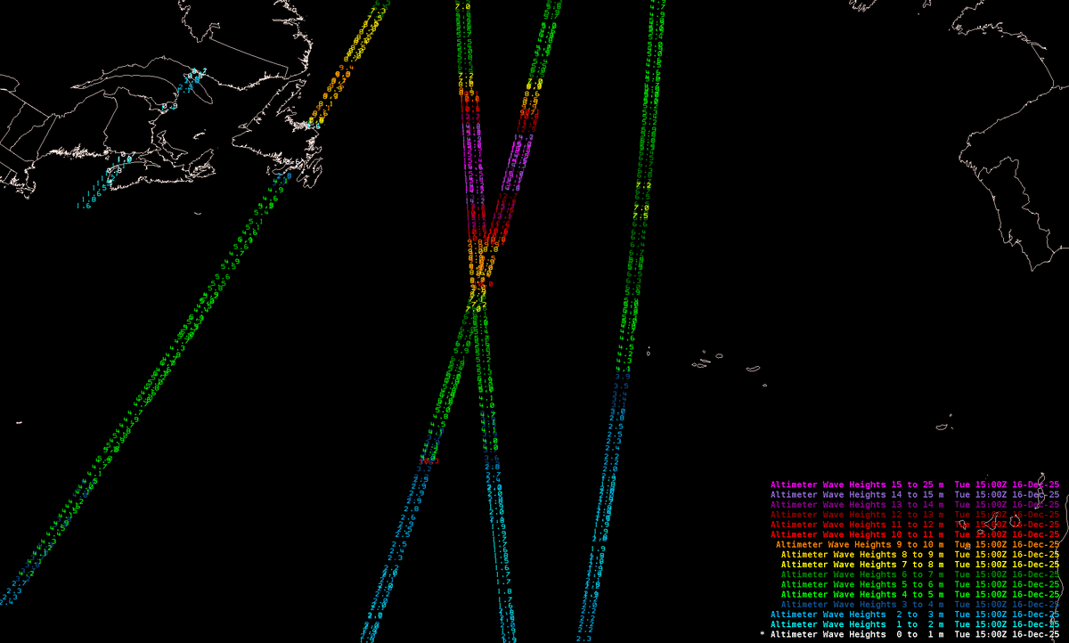
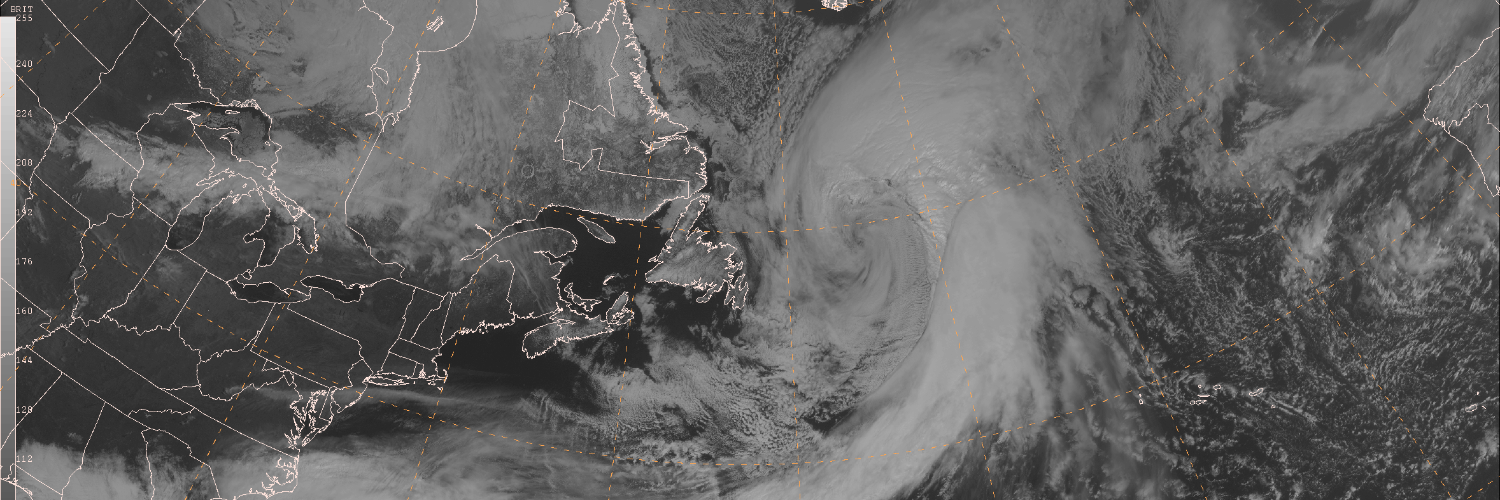
NWS Ocean Prediction Center

6.5K posts

NWS Ocean Prediction Center banner
NWS Ocean Prediction Center

NWS Ocean Prediction Center

@NWSOPC

Official X account for the National Weather Service Ocean Prediction Center.

College Park, MD Beigetreten Mayıs 2013
274 Folgt26.1K Follower
NWS Ocean Prediction Center
[Mar 15] While the low pressure from yesterday has filled slightly today and is no longer producing hurricane-force winds, an elongated fetch of strong storm force winds are generating very high to phenomenal seas, last analyzed up to 16 meters / >50 ft. #MarineWx
NWS Ocean Prediction Center tweet mediaNWS Ocean Prediction Center tweet mediaNWS Ocean Prediction Center tweet media
NWS Ocean Prediction Center@NWSOPC

24-hr difference seen via GOES-E Air Mass RGB satellite imagery, from a 991 mb low yesterday near Newfoundland, to now a sprawling 956 mb low pressure SE of Greenland. Widespread gale, storm, and hurricane-force winds continue this morning, with seas in excess of 40 ft. #MarineWx

English
0
1
4
844
NWS Ocean Prediction Center
24-hr difference seen via GOES-E Air Mass RGB satellite imagery, from a 991 mb low yesterday near Newfoundland, to now a sprawling 956 mb low pressure SE of Greenland. Widespread gale, storm, and hurricane-force winds continue this morning, with seas in excess of 40 ft. #MarineWx
NWS Ocean Prediction Center tweet mediaNWS Ocean Prediction Center tweet mediaNWS Ocean Prediction Center tweet mediaNWS Ocean Prediction Center tweet media
English
0
2
5
1.4K
NWS Ocean Prediction Center
Experimental week-2 probabilistic outlooks show active weather likely continuing across both ocean basins March 20-27, in particular across the N Atlantic with widespread gale and storm, to possible hurricane-force conditions. Details and more info here! ocean.weather.gov/week2/
NWS Ocean Prediction Center tweet mediaNWS Ocean Prediction Center tweet mediaNWS Ocean Prediction Center tweet mediaNWS Ocean Prediction Center tweet media
English
0
1
4
486
NWS Ocean Prediction Center
[Mar 13] Low pressure nearing Newfoundland will rapidly intensify, broaden across the N Atlantic over the next 24 hours generating widespread storm to hurricane-force winds, building seas in excess of 40 ft #MarineWx Latest Atlc analysis/forecast info: ocean.weather.gov/Atl_tab.php
NWS Ocean Prediction Center tweet media
English
0
3
2
500
NWS Ocean Prediction Center
[Feb 23] The latest briefing for the powerful low pressure affecting the mid-Atlantic and New England waters. Primary marine hazards continue with hurricane-force winds, building seas reaching 40+ ft #MarineWx
NWS Ocean Prediction Center tweet mediaNWS Ocean Prediction Center tweet media
NWS Ocean Prediction Center@NWSOPC

Low pressure last analyzed at 12z to 966 mb (41 mb decrease in 24 hrs) -- still producing hurricane-force winds, max seas analyzed to 10m (33 ft) but will continue building through the day. #MarineWx

English
0
3
2
716
NWS Ocean Prediction Center
Low pressure last analyzed at 12z to 966 mb (41 mb decrease in 24 hrs) -- still producing hurricane-force winds, max seas analyzed to 10m (33 ft) but will continue building through the day. #MarineWx
NWS Ocean Prediction Center tweet mediaNWS Ocean Prediction Center tweet mediaNWS Ocean Prediction Center tweet media
English
0
4
9
1.2K
NWS Ocean Prediction Center
[Feb 22] Latest briefing for the rapidly intensifying, developing hurricane-force low across the mid-Atlantic & New England ocean waters today thru Monday. Primary marine hazards: winds increasing to 55-70 kt, seas building from 12-24 ft w/peak significant waves reaching 40+ ft
NWS Ocean Prediction Center tweet mediaNWS Ocean Prediction Center tweet media
English
0
2
4
612
NWS Ocean Prediction Center
Another potent storm-force low will advance off the East Coast Sunday night into Monday morning. Pictured is the forecast wind speed valid 7 AM Monday Morning, with wind speeds exceeding 55 kt! #MarineWx
NWS Ocean Prediction Center tweet media
English
0
5
3
818
NWS Ocean Prediction Center
As one hurricane-force low continues NE into the N Atlantic, the next impactful system is nearing the coast. Another rapidly intensifying, developing hurricane-force low is expected just east of the OPC offshore waters by late Sat night, w/widespread hazards across the wrn Atlc.
GIF
NWS Ocean Prediction Center tweet mediaNWS Ocean Prediction Center tweet media
English
0
3
4
949
NWS Ocean Prediction Center
Merry Christmas and Happy Holidays from all of us at the Ocean Prediction Center!
NWS Ocean Prediction Center tweet media
English
1
1
26
1.2K
NWS Ocean Prediction Center
While hurricane season is over, non-tropical lows can still bring hurricane force winds across parts of the Atlantic. So far this season, we are seeing a higher than average number pass through the basin. See the latest: ocean.weather.gov
NWS Ocean Prediction Center tweet mediaNWS Ocean Prediction Center tweet media
English
0
0
3
1.5K
NWS Ocean Prediction Center
Adding ASCAT overpasses, with returns in excess of 75 kt in the southern quadrant of the low. Significant wave heights (from CryoSat-2 and Sentinel-3A altimeters) show 200 nm swaths of phenomenal seas (>14m), with max up to 16.6 m / 54 ft. #SatWind #SatWave
NWS Ocean Prediction Center tweet mediaNWS Ocean Prediction Center tweet mediaNWS Ocean Prediction Center tweet media
NWS Ocean Prediction Center@NWSOPC

A hurricane-force low pressure rapidly intensified across the Atlantic over the past couple of days; time series of GOES-E RGB air mass images taken from Dec 15 18z (963 mb), Dec 16 00z (949 mb), Dec 16 06z (939 mb), and Dec 16 12z (938 mb).

English
0
2
4
766