
OpenAerialMap
111 posts

OpenAerialMap
@OpenAerialMap
Set of tools by @hotosm for searching, sharing, and using openly licensed satellite and unmanned aerial vehicle (UAV) imagery
Beigetreten Mayıs 2015
191 Folgt1.5K Follower

@OpenAerialMap Hi! Your feedback form is borken: "There was a problem during submission. Please try again."
All the Astro Digital images are also broken - the S3 bucket they used to be hosted on doesn't exist anymore.
English
OpenAerialMap retweetet

🤖🗺️ Awesome detailed walkthrough by daniel-j-h of automated building extraction in Tanzania using @mapbox's open source robosat pipeline, @openstreetmap, and @OpenAerialMap openstreetmap.org/user/daniel-j-…
GIF
San Francisco, CA 🇺🇸 English
OpenAerialMap retweetet

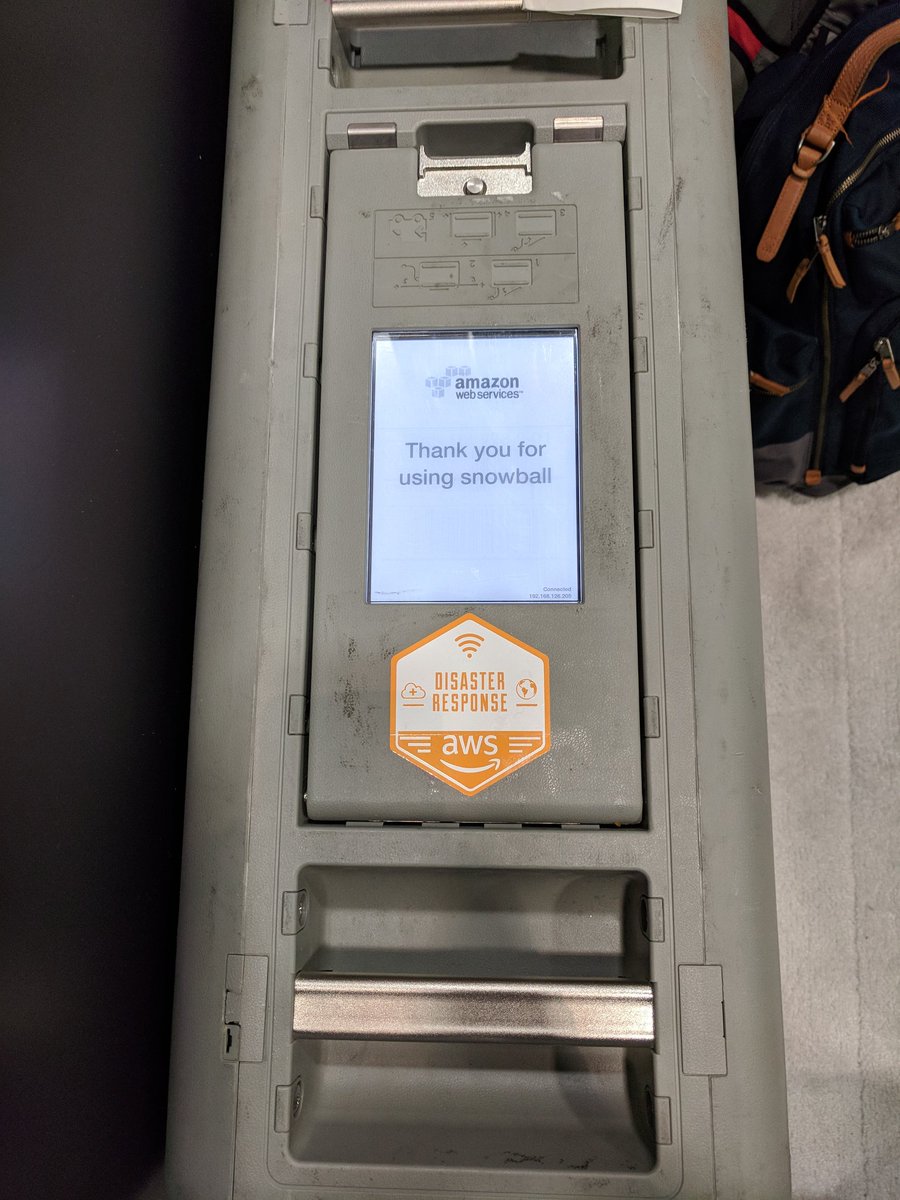
Got a demo today on @awscloud Snowball Edge today from @mojodna. It is a Petabyte data transfer (dustproof, waterproof) device that can be deployed post disaster, running @OpenAerialMap @awesomeposm and #OpenStreetMap editing completely offline. #AWSPSSummit @joseph_flasher


English
Every day new imagery is uploaded. Contribute imagery and directly support organizations on the ground. Learn more about the growing OAM community and check out our new video 📽️ blog.openaerialmap.org/growing-the-op…
GIF
English
OpenAerialMap retweetet

@Asgerpetersen So awesome!!! Didn't realize you could just type it in. And it seems like @qgis 3 also fixed the transparency issues. So cool to see a 1.2 gig file load instantly and stream in. Thanks @OpenAerialMap for the data! Gotta update my cog tutorial to tell people to just use QGIS 3.
GIF
English
Have machine learning skills & want to combine with aerial imagery of 🇹🇴? Launching an Open AI Challenge in the South Pacific together with @WeRobotics and @worldbankdata: blog.openaerialmap.org/open-ai-challe…

English
OpenAerialMap retweetet

We're excited to launch the Open #AI Challenge for the South Pacific with the @WorldBank and @OpenAerialMap! The goal is to automatically analyze aerial imagery for food security analysis & more by using Artificial Intelligence bit.ly/2qO3OuN

English
OpenAerialMap retweetet

Sift through one of the cleanest and most advanced cloud native geospatial architectures - @openaerialmap. Part 4 in a series by @opencholmes. medium.com/planet-stories…
English
We're fully back online with new features and an API. Everything is operating normally. Stay tuned for updates on what's new.
English
Status update! We’re deploying updates to our API and website. Users may experience a few minutes of downtime.
English
Update on UAV imagery in the Caribbean & Mexico after recent disasters. Supporting recovery work across the region: blog.openaerialmap.org/new-uav-imager…

English
OpenAerialMap retweetet

If you are flying UAV for #Harvey or #Irma please upload your captured imagery to @OpenAerialMap Free open hosting of drone imagery.
English
This last week we presented at the @WoDCongress in Brisbane. New blog post up with a recap of our session: blog.openaerialmap.org/openaerialmap-…
English
OpenAerialMap retweetet

A collection of relief & rescue maps for #HurricaneHarvey #HarveyRelief Working on something? Let us know blog.mapbox.com/hurricane-harv…

English
OpenAerialMap retweetet

#PacificHumanitarianChallenge winner PacDID presenting at @WoDCongress about aerial mapping in the Pacific #WoDC17 #OpenAerialMap #drones

English
OpenAerialMap retweetet

Officially open! World of Drones Congress kicks off in Brisbane. Sharing about @OpenAerialMap work in the Pacific. Say hello! #WoDC17

English
Open source flying, processing & sharing drone imagery. Checkout @danbjoseph’s talk tomorrow at #foss4g
#9M4SVbV9EHnkBbgCPl" target="_blank" rel="nofollow noopener">foss4g.guide/#9M4SVbV9EHnkB…

English
Want to keep up to date on @OpenAerialMap updates and community stories? Follow our new blog at blog.openaerialmap.org.

English
Combining UAV & street-level imagery for improved OSM mapping. @TheMissingMaps shares about work in the Philippines: missingmaps.org/blog/2017/07/2…

English
OpenAerialMap retweetet

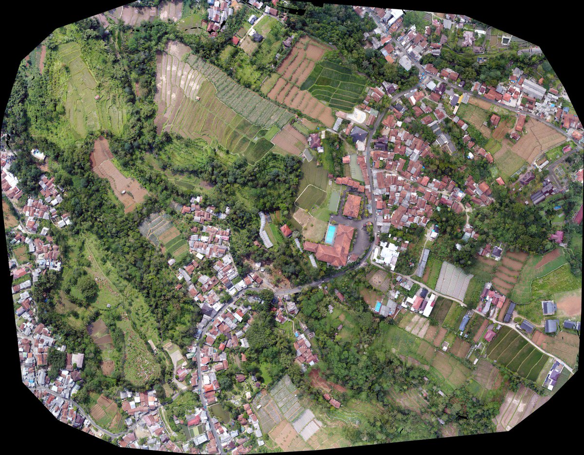
Nicely done aerial UAV imagery DJI + litchi + qgis post processed by Web @OpenDroneMap vs @pix4d hosted in @OpenAerialMap ready for mapping


English