
UP Mappers
122 posts

UP Mappers
@UPmappers
@UPTuks students who volunteer to map for a cause #openstreetmap. Centre for Geoinformation Science (#CGIS) @Youthmappers chapter
Pretoria, South Africa Beigetreten Mart 2019
64 Folgt88 Follower
Day 30: Metamapping and the final day of #30DayMapChallenge 😅 Today's map, created by @Zelbe04 , shows an overview of the maps produced by our team, @GeotoZee , @geobach_za , @terisha_pillay1 , @DrNicNacks and @Zelbe04

English
OSM buildings🏢 with NULL values for Day 29 of the #30DayMapChallenge . Today's map was created by @geobach_za

English
Day 28: The Earth is not Flat done by @terisha_pillay1. 3D model of a Dymaxian map. Template by @Stephan_Barany

English
Day 27: Heatmap. @DrNicNacks made a map showing the hospital 🏥 distribution in South Africa. #30DayMapChallenge

English
Day 26 of the #30DayMapChallenge and the theme is Choropleth. @GeotoZee has made a map showing the population density for Asia🌏.

English
Day 25: An Interactive map for the #30DayMapChallenge @Zelbe04 created this map for her honours research project. The map visualizes rainfall🌧 data scraped from OpenWeatherMap and SAWS. The interactive map can be found here zelbe04.github.io/research_proje…

English
Late Day 24 of the #30DayMapChallenge. @geobach_za played around with the rendering options in QGIS yo create a "historic" map of Pretorja Central ⏳

English
Late entry to Day 23 of the #30DayMapChallenge @terisha_pillay1 created a map using GHS data.

English
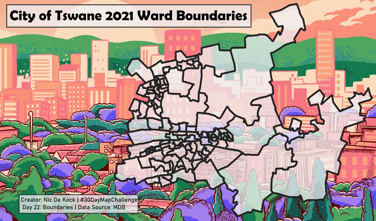
@DrNicNacks created a map of the City of Tshwane Boundaries for Day 22 of the #30DayMapChallenge
English
Day 21: Elevation 🏔 of the #30DayMapChallenge @GeotoZee created a map illustrating South Africa's Elevation.

English
Day 20 of the #30DayMapChallenge and today's challenge is to map Movement. Commercial Airliners🛩 trasport millions of people each year between different locations, which is why @Zelbe04 mapped the 10 busiest air routes in Africa based on the number of passengers transported.

English
Day 19: Islands. With South Africa going into the summer season it is interesting to see how the heat islands vary across the country on a summers day. ☀️
#30DayMapChallenge

English
Day 18 of the #30DayMapChallenge
Water is today's topic 💧 and @terisha_pillay1 created a map showing the rivers in Gauteng.

English

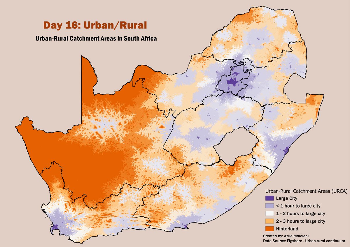
@GeotoZee 's map is of Urban-Rural Catchment areas - how far an area is from a large city (population > 5 million) based on travel time. Day 16 of the #30DayMapChallenge
English
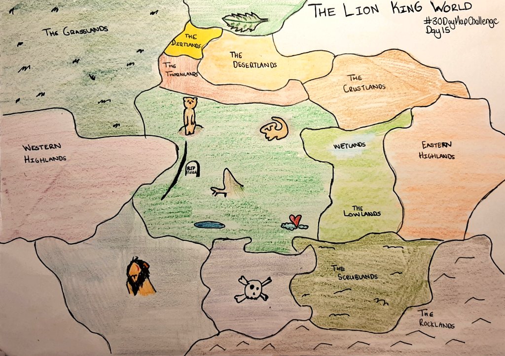
Day 15: Map made without using a computer. Today's map dives into the fictional world. @Zelbe04 drew a map of what she would imagine the Lion King World looks like 🦁. #30DayMapChallenge

English
Day 14: Map with a new tool🔨. @geobach_za explored the PrettyMaps. It is really cool library!
#30DayMapChallenge

English
Day 13 and Data challenge 2 of the #30DayMapChallenge . The challenge being using Natural Earth data. @terisha_pillay1 used the Bathemetry, rivers and shaded relief datasets. 🗺

English