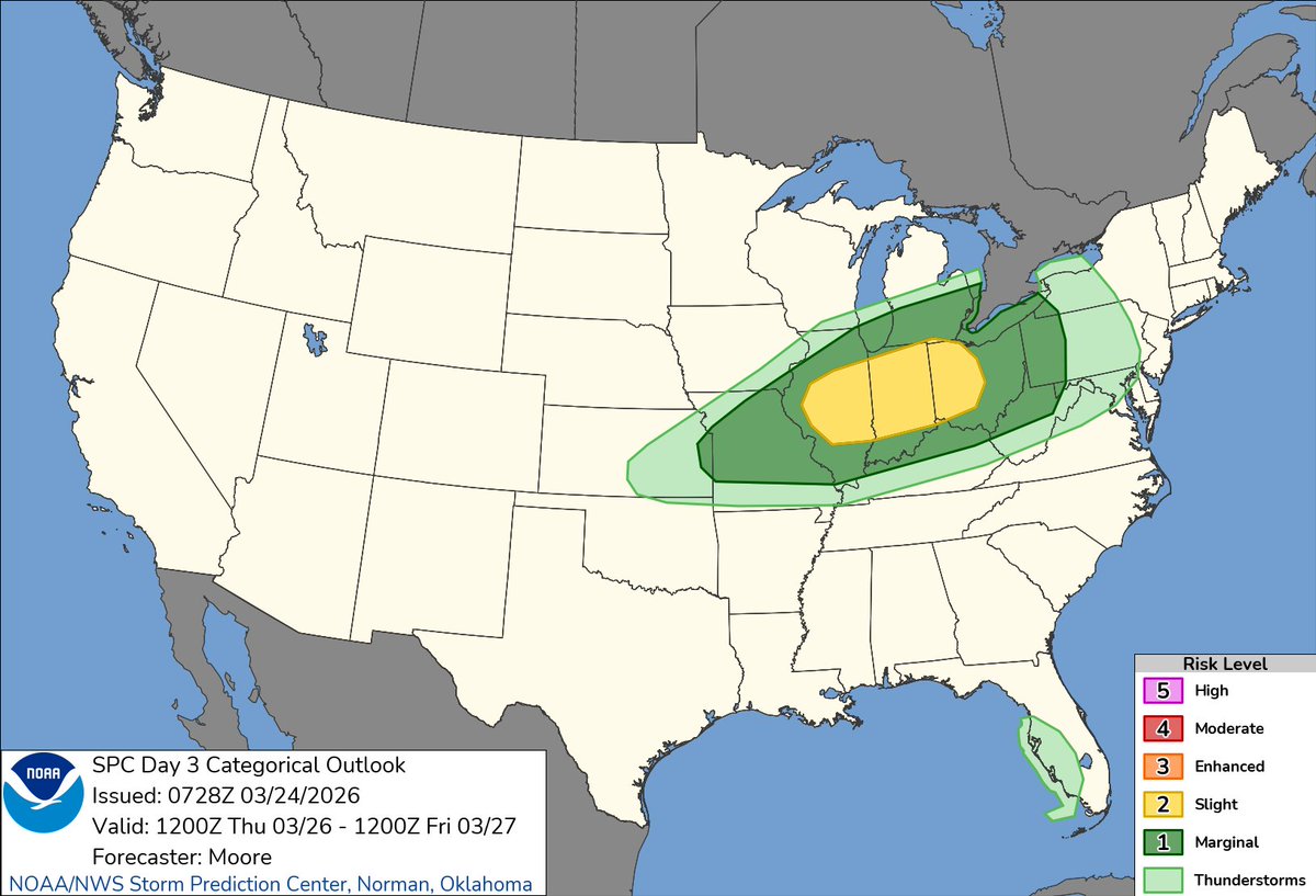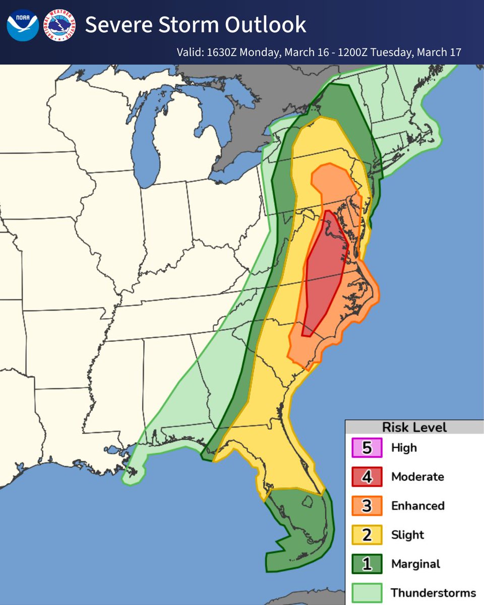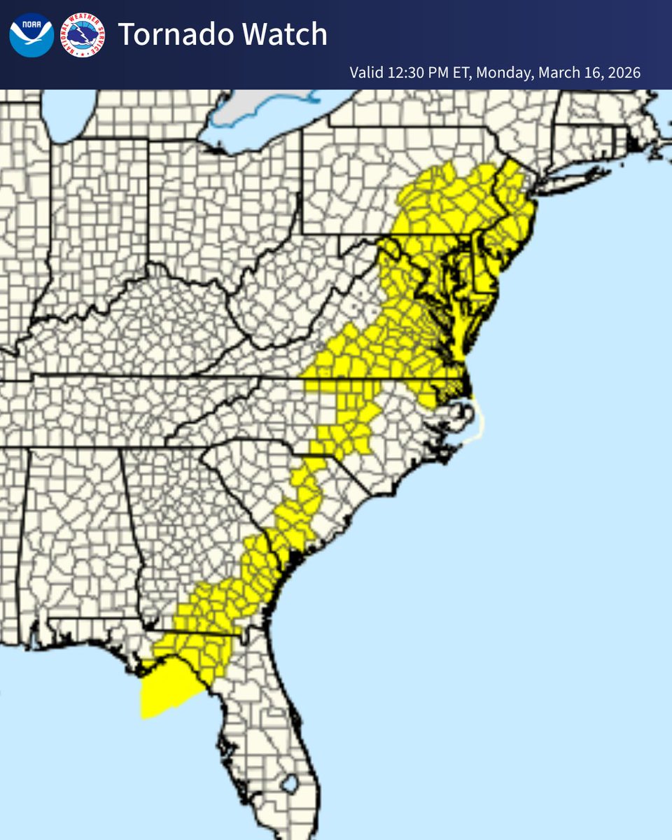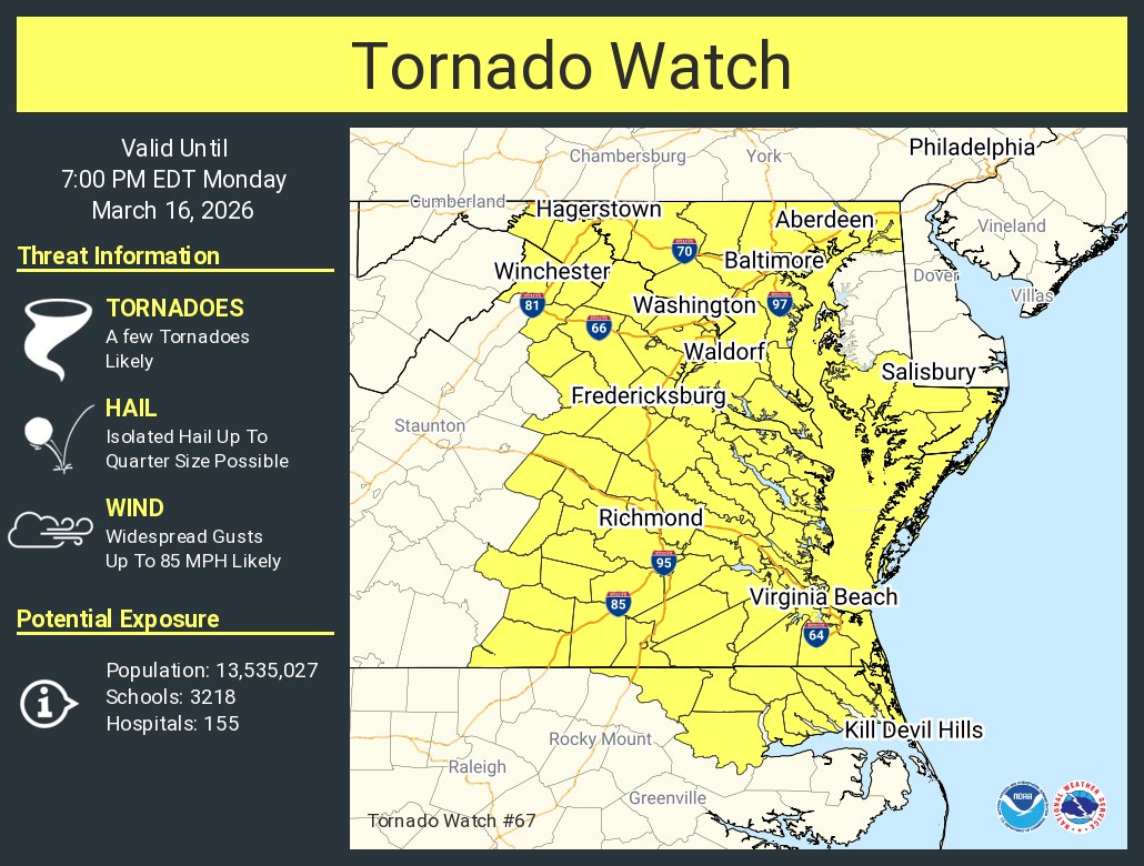

Weather WatcherX retweetet

The National Weather Service is modernizing operations and moving to the cloud!
This will greatly improve our mission to provide weather, water and climate data, forecasts, warnings, and impact-based decision support services for the protection of life and property and enhancement of the national economy.
Learn more: noaa.gov/news-release/n…

English