MapTheClouds

1.7K posts

MapTheClouds banner
MapTheClouds

MapTheClouds

@maptheclouds

Webdev and cartographer, on a journey to 3Dmaps and dataviz. Grab a coffee and buckle up, we're going to map the clouds! 🌩️ 🏞️ 🌩️

Beigetreten Ocak 2019
1.3K Folgt1.9K Follower
Angehefteter Tweet
MapTheClouds
MapTheClouds@maptheclouds·
It's the end of an era, and the beginning of a new one. 10+ years: 
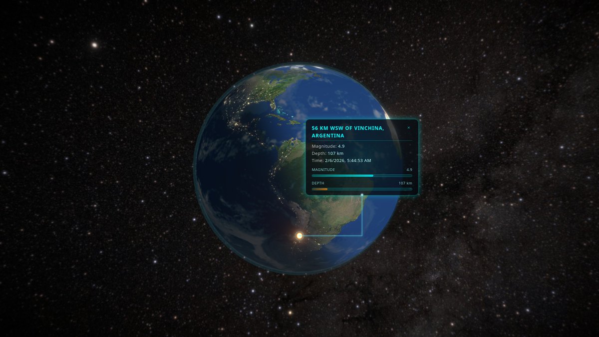
LiDAR → GIS → WebGL → immersive work
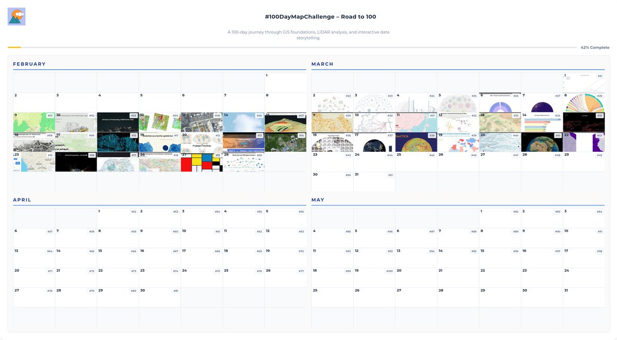
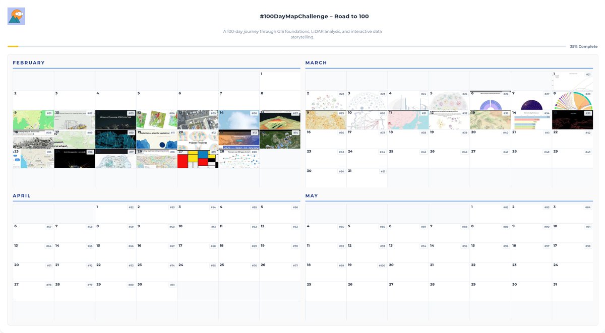
 Starting Feb 9: #100DayMapChallenge 100 days revisiting projects shaping my path from GIS to interactive 3D viz. Follow along! 🗺️ #3DMaps #WebGL #DataViz
MapTheClouds tweet media
English
2
17
190
9.1K
MapTheClouds
MapTheClouds@maptheclouds·
Day 46. Interactive virtual land map 🗺️ Built a two-level map for a blockchain virtual land platform: world overview + detailed plot interaction. #100DayMapChallenge 46/100 🔒 Client production
English
0
0
2
103
MapTheClouds
MapTheClouds@maptheclouds·
Day 45. Chlorophyll ocean data 🌊 I visualized 12 months of NASA Aqua/MODIS chlorophyll on an interactive 3D globe with Three.js + WebGL. Custom GLSL transition + vignette shaders keep seasonal flow smooth and readable. maptheclouds.com/playground/thr… #100DayMapChallenge 45/100
English
1
1
19
787
MapTheClouds
MapTheClouds@maptheclouds·
Week 6 done: from vinyl Voronoi experiments to 50k+ cities, Antarctica gravity, UNESCO client work, Corgi GPX fun, an Africa-centered globe, and river hierarchies. Different topics, same underlying method. #100DayMapChallenge
MapTheClouds tweet media
English
0
0
2
144
MapTheClouds retweetet
Three.js
Three.js@threejs·
ZXX
13
57
857
32.8K
MapTheClouds
MapTheClouds@maptheclouds·
Day 39. Education inequality at global scale 🌍 Client work: interactive animated choropleth for education research org. Gender Parity Index across 5 levels (primary to tertiary). Leaflet + D3.js Gender gap widens as girls progress. #100DayMapChallenge
English
0
0
1
101
MapTheClouds retweetet
Jeff McKenna
Jeff McKenna@mapserving·
Take a moment to thank and appreciate PROJ today, as it celebrates its earliest available commit (even though the project goes back to the 70's/80's). Here's that commit: github.com/OSGeo/PROJ/com… Thanks to all of the contributors over so many decades! #foss4g
Jeff McKenna tweet media
English
1
2
16
505
MapTheClouds
MapTheClouds@maptheclouds·
Week 5. The daily mapping challenge is starting to feel less like discipline and more like exploration. Seven projects this week: networks, terrain, timelines. 35 days down, 65 to go. #100DayMapChallenge
MapTheClouds tweet media
English
0
0
4
148
MapTheClouds
MapTheClouds@maptheclouds·
@AJAllchin The Natural Earth land dataset is a MultiPolygon GeoJSON. Applying LineTo everywhere also generated straight lines between the polygons within the same feature. I didn’t try to remove them, because the effect actually looks quite interesting. 🙂
English
1
0
0
19