Mapping Tottenham

146 posts

Mapping Tottenham banner
Mapping Tottenham

Mapping Tottenham

@maptottenham

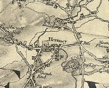
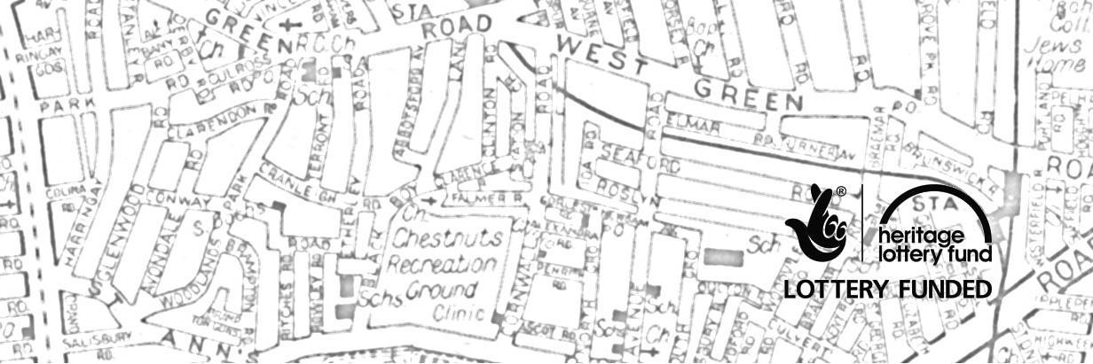
South Tottenham community history project, spring and summer 2015. Delivered by the Bridge Renewal Trust and funded by the Heritage Lottery Fund.

South Tottenham Beigetreten Mart 2015
178 Folgt160 Follower
Mapping Tottenham retweetet
Tottenham Civic Society
Tottenham Civic Society@TottenhamCivic·
Another lovely old wrought iron pub sign. West Green Road, Tottenham. Nowadays the Nile Bar
Tottenham Civic Society tweet media
English
0
5
3
0
Mapping Tottenham retweetet
Haringey Council
Haringey Council@haringeycouncil·
A new pocket park is bringing a taste of the tropical to West Green Road. See how it's transformed the area: ow.ly/RccjN
English
1
4
2
0
Mapping Tottenham retweetet
Royal Court
Royal Court@royalcourt·
The Five Steps to Privatisation, a devised piece by the #WhoCaresNHS community cast @ Holy Trinity Church, N15 29 Aug bit.ly/1JteKdX
English
0
7
4
0
Mapping Tottenham retweetet
Chestnuts Community
Chestnuts Community@ChestnutsCentre·
Want To Keep Fit?, Come Down For A Taster Session Here At Chestnuts, Zumba Classes Start Time 7pm-8pm
Chestnuts Community tweet media
English
0
1
0
0
Mapping Tottenham retweetet
Living Streets
Living Streets@livingstreets·
Today's @TimeOutLondon pg26 has brightened this grey morning! Walking is 'the nicest way to get to work' - and the third most popular! YES!
English
0
5
3
0
Mapping Tottenham
Mapping Tottenham@maptottenham·
Lovely old ad for Myall's once supplier of boots to @SpursOfficial. More on local retail history on our guided walks.
Mapping Tottenham tweet media
English
0
0
0
0
Mapping Tottenham retweetet
Historic England
Historic England@HistoricEngland·
Please help improve our online Heritage At Risk Register by completing this quick survey: buff.ly/1DK97f8
Historic England tweet media
English
2
31
17
0