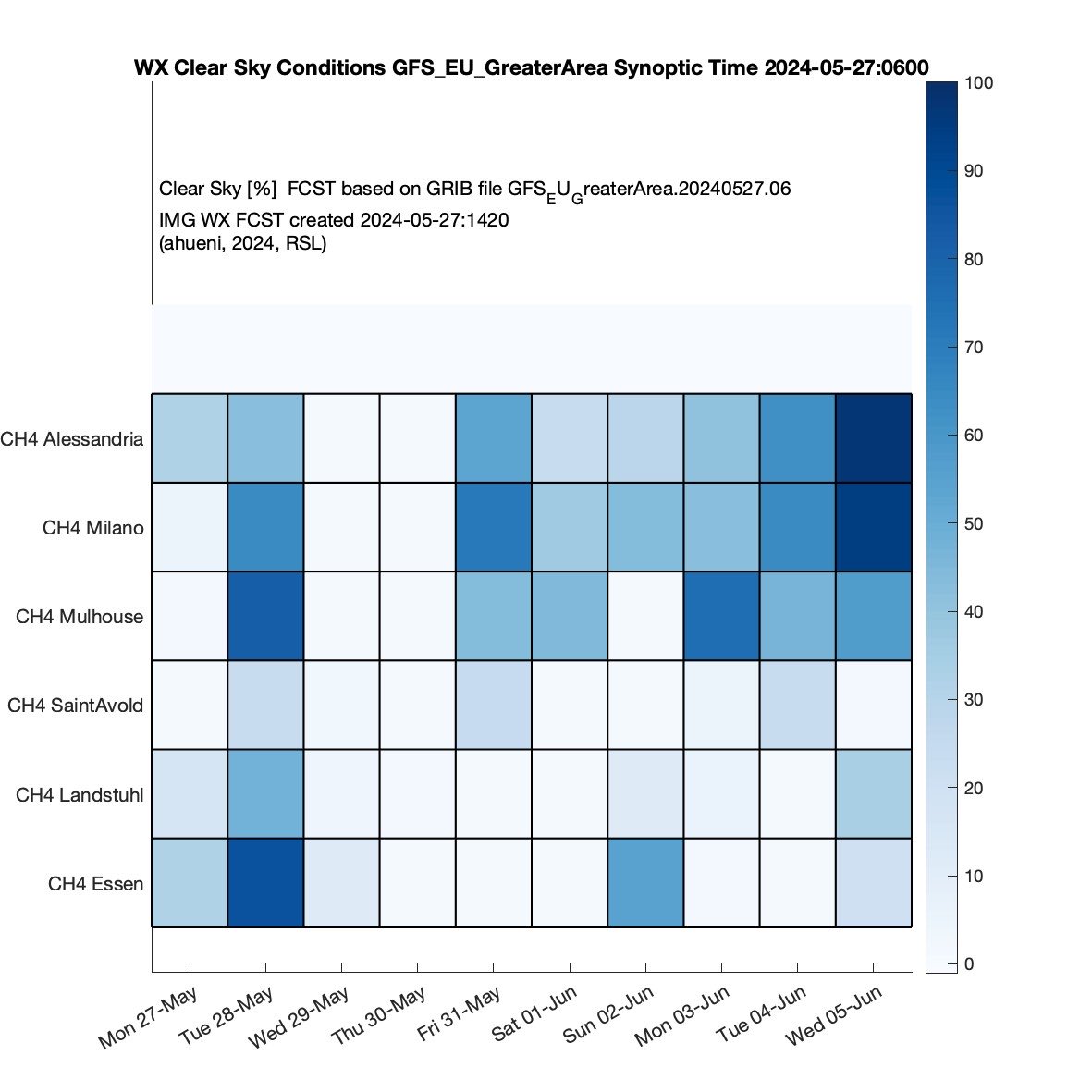
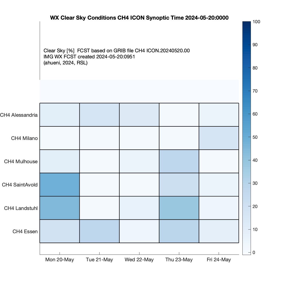
FLT Outlook for CH4 Mission:
No FLTs foreseen due to unstable WX conditions in overall mission area. The WX remains patchy till well into the start of JUN.
Yesterday was the busiest day for commercial aviation that we’ve ever tracked. We tracked 134,386 commercial flights on 6 July and today is shaping up to be another busy day. More than 20,000 flights are in the air right now.
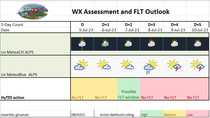
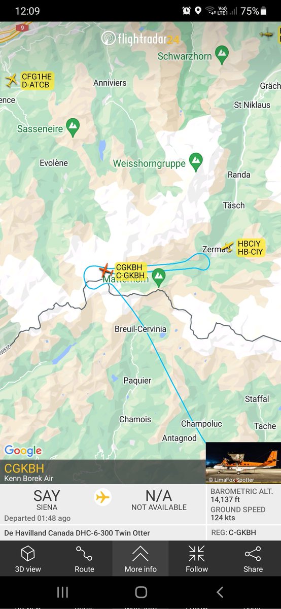
Weather update 05/07/2023. The general weatherconditions and current ops plans of HyTES point towards an imaging flight on Friday, where CH will be under the conveyor belt infront of the next bad weather front. Firday 07/07/2023 is the best option to image the two glaciers!
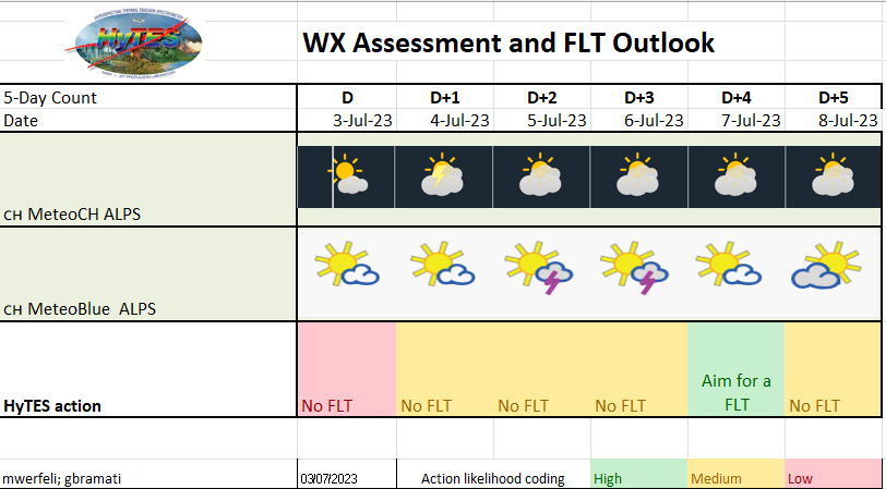
Weather update for 03/07/2023: The weather conditions are still tricky to predict. Still we are excited to anounce that we have found a day (07/07/2023) we aim to get the HyTES flights done!!
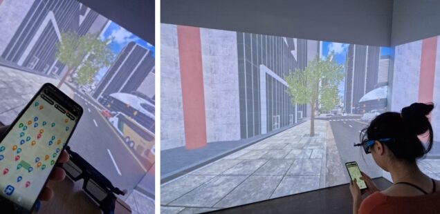
Help us shape the future of mobile map design!
Have you ever tried finding your way to a coffee shop downtown efficiently without getting shoved by the crowds? We are now recruiting participants for our #VR experiment! 👉blog.geo.uzh.ch/mobile-map-des…#GIScience#map@giva_uzh
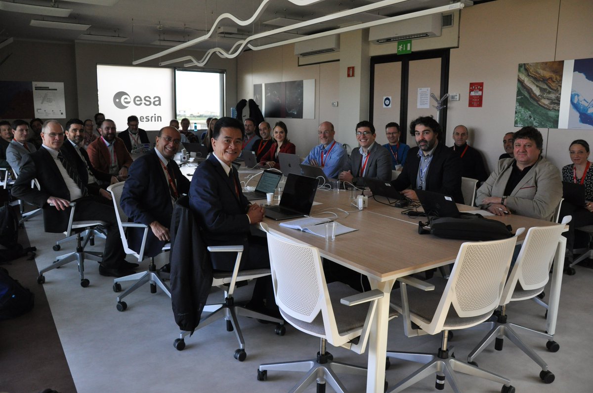
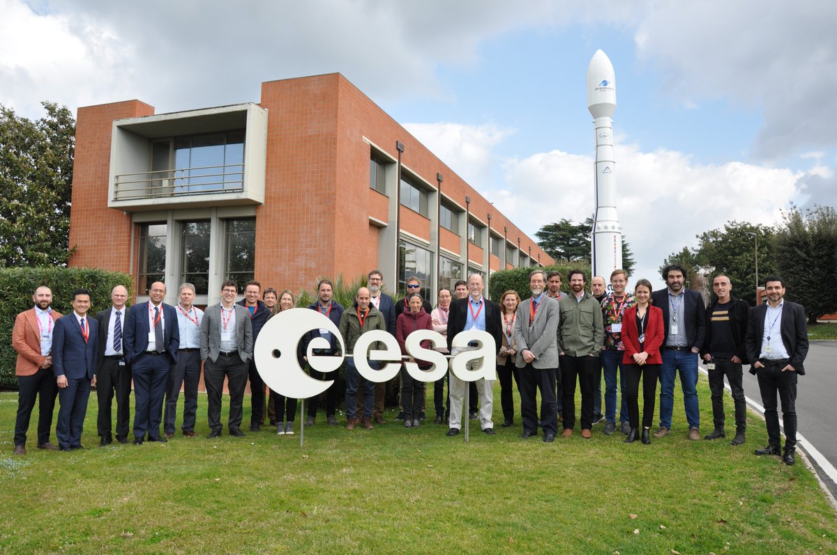
The teams discussed the future steps towards harmonisation of data products and practices, open science elements, products calibration and validation.
The next step? Another coordination meeting is planned for November 2023 at the SBG Community Workshop in the US. See you soon!
This week we welcomed to @esa ESRIN (our home in Italy) colleagues from CHIME and @NASAJPL SBG missions.
CHIME and NASA’s Surface Biology Geology mission will provide global scale operational Imaging Spectroscopy observations
🧵continue reading
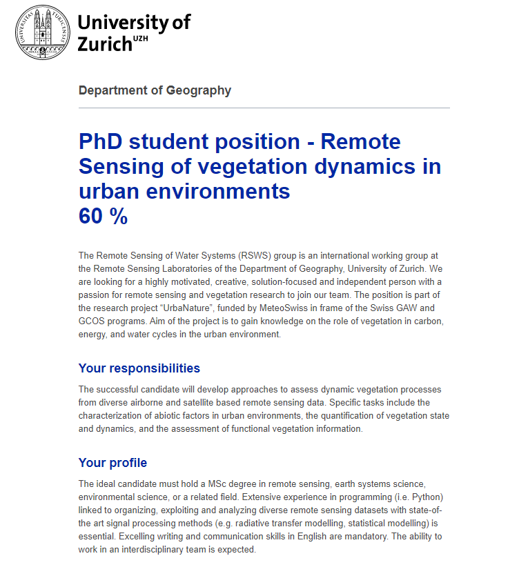
🚨Job alert: PhD position 🚨 We're looking for a new #PhD student who will use #remotesensing to assess the role of #urban#vegetation in the carbon, energy, and water cycles. 🛰️🌳🏙️
Today, I had the chance to present my view on this years @ForestSAT in Berlin. 😊 Thank you for being back to almost normal. I had an amazing week! #ForestSAT2022
Come visit our poster today at #ForestSAT2022! It's about our study on how to complement urban tree cadastres with tree species mapping from AVIRIS-NG imaging spectroscopy 🌳🌲✈️🏙️ @mikewerfeli@WSL_RemoteSens@uzh_geo