🚢 Reduce the risk of delivery errors, and make shipping more convenient for your customers.
GeoPostcodes boundary and postal databases help DB Schenker to:
▪ retrieve and validate postal data at input
▪ translate postal codes into coordinates
▪ map customers to an area
😯 According to Gartner, 83% of data migration projects fail or exceed budgets due to bad data quality.
📈 GeoPostcodes' accurate and up-to-date location database helps ensure the accuracy and integrity of your data before finalizing the importing process.
🪴Did you know spatial techniques can be used to provide early warnings of crop failure?
In Burkina Faso, the color of ripened cashew crops was analyzed to estimate yields.
🫘This gives governments & aid organizations time to prepare for food shortages.
📍Deviating formats, incomplete addresses, and translation issues generate a negative impact on customer experience.
Learn how to validate addresses like an expert.
🚢 Accurate geolocation data is critical for global supply chain management leaders.
Discover how our postal and boundaries data help @DBSchenker validate postal codes 300 times faster.
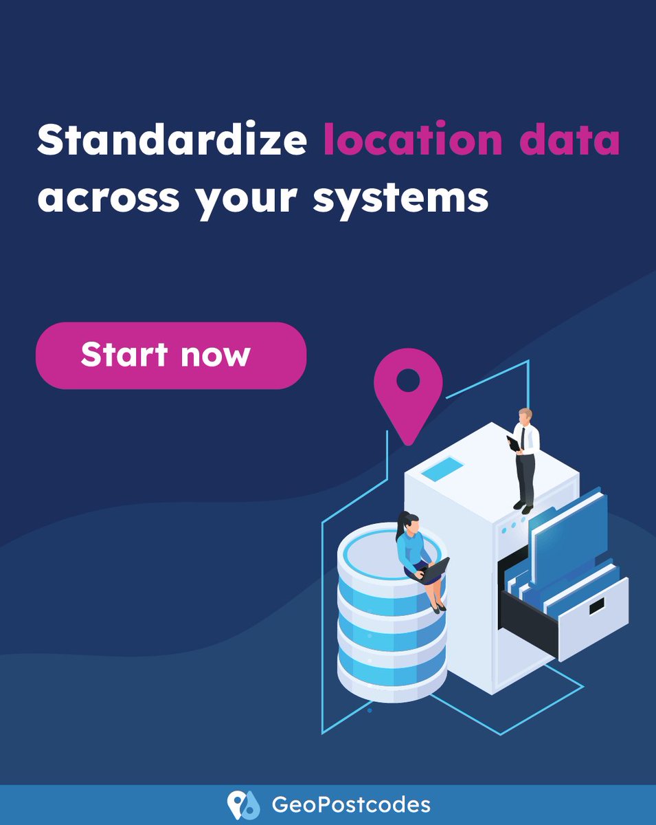
🚨Managing location data across multiple systems, CRMs, and ERPs for instance, can lead to:
▪ duplicates
▪ inconsistencies
▪ no single source of truth
Standardize your location master data formats with our plug-and-play datasets ⬇️
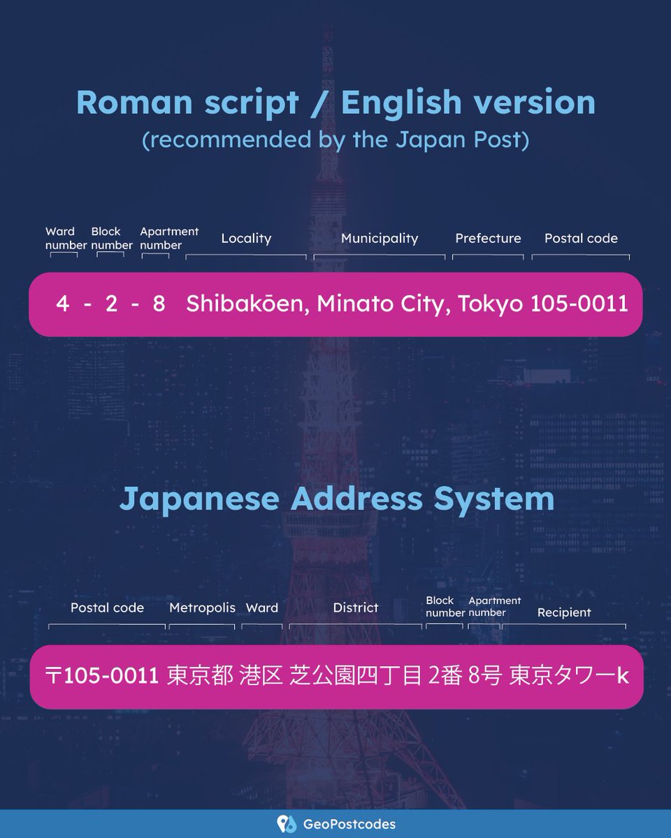
🇯🇵Did you know that Japan writes addresses differently than Western countries?
The addressing system is configured from the most significant administrative unit to the smallest.
🗾The Japan Post recommends writing addresses in reverse order using Roman or English script.