पिन किया गया ट्वीट
josh 𐚁
16.6K posts


josh 𐚁
@JoshHasAProblem
contributor @VortixWx | Beyhive | Joshua Patrick Allen clears your favorite QB | 17
Atlanta, GA शामिल हुए Eylül 2021
226 फ़ॉलोइंग718 फ़ॉलोवर्स

josh 𐚁 रीट्वीट किया

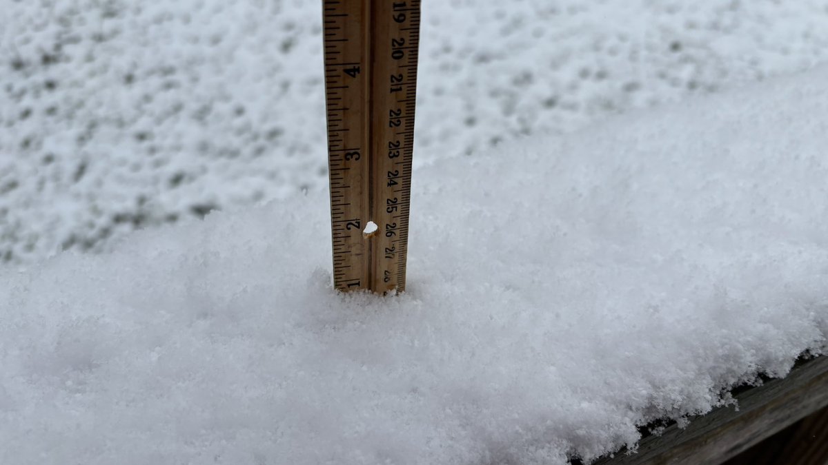
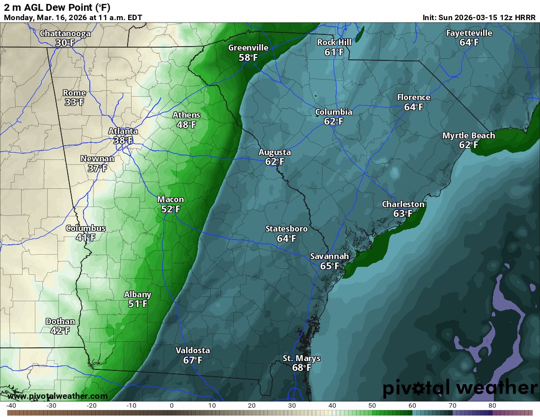
Annddddd we officially have snow and ice.
Roads will be fine through the day!
GIF
English
josh 𐚁 रीट्वीट किया

English

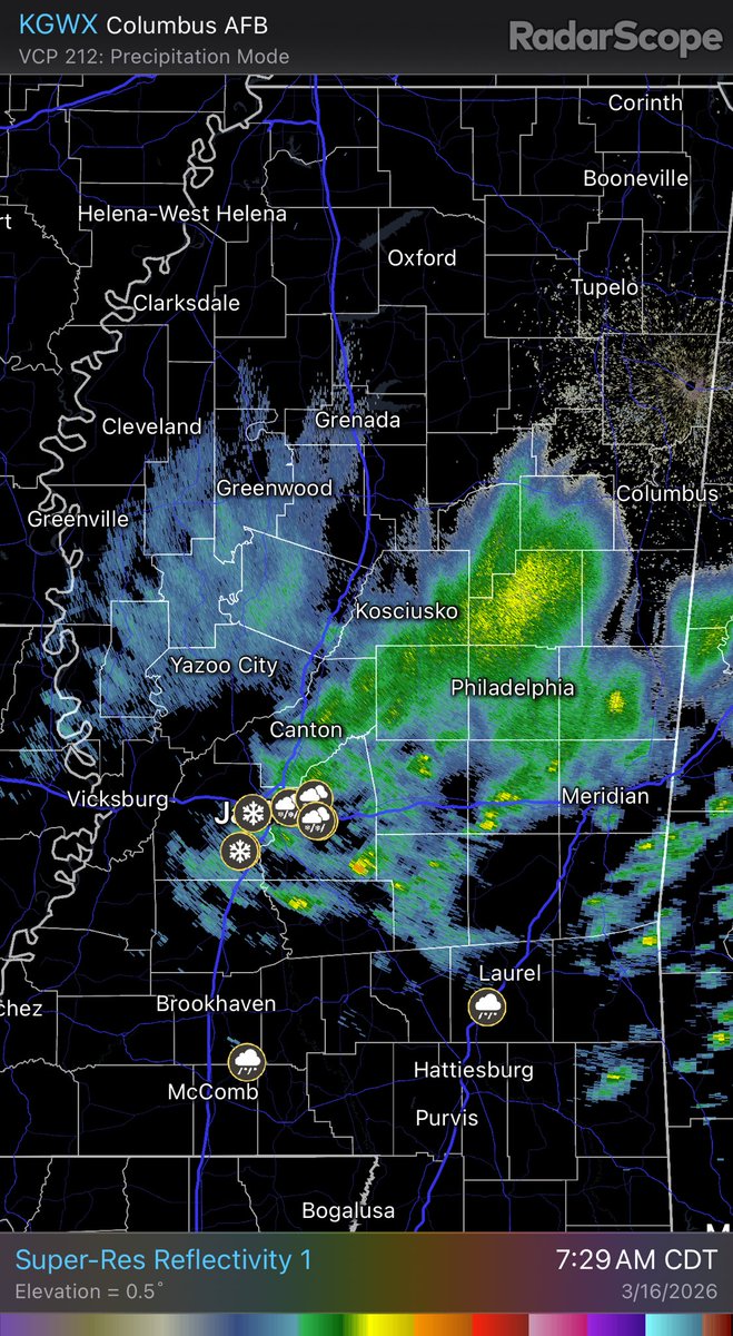
I hear a roar and a TVS is seen on radar. Yo I’m actually taking cover
English
josh 𐚁 रीट्वीट किया
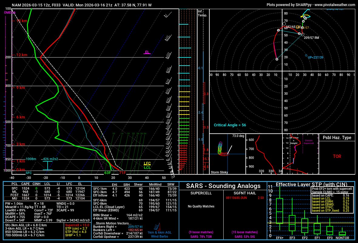
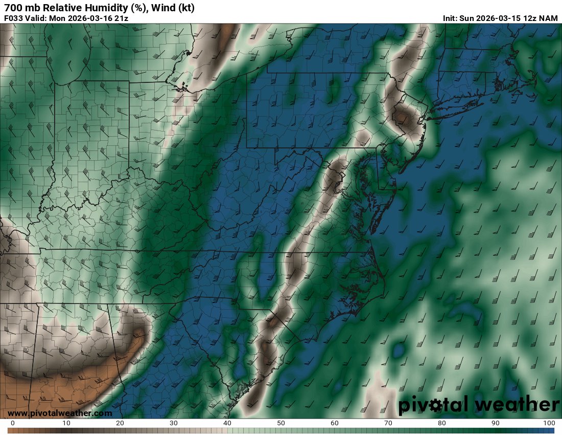
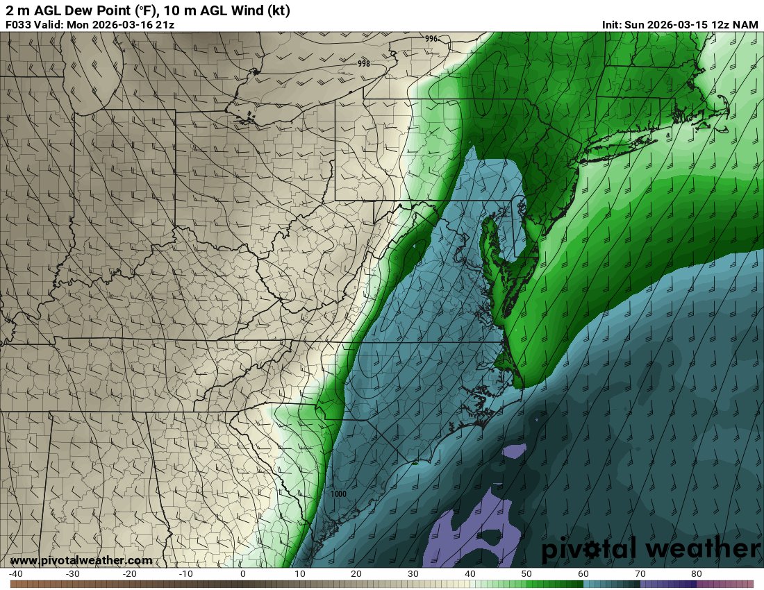
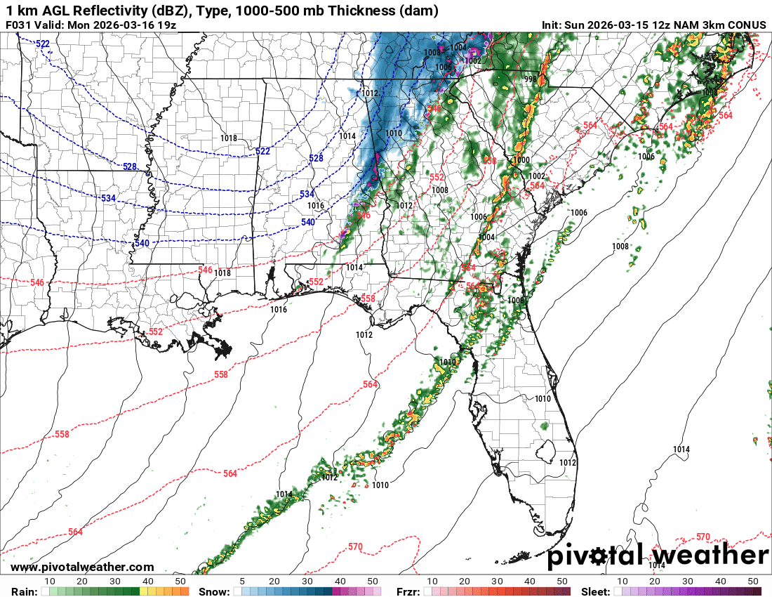
A legit EML is showing up on the NAM now over a clean warm sector + a mesolow over Western VA.
This is a higher-end scenario.
English
josh 𐚁 रीट्वीट किया

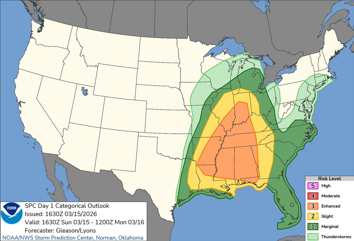
11:32am CDT #SPC Day1 Outlook Enhanced Risk: this afternoon and tonight across much of the lower/mid Mississippi Valley, lower Ohio Valley, Tennessee Valley, and Southeast spc.noaa.gov/products/outlo…
English
josh 𐚁 रीट्वीट किया

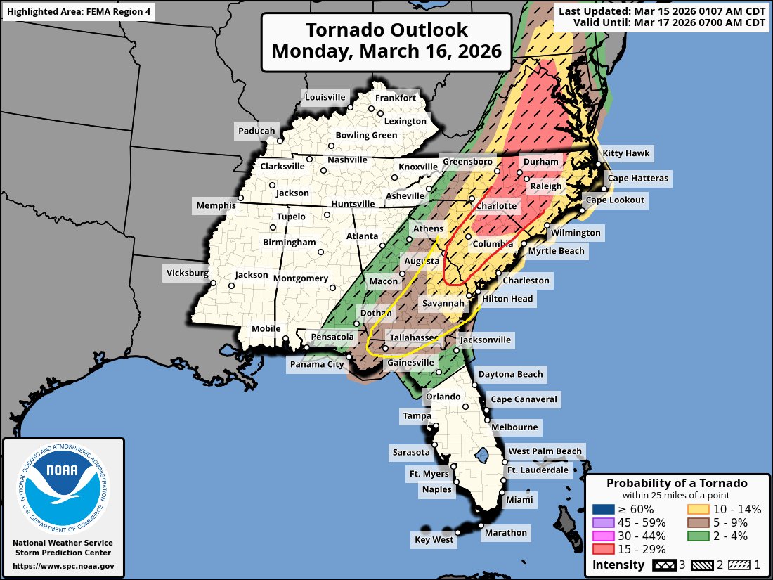
I think the tornado risk will increase for the Southern mode of this system. I think the 15% & 10% tornado risk area will extend further South. Now keep in mind the further Southwest you are, the earlier in the day your highest tornado threat will be.
I do think we wake up to a ton of ongoing tornado warnings tomorrow morning for GA & the panhandle of Florida & even into South Carolina. I don't think tomorrow will be like today where it takes the entire morning & early afternoon period for the atmosphere to get going, it will already be prime late tonight into the morning hours tomorrow for the Southern mode especially. The thermodynamic environment will only improve through the morning & afternoon hours ahead of the morning line of storms. Kinematic wise, the entire severe risk area will be loaded with wind energy.
Below are some frames from the latest HRRR for 11 am tomorrow morning. CAPE levels (storm fuel) will build. We don't need a lot to have a significant severe weather event in this set up..


English
josh 𐚁 रीट्वीट किया
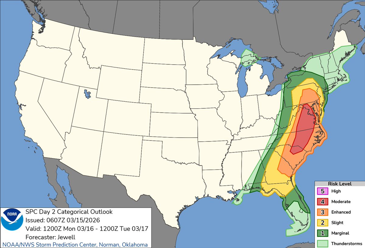
1:09am CDT #SPC Day2 Outlook Moderate Risk: from northern South Carolina across North Carolina and into Virginia and Maryland spc.noaa.gov/products/outlo…
English
josh 𐚁 रीट्वीट किया
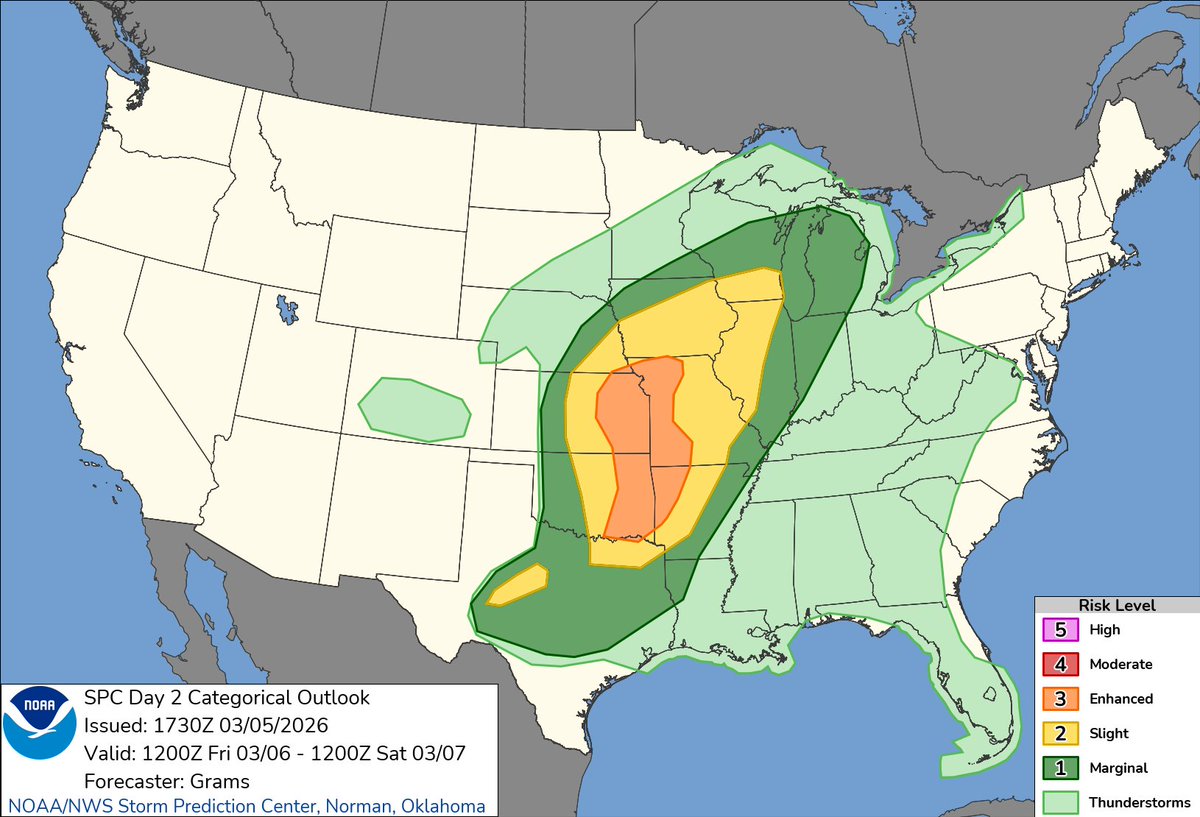
12:32pm CDT #SPC Day2 Outlook Enhanced Risk: in the Ark-La-Tex/Ark-La-Miss to the Wabash/Lower OH Valleys spc.noaa.gov/products/outlo…

English
josh 𐚁 रीट्वीट किया

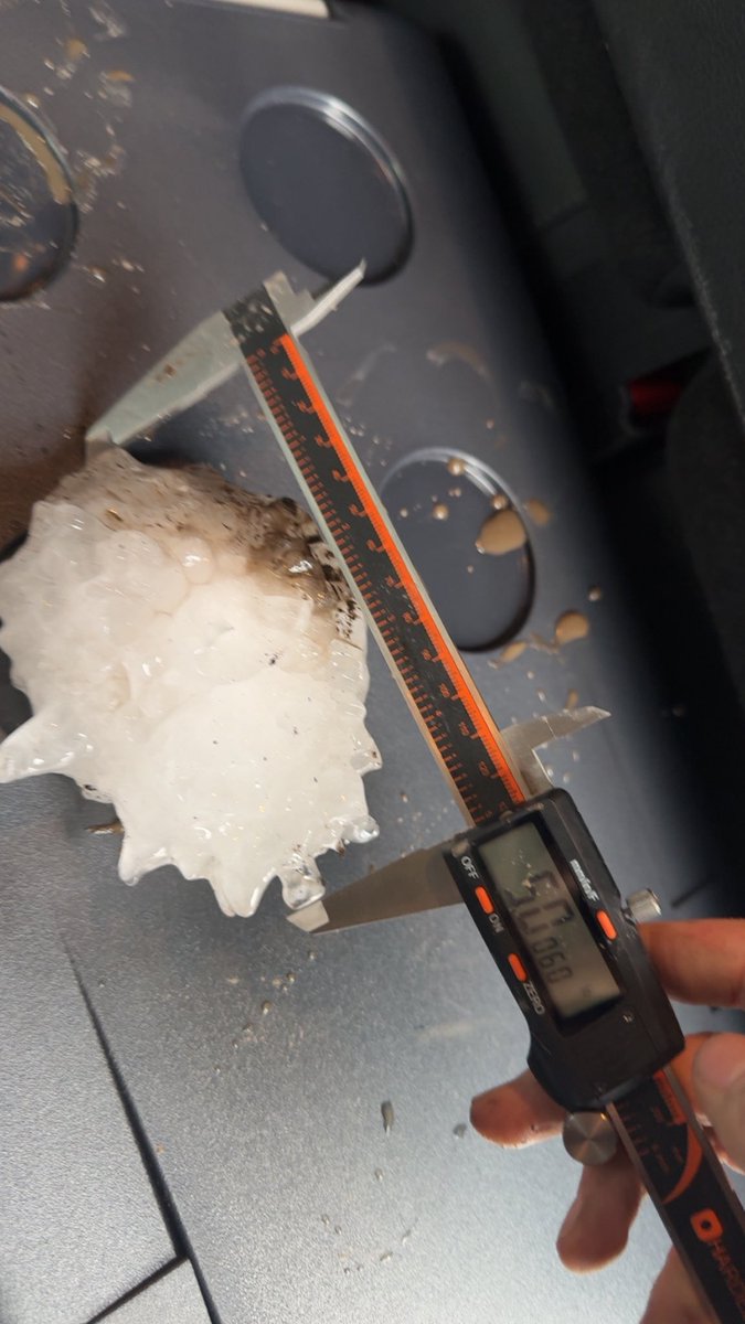
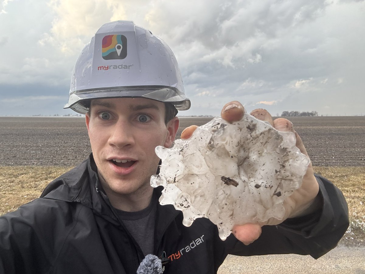
HOLY SH*T THE ILLINOIS STATE RECORD HAILSTONE OF FIVE INCHES IN DIAMETER HAS BEEN FOUND NW OF BUCKINGHAM
WE DID IT @MyRadarWX
English
josh 𐚁 रीट्वीट किया
josh 𐚁 रीट्वीट किया
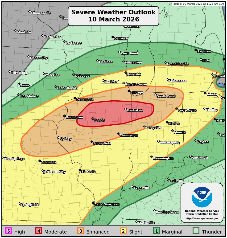
11:30am CDT #SPC Day1 Outlook Moderate Risk: across parts of northern/central Illinois into northwest Indiana spc.noaa.gov/products/outlo…

English
josh 𐚁 रीट्वीट किया
11:32am CST #SPC Day2 Outlook Enhanced Risk: IN EASTERN KS/OK AND WESTERN MO/AR spc.noaa.gov/products/outlo…
English
josh 𐚁 रीट्वीट किया
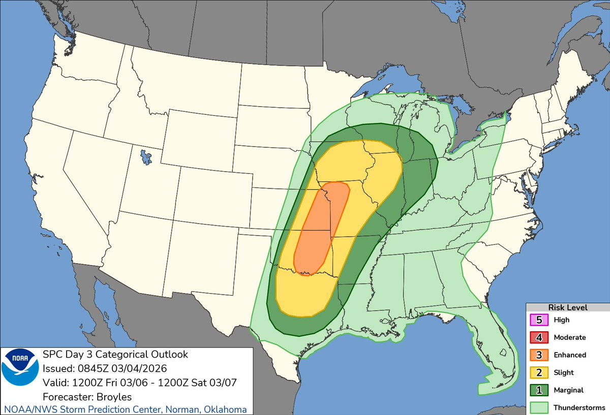
2:46am CST #SPC Day3 Outlook Enhanced Risk: across parts of the southern and central Plains into the lower to mid Missouri Valley spc.noaa.gov/products/outlo…
English
josh 𐚁 रीट्वीट किया
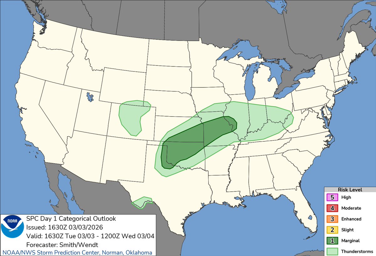
11:07am CST #SPC Day1 Outlook Marginal Risk: across parts of the southern/central Plains into Missouri and western Illinois spc.noaa.gov/products/outlo…
English
josh 𐚁 रीट्वीट किया

this is rather embarrassing for y’all
The White House@WhiteHouse
"THE UNITED STATES OF AMERICA WILL NEVER ALLOW A RADICAL LEFT, WOKE COMPANY TO DICTATE HOW OUR GREAT MILITARY FIGHTS AND WINS WARS! That decision belongs to YOUR COMMANDER-IN-CHIEF, and the tremendous leaders I appoint to run our Military. The Leftwing nut jobs at Anthropic have made a DISASTROUS MISTAKE..." - President Donald J. Trump
English