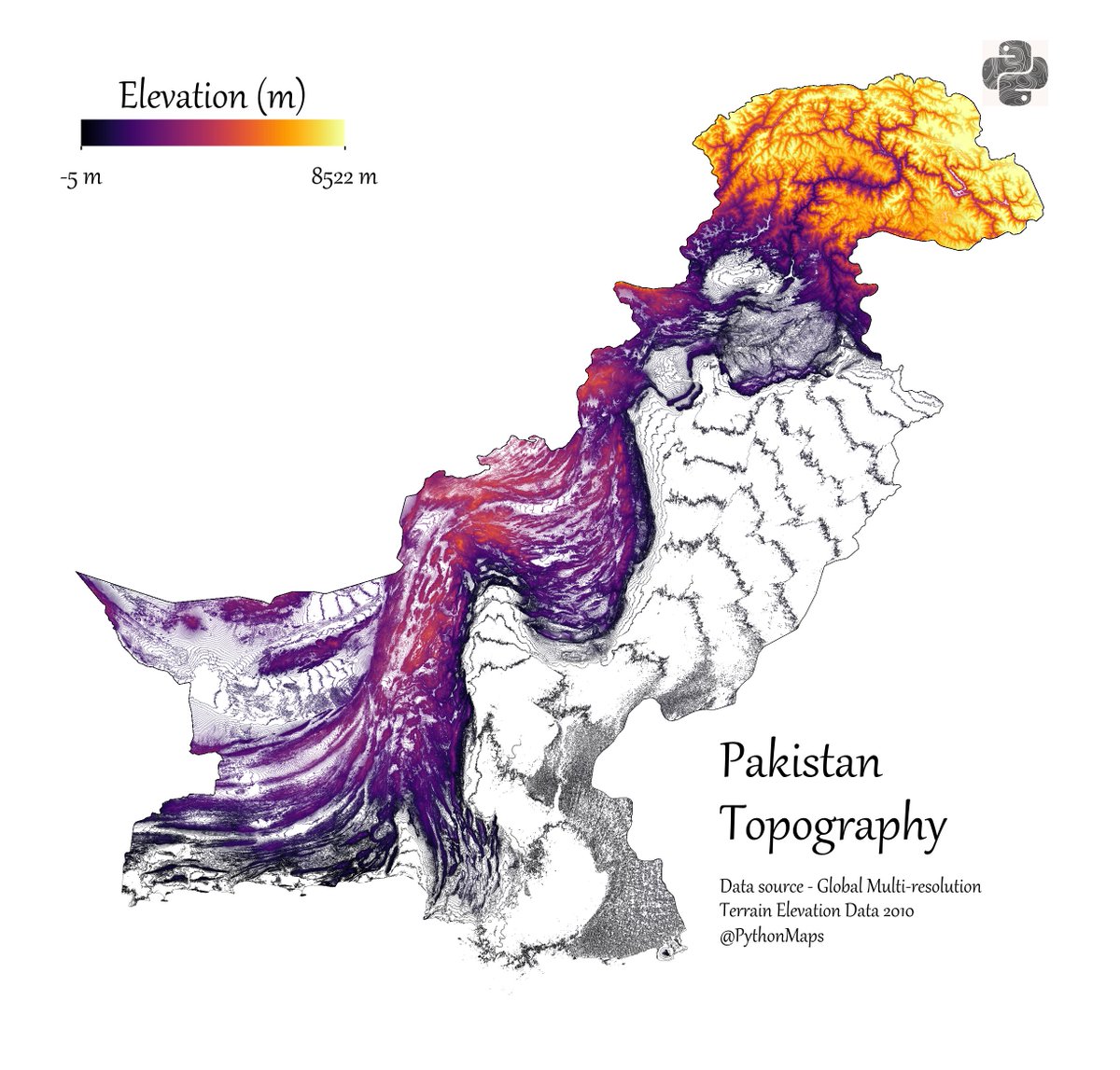
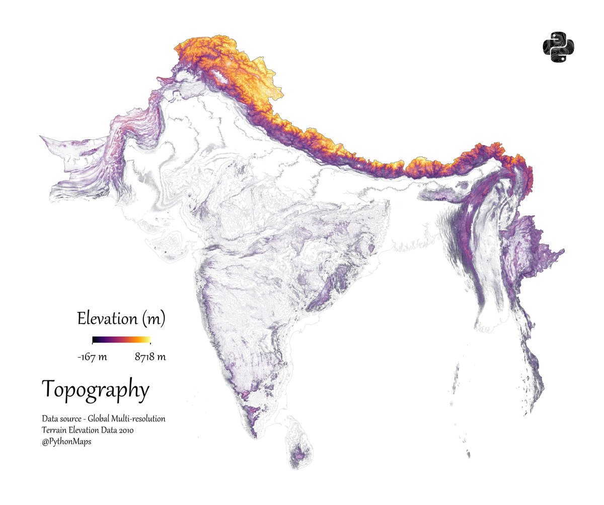
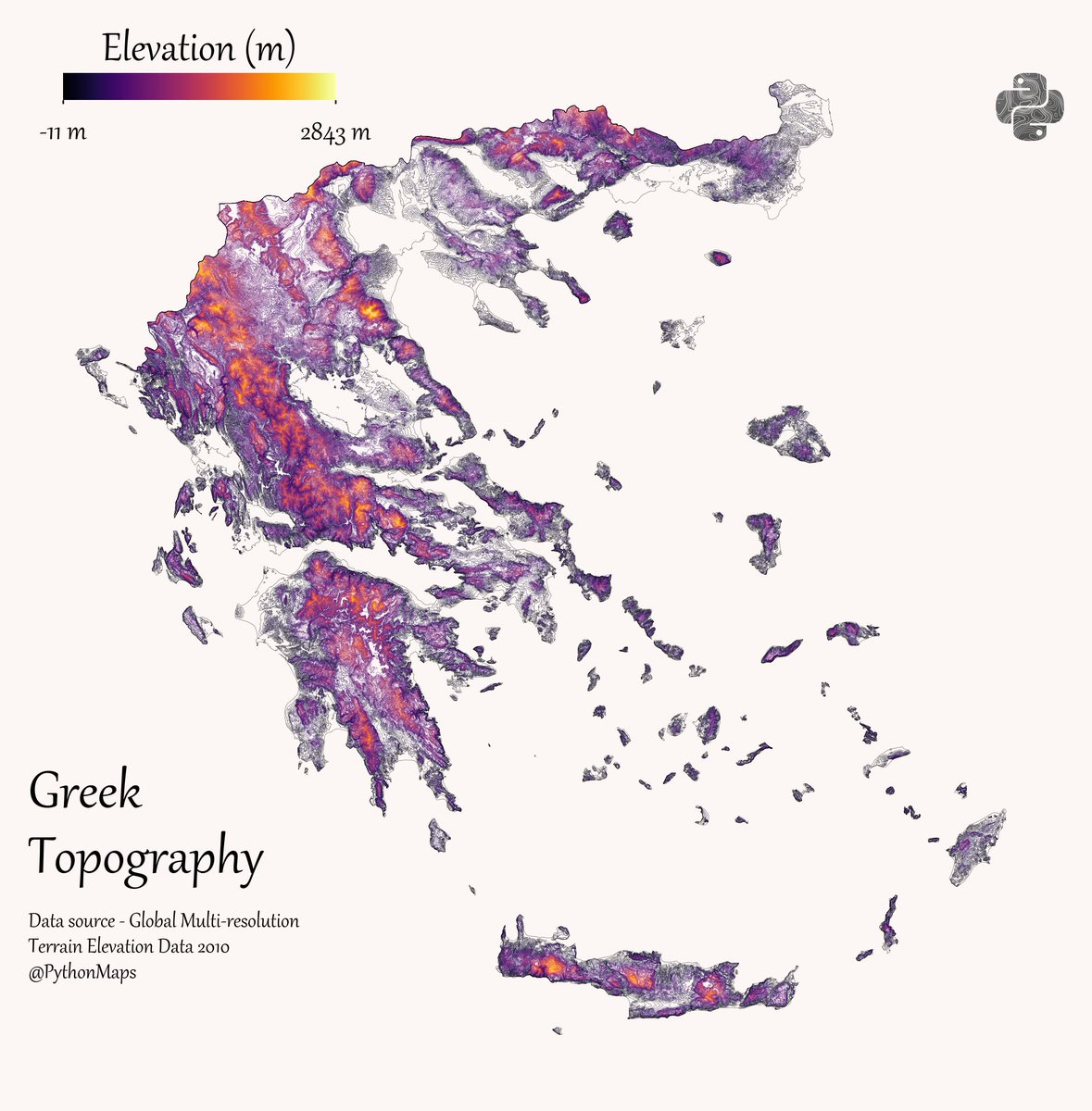
In the final chapter of my book, I show you how to use GDAL to transform digital elevation models into contour line maps (and vice versa). Here's a sneak peek at the maps 1/n