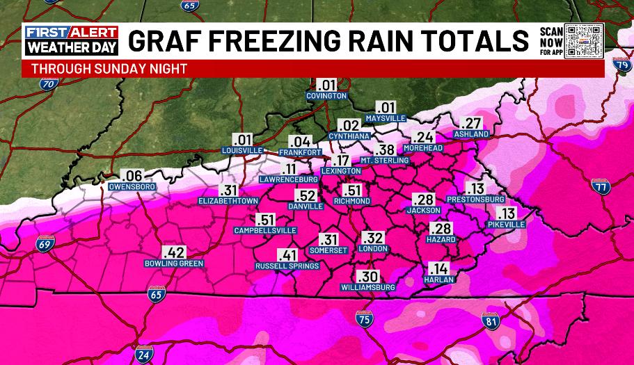
I just ran our in-house forecast model known as the GRAF. It does reasonably well within 24 hours of a winter storm impacting our region. Here are the snow and freezing rain numbers it gave me. This is ONLY a model forecast. #kywx
All contestants to the KSR METEOROLOGIST MADNESS must have their forecasts for Lexington and Louisville in by 11:30 am tomorrow. I will read them on the show. Whoever combines closest for both cities wins $10,000 for charity is crowned
King (or Queen) of Kentucky Weather!!!!
@Kentucky_WX NWS Louisville is still banking on 12-15 inches for us around Richmond. I pray that verifies but it seems steep 🫨 I’m thinking more 7-10” from previous runs.
I do not think the GFS is right with this setup…..
However I would do MANY things to allow it to verify for our state…..
All aboard the snow train, let’s reel this thing in tonight ❄️🫡
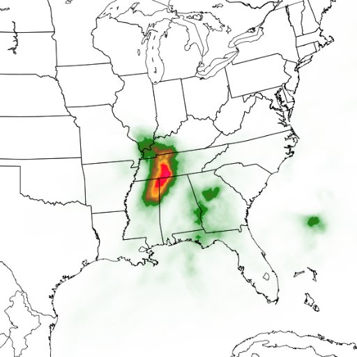
The shear amount of precipitation with this winter storm is astounding. This is the new NAM from Saturday morning through Sunday morning. Look how much moisture is still coming at us from the southwest. Mercy. #kywx
@Kentucky_WX Would love nothing more than an absolute thumping of snow in Central/Eastern Kentucky. The uncertainty with this setup has my expectations very low though.
GFS ensembles are still picking up on an active pattern late this week.
Each storm will affect the next track so it is vital to take it one storm at a time.
Looks like, at the least, we will have on and off snow showers Thursday through Sunday. More to come as data becomes more clear. #KYwx
The models underestimated the amount of cold air across Kentucky today. This argues for a slightly farther south tracking system and snow shield. #kywx
I'm going to all 54 Buc-ee's locations starting tomorrow. Raising $10,000 for an animal shelter in Northeast Ohio
Be a part of the journey and donate here: gofund.me/7ed1bf74
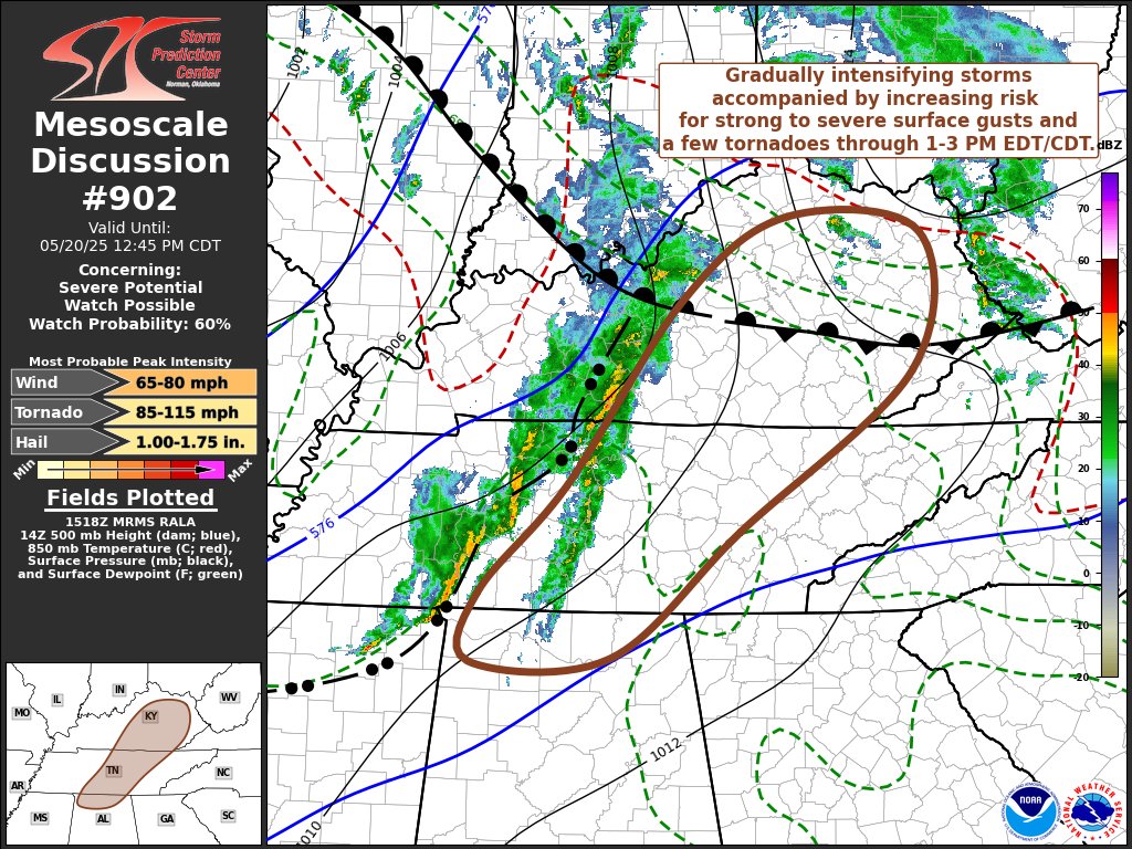
Some pretty good rotation is showing up with this storm just southeast of Lancaster moving into southern southern Madison County & Northern Rockcastle County. I’m surprised they haven’t issued a tornado warning for it. #kywx
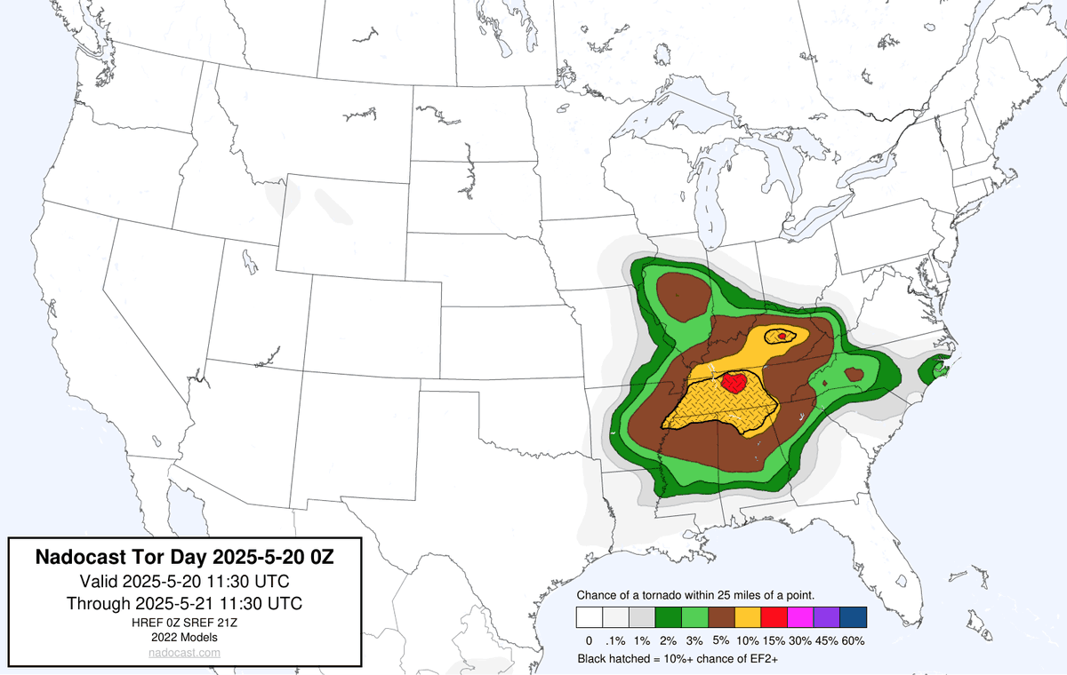
The latest future radar from the HRRR brings two rounds of strong to severe storms sweeping eastward across the state this afternoon and evening. #kywx