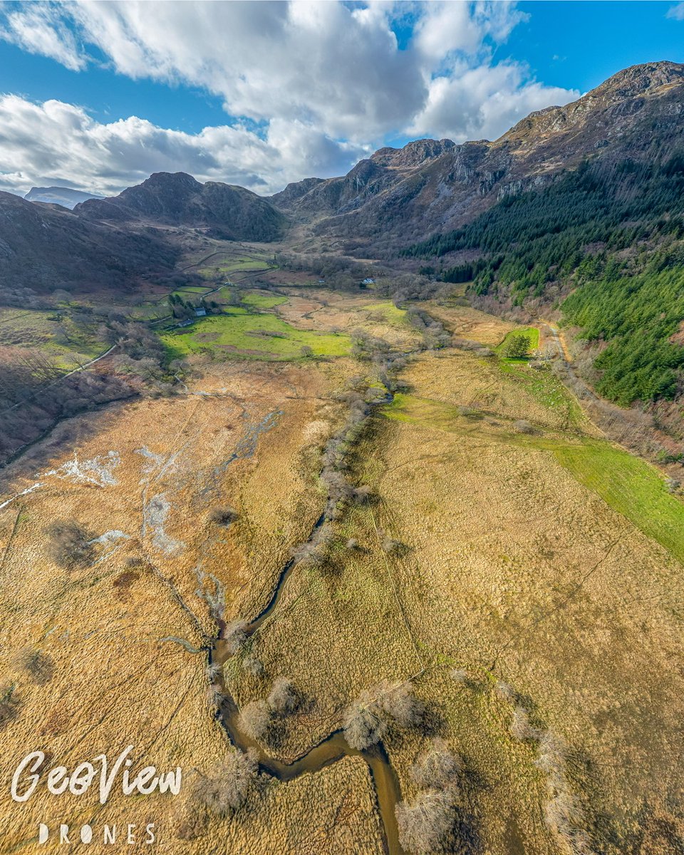
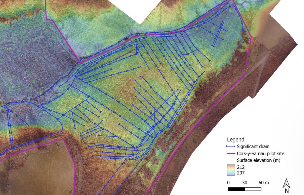
proving critical for understanding the hydrology of the site, and the cross-cutting relationship between ditches and subtle variations in their elevation. This directly informed the restoration plan for the site ✅
👀 Read the project report here: vb.nweurope.eu/media/21503/ca…
3/3
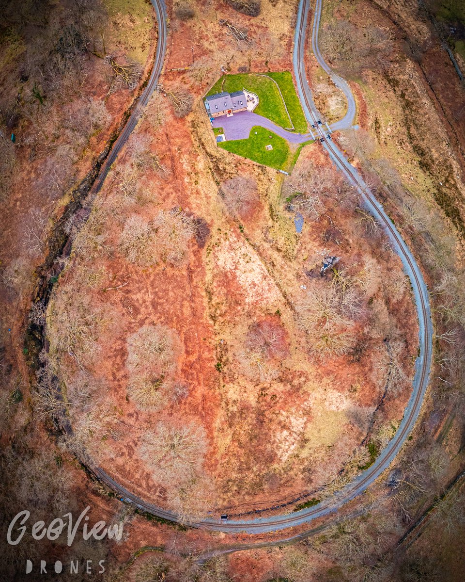
🗺️ Our high resolution orthomosaic map of the site provided rapid and cost-efficient identification of ground features, and photogrammetric Digital Surface Model closely approximated the ground surface in areas where vegetation had been cleared…
2/3
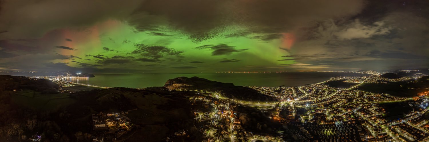
⏳It’s approaching 4 years since our involvement with the North Wales Wildlife Trust to provide aerial mapping services for the Cors-y-Sarnau Nature Reserve and the Interreg Care-Peat initiative… 🌱
🧵 1/3