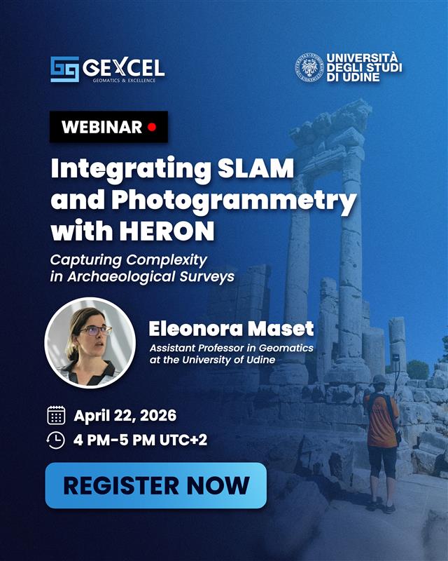
🚀 GEXCEL Webinar April 22, 4–5 PM (UTC+2). Combining UAV photogrammetry with HERON 3D improves efficiency and accuracy in documenting complex archaeological sites. Full workflow, even without GNSS. 👉 Register: shorturl.at/enELO
English
Geo-matching.com
8.8K posts
@Geomatching
https://t.co/3gwCkbV0gR The world’s largest product platform for surveying, positioning and machine guidance.