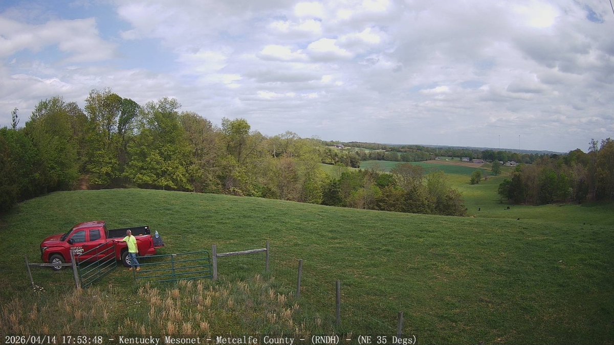
Our field technicians are now in the midst of '#spring pass'. This is where our crews make the rounds to all our 86 sites, checking and cleaning instrumentation, swapping out sensors or wires as needed, and making sure vegetation is cut, if necessary. (1/2)
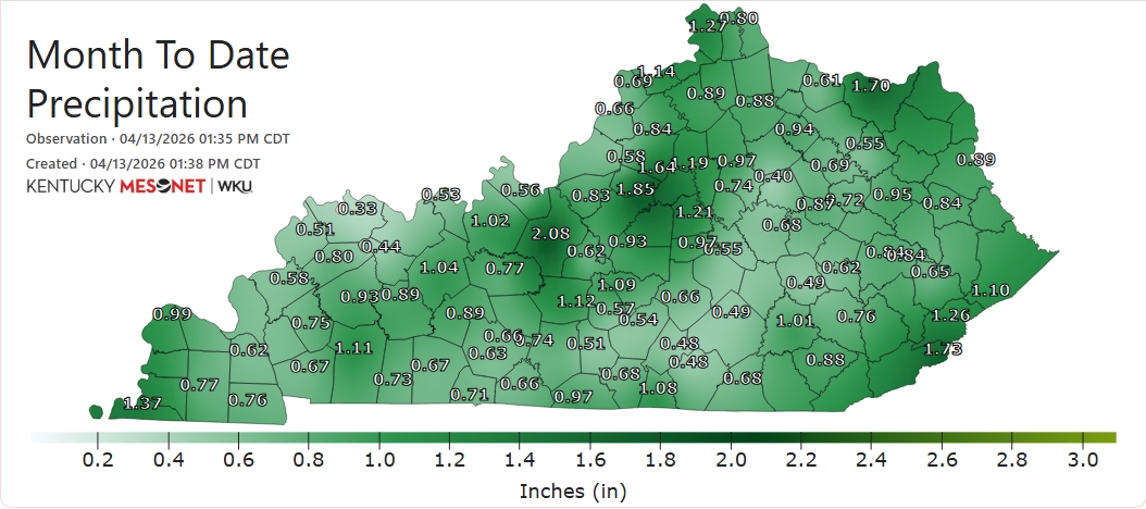
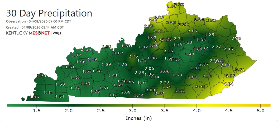
As we approach the halfway point of April, we find that a great number of sites have received < 1" for the month to date. Some have yet to see more than one-half inch accumulate. #kywx
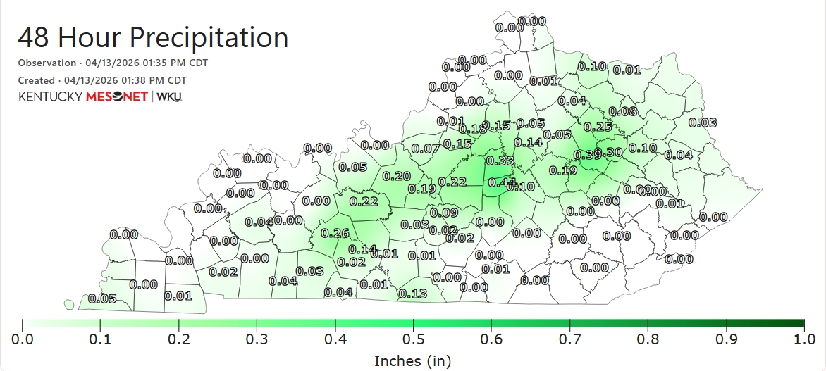
Much-needed rainfall has proven tough to come by in recent days. Some sites received measurable precipitation dating back to Saturday, while others have been shut out altogether. (1/2)
#OTD in 2004, dynamic cooling on the back side of low pressure moving NE up the Appalachians resulted in significant, wet #snow accumulations for parts of the state. Louisville had just 0.1", but Rochester in Butler Co. saw 3.5" & Rough River Lake a whopping (for April) 6"! #kywx
#OTD in 1948, an F2 tornado struck the Bluegrass Army Depot in Madison County near Richmond. Several large buildings were downed. No one was hurt. #kywx
Here is our latest Drought Information Statement slide deck: weather.gov/media/pah/DGT/… Severe drought (D2) has expanded over more of the region with this week's update. Paducah has officially observed their driest December 1st through April 9th period on record.
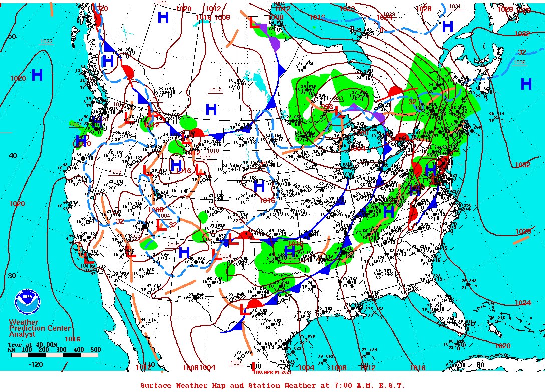
#OTD in 1991, a 'derecho', a long-lived complex of severe thunderstorms with widespread wind damage, raced NE from the mid-South into the mid-Atlantic. Central/eastern sections of the Commonwealth bore the brunt of this event with numerous downed trees and power lines. #kywx
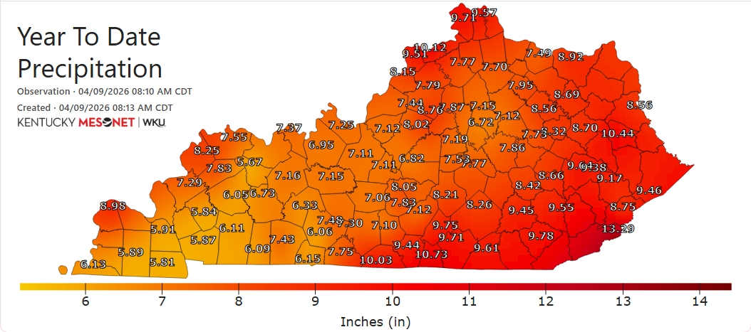
The #spring season has featured a general lack of significant rainfall for extended spells for much of the state. Many sites have received <2" of rainfall in the past 30 days. Rainfall deficits for the year-to-date are running > 5" below normal for many. #kywx
D1 (Moderate Drought) has also expanded eastward into southern portions of the Blue Grass region and parts of the mountainous east. The yellow denotes D0 ('abnormally dry') conditions. (2/3)
🧵🟠DROUGHT SPREADS: Per the latest update from @NOAADrought, more than half of the state - nearly 55% of it - is now officially in #drought. D2 (Severe Drought) has expanded east to take in Bowling Green and a large portion of south-central and far W KY. (1/3)
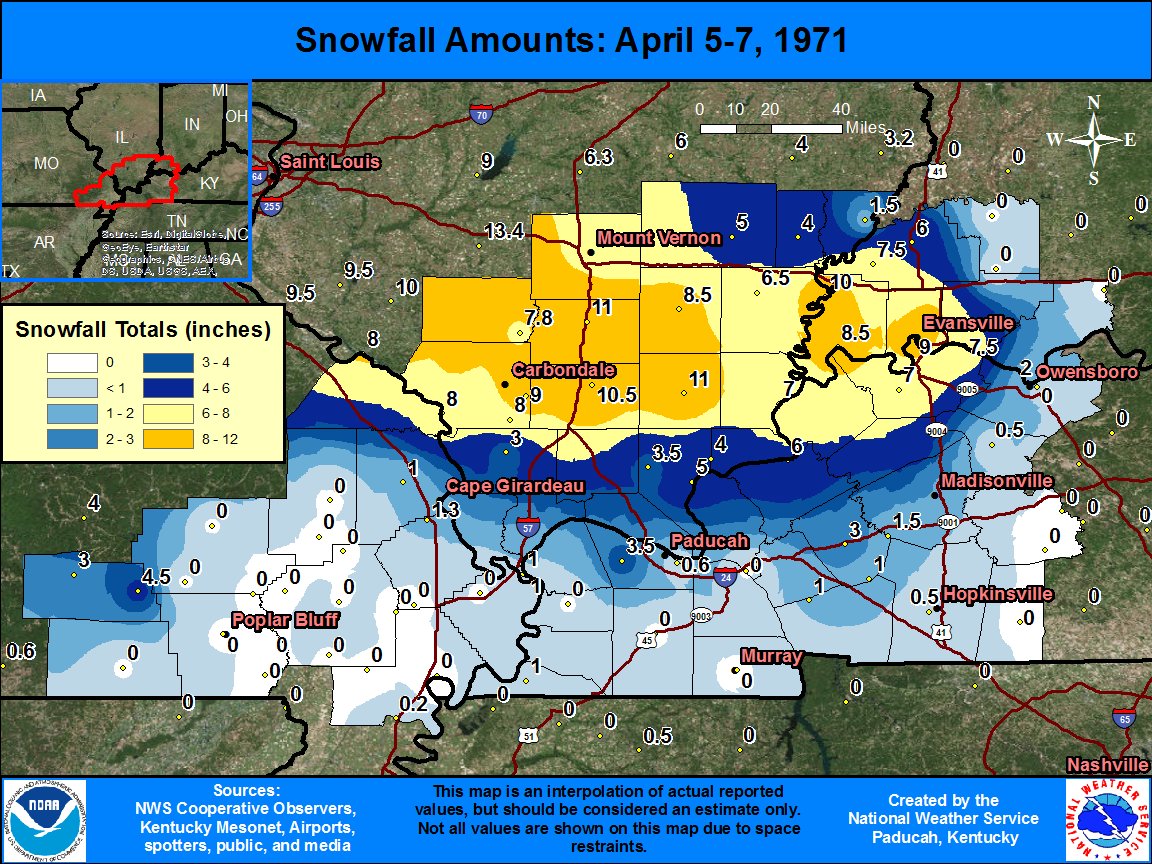
#OTD in 1971, a very rare, late-season winter storm affected mainly the western region with slushy, accumulating #snow. Portions of Union, Henderson, and Webster Cos. received 6"+, with up to 9" in the city of Henderson. (data: @NWSPaducah) #kywx
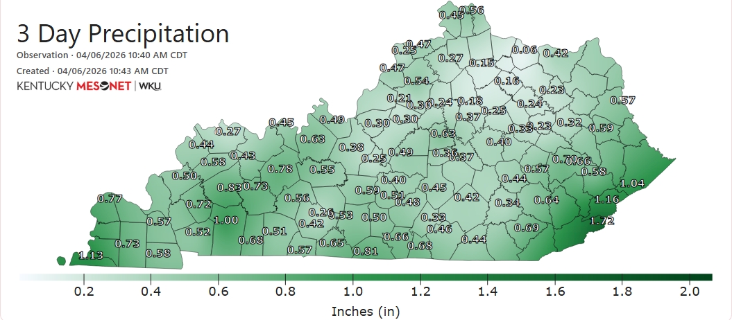
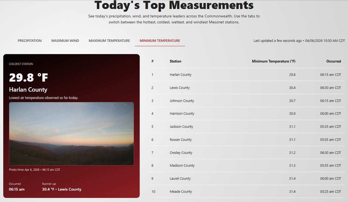
The #easterweekend provided the Commonwealth with badly-needed rainfall for many. While some locations saw < .25", others received > 1", including Black Mountain in the east. That's also where the coldest low temperature occurred this morning (just shy of 30F).
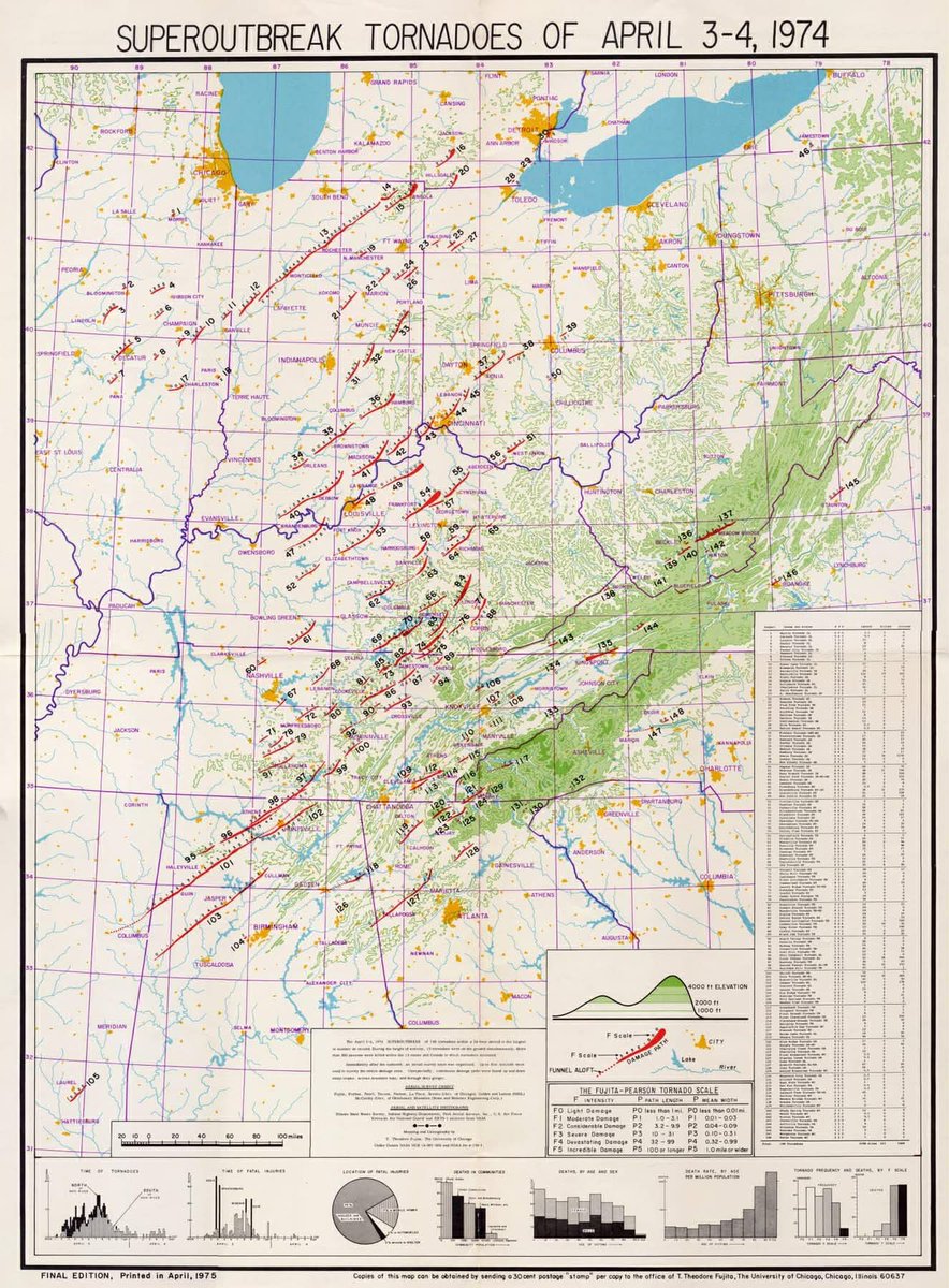
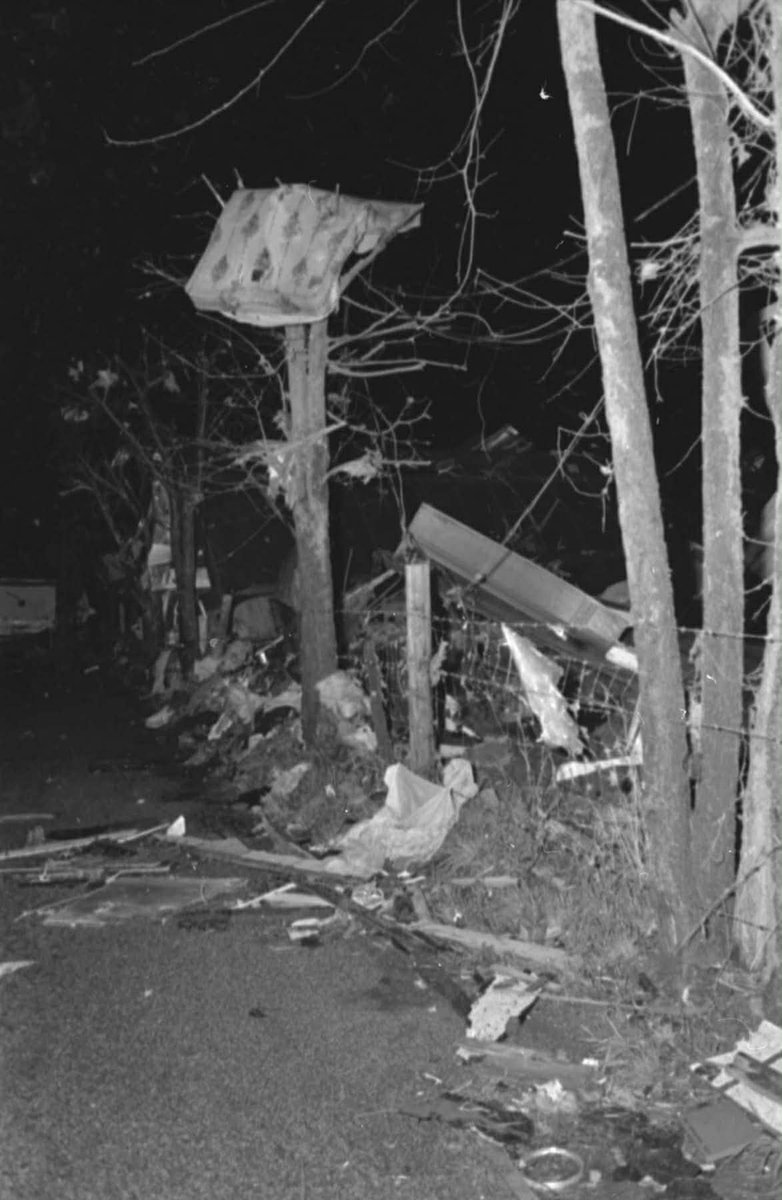
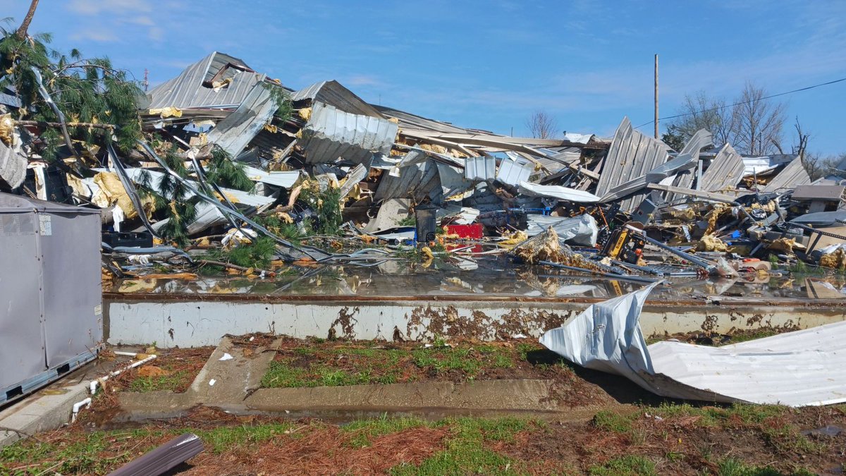
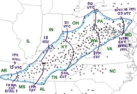
#OTD 50 years ago, an event that became known as the “SuperOutbreak” of tornadoes unfolded. Some 148 tornadoes swept across the eastern U.S. This included the only F5/EF-5 to ever strike KY (Brandenburg), where 31 people lost their lives. (1/2)
@NWSPaducah The strongest tornado touched down in Jeffersontown, a suburb of Louisville, where an EF-3 with winds to 145 mph was confirmed on the 2nd. (tornado data/map: @NWSLouisville) #kywx
@NWSPaducah Several fatalities were blamed on the flooding, with numerous road closures as well as businesses and schools shut down for a time. In addition to the heavy rains, this system also produced rounds of severe thunderstorms with several tornadoes...
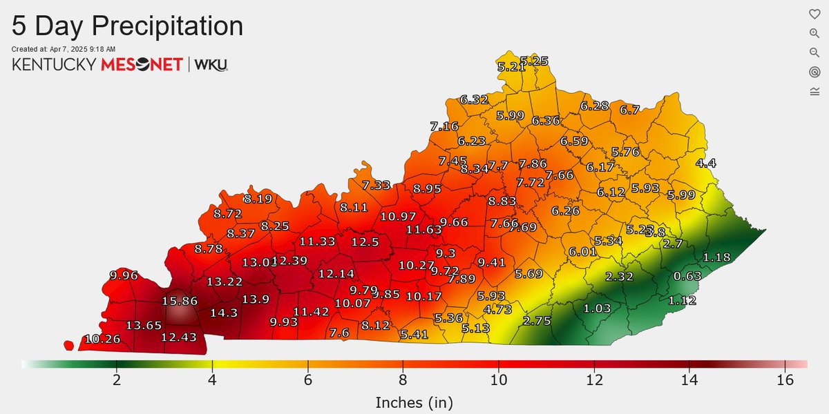
🧵#OTD a year ago, The April Flood of 2025 was getting underway as a cold front eased into Kentucky. This boundary became stationary, meandering over the state for several days. Waves of rain and thunderstorms moved over Kentucky between the 2nd and the 6th...