FLWX_TropicalTracker_✝️ me-retweet

It's Saturday, you know what that means!
It's Baseball Night in America TONIGHT on FOX! ⚾️

English
FLWX_TropicalTracker_✝️
17.4K posts

@flimpct
Matthew 5:15-16 Joshua 1:8 ✝️ Hurricane Tracker Enthusiast/Chaser🏃♂️(3) Baseball ⚾️ Surveyor 👷♂️ All of which are my passions. Please let's discuss 🧐🌩
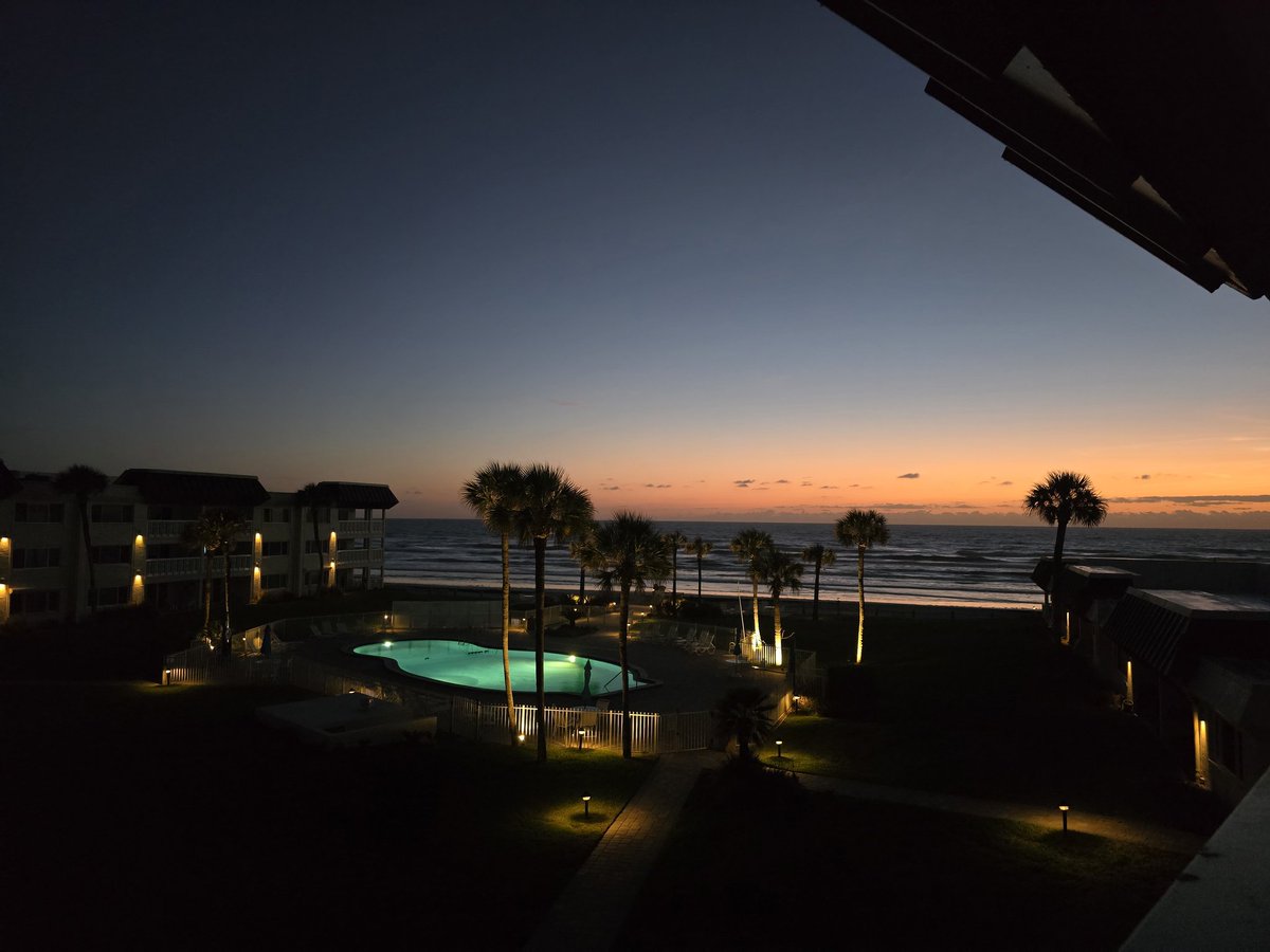
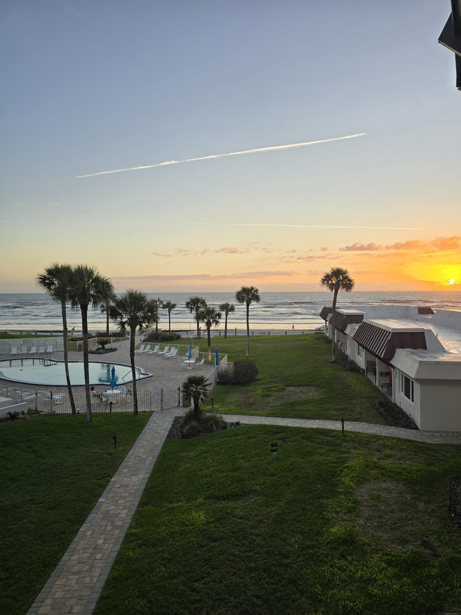
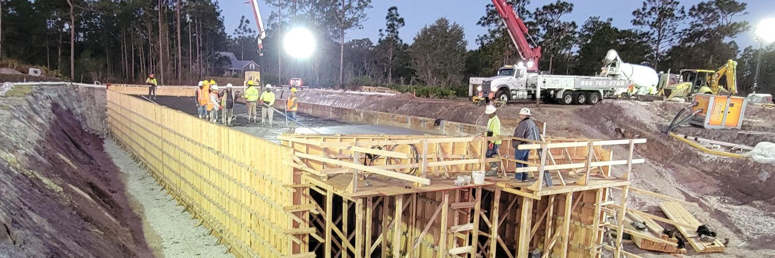
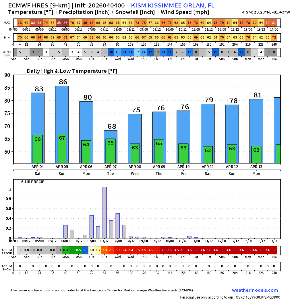
GOOD MORNING FROM NORTHEAST FLORIDA...


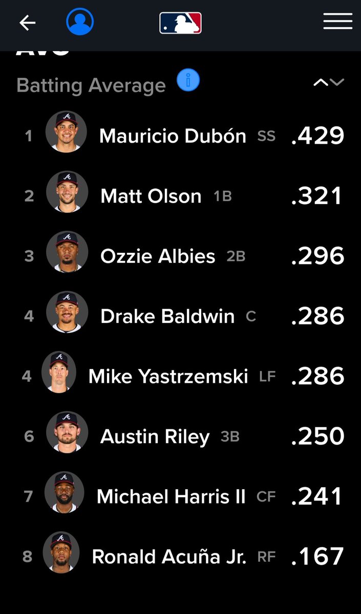
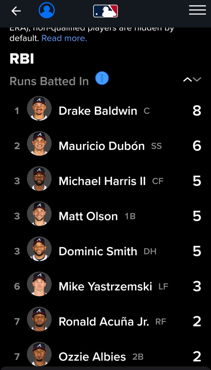
Okay Mauricio Dubón! I see you! Your Atlanta Braves batting average and RBI (Runs Batted In) leaders so far through the first 7 games (5-2) of the season. #BravesCountry #MLB #Stats

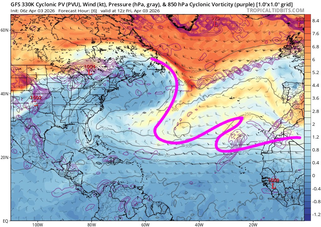
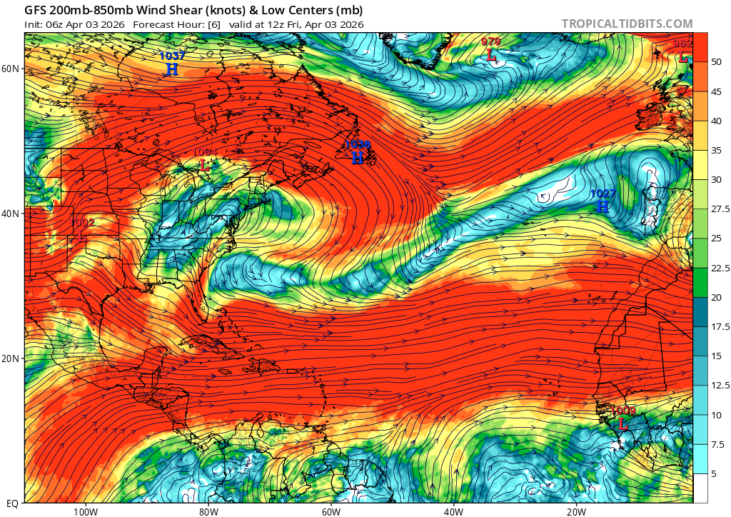

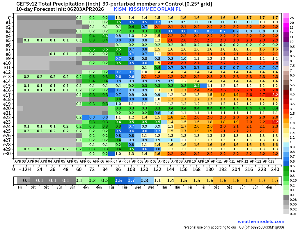
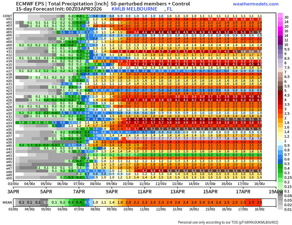
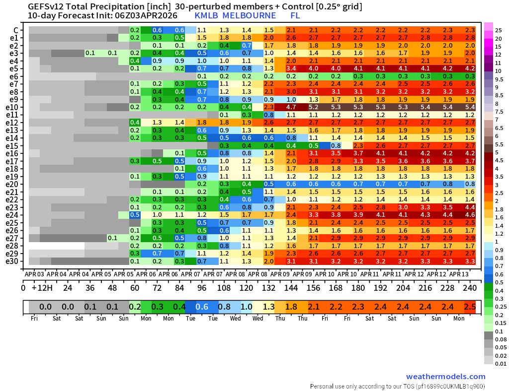
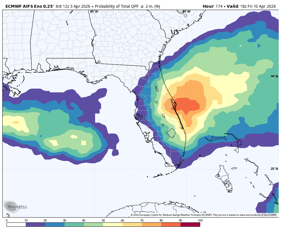
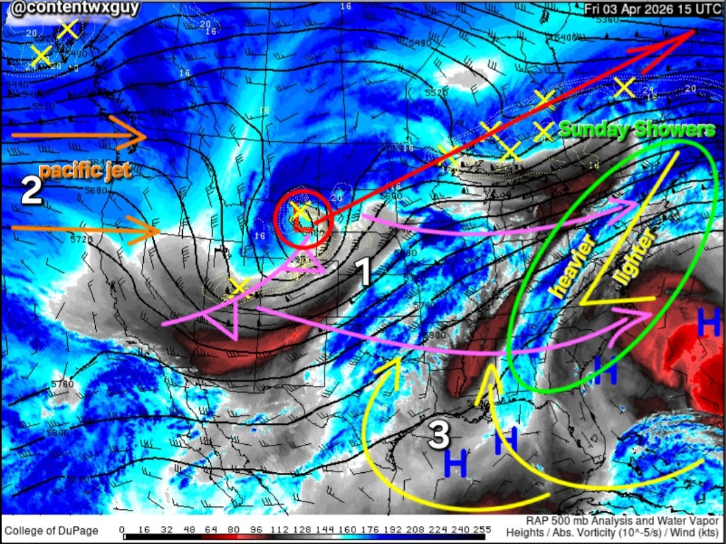
06Z GFS....STILL NOT SAYING THE MDL WILL VERIFY....GFS CAN SOMETIMES GET INSIDE A 5 DAY WINDOW AND TOTALLY REVERSE IT'S THINKING...F CUBA WAS A MOUTH #PAREIDOLIA SPIN I MEAN SPRING...S N DA HEIR✝️ HAPPY GOOD FRIDAY....