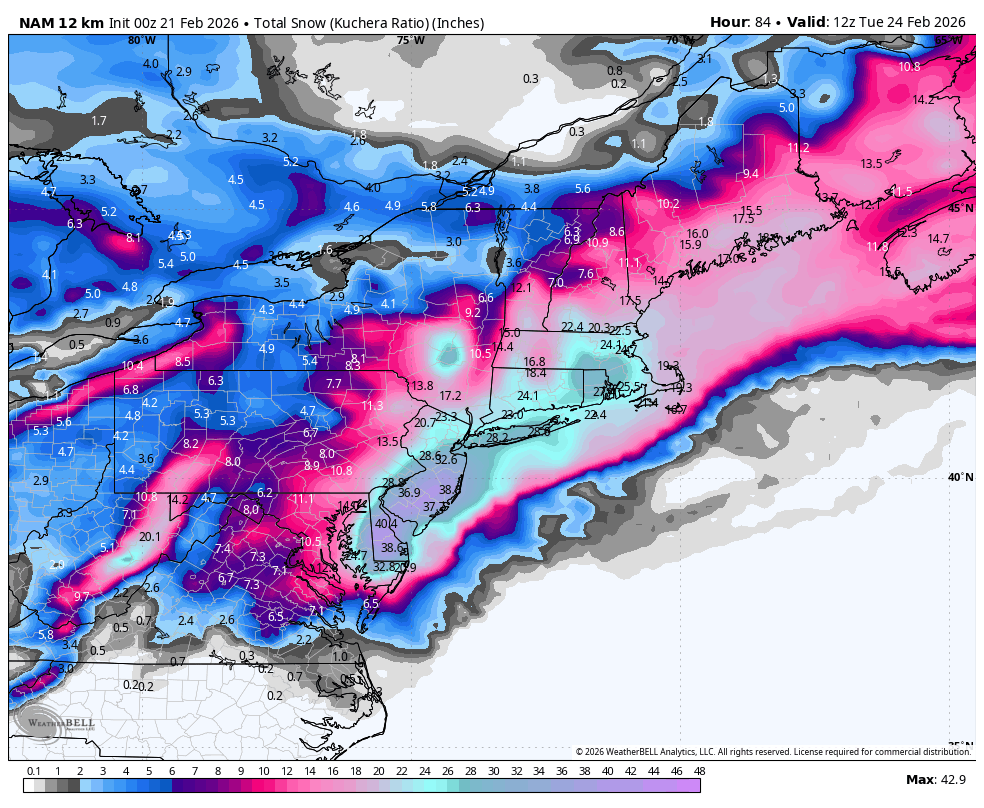
00z NAM is now out and oh my gosh. I genuinely have never seen a storm that looks like this.
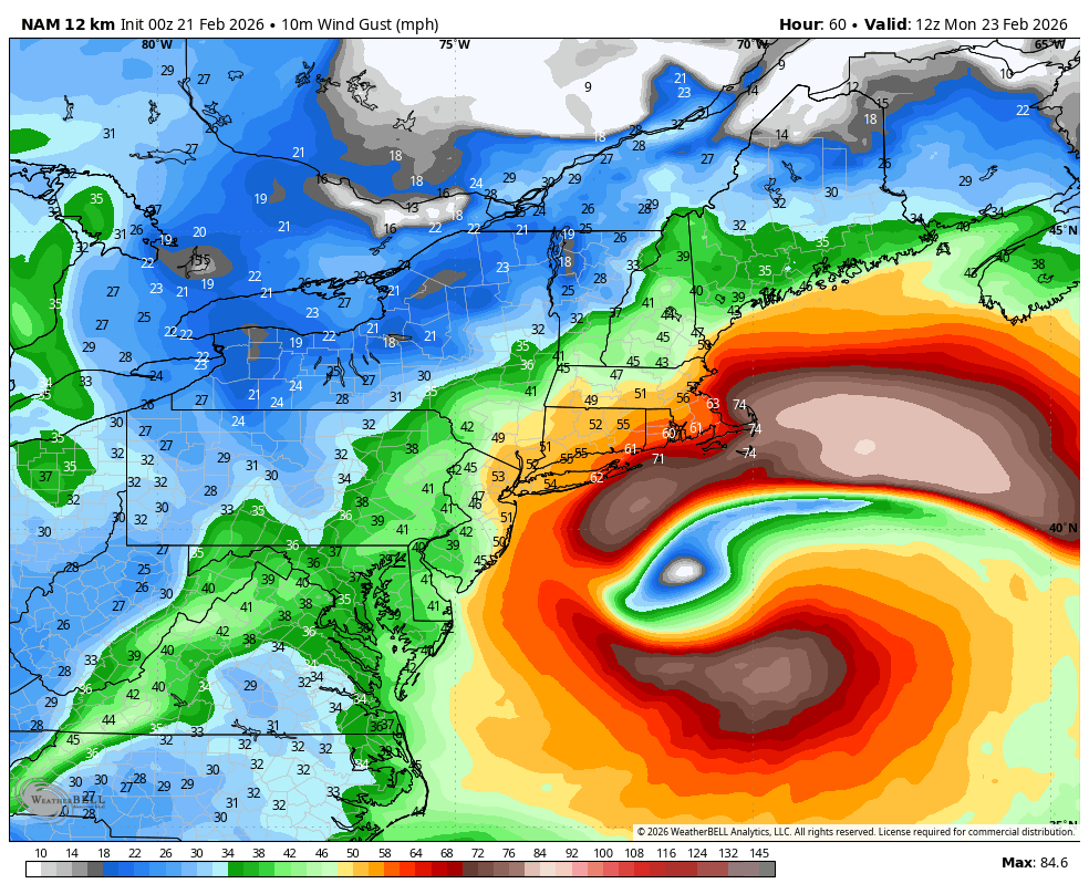
Several feet of snow, hurricane-force winds, and likely dangerous coastal flooding. Classic bombogensis to the benchmark.
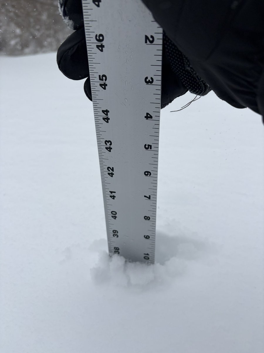
So a few have questioned my measurements and I’m not perfect and am not afraid to admit if I was wrong… so I went back out for a while and instead of just measuring on my deck I went all around my front yard which is wide open, not near any trees or houses, stayed away from obvious drifts or areas where snow obviously blew from, and took a bunch of measurements, all ranged from about 32-33”to about 40”- yes there were still a few inches on the ground even after 2 rain events, so call the range 29-37? Average it out and call it 33” I guess? I mean winds are blowing 60+ mph… usually the deck works well bc it’s pretty open and winds aren’t as crazy but I acknowledge snow blowing off the roof can affect (but it can affect the yard too lol) @buchrwx@tjdelsanto@tony_tpetrarca@AJ_Mast_WX@tuckerweather@NWSBoston@Eweather13@BradyBGWX
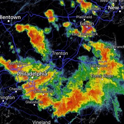
It's really time to stop looking at the models and focus on the radar and what's staring you right in the face. Surface pressure is tucked in, heavy banding continues to come in off the ocean. It will continue to dump
@weatherwilly Last measurement was taken at 11:00 PM and that was 6.5 inches. At 12 AM I am going to take another hourly measurement and by the looks of it might surpass 2 inches.
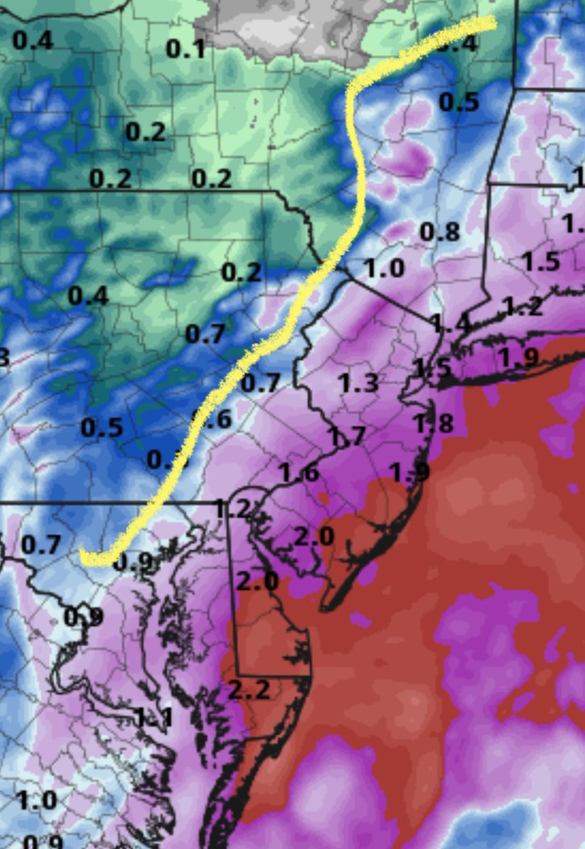
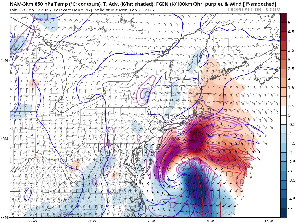
As the upper level trough becomes increasingly negatively tilted and the surface low rapidly deepens, the strengthening mid-level frontogenesis driven snow band is starting to pivot towards the SSW-NNE as it moves through central NJ, Long Island & NYC.
This band will eventually become quasi-stationary between the western half of NJ & far eastern PA. Intensifying snow rates driven by strengthening mid-level warm air advection & convergence are already evident over the northern Delmarva.
@mikestanislaw Yeah we’ll see about that. Every storm is “historic” and it ends up dropping about a foot. That’s not historic that just an average major snowstorm this one just happens to have a lot of wind. They always blow it out of proportion with these forcast 🤦
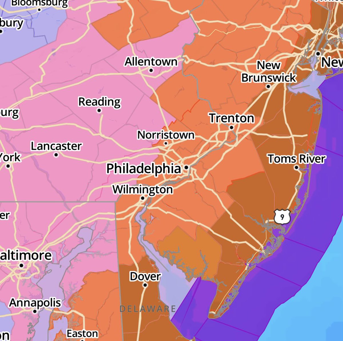
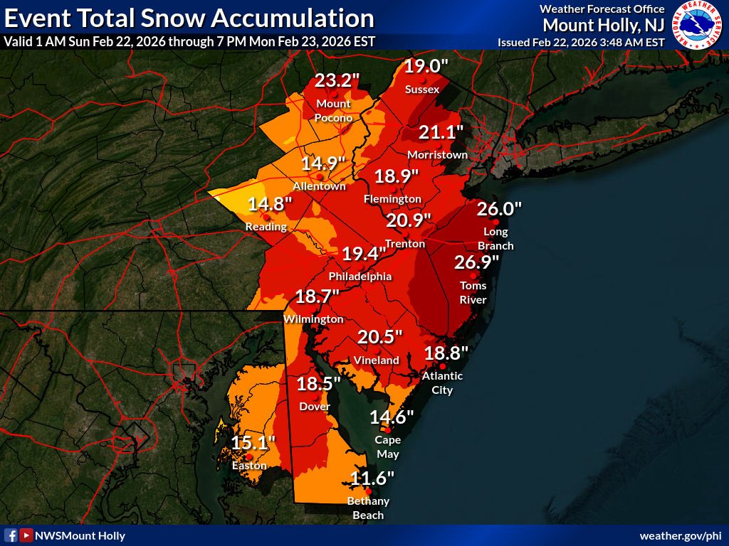
A destructive blizzard is on hand. The NWS has now issued a blizzard warning for Philly. Snowfall between 18-24 inches with damaging winds. Extreme conditions including power outages. 1-2 and even 3 inches per hour snowfall is likely overnight and the heaviest snow will be then.
@LI_Weather516 You guys are actually so dumb the guy is using Kuchera ratio it bumps up the snowfall amounts to rediculous water to snow equivalents. Don’t trust this this is literally click bait.
@burgwx Finally someone who gives an honest take on what this storm is actually going to look like👏 all these other forecasters a putting forth these rediculous totals that so clearly have no chance of happening.
0z HRRR is predictably coming in less amplified than the way-overdone 18z HRRR, and is likely still somewhat overdone with how amplified the system is as a whole
@oldscarf1stweek What nonsense BS are you posting? Stop just making stuff up to hype this storm up. Everyone knows it’s not going to be anywhere near this bad.
@reid_lt You’re being unrealistic. Totals are probably gonna be 10-15 inches less than expected let’s not act like these storms ever play out like they’re forecasted.
@HawkeyeHighligh Really hope they investigate this one. Highly suspicious! Why take that risk? He fumbles and that’s a TD. Just count to 3 and throw it away, take a knee, or at least run it out of the ends zone!