고정된 트윗

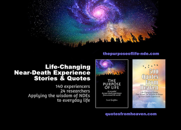
Life-changing near-death experience stories and quotes:
The Purpose Of Life
amzn.to/3K8gpjb
And its companion book:
500 Quotes From Heaven
amzn.to/3LZ20Ho
Reviews:
“This is one jewel of a book, a real treasure, and I have been recommending it to everyone I know. For anyone who wants to learn what near-death experiences are all about, this is the book for you.”
— Renowned near-death experience researcher Kenneth Ring, Ph.D., author of many prominent NDE books including Lessons from the Light
…….
“I have studied human consciousness, science, NDEs, etc. for more than 30 years including research papers, and literally hundreds of books. Throughout all the research, bits and pieces, I always asked myself, ‘But what is it all about? What knowledge did these NDErs bring back about the world? Who we are? Why we suffer? What the other side is like?’
“This book answered ALL my questions. It provides personal and profound insights from people who have experienced it all first hand — and they give the answers to life’s questions and what awaits us in their own words and as best as they can.
“As someone who has studied the anecdotal and veridical NDEs, neuroscience, quantum physics from Penrose, Greyson, Van Lommel, Hameroff, Kaku and many others, this book is a MUST if you have always wanted to know.
“As you read through the book, you will realize that no one could ever make this stuff up. The profundity is overwhelming both spiritually and from an informational viewpoint.
“The NDEs dovetail so beautifully with the science we have to this point, that you will find yourself saying ‘Ah Ha!’ more times than you can imagine.”
— Frank J. Monteleone
…….
“I have been reading books about near-death experiences since 1975, when ‘Life After Life’ by Raymond A. Moody, Jr., M.D., Ph.D., was first published. In fact, I have read far more than 100 NDE books since then, and heard many other firsthand NDE accounts in person and on the telephone. I believe ‘The Purpose of Life’ by David Sunfellow is one of the two finest NDE books that have been written. The other one is ‘Lessons From The Light’ by Kenneth Ring, Ph.D. Both books are very spiritual in their message, very clear, and very easy to read and understand. Both books provided me with many new insights and inspired me to transcend my current beliefs. ‘The Purpose of Life’ is a book you will want to read and reread as your spirituality matures and you seek ever deeper wisdom. I believe every IANDS Chapter, every bereavement support group, and every personal growth institution will want to have at least one copy of ‘The Purpose of Life’ in their lending library.”
— Best-selling author Bill Guggenheim, coauthor of Hello from Heaven
…….
“As a near-death experiencer myself, and as a researcher who has spent the last 40+ years studying the aftereffects of the near-death experiencer, this new book dispenses the-best-of-the-best wisdom we have gleaned from ‘crossing the veil’ and returning. I and the hundreds of others I and my colleagues have interviewed, struggle to find words to begin to describe something indescribable. This author has taken the best quotes from the most articulate experiencers and organized them into an easily understandable collection of what is really quite ineffable. This is an amazing contribution. I highly recommend this book! It stands out from the growing collection of books in this genre because it gets to the heart of the matter! It has taken on and brought us the Soul of the NDE. And the author doesn’t hide from the dark places. This book brings it all together.”
— Near-death experiencer and researcher, Barbara Harris Whitfield, author of Spiritual Awakenings: Insights of the Near-Death Experience and Other Doorways to Our Soul
…….
“This book is not only well worth the read, absorbing its psycho-spiritual information may be the closest thing to having a near-death experience without going through the risk and pain. Thank you David for synthesizing all these great life-changing experiences!”
— Charles Whitfield, M.D., physician, psychotherapist, and author of the best-selling book Healing the Child Within: Discovery and Recovery for Adult Children of Dysfunctional Families
…….
“I finally had a chance to dive deep into the book and website. WOW. What a masterpiece! It’s gorgeous! You have created something so comprehensive and beautiful in spirit. Bravo!”
— Lisa Smartt, author of Words at the Threshold, Veil, and Cante Bardo, founder, The Final Words Project, co-founder, The University of Heaven
…….
“Most if not all of the best scholarly and experiential NDE/STE literature sits on my shelf well read. I learned about your two quote books only a few months ago, coincidentally while reading something by Ken Ring. I’ve subsequently given 20 copies of Purpose Of Life to members of a local NDE study group, and several of them then bought 500 Quotes. Both books are quite well received here. In my estimation your books’ unique spotlight on experiencer quotes provides one of the most meaningful advances in perspective since [Raymond] Moody started it all. I think your books represent a major advance in this entire field of inquiry, because so very much is still being written about the HOW/WHAT and so little on the all-important WHY.”
— Don Coffey
…….
“David, I loved your book! Really! In fact, I posted a review of it on Amazon as well as on my Facebook page. I hope it helps to get your book noticed and read. On another note, I found myself so many times saying, ‘yes, yes, of course, this is what I also experienced.’ So for me personally, it was as if I was taking another journey into The Light. So beautifully put together, so loving, so relevant to what our message for humanity is all about. You did an outstanding job with it. I love the simplicity of it. Thank you for putting it out and into the world so people can be reminded that it is ALL about LOVE!”
— Near-death experiencer, speaker and author Nancy Clark
…….
“I read this book and was so blown away at times that I actually couldn’t just read it through. I had to stop and come back later when I was ready. It is a rich read, and far richer than it appears to be. This is a book that cannot be judged by its sweet, tastefully done cover. The author is obviously very well versed, an expert, when it comes to near-death experiences. He also stops short of adding too much of his own opinions, rather he allows the words of experiencers stand on their own, which I deeply appreciate.
“The wisdom in this book, and the uplift that the words of these experiencers provides to the reader, are worth their weight in GOLD. The book will comfort you, uplift you, increase your faith in the Divine, and will leave you feeling deeply nourished in a very WHOLE-istic way.
“This turned out to be one of the best books on this subject that I have read, and I have read A LOT of them… Research into NDEs is my life’s mission. I would recommend it to both newbies and those like me who have been immersed in the subject matter for many years. Fantastic!”
— BA via Amazon
…….
“As a near-death experiencer myself, and having read many books on the subject and heard many first hand accounts from other NDErs, I have to say this is THE BEST compilation of NDEs encompassing the essence and most important messages of the experience. I read the first book twice and gave some copies to friends. I’m sure I’ll do the same with this one. This is the only book I’ve ever read more than once and I think I will keep rereading it many more times. It’s the ultimate feel-good book to read before sleep. I just can’t say enough good about it. I wish everyone in the world could read it!!!”
— Patricia Danz
…….
“I ABSOLUTELY LOVE LOVE LOVE this book!! The first night I opened it up I could not put it down and easily read up to page 104. The next evening I finished it. Although this subject is not foreign to me in that I’ve read NDE stories before, this book offers up an assortment of compelling, truly awesome encounters from many folks who have passed. Even more interesting are the few important common threads that tie all of these stories together with a common message from people who do not know each other. On a personal note, I found that this book gave me a sense of peace and also in many ways confirmed my own beliefs about what we are here to do on this earth plane and what is truly important. I HIGHLY recommend David Sunfellow’s extraordinary book. I LOVED It and plan on purchasing several copies for my friend and family for the holidays. Thank you David!”
— Tommysgirl via Amazon
English