WAVY Weather retweetledi

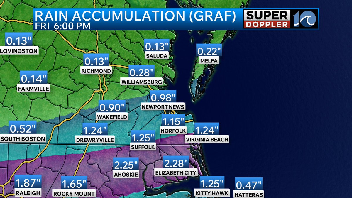
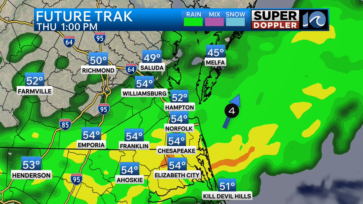
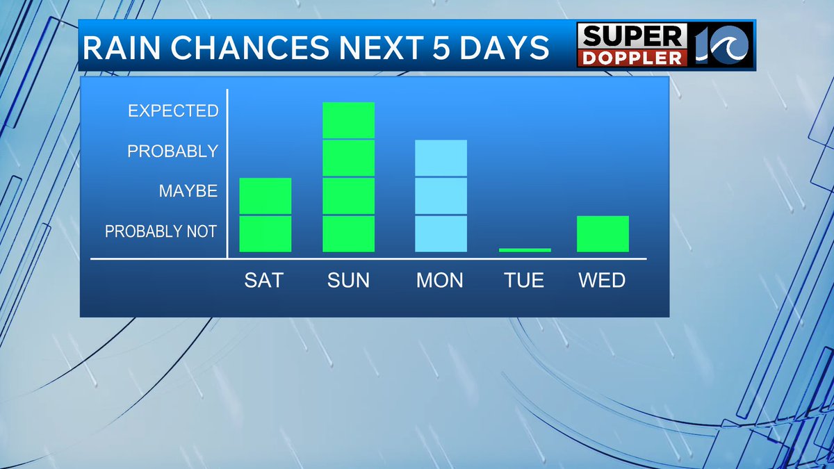
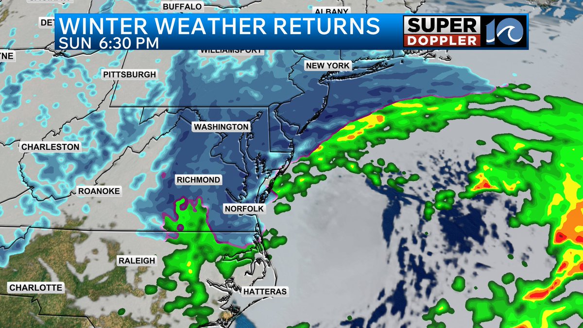
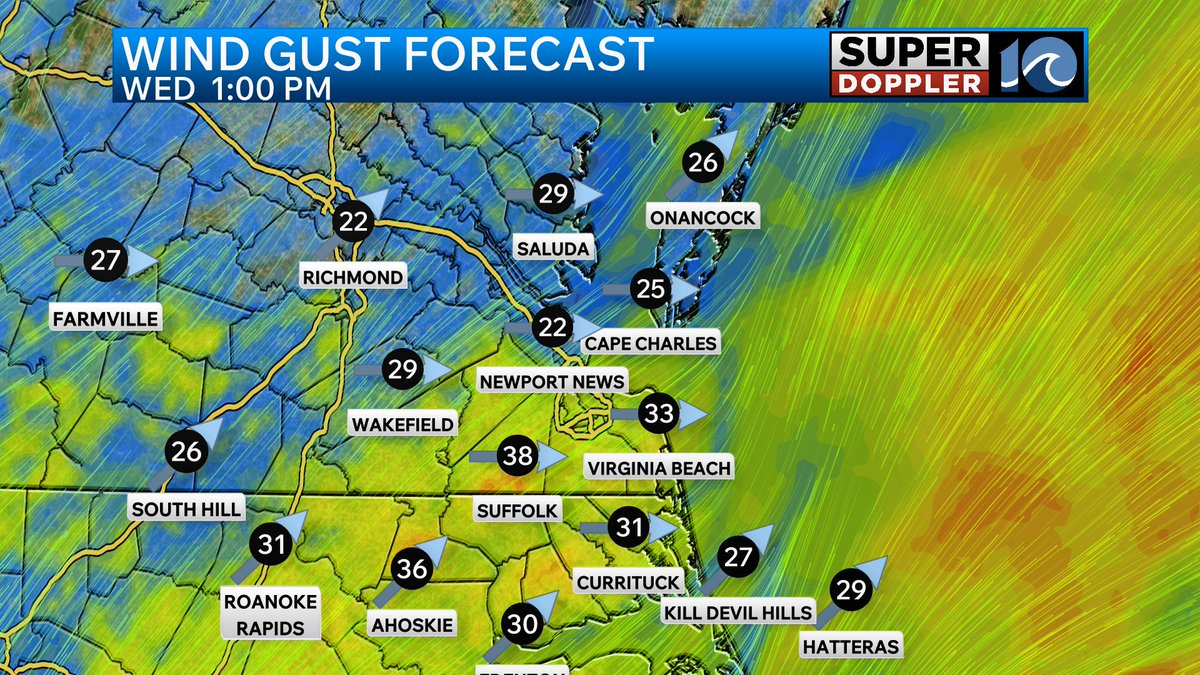
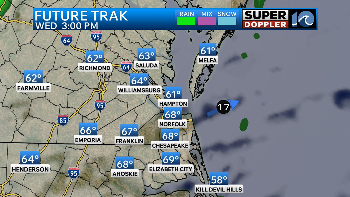
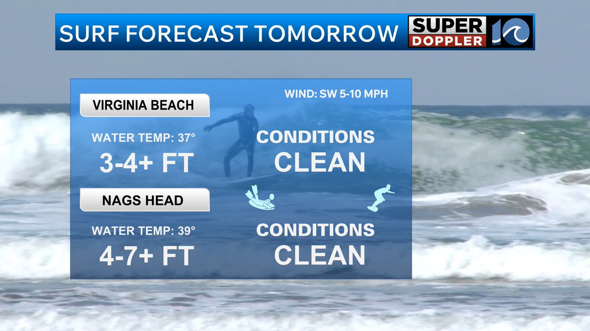
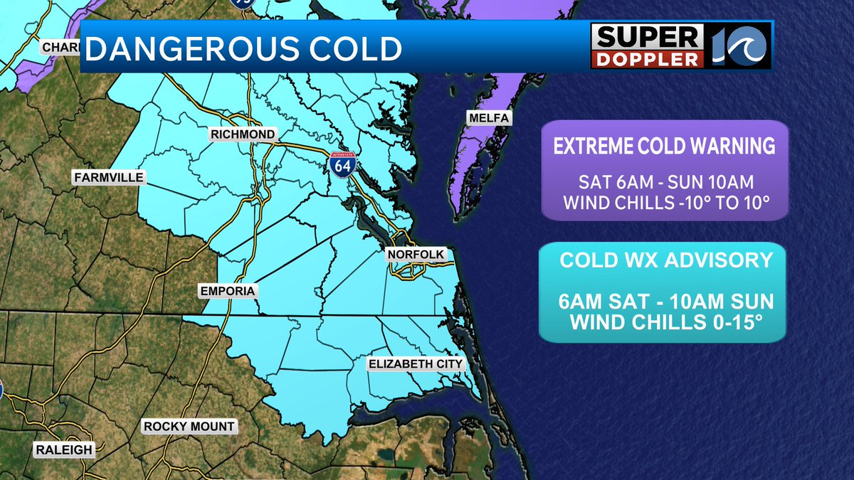
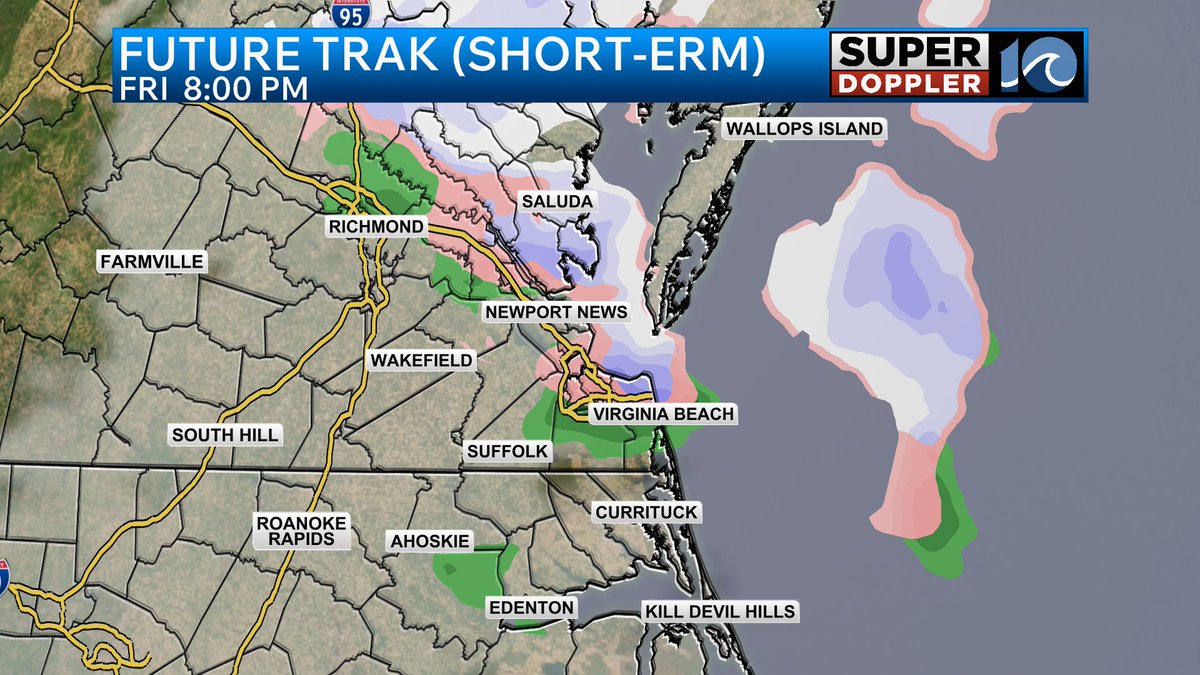
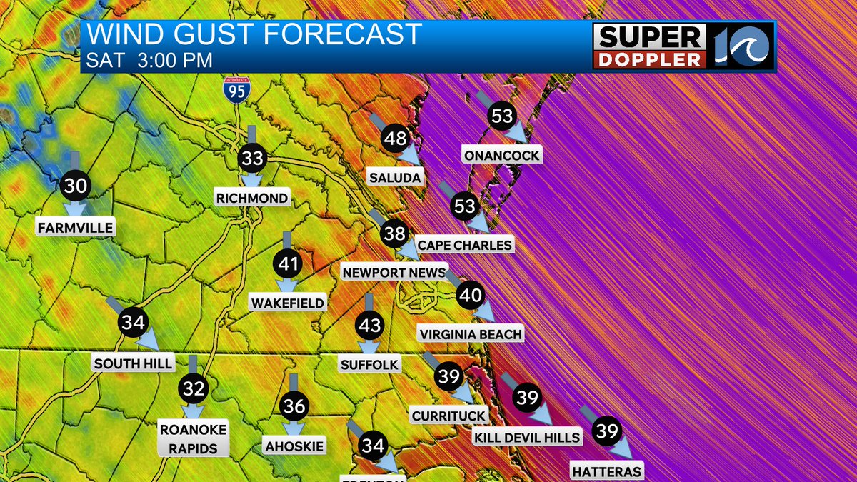
Heading out on the water this weekend? Check the forecast before you head out! @WAVY_News
wavy.com/blogs/weather-…
English
WAVY Weather
22.3K posts


@WAVY_Weather
Accurate, timely information on the latest forecast from the @wavy_news meteorologists for the Hampton Roads, Virginia & North Carolina areas.