
Big weather swings are ahead for the next month. 🌩️➡️☀️➡️🌧️
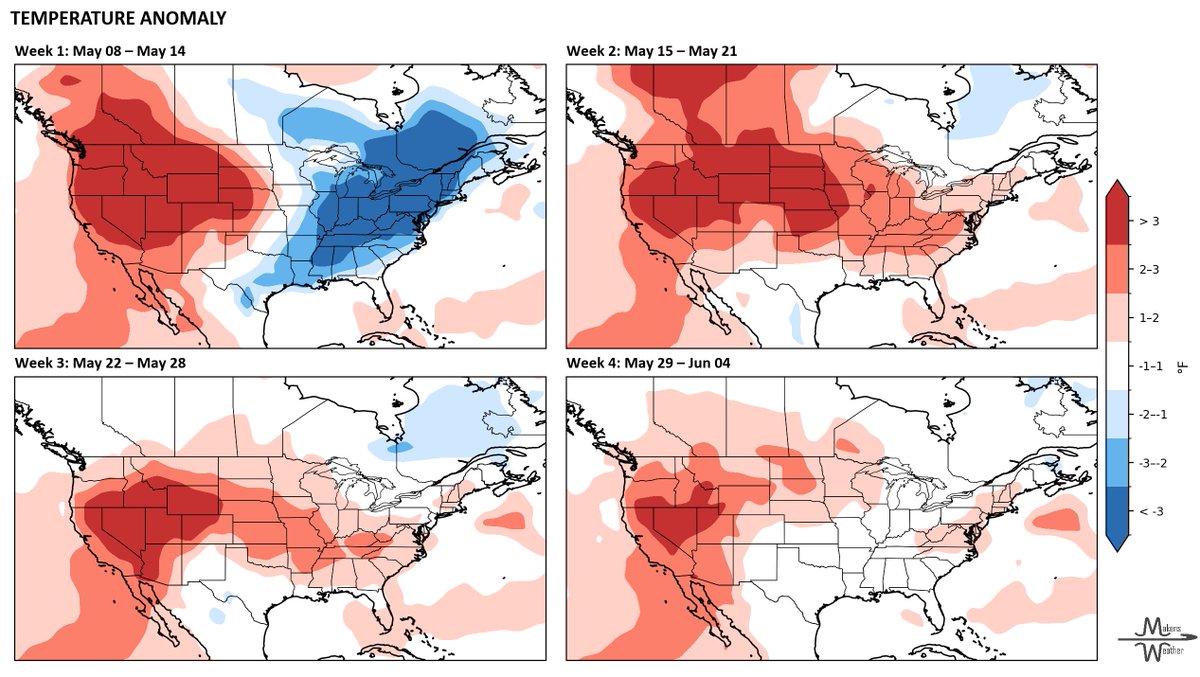
The next 7–10 days start active with severe storms, heavy rain, flooding concerns and even frost risk in parts of the northern Plains and Upper Midwest. Producers from Texas to the Mississippi Valley should stay alert for hail, damaging winds and localized flooding this weekend.
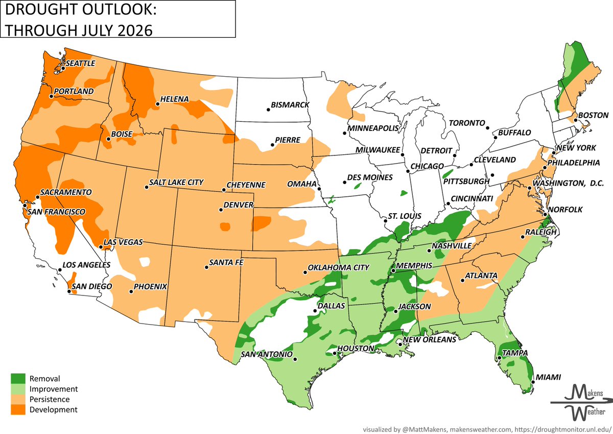
By mid-May, much of the Plains turn warmer and drier, helping fieldwork progress but increasing stress on topsoil moisture, livestock and fire weather concerns — especially across the western Plains and Canadian Prairies.
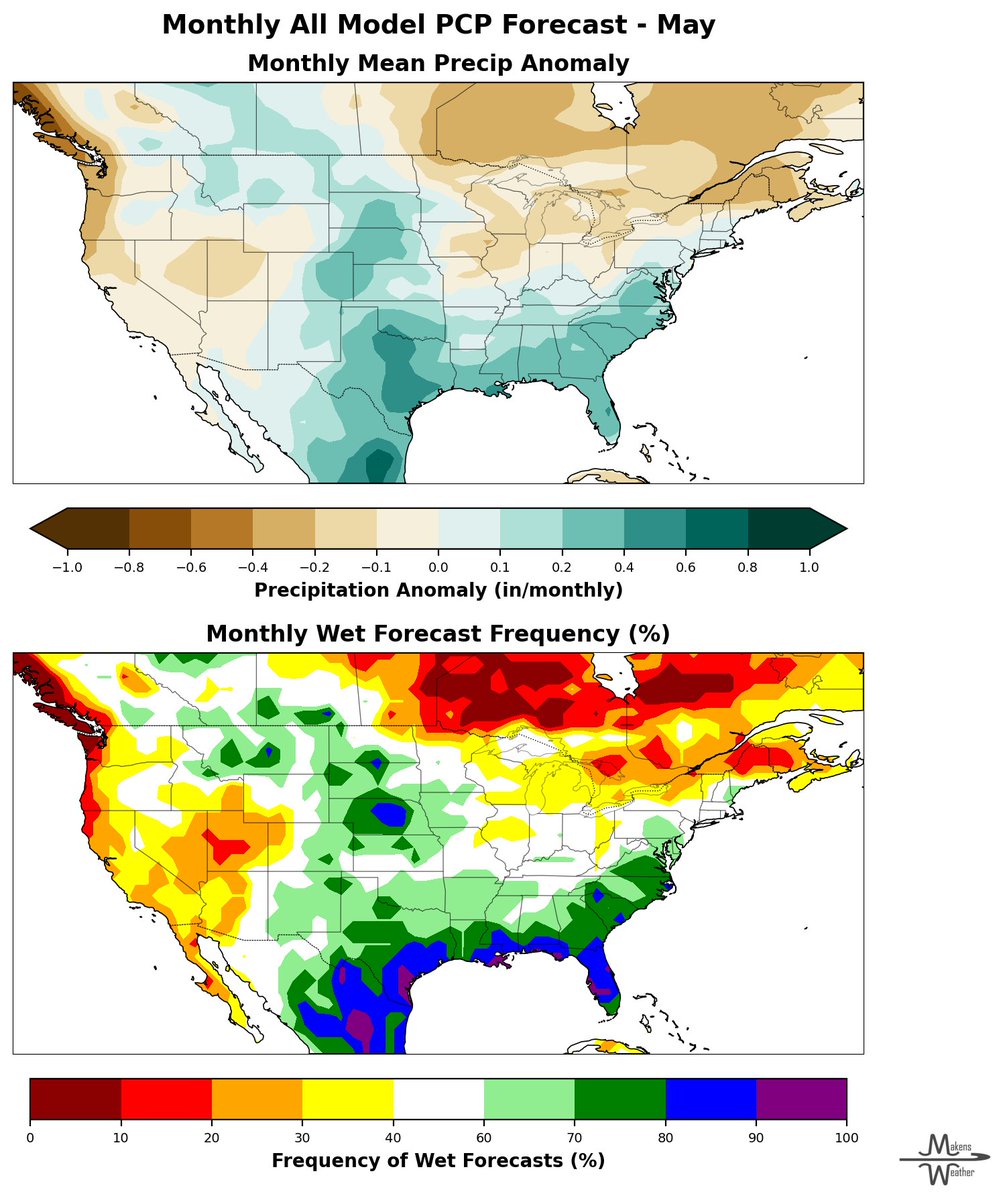
As we head toward late May, moisture chances begin rebuilding from the south, with wetter signals increasing for Texas, Oklahoma and parts of the central U.S. Severe weather will likely remain part of the pattern wherever warm, humid air collides with incoming systems.
Bottom line: Expect a rollercoaster pattern with rapid shifts between stormy, dry, warm and wet conditions through early June. Stay flexible and keep an eye on short-range forecasts as conditions evolve.
@MattMakens

English