Sabitlenmiş Tweet
3D Nautical Charts & Maps by Landfall Artwork
1.9K posts
3D Nautical Charts & Maps by Landfall Artwork
@Landfall3DArt
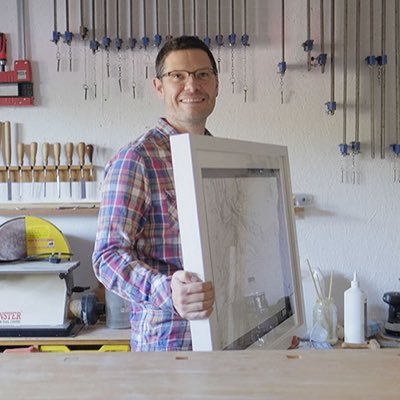
Framed #3D #Nautical #Charts & #OS #Maps - I create intricate hand crafted relief models of our scenic landscape. Est. 2013 [email protected] #SBS winner
Devon, UK Katılım Mart 2014
4.9K Takip Edilen2.8K Takipçiler
I’m really pleased to share my latest completed piece — a hand-cut model of the beautiful River Fal.
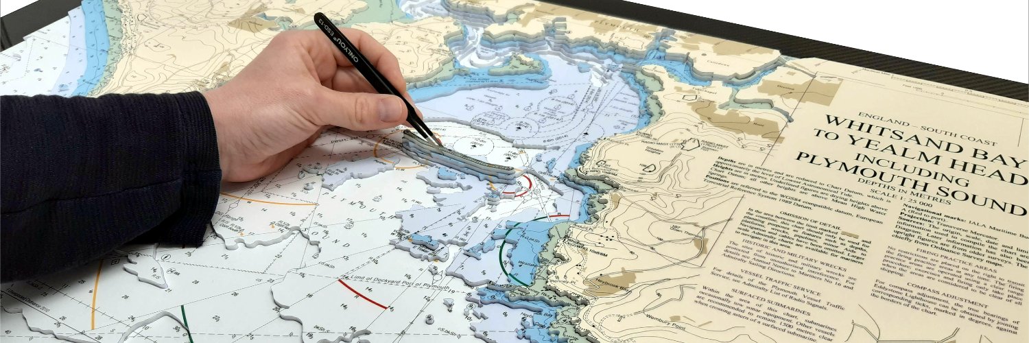
Each piece is individually hand cut from nautical charts
If you’d like a custom piece of your own, take a look at my website: landfall.co.uk

English
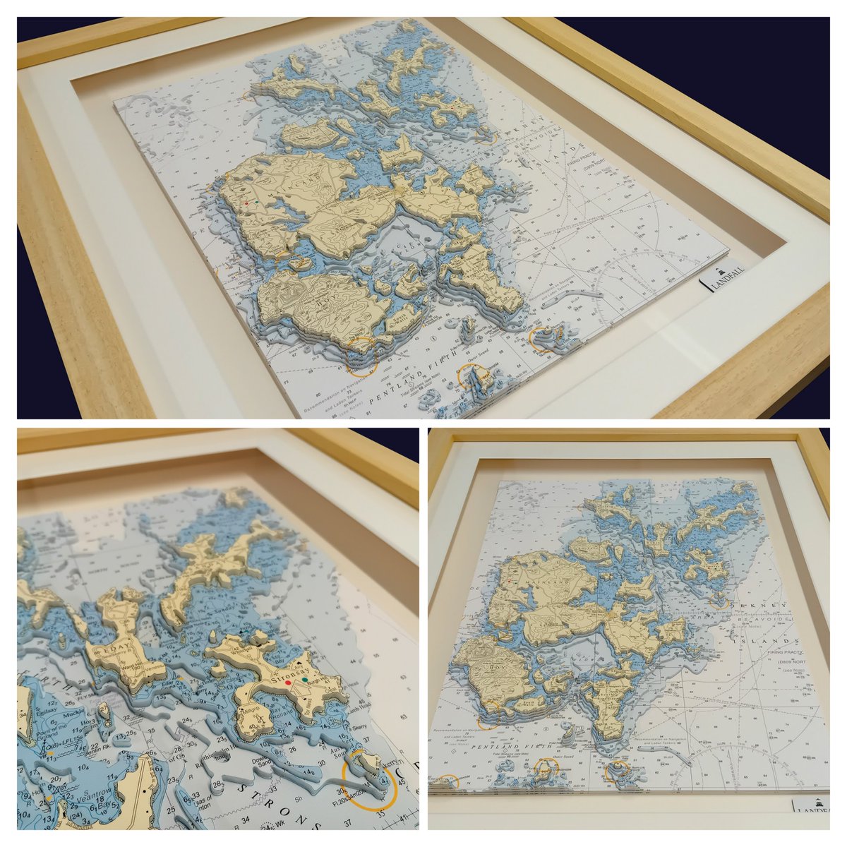
Layer by layer, the Orkney Isles brought to life from nautical charts 🌊✂️
Now beautifully framed—a place captured in detail and memory.
Commission your own special destination: landfall.co.uk
#OrkneyIsles #NauticalArt #MapArt #BespokeArt #Landfall
English
Finished this hand-cut model of the Orkney Isles today ✨
It’ll be framed over the weekend before heading to its new home next week.
If there’s a place that means something to you, I’d love to create one just for you: landfall.co.uk

English
Hand-cut precision meets coastal beauty 🌊
Explore Exmouth like never before with our stunning 3D nautical chart—crafted by hand, layered with detail, and built to inspire.
Perfect for sailors, explorers & coastal lovers.
Discover yours 👉 landfall.co.uk

English
This hand-cut topographic model of Llandudno is finished, framed, and heading off to its new home this week.
More pieces like this at landfall.co.uk

English
Hand-cut topographic model of Llandudno, crafted from OS maps — every contour shaped by hand. One place, one story, one maker.
Commission your own meaningful landscape: landfall.co.uk
#Landfall #TopographicArt #MapArt #Handmade #Bespoke

English
I’ve just started a new hand-cut model of Exmouth — the place I grew up 🌊
Every layer brings back memories of the coast and home. I’ll share the finished piece next week.
Want your own meaningful location captured? Get in touch:
landfall.co.uk
English
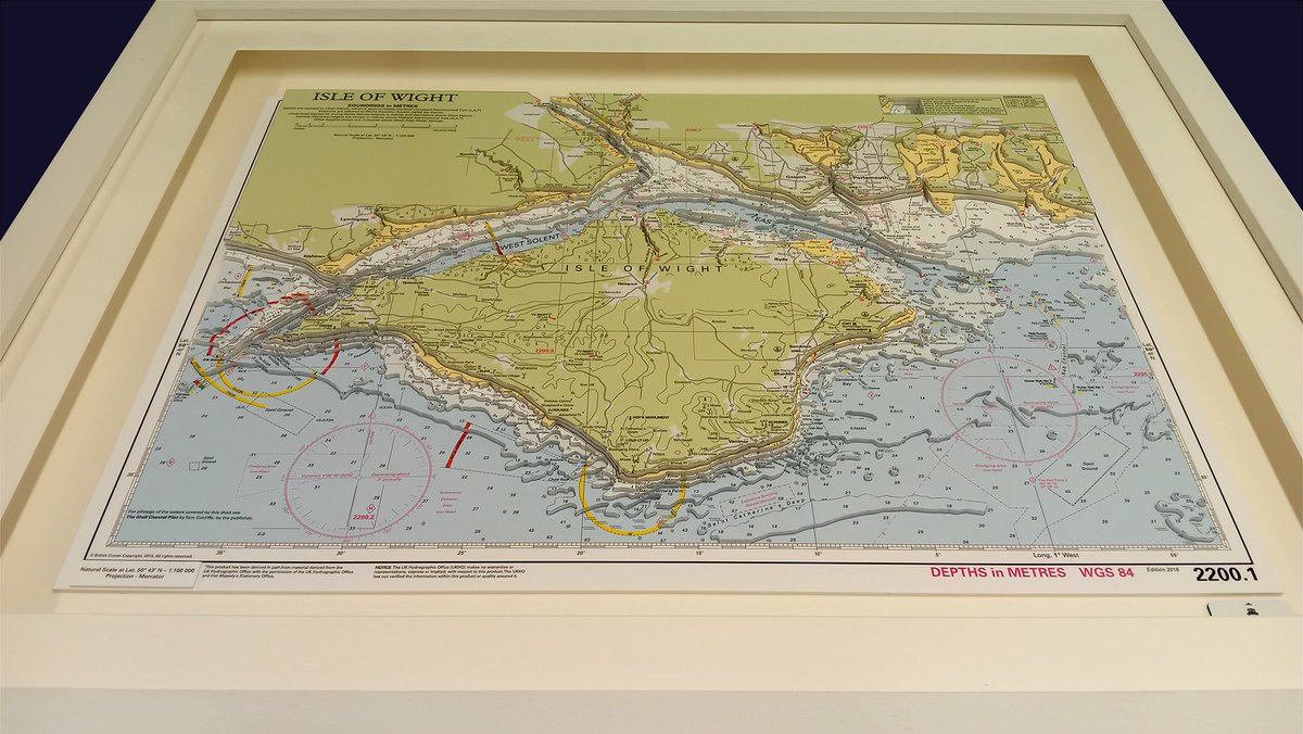
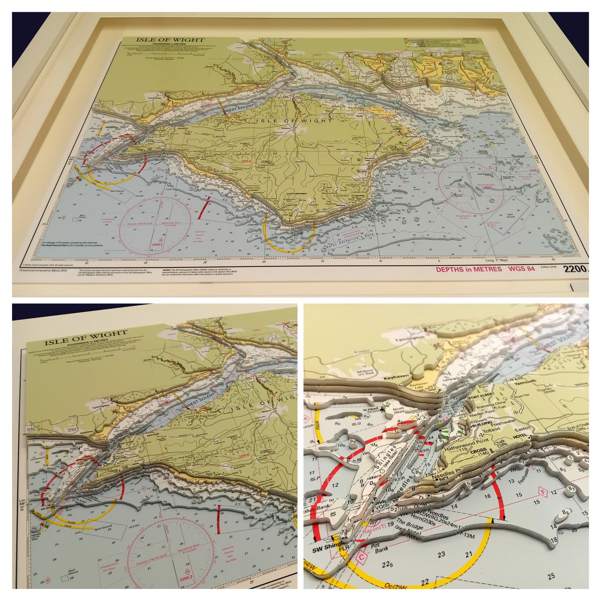
The Solent & Isle of Wight – hand-cut, layered, and now beautifully framed as it heads to its new home. 🌊
Each of my 3D nautical charts is individually crafted and completely bespoke.
Interested in commissioning your own?
Visit landfall.co.uk to enquire.
#IsleOfWight
English
Fresh off the cutting board!
A hand-cut 3D relief chart of the Solent and the Isle of Wight, created from Imray nautical charts.
Heading to its new home next week.
Custom commissions available:
landfall.co.uk
#Solent #IsleOfWight #NauticalArt #Handmade

English
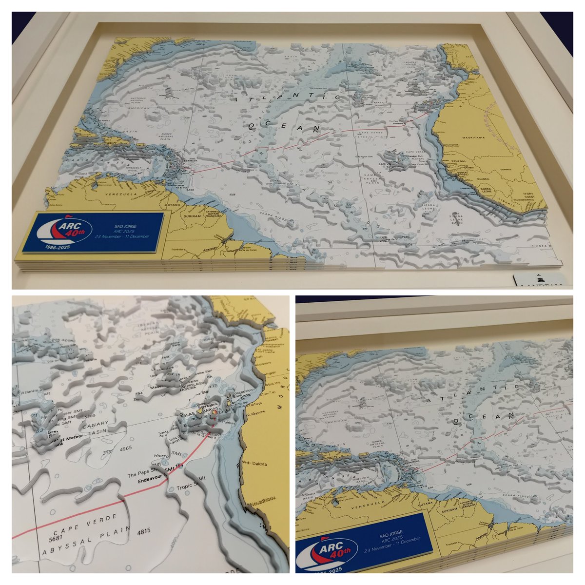
Fresh off the workbench 🌊✂️
A hand-cut 3D nautical chart showing the ARC 2025 Atlantic crossing route from the Canary Islands to the Caribbean. Every layer is cut and assembled by hand from real chart data in my one-person workshop.
See more: landfall.co.uk
#ARC2025
English
A nautical chart, reimagined in 3D.
This hand-cut relief model of the Isle of Wight and the Solent was built from an Imray chart, layer by layer, revealing the seabed in sculpted form.
Each piece is made by hand in my workshop.
Commissions: landfall.co.uk
English
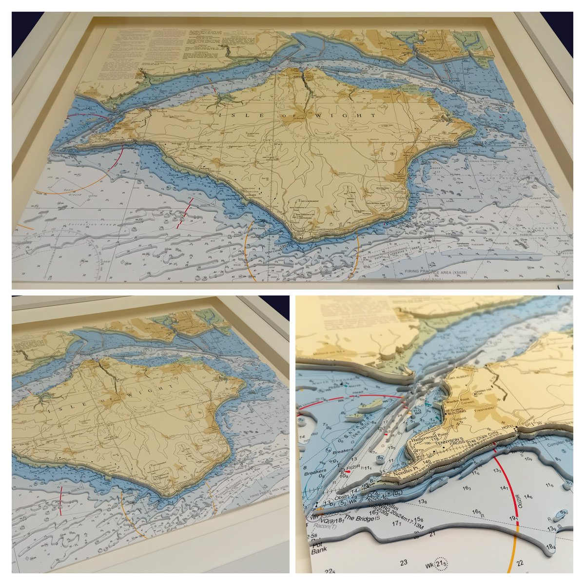
Handcrafted 3D topographic models made from authentic nautical charts 🌊🗺️
This Isle of Wight piece was finished this morning — every contour & depth layer cut and built by hand.
Commission your own meaningful coastline, sailing ground or hometown.
landfall.co.uk
English
Finished today: a hand-cut 3D nautical chart from Bournemouth to the Isle of Wight. Built layer by layer from paper charts, showing the historic waters of the Solent. 🌊✂️
#MapArt #PaperCraft #Handmade

English
Made last week, framed over the weekend, and already collected by a happy customer. This handcrafted 3D nautical chart was cut by hand in my #Devon workshop. Bespoke chart & map art at landfall.co.uk
#3DNauticalChart #HandmadeUK #SmallBusiness #MapArt
English
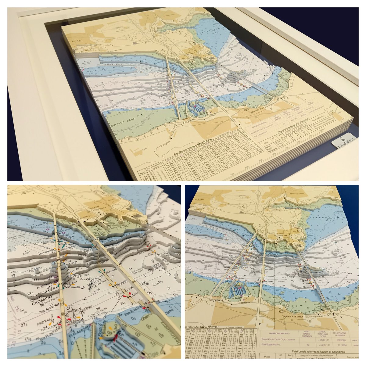
Completed today! A hand-cut 3D nautical chart featuring the Forth Bridges, Scotland ⚓️
Carefully layered by hand to capture this iconic stretch of water. Framing this piece over the weekend and looking forward to sharing the finished result soon.

English
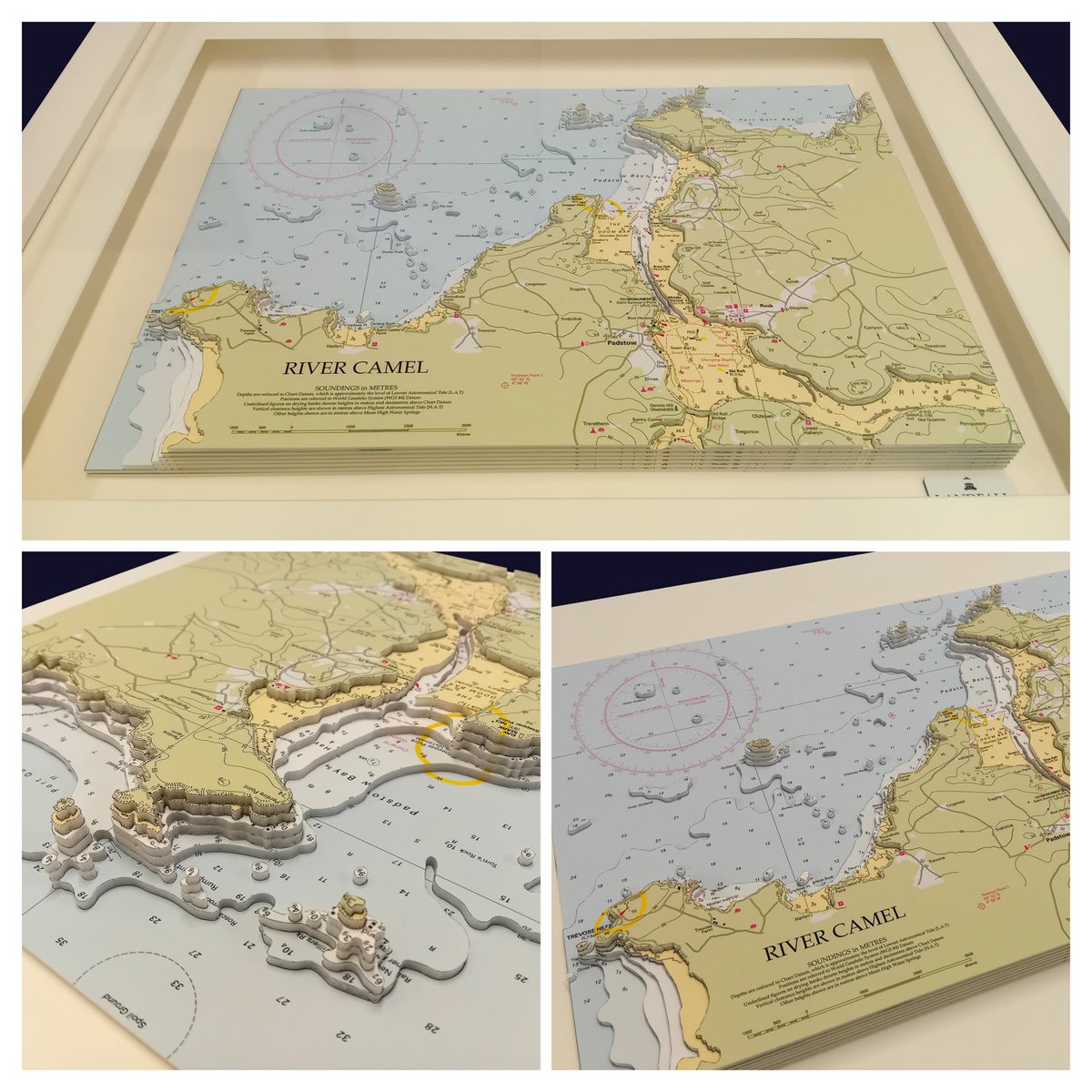
3D nautical chart of the River Camel, Padstow & Rock
Cut by hand from traditional nautical charts, revealing the channels and coastline that shaped this historic Cornish estuary and its maritime past.
#RiverCamel #Padstow #NauticalArt #Handmade #Cornwall
English
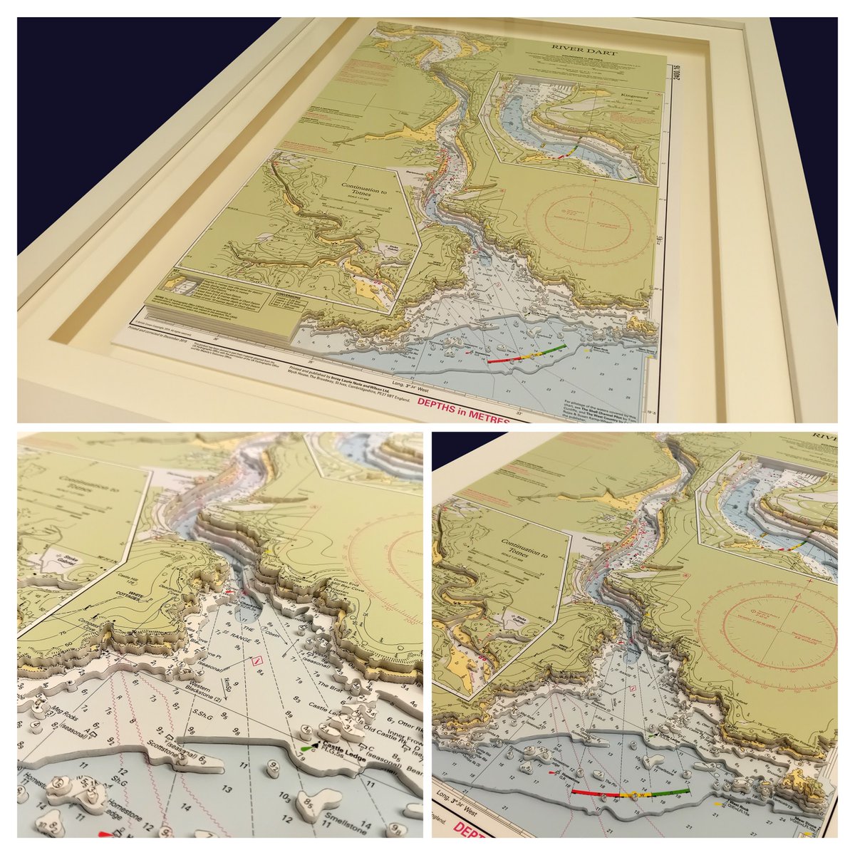
Hand-cut 3D nautical chart of Dartmouth & the River Dart completed today
From medieval trade to the D-Day embarkations of 1944, this historic Devon estuary has shaped Britain’s maritime story.
Explore more: landfall.co.uk
#RiverDart #Dartmouth #Devon #NauticalArt
English
Now framed and ready for its new home ⚓🖼️
Handcrafted 3D nautical chart of the Firth of Clyde, carefully layered to highlight seabed contours and coastline detail.
Bespoke charts available:
🌊 landfall.co.uk
#NauticalArt #3DChart #MaritimeArt #Landfall

English
Hand cut 3D nautical chart ready to be framed before heading to its new home ⚓
Featuring the historic Firth of Clyde – Arran, Jura, Islay, Kintyre & Loch Ruel. Each piece is handcrafted from Admiralty charts.
🌊 landfall.co.uk
#MaritimeArt #Sailing #Handmade

English