Matthew Cappucci@MatthewCappucci
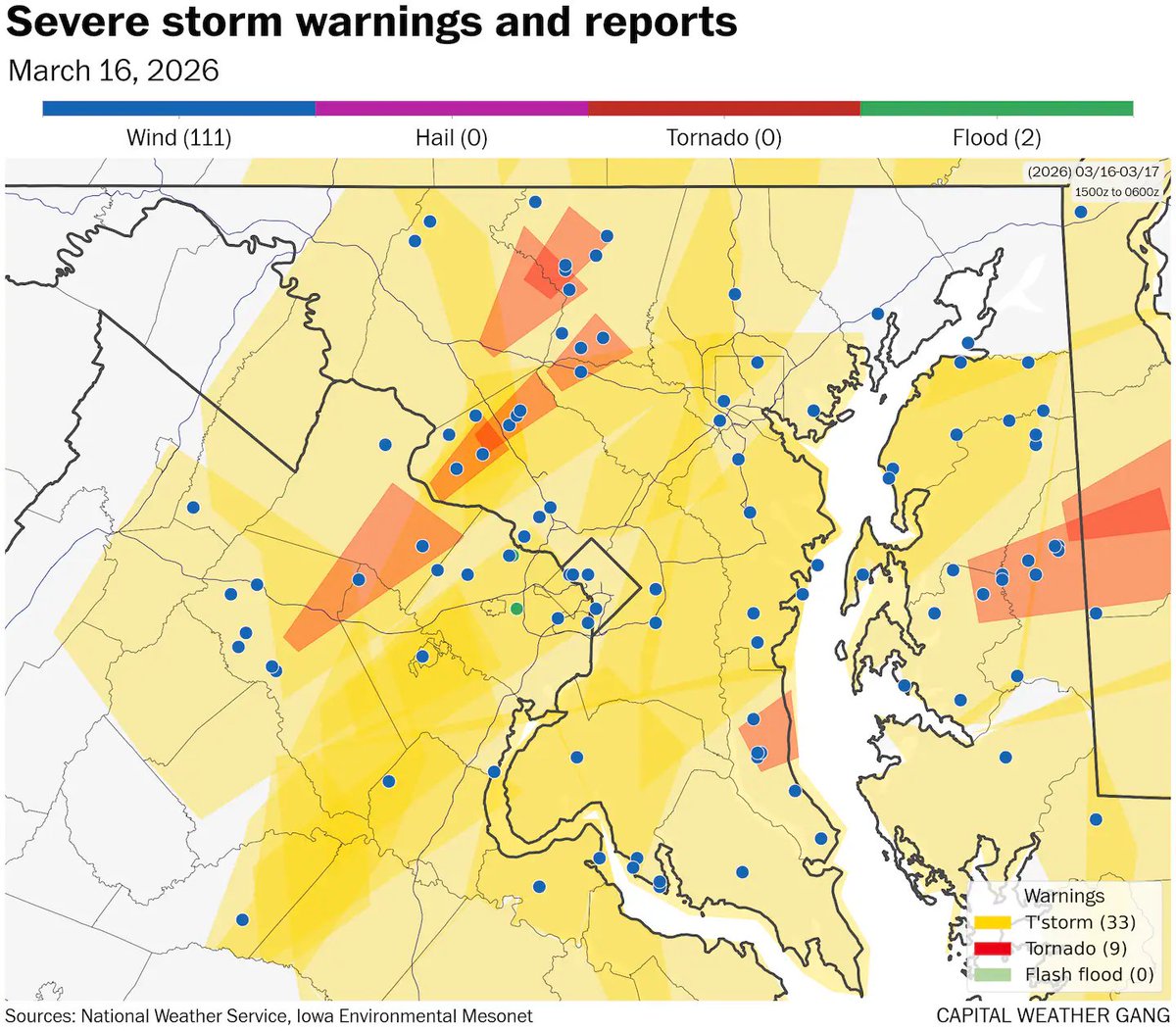
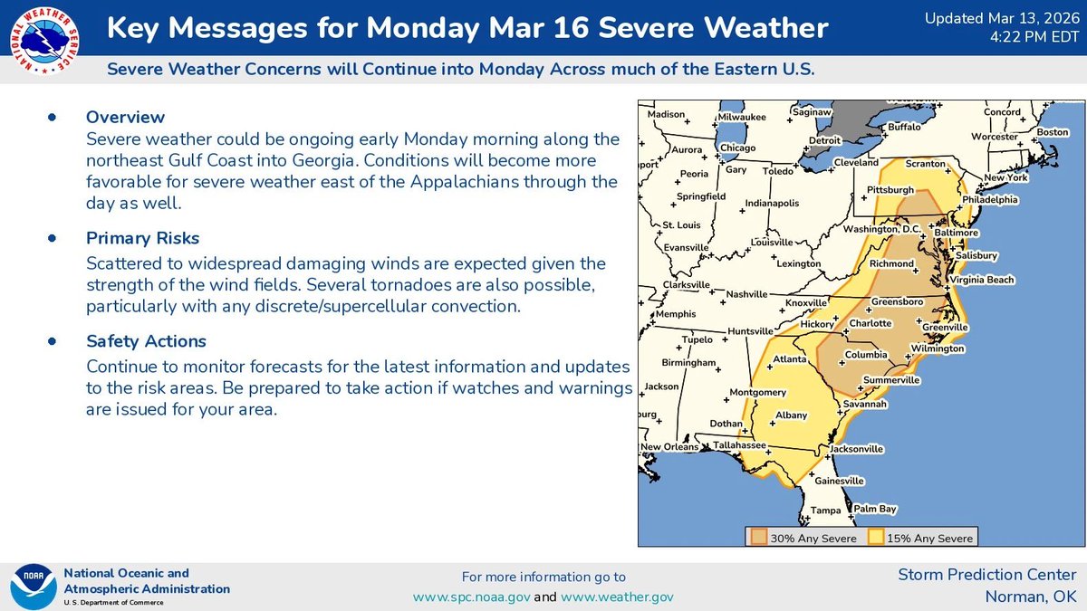
SUN PM update: D.C., Baltimore, Fredericksburg, Culpeper, Richmond, Virginia Beach, Norfolk, Charlottesville... be ready for multiple rounds of storms with possible tornado risk on MONDAY, March 16. PLEASE SHARE with friends/family!
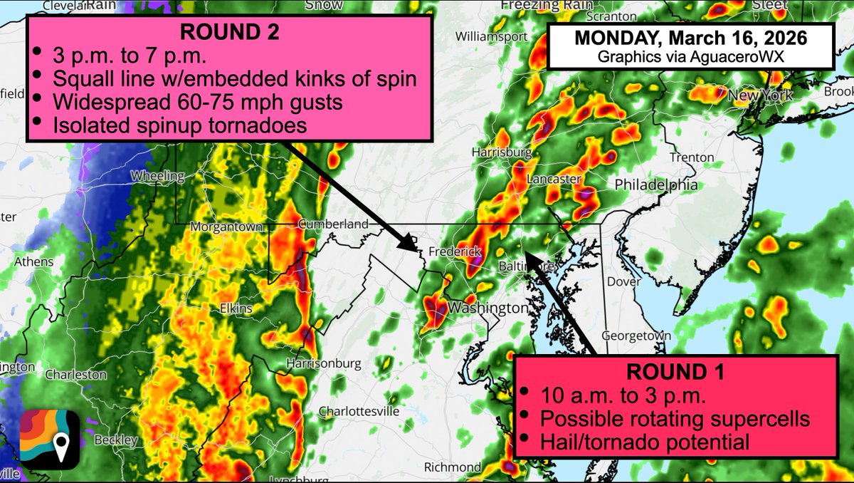
The morning round will be more sporadic... 20-30% of folks might get an "appetizer" storm as the air mass becomes warmer and more humid. But changing winds with height will allow even the appetizers to rotate. That's why the risk for an isolated tornado or hail could start earlier.
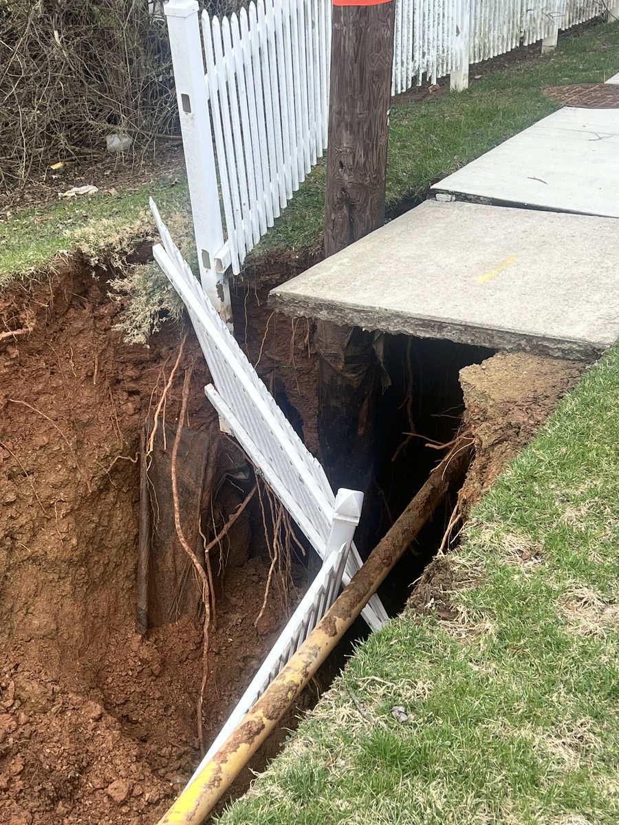
The MAIN EVENT, a squall line with widespread damaging winds/embedded kinks of spin and a few tornadoes, comes through during the afternoon between 3 p.m. and 7 p.m.; we'll see widespread gusts of 60 to 75 mph and a few tornadoes, and there's even the chance of an isolated significant (EF2+) tornado.
We could see a bit of snow on the back side in the Blue Ridge, Potomac Highlands and I-68 corridor in the Maryland Panhandle during the evening as temperatures quickly drop behind the front.