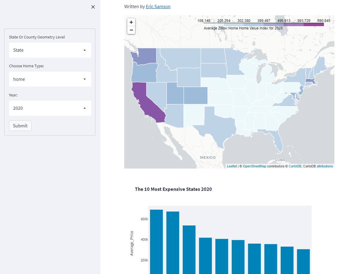
Created my first streamlit app that visualizes Zillow's ZHVI data using folium and geopandas. Can't wait to build more!
You can check out the app live here: bit.ly/ZHVI_Streamlit
and while i am happy about this technical achievement i am super sad to be working on an interactive tracking mass shootings in the US :( :( this data does not need to exist
D3 tooltips can be a bit tricky, and i’m super excited because i figured out a good way to dynamically handle edge detection w/o a million lines of code or endless if else statements (iykyk)
@MapMakinMeyers I’ve had issues with this before as well. Selecting all of the features within the geopackage layer, then exporting has fixed this for me in the past
I'll be controversial and ask something i've been pondering - what are good arguments to *not* use d3 for coding web visualizations? / better alternatives.
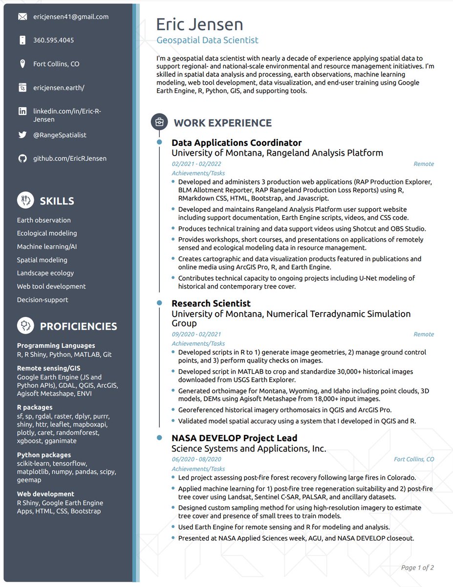
5⃣ Fancy CV template 📝: I wanted my CV to put my technical proficiencies (programming, modeling, etc.) at the forefront, so I paid $20 for a service with a template I liked.
My new boss loved how clear my CV was, which he then used to advocate for my salary. $20 well spent.
After an extensive job search resulting in landing my #1 desired job (Data Scientist at @ClimateEngine) 🎉, I wanted to compile some reflections into a 🧵
Below are things that I focused that on I think positioned me to get my #Geospatial#DataScience job. 👇
#EOchat#GISchat
I'm a little mapping library that was born 11 years ago in Ukraine. 🇺🇦 Yesterday, after enduring 8 years of hybrid warfare that killed 15000+ and displaced millions, Ukrainians listened to a 40-minute hate speech from Russia's insane president on why Ukraine shouldn't exist. 1/4
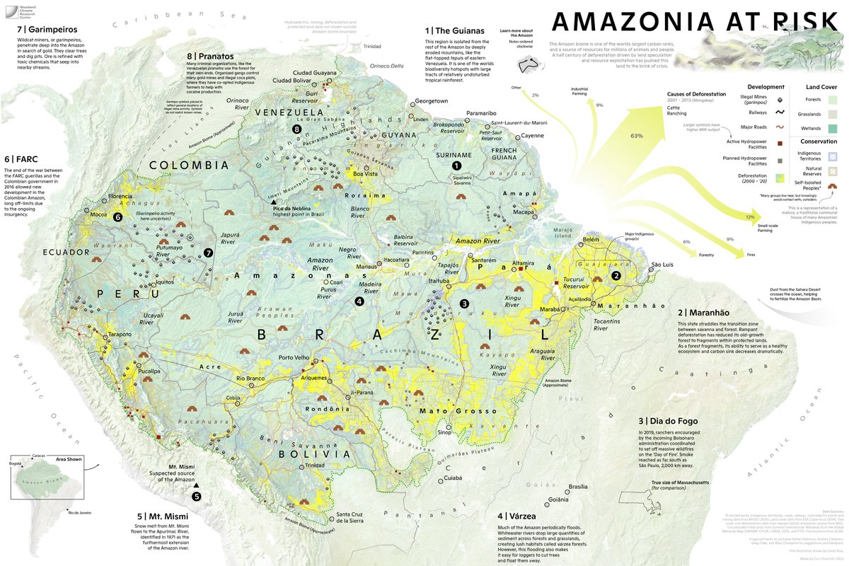
So excited to share a (downsized for twitter) #map I have been working on, with illustration work by @The_Ruizium. A picture of the #Amazon region in crisis. Not only the struggle to deal with #deforestation, but its geography, cultures, and political divisions.