SalArmyNashville รีทวีตแล้ว

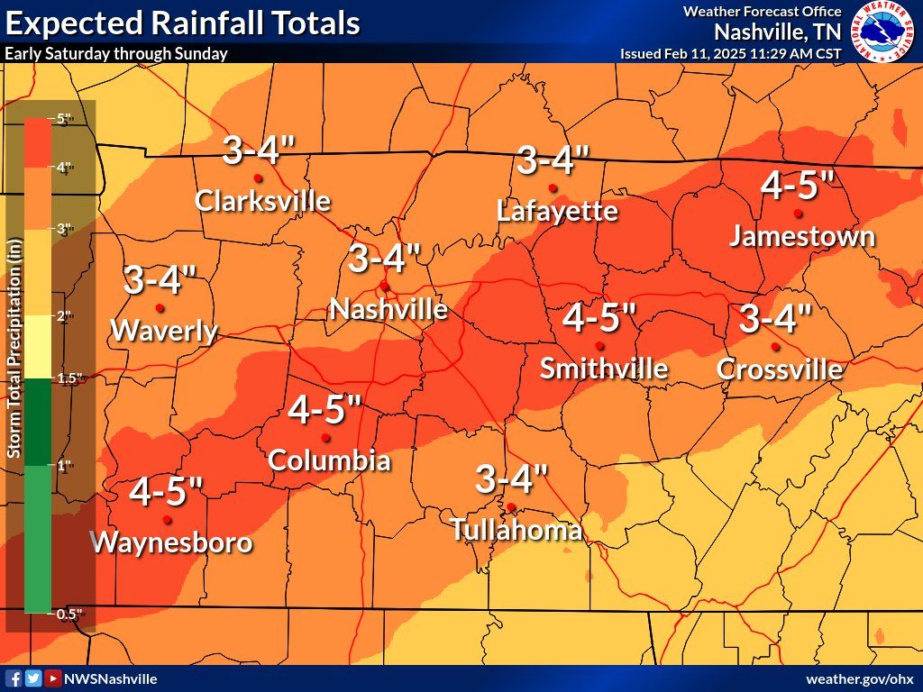
Crisis Cleanup has been activated and may be able to help those affected by this Winter Storm. Call 844-965-1386 for free assistance!
Please note, due to overwhelming need, service cannot be guaranteed.

English
SalArmyNashville
6.9K posts

@SalArmy
Nashville Area Command. #GetBehindTheShield