DronaMaps
167 posts

DronaMaps
@DronaMaps
Drone 3D Mapping Platform [email protected]
Gurgaon, India شامل ہوئے Mart 2017
175 فالونگ126 فالوورز

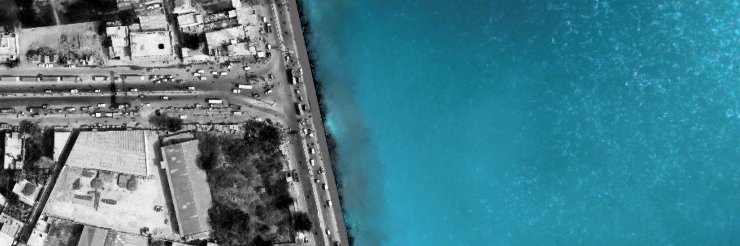
We use aerial images/videos taken by drones to accelerate and simplify topographic surveys for land management and planning. This holds true for site scouting, allotment planning
and design, as well as final construction of roads, buildings and utilities.
#dronamaps
English
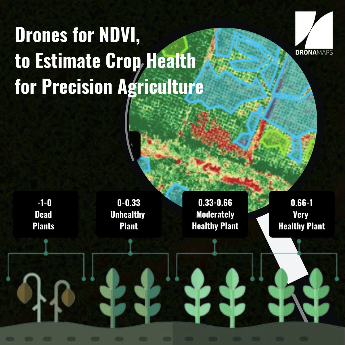
Combining the advanced drone technology and Machine Learning for Precision Agriculture to track crop fertility for improved crop yields and profitability.
#dronamaps #dronetechnologies #startupindia
English

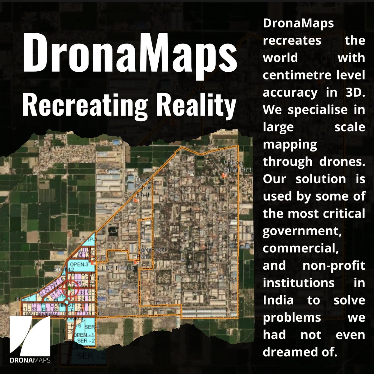
In rural/urban mapping and development, DronaMaps provides a web application with highly accurate geospatial information to aid planning & monitoring of massive infrastructure projects and their volumetric change tracking.
Read more here: egov.eletsonline.com/2019/05/dronam…
English
DronaMaps specializes in command-and-control centers that enable prioritization and decision making on the ground, drastically cutting down the time and risk of reconnaissance at the time of disaster.
ow.ly/OOTs50K032a
English
DronaMaps ری ٹویٹ کیا

#DIW2022|Visit Punjab stall at the Digital Mela to explore new-age #DigitalIndia initiatives being taken in the State,like dynamically updating geo-database developed by @PunjabGovtIndia with @DronaMaps|@GoI_MeitY @PMOIndia @AshwiniVaishnaw @Rajeev_GoI @_DigitalIndia @JeetKVijay
English
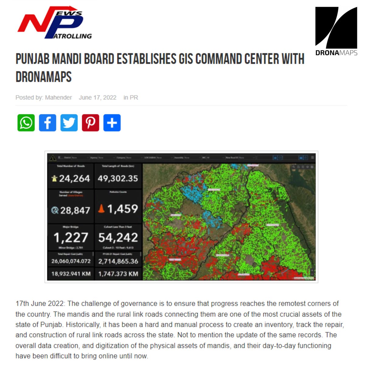
DronaMaps collaborated with the Punjab Mandi Board and Department of Governance Reform and have already digitized and incorporated 110 Mandis and 24,262 rural link roads in the GIS control and command center.
Pead more here: ow.ly/kJKS50JYTMW
English
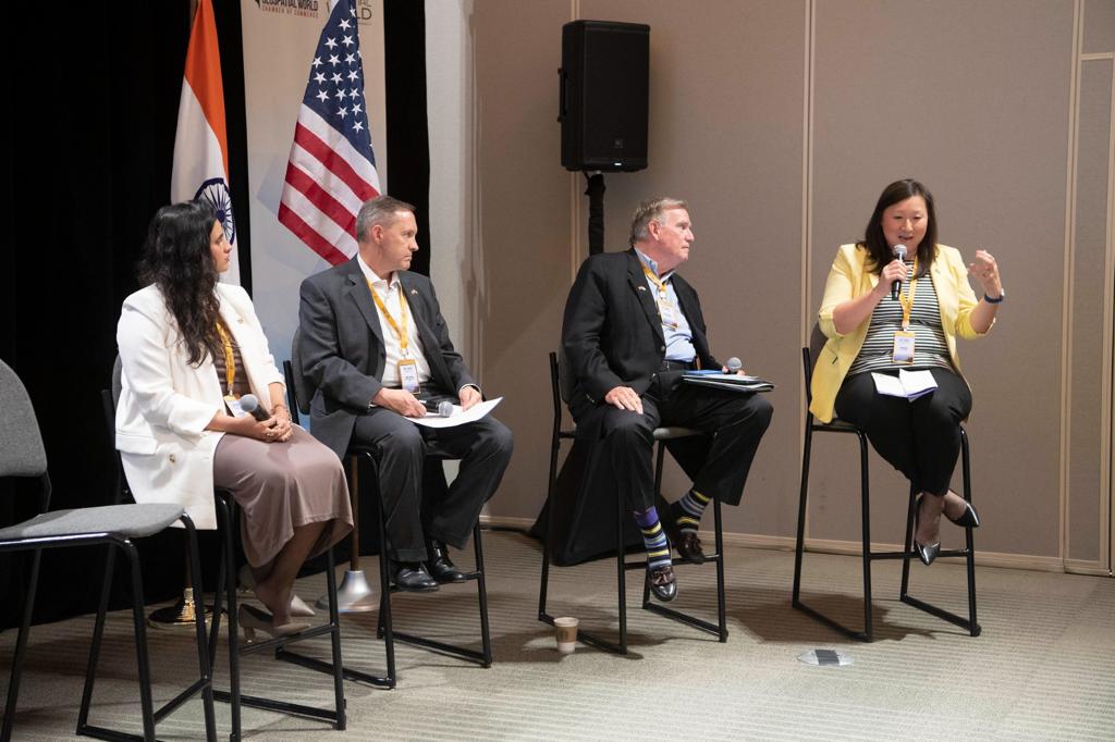
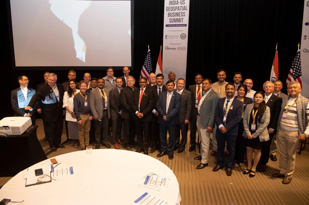
Glimpses from India-US Geospatial Business Summit, California
Geospatial World U.S. Department of State Embassy of India in Washington and Geospatial World Chamber of Commerce
#Geobuizsummit2022 #dronamaps #startupindia


English
We, at DronaMaps, combine the advanced drone technology and Machine Learning for Crop yield forecasts, crop emergence analysis, irrigation monitoring, crop health, crop damage assessment, field soil analysis for improved crop yields and profitability.
#dronamaps #startupindia
English
DronaMaps ری ٹویٹ کیا

.@DronaMaps provides #drone based solutions across various industries using 3D models. Here are a few glimpses of their participation at #DIW2022 Digital Mela. #IndiasTechade
English
DronaMaps ری ٹویٹ کیا
.@DronaMaps provides #drone based solutions across various industries using 3D models. Here are a few glimpses of their participation at #DIW2022 Digital Mela. #IndiasTechade
English
It was a privilege to showcase our work with four different departments of Punjab i.e. DGR, PMD, PMIDC, GMADA at the Digital Mela 2022 Gujrat.
We thank MEITY, Digital India & other respected dignitaries who visited our stall at Digital mela 2022, Gujrat.
#digitalindiaweek2022
English
DronaMaps ری ٹویٹ کیا

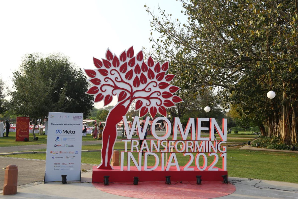
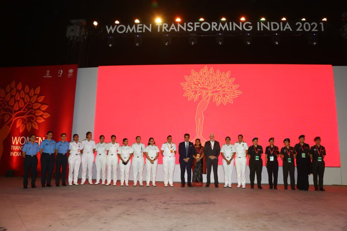
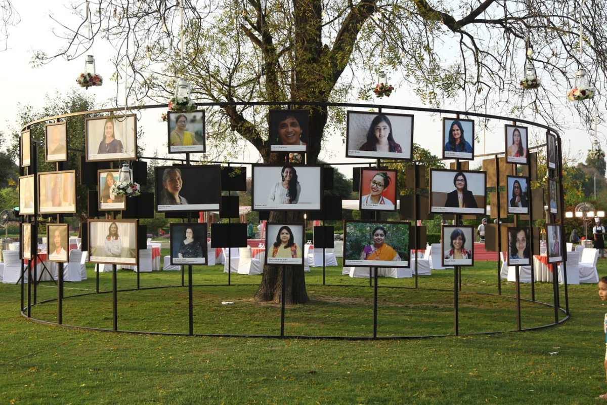
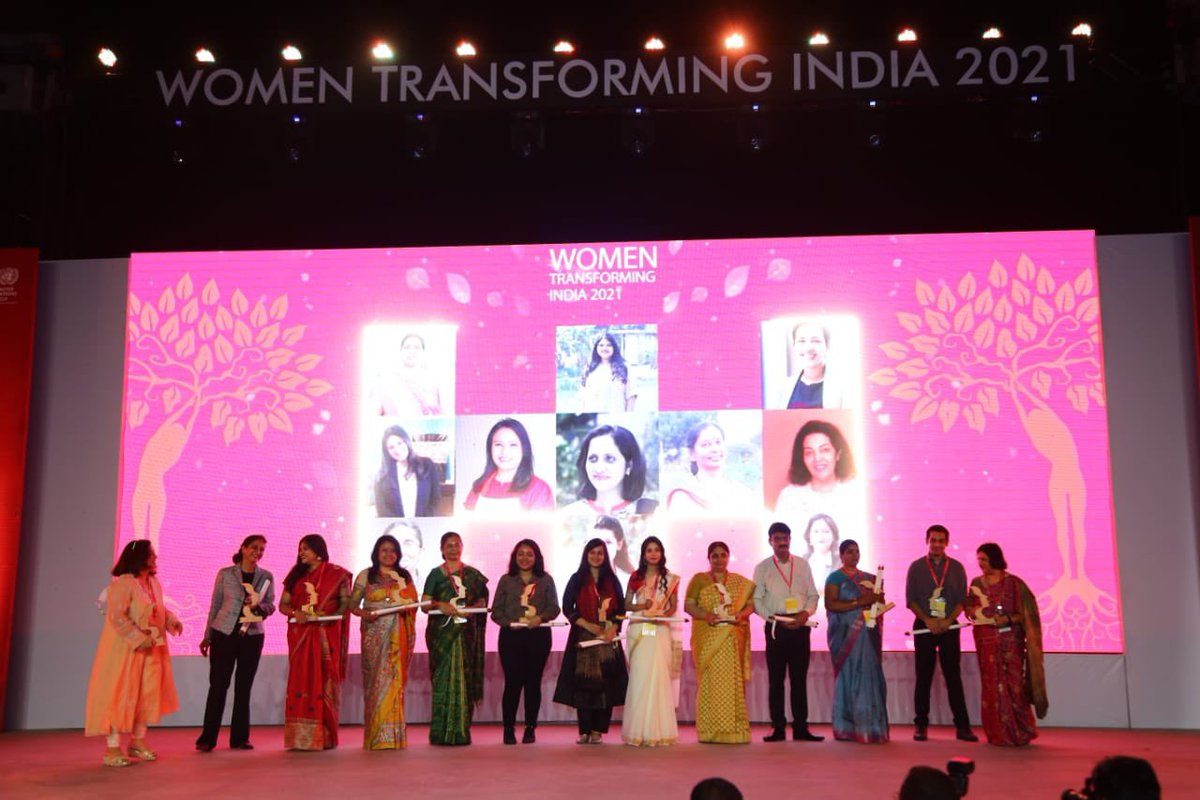
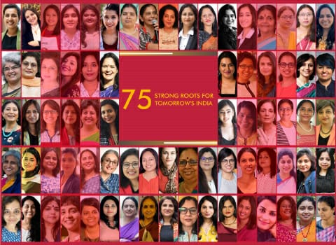
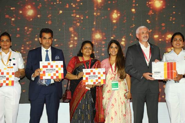
Congratulating all 75 winners of #WTIAwards2021.
Really inspired to see women paving the way for an inclusive and progressive society.
A mesmerising evening with remarkable women, excelling in a vast range of areas. Phenomenal achievers!
English
DronaMaps ری ٹویٹ کیا

#NITIAayog's @WEP_NITIAayog celebrated #WTIAwards2021, yesterday.
The awards recognised women entrepreneurs who have made their mark across sectors.
👉Know more about the 75 #Women achievers, here: pib.gov.in/PressReleasePa…
📹Watch the ceremony, here: tinyurl.com/WTIAwards
English
Thank you @NITIAayog and @thekiranbedi mam for bestowing the honour of “Women Transforming India” to our Director @mishra_ayushi . We feel humbled by this amazing recognition of our work, and hope to continue serving the nation for years to come!

English
This is unprecedented! The new Drone Policy 2021 allows us to scale up our operations and compete with the world, transform every state of India using drones. Thank you so much @MoCA_GoI @PMOIndia @DGCAIndia and thank you @dronefed !
nasscom@nasscom
The liberalization of the #drone policy & opening up sector to drive #innovation is a welcome and exciting move! Another huge boost to innovate in India and innovate for #India! Thank you @PMOIndia and @MoCA_GoI for taking this much needed step. #ThinkDigitalThinkIndia
English
DronaMaps ری ٹویٹ کیا

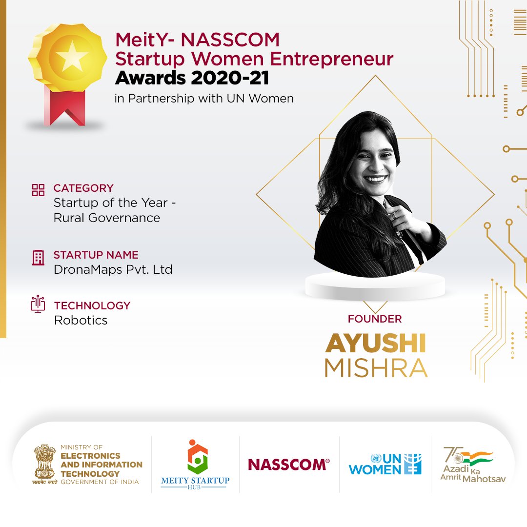
Congratulations to Ayushi Mishra and the team at @DronaMaps on winning the 'Startup of the year' award in the rural governance category at MeitY-NASSCOM Startup Women Entrepreneurs Awards 2020-2021.
@usinghjhu @GoI_MeitY @MSH_MeitY @nasscom @UN_Women #ShriShakti
English
DronaMaps ری ٹویٹ کیا

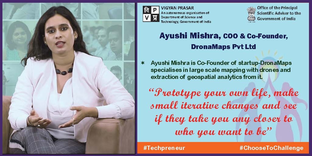
A biomedical engineer by profession, Ayushi Mishra discovered her natural talent for art & combined it with tech knowledge to solve real-world challenges, with that she co-founded @DronaMaps
Read about her journey: indiaai.gov.in/article/ayushi…
@debjani_ghosh_ @sangeetagupta29

English
DronaMaps ری ٹویٹ کیا

Meet Ayushi Mishra, Co-Founder of startup-DronaMaps specializes in large-scale mapping with drones and extraction of geospatial analytics from it.
Read more about her:
indiascienceandtechnology.gov.in/listingpage/ay…
#IWD2021 #techpreneurs #choosetochallenge #womeninscience #dronamaps #startup
English