NatGeoMaps

3.6K posts

NatGeoMaps banner
NatGeoMaps

NatGeoMaps

@NatGeoMaps

Since 1915, National Geographic Maps has been responsible for illustrating the world around us through the art and science of mapmaking.

Washington, DC | Evergreen, CO شامل ہوئے Nisan 2009
214 فالونگ36.1K فالوورز
NatGeoMaps
NatGeoMaps@NatGeoMaps·
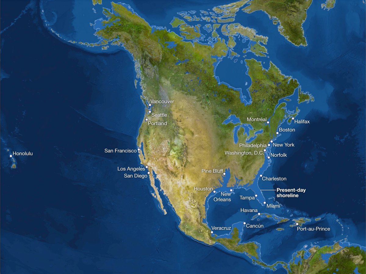
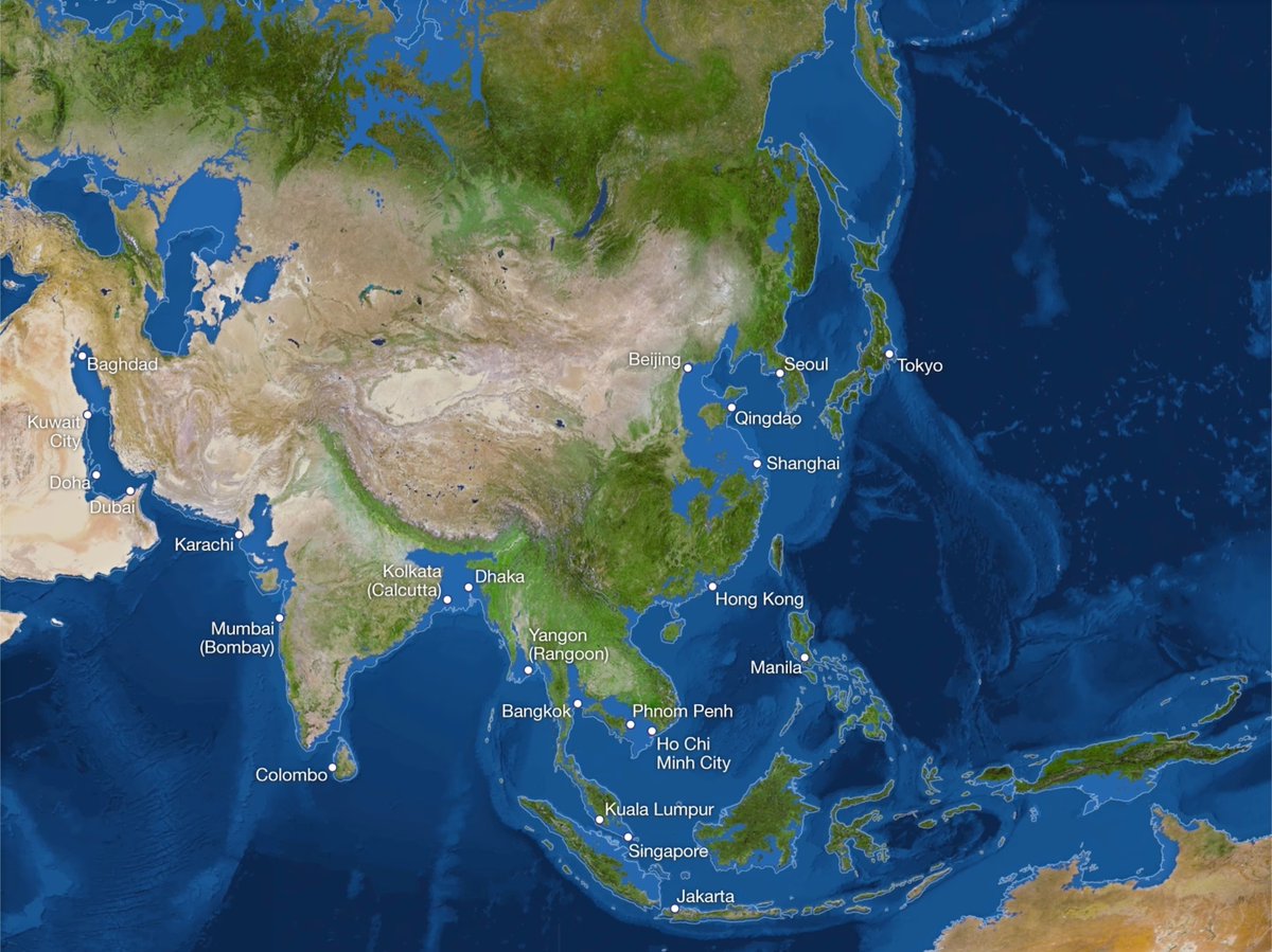
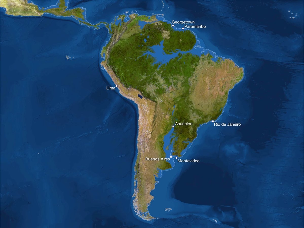
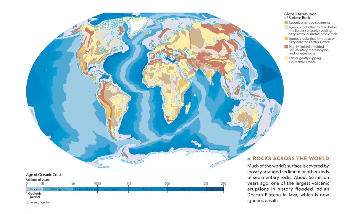
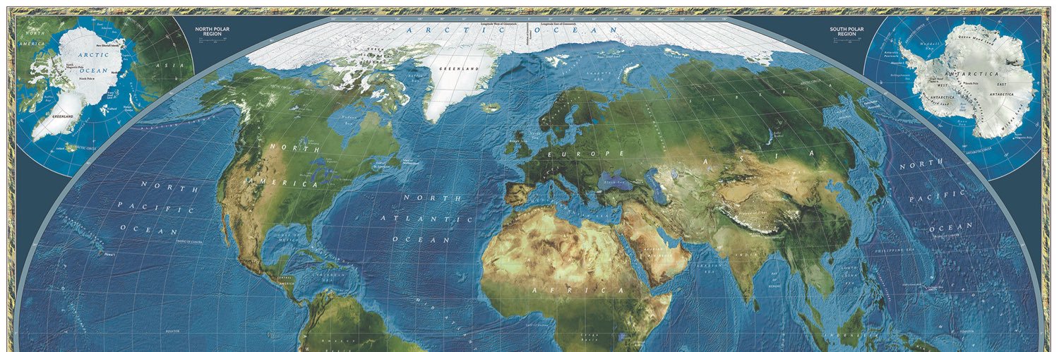
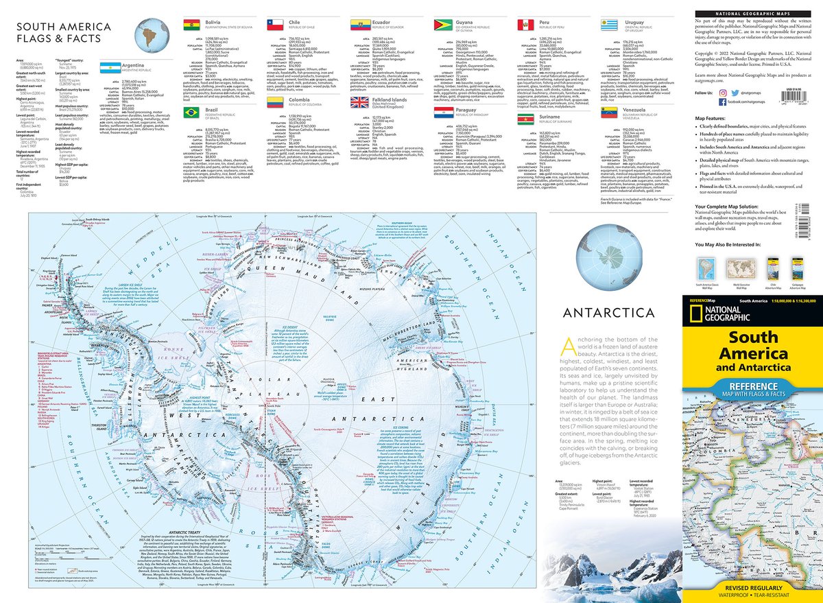
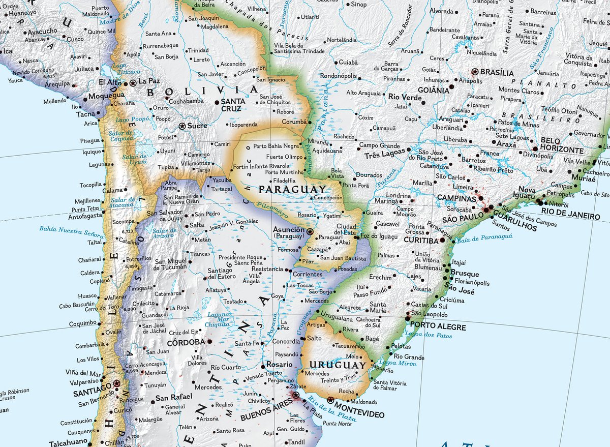
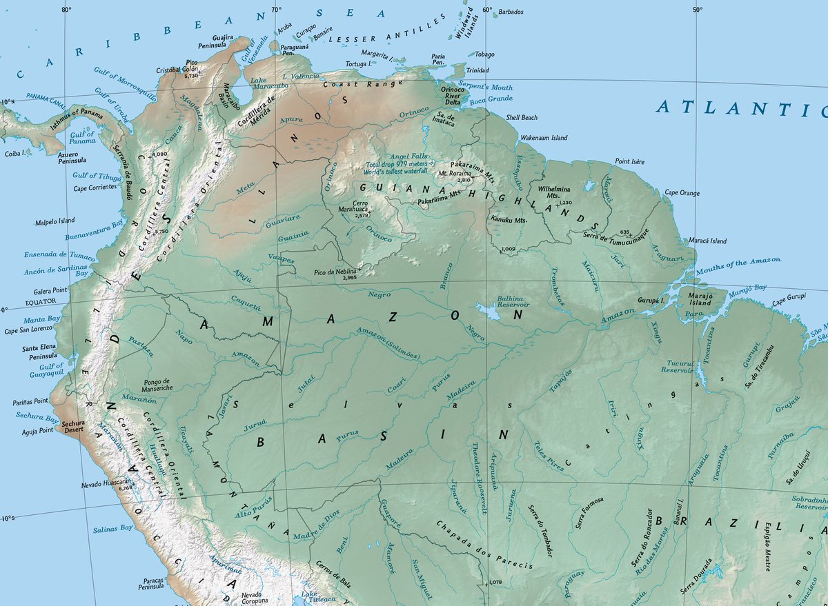
Designed for travelers and printed on waterproof and tear-resistant paper, our new series of folded reference maps for the continents is based on the classic political and physical maps from our atlases, with country flags and facts on the back side. on.natgeo.com/44B3g9Y
NatGeoMaps tweet mediaNatGeoMaps tweet mediaNatGeoMaps tweet mediaNatGeoMaps tweet media
English
13
11
55
12.3K
NatGeoMaps
NatGeoMaps@NatGeoMaps·
The September 2013 issue of @NatGeoMag published these maps showing the world as it is now, but with all the ice on land melted and drained into the sea, raising it 216 feet and creating new shorelines for our continents and inland seas. on.natgeo.com/42WhnoY #sealevelrise #map
NatGeoMaps tweet mediaNatGeoMaps tweet mediaNatGeoMaps tweet mediaNatGeoMaps tweet media
English
5
27
119
20.4K
NatGeoMaps
NatGeoMaps@NatGeoMaps·
Igneous and metamorphic rocks make up 95 percent of the crust’s volume. Sedimentary rocks, although only a small percentage of the total, are the type most commonly found exposed on the surface. From the @NatGeoBooks Family Reference Atlas on.natgeo.com/3WU7TZd #rocks #geology
NatGeoMaps tweet mediaNatGeoMaps tweet media
English
0
8
26
6.7K
NatGeoMaps
NatGeoMaps@NatGeoMaps·
After almost four centuries of peace and prosperity under Rome, Britain faced an onslaught from pagan aggressors. Only Ireland was spared. Historians dispute their intent but agree on their identity—the Angles, the Saxons, and the Jutes—and that they came to stay. @NatGeoBooks
NatGeoMaps tweet media
English
4
6
51
6.3K
NatGeoMaps ری ٹویٹ کیا
Nat Geo Books
Nat Geo Books@NatGeoBooks·
Summer is the perfect time to go stargazing! 🌌💫 Illustrated with luminous photographs and informative graphics, this expansive book is the ultimate guide for everyone discovering the wonders of the night sky. Prepare to be dazzled: rebrand.ly/3las1yw
English
1
4
14
4.5K
NatGeoMaps
NatGeoMaps@NatGeoMaps·
Almost a third of all US lands and waters are now protected areas, sheltering many of the nation's remaining wild spaces. Over a century and a half, these natural landscapes have been set aside to prevent their conversion into other uses, such as urban development or agriculture.
NatGeoMaps tweet media
English
1
6
30
5.6K
NatGeoMaps
NatGeoMaps@NatGeoMaps·
Hidden canyons and high meadows distinguish the Gila Wilderness, land once inhabited by the Apache. In 1924, the US Forest Service designated it as the world’s first “wilderness area,” where people could visit but must leave no permanent mark. From the June issue of @NatGeoMag
NatGeoMaps tweet media
English
0
4
23
5.1K
Avenza Systems Inc.
Avenza Systems Inc.@Avenza·
This beautiful map, created by Riley Champine, outlines the physical features of Serengeti, the boundaries of many protected areas, and the migration of over a million wildebeests! bit.ly/3JAlh0T
Avenza Systems Inc. tweet media
English
1
11
44
11.8K
NatGeoMaps
NatGeoMaps@NatGeoMaps·
By the end of the 3rd millennium BCE, Semitic tribes had settled on the coast of present-day Lebanon and Syria, making the cities of Tyre, Sidon, and Byblos. The Greeks named them Phoenicians, from the word “phoinix,” or purple, due to their purple cloaks. on.natgeo.com/3J1SSjb
NatGeoMaps tweet mediaNatGeoMaps tweet media
English
0
22
84
16.5K
NatGeoMaps
NatGeoMaps@NatGeoMaps·
For centuries, competing empires have fought over the fertile plains and strategic waterways that make up modern #Ukraine. Independent since the 1991 breakup of the Soviet Union, it has been trying to reclaim territory seized by Russia in 2014. Get the map in the June @NatGeoMag.
NatGeoMaps tweet media
English
0
21
65
16K
NatGeoMaps
NatGeoMaps@NatGeoMaps·
Kris Tompkins leads the visionary effort that she and her late husband began in the 90's to buy millions of acres in Chile and Argentina, then donate them to create new parks. @NatGeoTV documentary Wild Life chronicles their effort. on.natgeo.com/3MW4SF9 on.natgeo.com/3IEEgWA
NatGeoMaps tweet media
English
2
4
23
4.3K