A massive fire has been reported at the Dos Bocas refinery in Tabasco, Mexico, with workers saying a tower at the coking plant is involved and heavy smoke is rising.
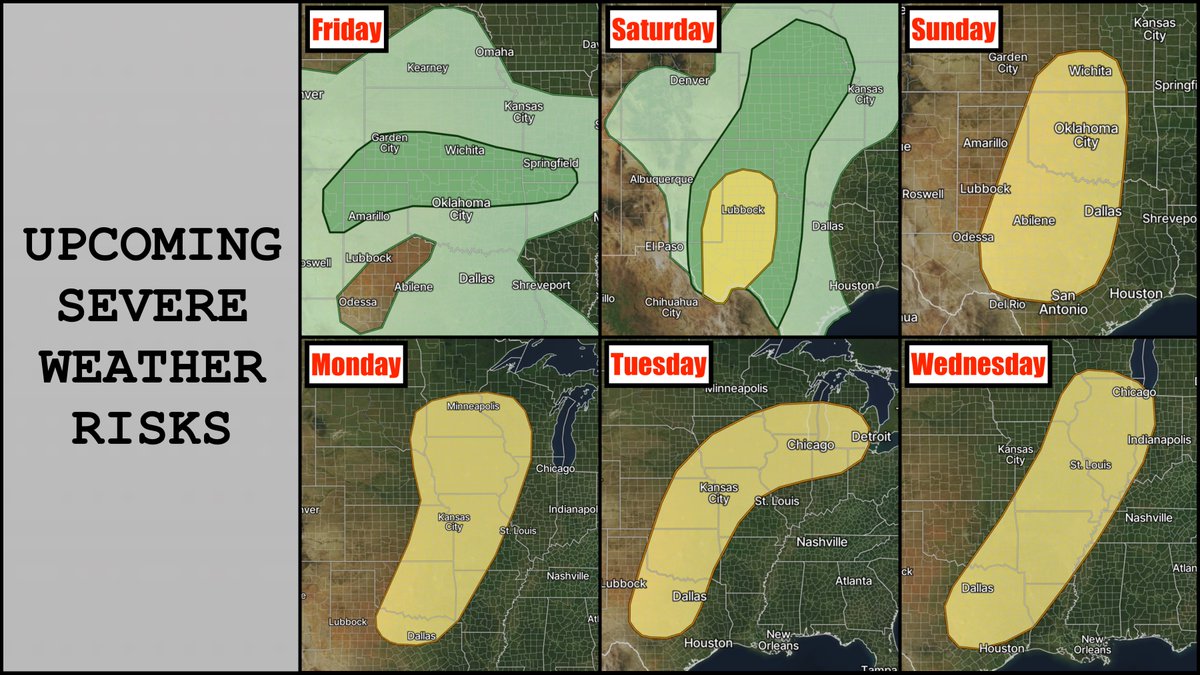
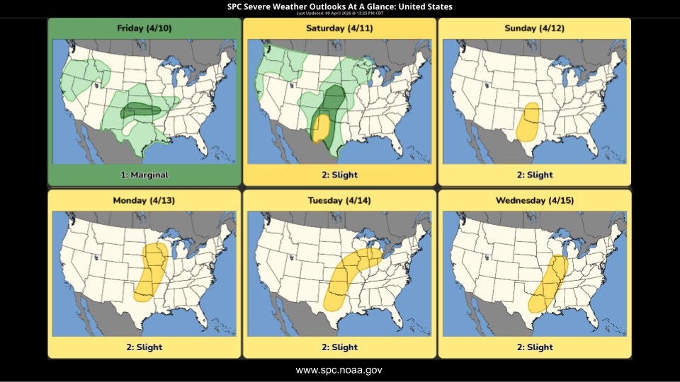
Latest SPC outlooks for the next several days, beginning tomorrow through next Wednesday. A very active stretch of severe weather is on tap, with next week's risk areas perhaps representing days with the highest ceiling. I'll have more specific info, including forecast videos, as needed over the coming days.
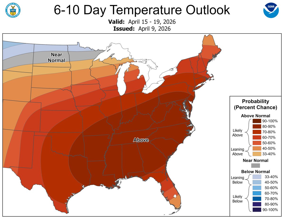
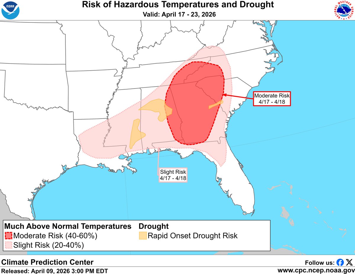
Early season heat is forecast across the eastern U.S. next week, with portions of the Mid-Atlantic and Southeast possibly having temperatures above 90 deg F for the first time this year. Drought expansion and increased wildfire threat are also a concern.
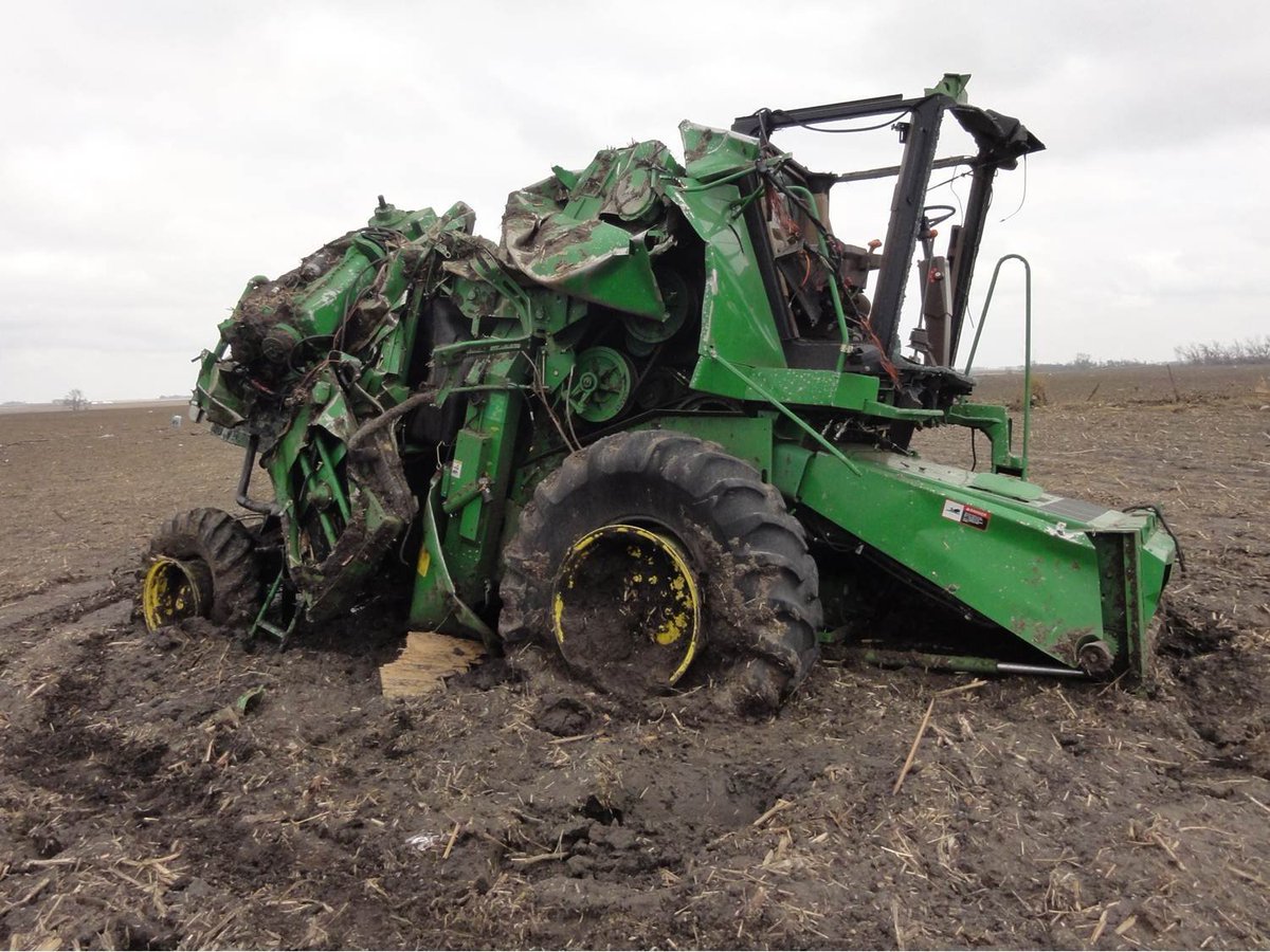
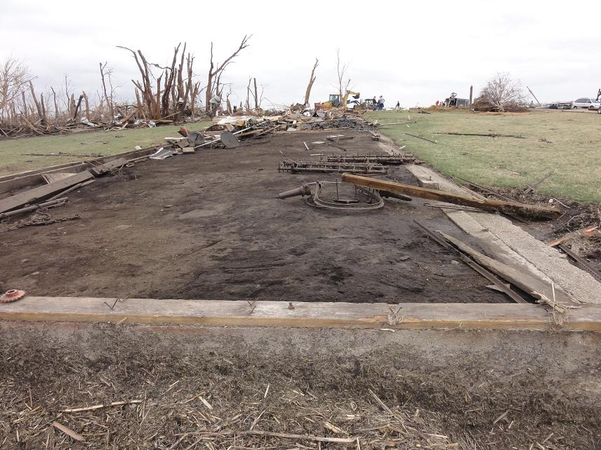
On this day in 2011:
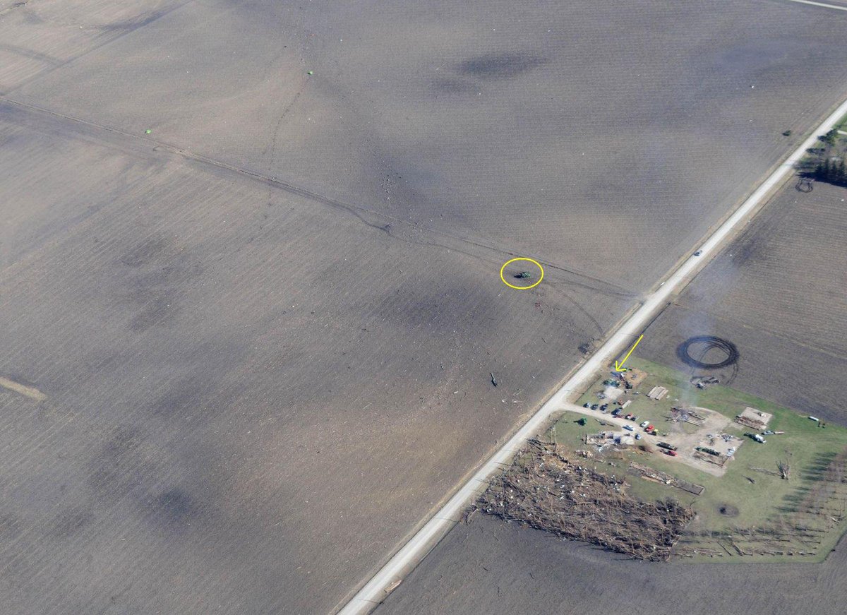
A cyclic supercell produced multiple intense tornadoes, including a narrow yet violent EF4 west of Pocahontas, Iowa. A farmstead was completely obliterated, and a 30,000-pound combine was thrown more than 50 meters into a nearby field. The site it originated from exhibited extreme damage, though the official rating was 170 mph. In my view, the intensity at that location was likely stronger, arguably consistent with potentially EF5 damage based on the same contextual reasoning used in the Enderlin upgrade, the paper mentions a combine being thrown or tossed more than 50 meters indicates EF5 winds over 200 mph. This was also not likely a satellite tornado, but had its own mesocyclone.
Severe storm activity is expected to increase this weekend into early next week over the central US. While the specifics are still unclear, now is a great time to review storm safety plans and prepare for possible severe weather!
Follow for updates: spc.noaa.gov
*DROUGHT UPDATE*
Latest numbers are out.
Much of South Central & Western KY, including West TN are now in a Severe Drought.
Even the Moderate Drought has expanded up into Central KY.
Basically, WE NEED RAIN.
A chance of some on the Weekend but next weekend looks limited as well. I am tracking a better shot by late next week though but still hard to for-see at the moment.
-Mike
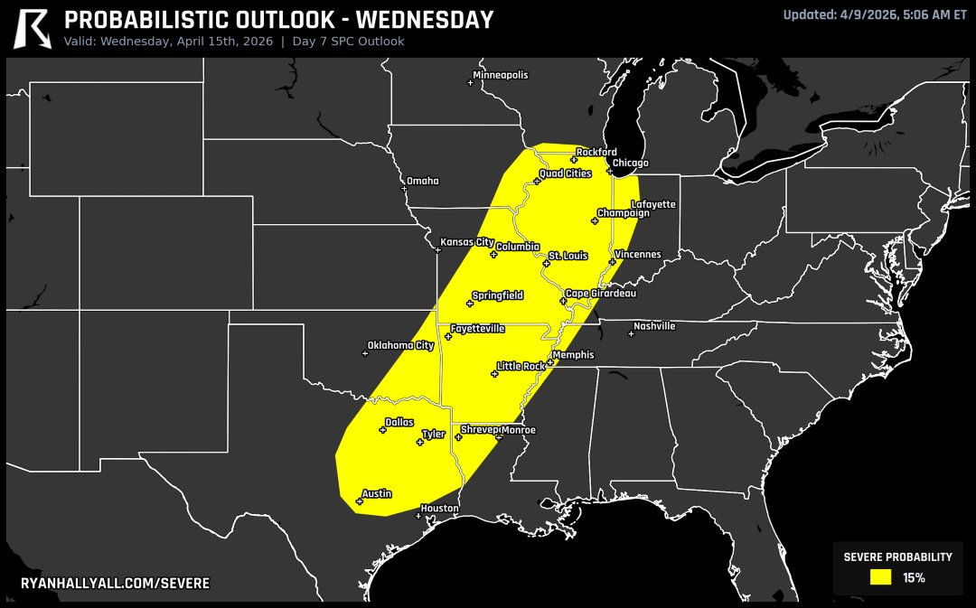
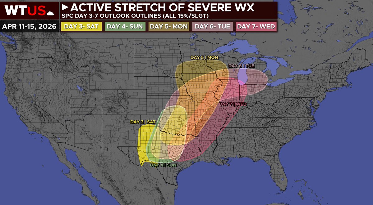
We're on day 7 of the outlook and there's STILL severe weather on the map. Wednesday shows another round of storms from the Great Plains into the Upper Midwest as the front pushes through. Countless consecutive days of severe potential from one system. This pattern just will not quit.
Kentucky State Police Investigates Fatal Collision in Simpson County
BOWLING GREEN, KY. (April 08, 2026) – At just before 6:00 p.m., the Kentucky State Police Post 03 Bowling Green received a call about an injury collision. Troopers arrived on scene in the 1200 block of Witt Road.
A preliminary investigation indicates that a 2008 Harley-Davidson motorcycle operated by Jared Jones, 47, of Salem, Indiana was traveling south on Witt Road. Mr. Jones's vehicle left the roadway off of the right shoulder. The operator and the passenger were both ejected from the motorcycle. Mr. Jones was pronounced deceased at the scene. The passenger was flown to TriStar Skyline Medical Center.
The investigation is ongoing and will be led by Trooper Grant Roberson. He was assisted at the scene by the Simpson County Coroner's Office, Simspon County EMS, and other KSP personnel.
An active severe weather pattern will set up from the Southern Plains into the Midwest starting Sunday and then into mid-week next week. Have a plan for what to do in a severe thunderstorm or tornado warning in place before the threat increases in your area. Visit weather.gov/safety for more.
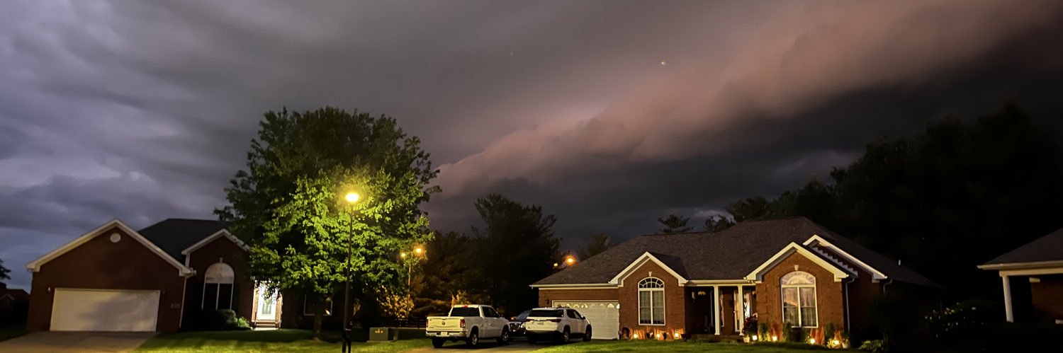
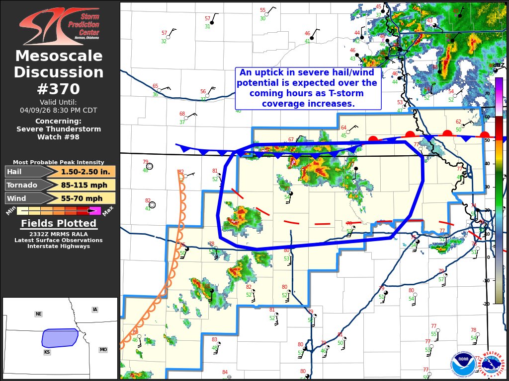
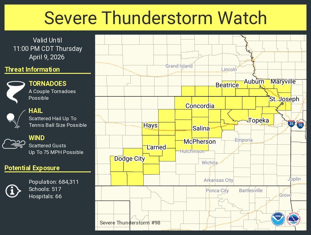
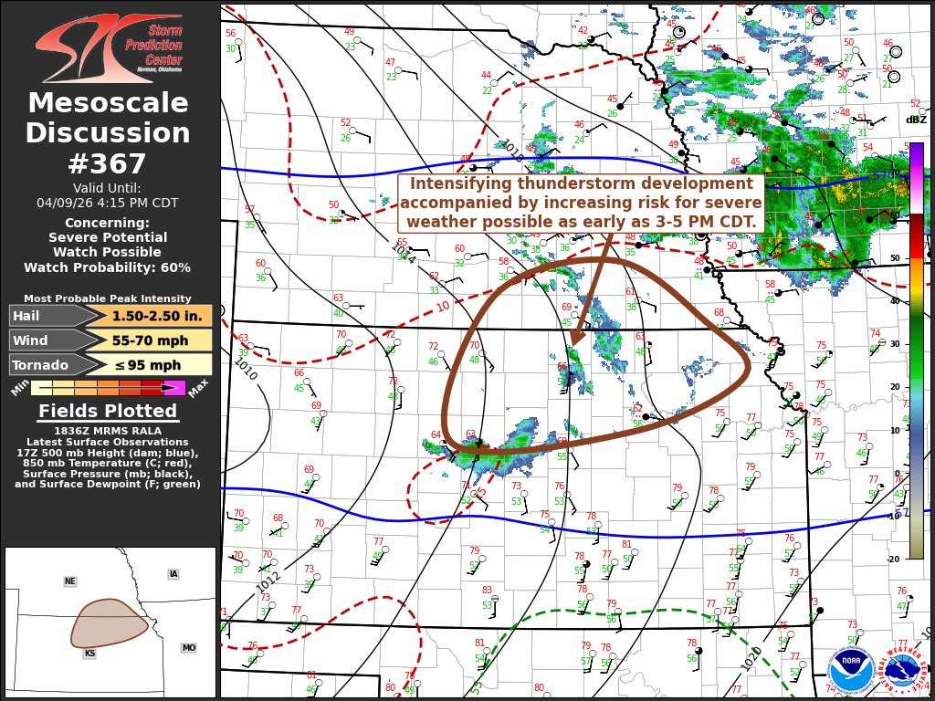
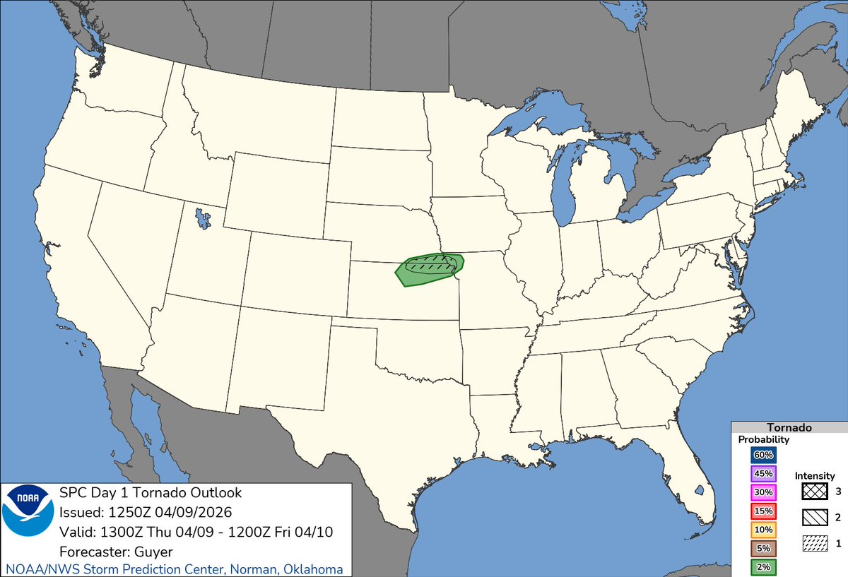
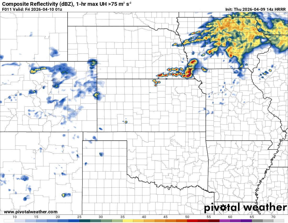
A few tornadoes are possible today along the NE/KS/MO border region. Heads up. Damaging winds and large hail still appear to be more of a threat with this little event.
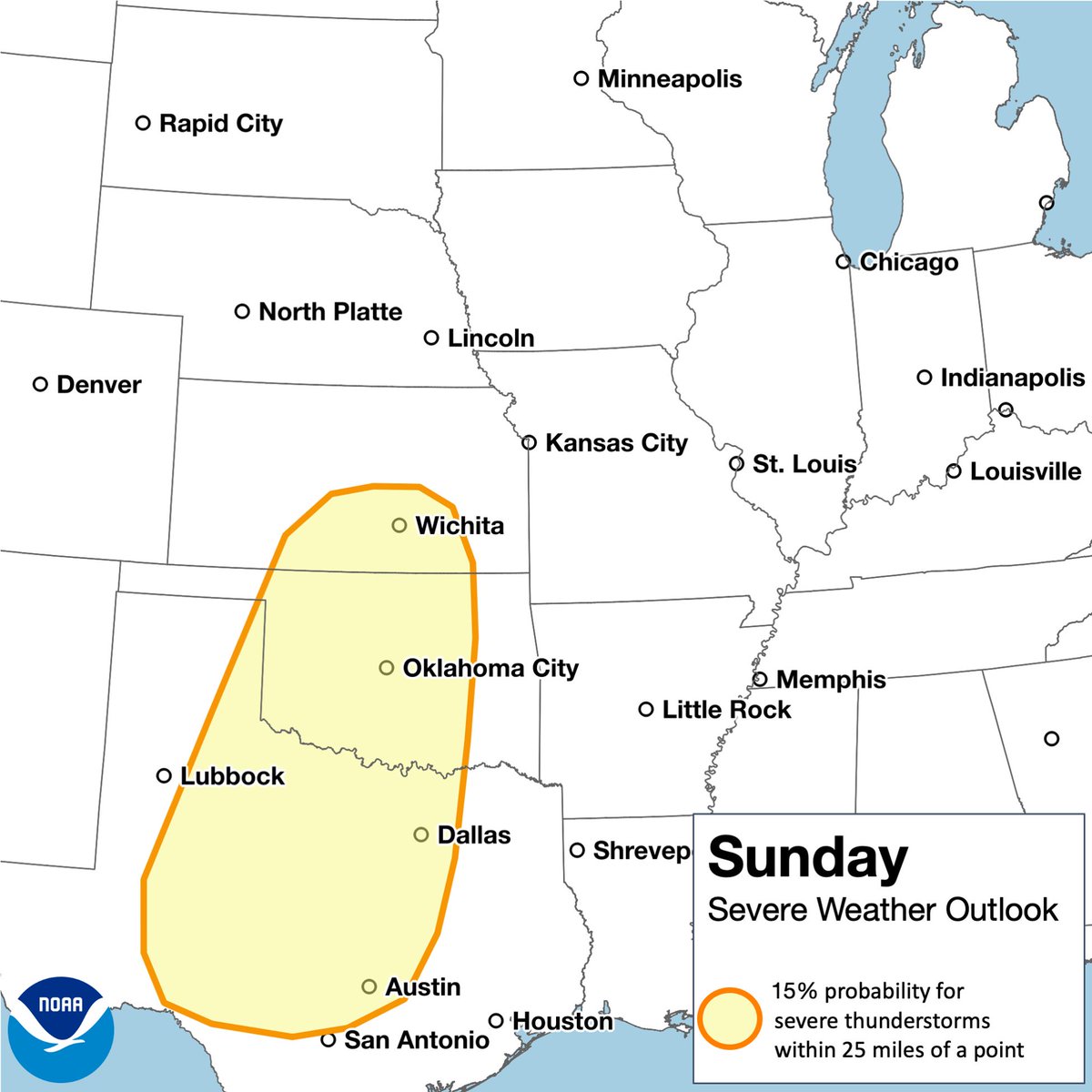
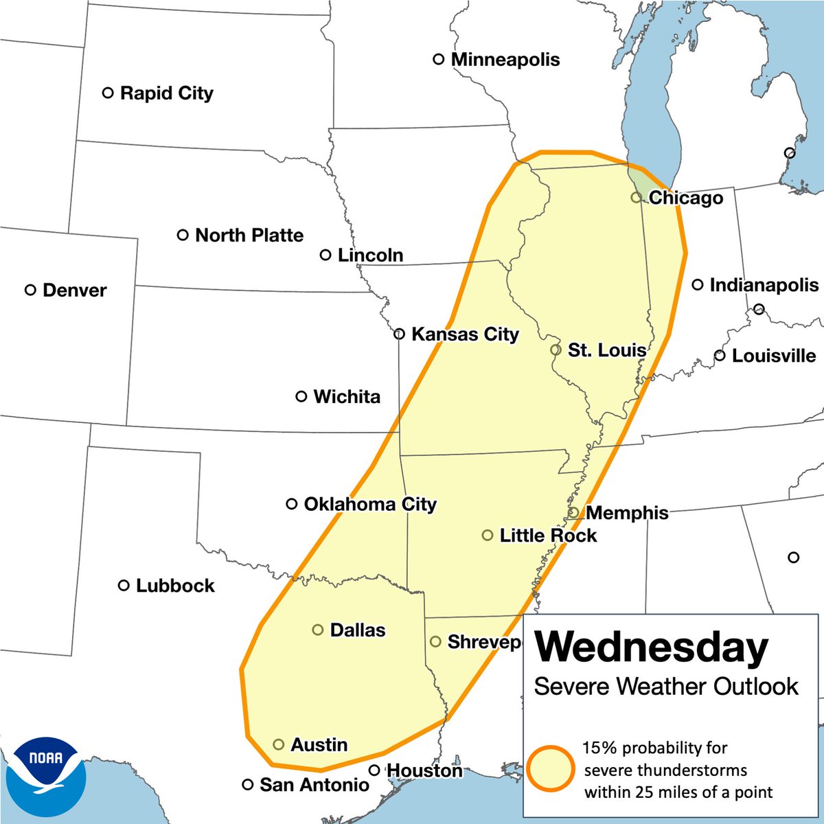
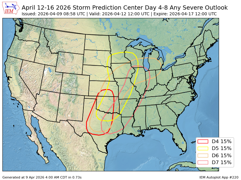
There are now 5 straight days under at least a 15%/Slight Risk of severe storms from Day 3 - Saturday, to Day 7 - Wednesday (Apr 11-15).
Day 3/Sat: Isolated-scattered damaging wind gusts and severe hail possible, mainly focused across West Texas.
Day 4/Sun: Threat moves east, with a more uncertain/conditional threat of storms, but if storms develop, mainly damaging winds and large hail will be possible, with perhaps a tornado threat as well.
Day 5/Mon: As stronger upper-level flow advances eastward, with more moisture advection, a more widespread, and perhaps more robust severe threat may materialize across the Central Plains, into the Upper Midwest. All severe hazards appear possible.
Day 6/Tue: Another severe risk is outlined across the Central Plains, into the Great Lakes/Midwest region, where a very widespread, and perhaps significant severe weather event may take shape, supporting all severe hazards, including the threat of tornadoes as well.
Day 7/Wed: As the main trough advances eastward, or exits, there could be a severe threat from the Southern Plains to the Midwest. Hazards are uncertain, mainly dependent on the evolution of Tuesday's activity.
Day 8/Thu: No severe risk has been outlined for this day, but there may be some severe potential on Thu across parts of the Mississippi Valley, Ohio Valley, and perhaps into the Mid-South.
MULTI-DAY SEVERE WEATHER OUTBREAK AHEAD, including #tornado threats, starting tomorrow in northeastern Kansas!
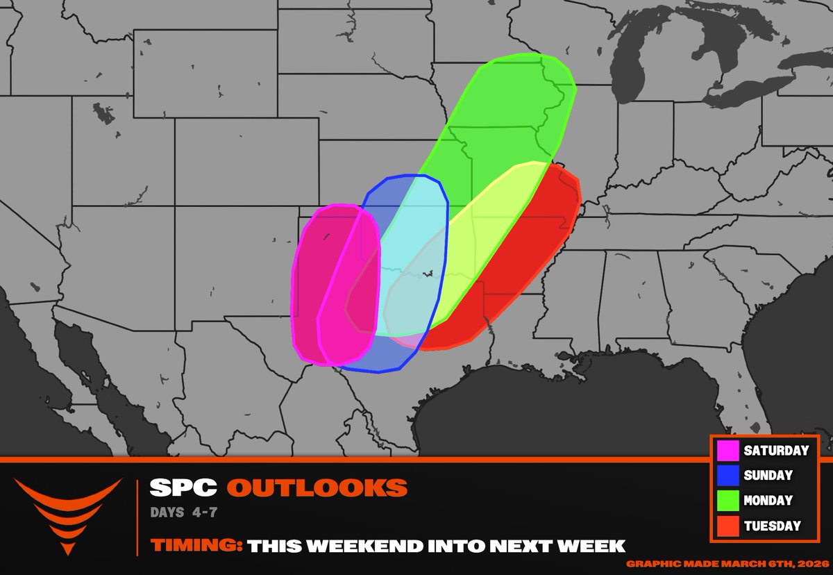
This map then shows the severe weather risk areas during Friday-Tuesday from west-to-east as a trough very gradually ejects from the Mountain West. I believe this wave will maximize Monday-Wednesday across the southern Plains to the Midwest/Corn Belt region.
The long-range models depict a potentially historic period for severe weather this April