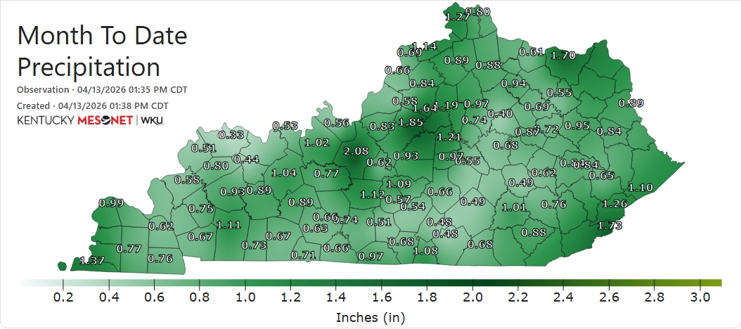
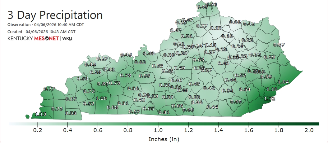
As we approach the halfway point of April, we find that a great number of sites have received < 1" for the month to date. Some have yet to see more than one-half inch accumulate. #kywx
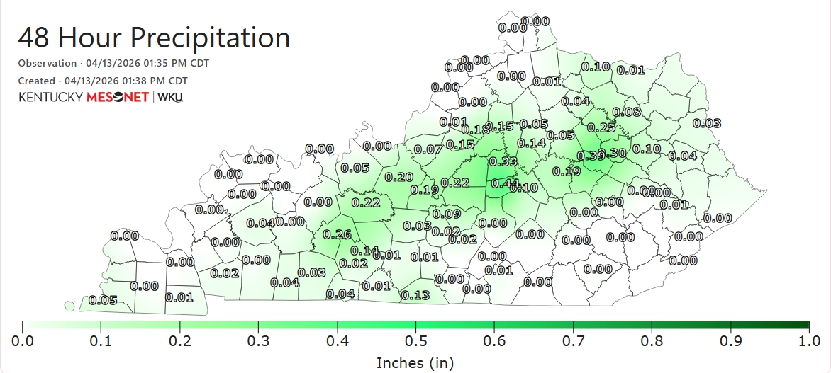
Much-needed rainfall has proven tough to come by in recent days. Some sites received measurable precipitation dating back to Saturday, while others have been shut out altogether. (1/2)
#OTD in 2004, dynamic cooling on the back side of low pressure moving NE up the Appalachians resulted in significant, wet #snow accumulations for parts of the state. Louisville had just 0.1", but Rochester in Butler Co. saw 3.5" & Rough River Lake a whopping (for April) 6"! #kywx
#OTD in 1948, an F2 tornado struck the Bluegrass Army Depot in Madison County near Richmond. Several large buildings were downed. No one was hurt. #kywx
Here is our latest Drought Information Statement slide deck: weather.gov/media/pah/DGT/… Severe drought (D2) has expanded over more of the region with this week's update. Paducah has officially observed their driest December 1st through April 9th period on record.
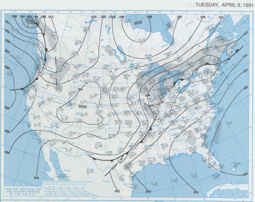
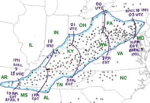
#OTD in 1991, a 'derecho', a long-lived complex of severe thunderstorms with widespread wind damage, raced NE from the mid-South into the mid-Atlantic. Central/eastern sections of the Commonwealth bore the brunt of this event with numerous downed trees and power lines. #kywx
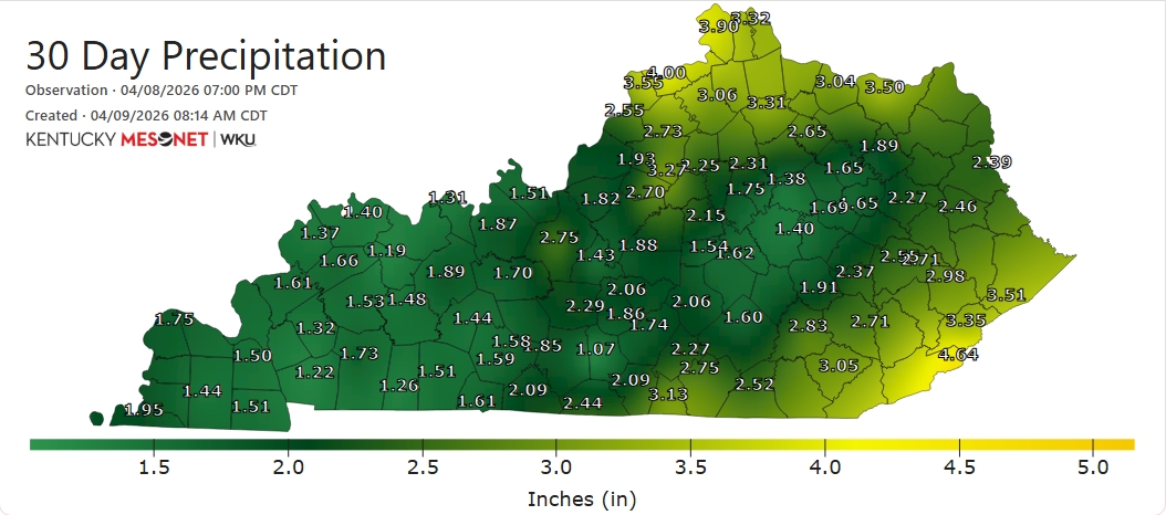
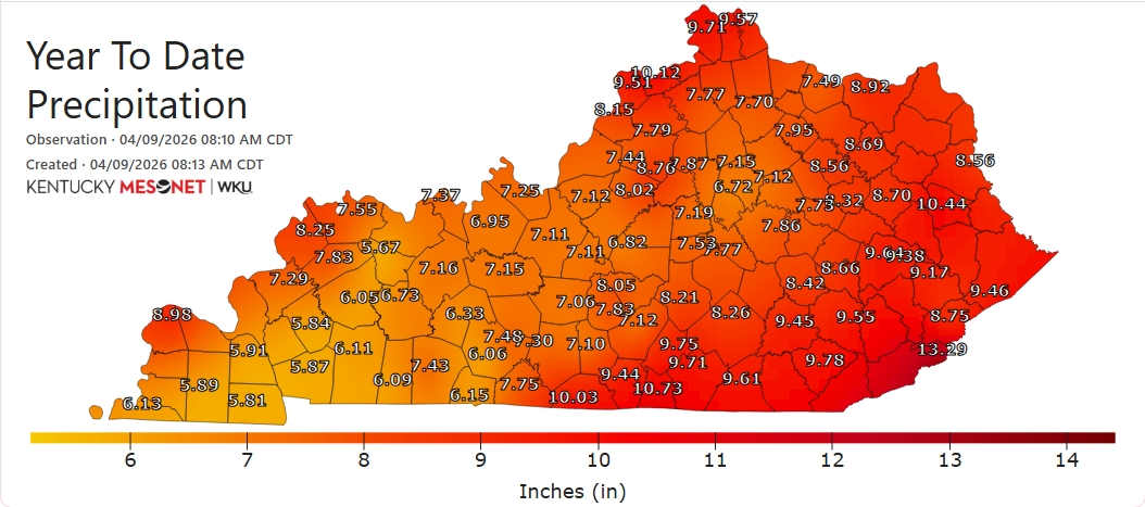
The #spring season has featured a general lack of significant rainfall for extended spells for much of the state. Many sites have received <2" of rainfall in the past 30 days. Rainfall deficits for the year-to-date are running > 5" below normal for many. #kywx
D1 (Moderate Drought) has also expanded eastward into southern portions of the Blue Grass region and parts of the mountainous east. The yellow denotes D0 ('abnormally dry') conditions. (2/3)
🧵🟠DROUGHT SPREADS: Per the latest update from @NOAADrought, more than half of the state - nearly 55% of it - is now officially in #drought. D2 (Severe Drought) has expanded east to take in Bowling Green and a large portion of south-central and far W KY. (1/3)
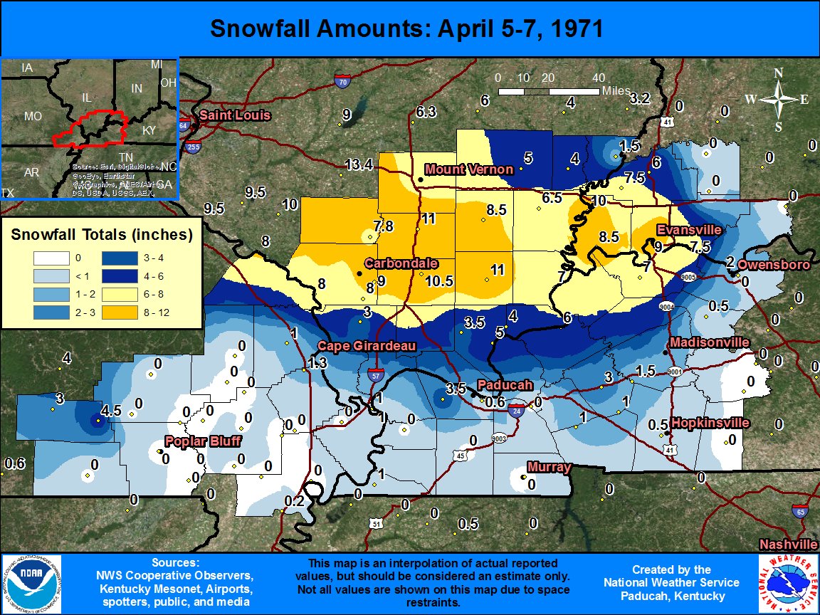
#OTD in 1971, a very rare, late-season winter storm affected mainly the western region with slushy, accumulating #snow. Portions of Union, Henderson, and Webster Cos. received 6"+, with up to 9" in the city of Henderson. (data: @NWSPaducah) #kywx
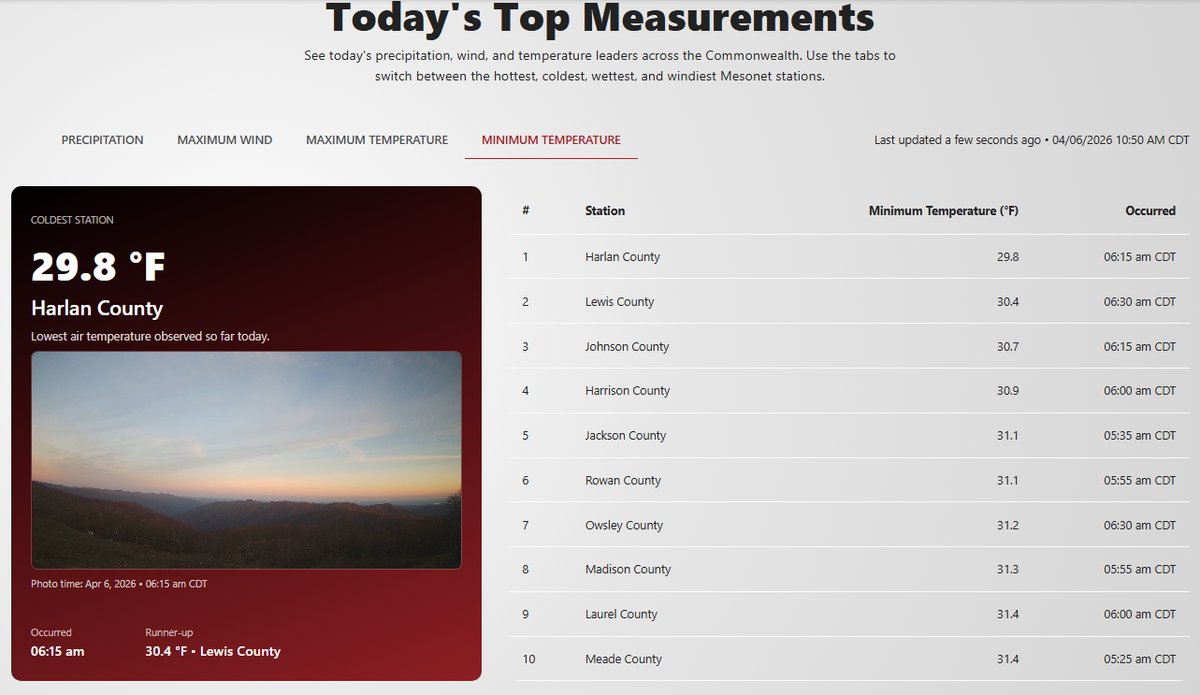
The #easterweekend provided the Commonwealth with badly-needed rainfall for many. While some locations saw < .25", others received > 1", including Black Mountain in the east. That's also where the coldest low temperature occurred this morning (just shy of 30F).
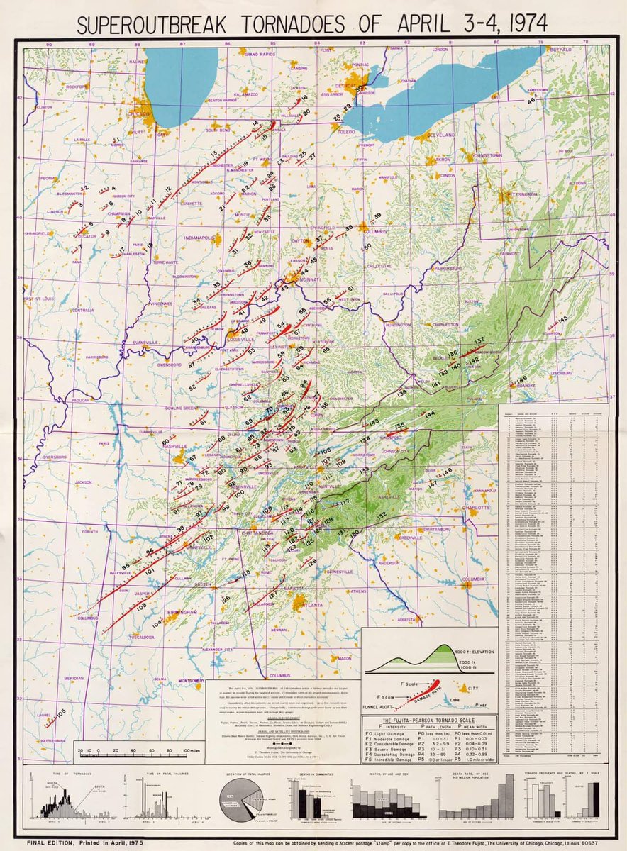
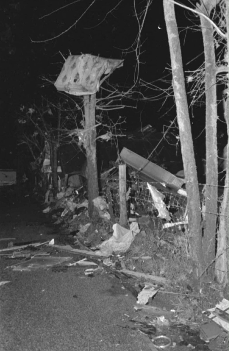
#OTD 50 years ago, an event that became known as the “SuperOutbreak” of tornadoes unfolded. Some 148 tornadoes swept across the eastern U.S. This included the only F5/EF-5 to ever strike KY (Brandenburg), where 31 people lost their lives. (1/2)
@NWSPaducah The strongest tornado touched down in Jeffersontown, a suburb of Louisville, where an EF-3 with winds to 145 mph was confirmed on the 2nd. (tornado data/map: @NWSLouisville) #kywx
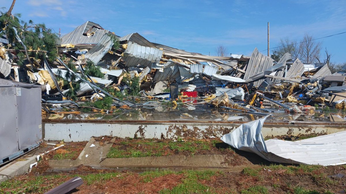
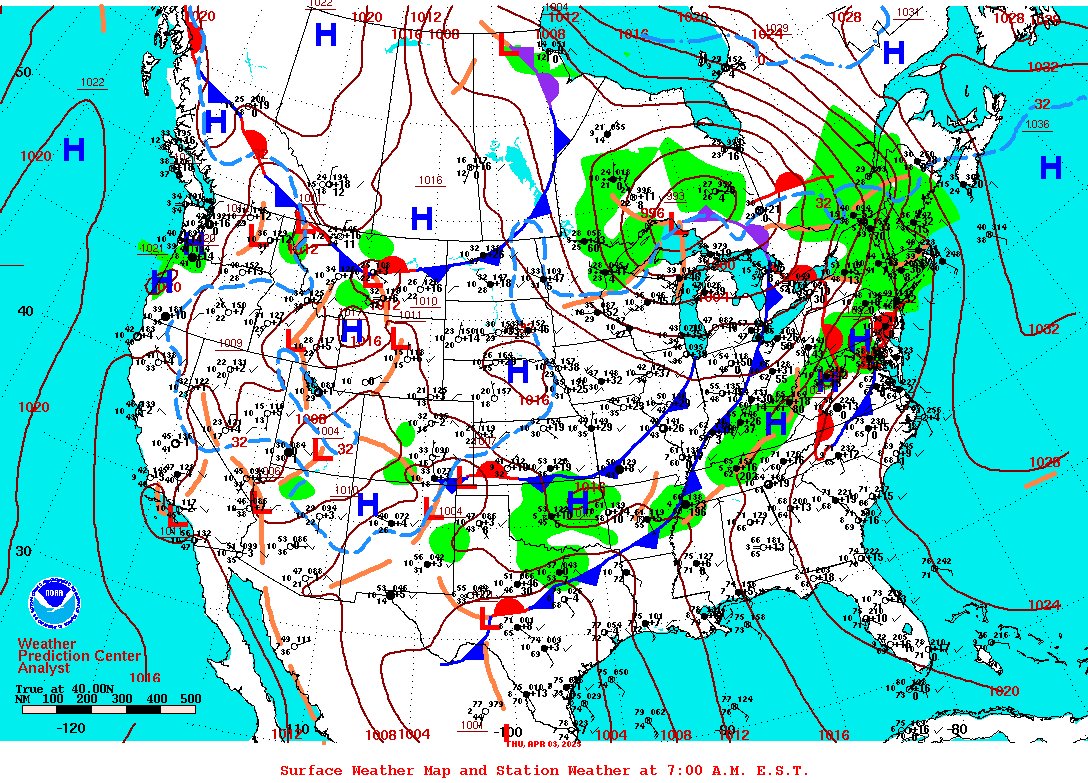
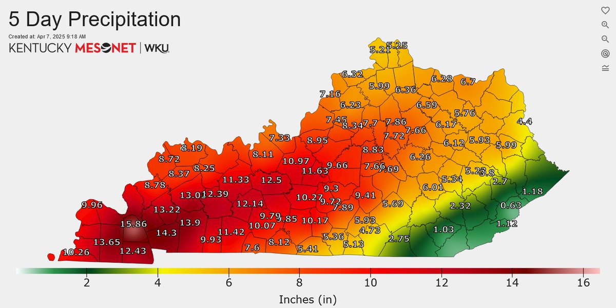
@NWSPaducah Several fatalities were blamed on the flooding, with numerous road closures as well as businesses and schools shut down for a time. In addition to the heavy rains, this system also produced rounds of severe thunderstorms with several tornadoes...
🧵#OTD a year ago, The April Flood of 2025 was getting underway as a cold front eased into Kentucky. This boundary became stationary, meandering over the state for several days. Waves of rain and thunderstorms moved over Kentucky between the 2nd and the 6th...