Ramon Arrowsmith
1.7K posts
Ramon Arrowsmith أُعيد تغريده
OpenTopography is at the @SACNAS National Diversity in STEM (#2024NDiSTEM) conference in Phoenix, AZ this week. Stop by our booth in the exhibit hall (shared with @AGeSGeochron) to say hi 👋, ask questions, and learn about available resources related to #lidar and topography.

English
Ramon Arrowsmith أُعيد تغريده
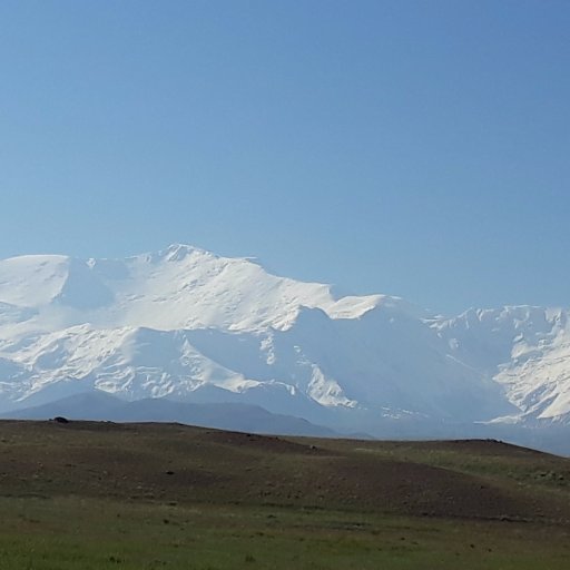
Here's a summary of our 2024 activity in the @NATO_SPS project “Earthquake Hazard and Environmental Security in Kazakhstan and Kyrgyzstan”: the field trip to the western USA quakesincentralasia.org/research-updat…
@ramonarrowsmith @RichardThomasW @gulkaiyr0788 @AMukambayev
English
Ramon Arrowsmith أُعيد تغريده
Ramon Arrowsmith أُعيد تغريده
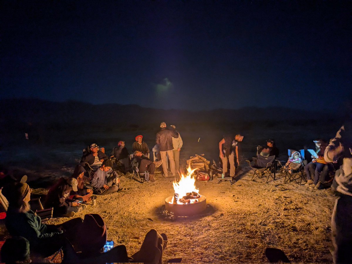
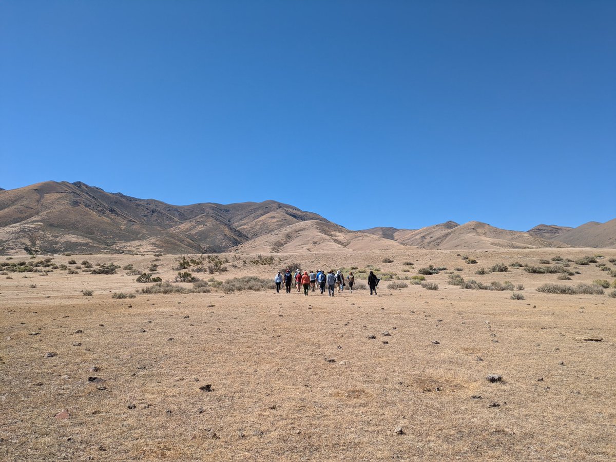
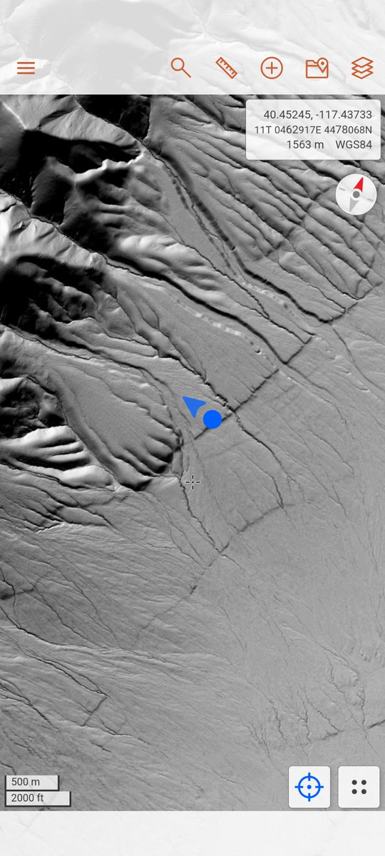
That's a huge scarp! Buffalo Valley fault, impressive both on the ground and in the #lidar data
English
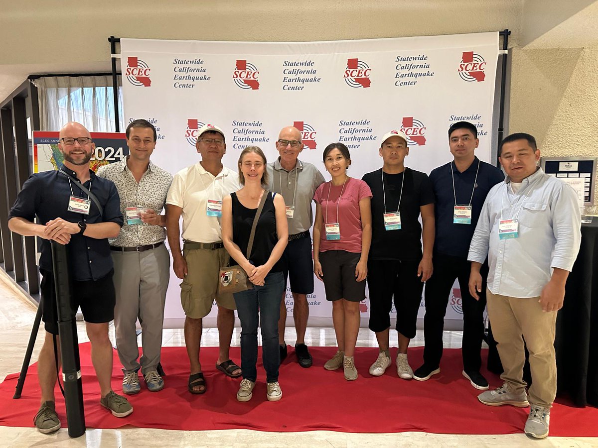
Ramon Arrowsmith أُعيد تغريده
Our group at the #SCECmeet:
@TTremblingEarth, @ch_gruetze, Cholponbek, Magali, @ramonarrowsmith, Gulkaiyr, Erkhin, Sultan, & @aimassemsk.
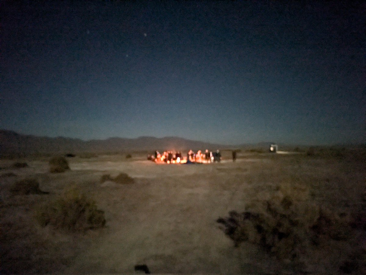
We really enjoyed the meeting so far and tomorrow we'll head off to N Nevada to see some faults!
English
Ramon Arrowsmith أُعيد تغريده
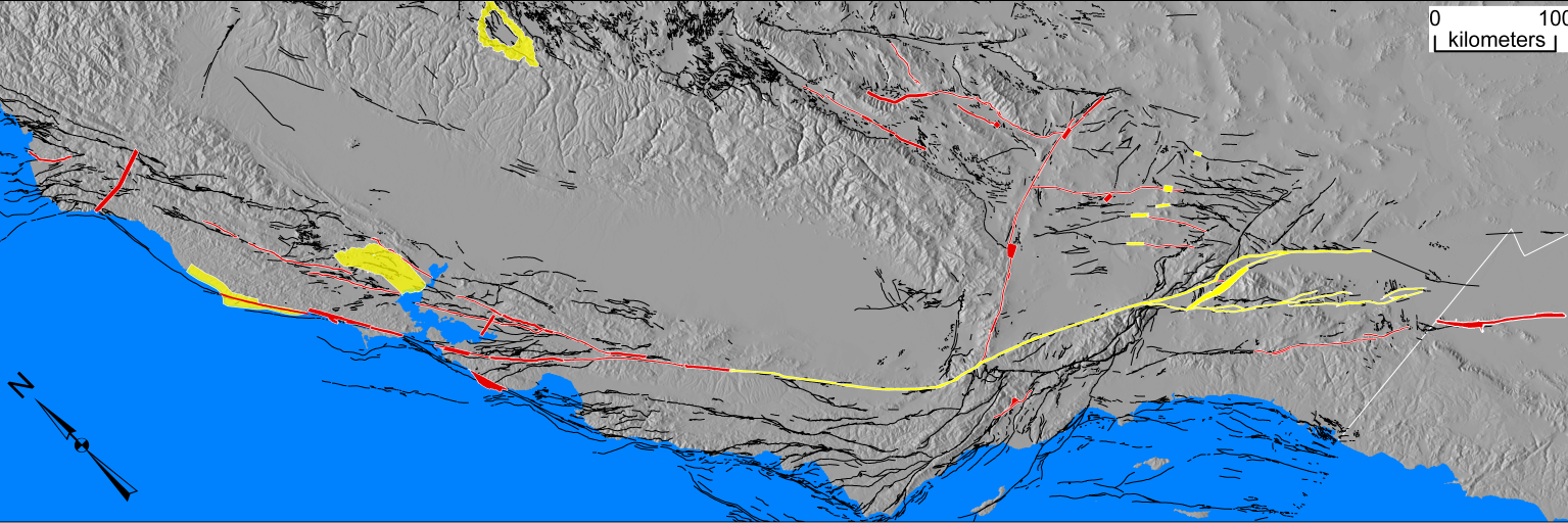
The recently felt #earthquake shaking in #Almaty is a reminder that there's the urgent need for greater earthquake #Resilience in continental Asia:
nature.com/articles/s4156…
#seismichazard @NATO_SPS
English
Ramon Arrowsmith أُعيد تغريده

Why there is the urgent need for greater earthquake resilience in continental Asia:
nature.com/articles/s4156…
English
Ramon Arrowsmith أُعيد تغريده
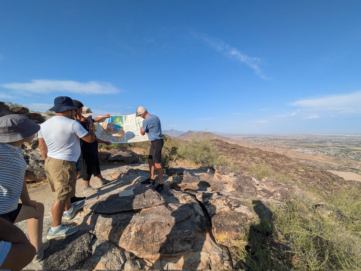
Today we're having an excursion to the South Mountains south of #Phoenix, led by @ramonarrowsmith from @ASU
English
Ramon Arrowsmith أُعيد تغريده
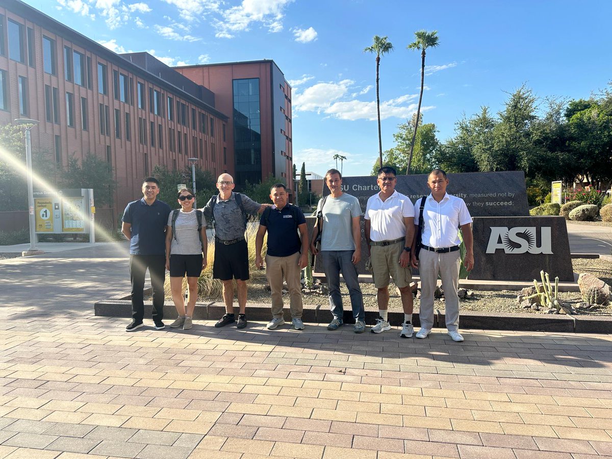
Everyone arrived in Tempe safely and we're going to have a few meetings at @ASU with @ramonarrowsmith & his group
Earthquakes in Central Asia@QuakesCentAsia
Now it's time for a last joint project meeting. @ramonarrowsmith from @ASU Tempe set up a great program for researchers from Kyrgyzstan, Kazakhstan, Canada, and Germany.
English
Ramon Arrowsmith أُعيد تغريده
Ramon Arrowsmith أُعيد تغريده
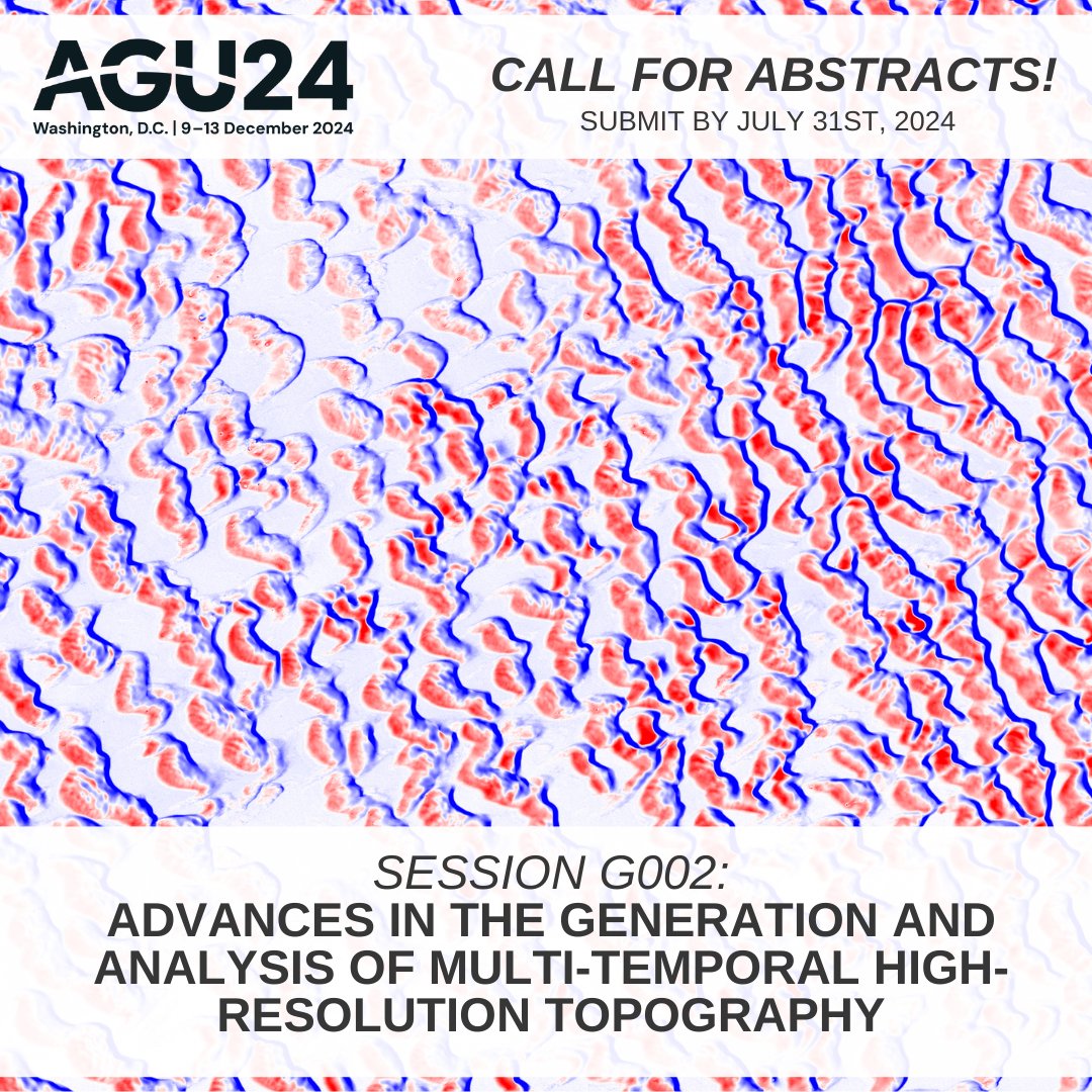
Call for #AGU24 abstracts! Are you developing innovative new methods to produce, analyze, & interpret high-resolution topographic change data? Consider submitting an abstract to our interdisciplinary methods session: agu.confex.com/agu/agu24/prel… #lidar #topography
English
Ramon Arrowsmith أُعيد تغريده
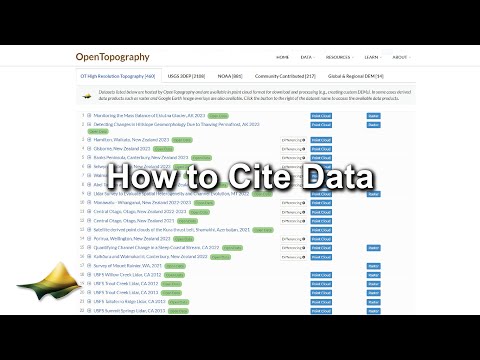
If you use data from OpenTopography in a publication, you should include a dataset citation. We provide pre-generated language you can copy & paste into your references. This new video shows how:
youtu.be/kVpuGnDcZ3E?fe…
OT citation policy for more info: opentopography.org/citations
YouTube
English
Ramon Arrowsmith أُعيد تغريده
Today is the 5 year anniversary of the 2019 Ridgecrest earthquakes (July 4th & 5th). There are several #lidar and photogrammetric (space-based and UAS) datasets available from OpenTopography covering the area impacted by this event: portal.opentopography.org/datasets?minX=…
OpenTopography@OpenTopography
Updated release of M6.4 & M7.1 Ridgecrest earthquake sequence #lidar. Release adds data over Naval Air Weapons Station China Lake, and now includes the main surface fault ruptures. Data collected by @NCALM_UH, funded by @USGS & @NSF.
English
Ramon Arrowsmith أُعيد تغريده
Join @crosbycj & @ramonarrowsmith for a one day "Introduction to High-Resolution Topography and OpenTopography" short course at the 2024 @geosociety national meeting #GSA2024 in Anaheim, CA on Sat, Sept 21st. More information and link to register: opentopography.org/workshops/2024… #lidar

English
Ramon Arrowsmith أُعيد تغريده
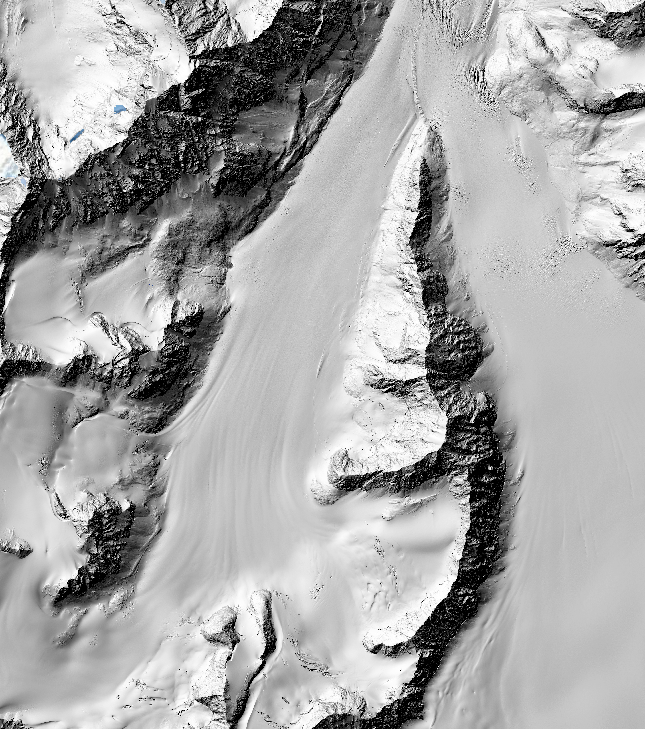
Pair of new @NCALM_UH seed #lidar datasets in Alaska, USA are now available on OpenTopography:
- Monitoring the Mass Balance of Eklutna Glacier, AK 2023
- Detecting Changes in Hillslope Geomorphology Due to Thawing Permafrost, interior AK 2023
More info: opentopography.org/news/two-new-n…
English
Ramon Arrowsmith أُعيد تغريده
Recent publication by @neotectonic et al., investigates earthquake hazards in the Greater Caucasus Mountains of Azerbaijan using satellite imagery-derived topography & paleoseismic trenching. Topographic data are available on OpenTopography at: doi.org/10.5069/G9RJ4G… #opendata
AGU's Eos@AGU_Eos
Paleoseismologists dug two trenches along the Greater Caucasus mountains to learn more about past—and potential future—earthquakes. eos.org/research-spotl… Read more in the June issue of Eos: bit.ly/Eos-Jun2024
English
Ramon Arrowsmith أُعيد تغريده
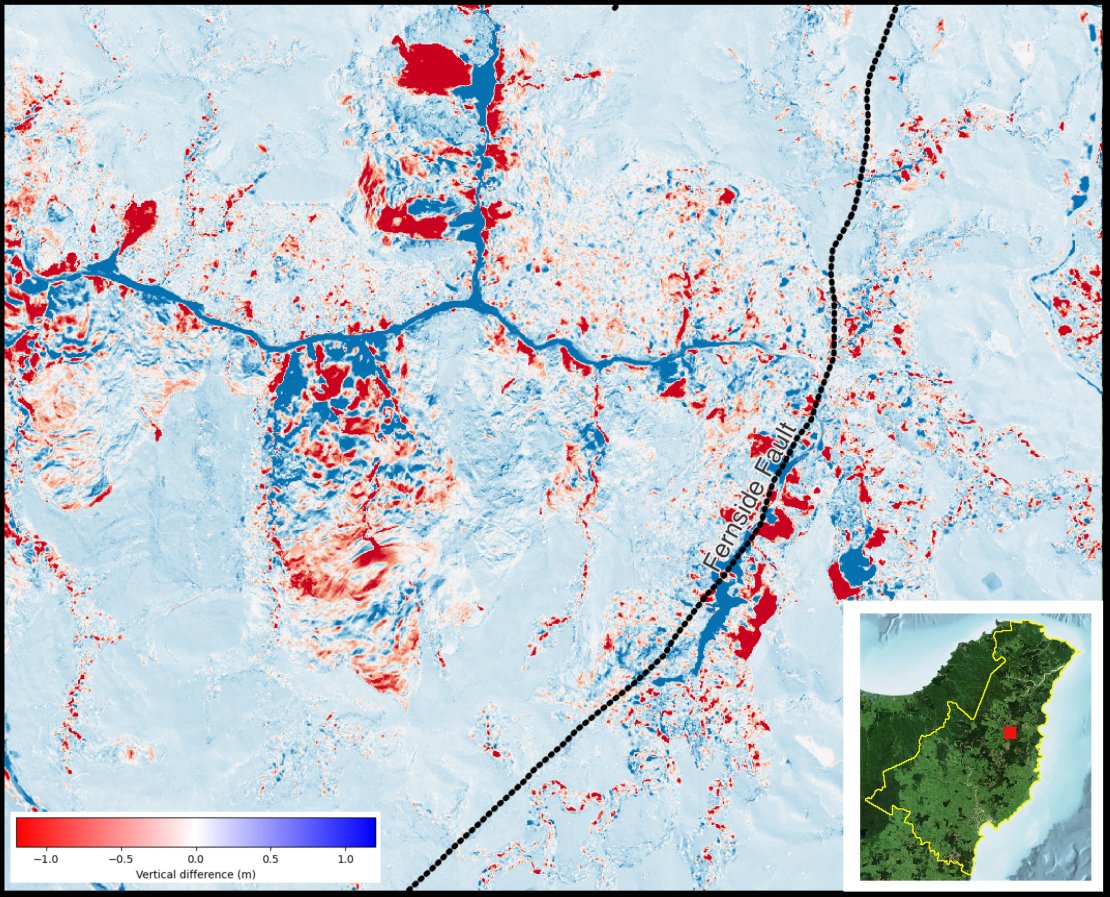
We've added an enhancement for topographic differencing results that allows users to visually compare the change between two overlapping datasets w/ a slider. 📷: Quarry near Washington, Indiana comparing 2013 & 2018 #lidar datasets. Info & more examples: opentopography.org/news/slider-vi…
GIF
English
Ramon Arrowsmith أُعيد تغريده
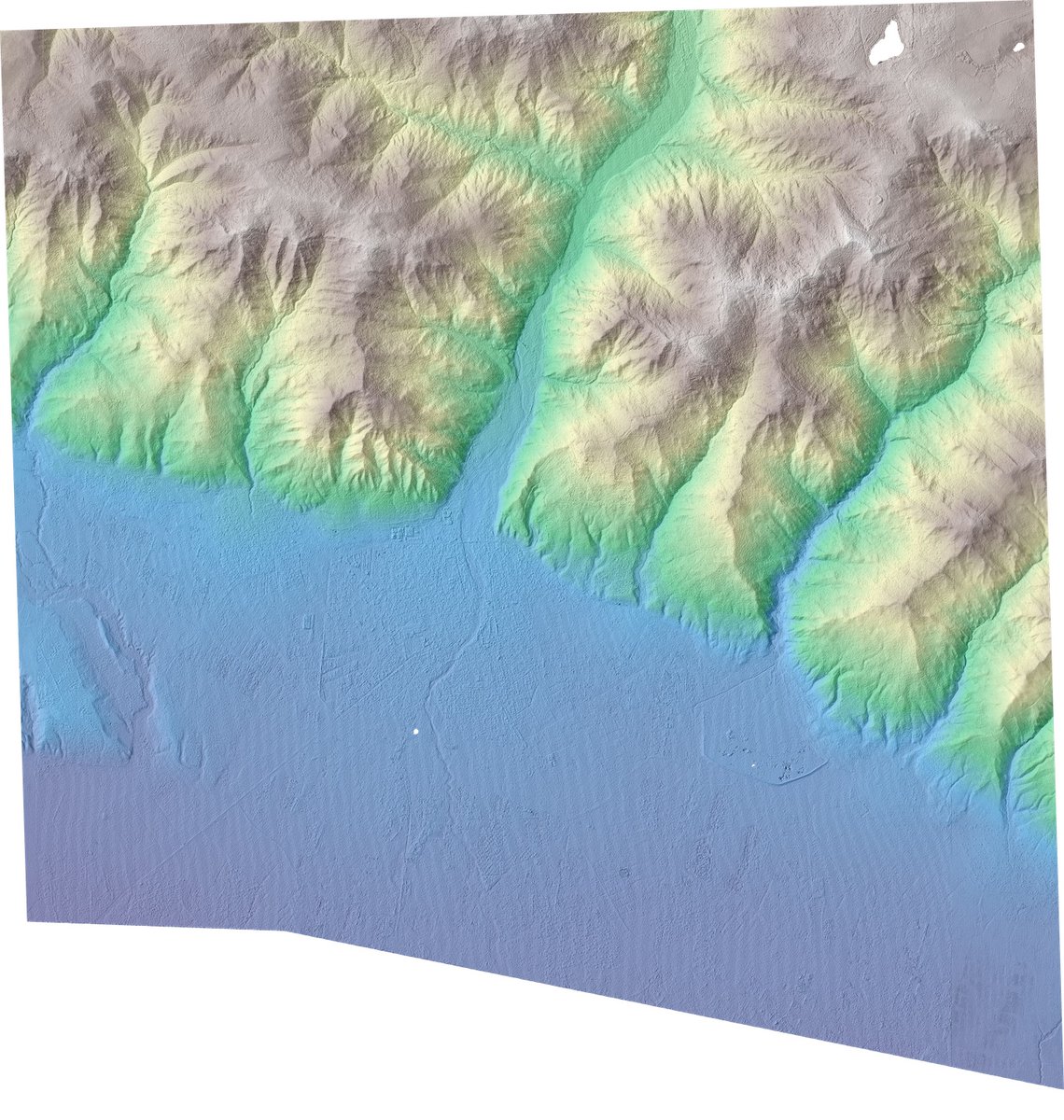
Another round of #lidar point cloud data for the north island of New Zealand 🇳🇿 added to OpenTopography. ~5000 sq km of new @LINZLDS data over Hamilton, Waikato & Gisborne: opentopography.org/news/gisborne-…

English
Animal shelter golf tournament fundraiser with @MathWorks socks! Thanks for the cool socks at @theAGU meeting and nice software!
English