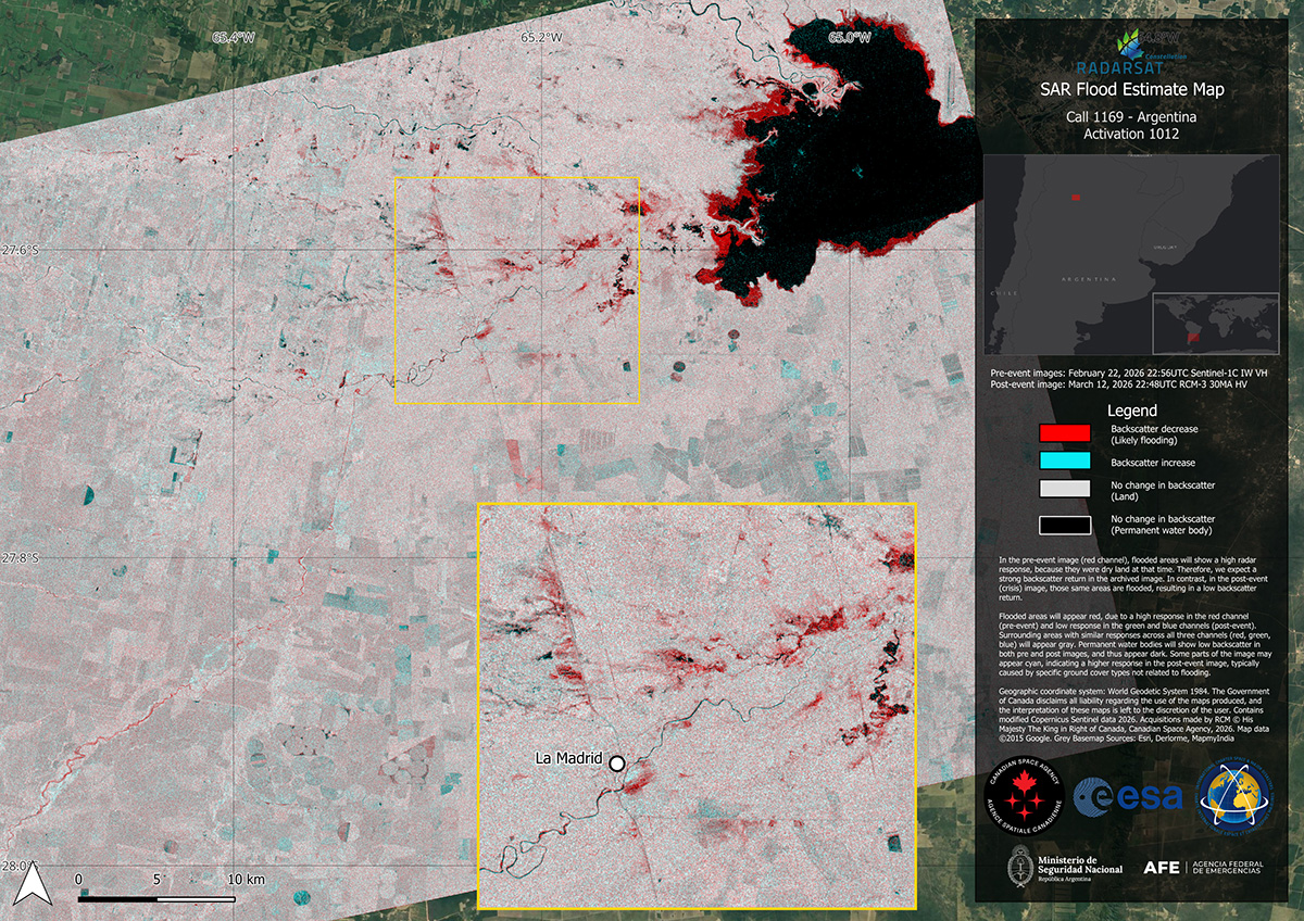
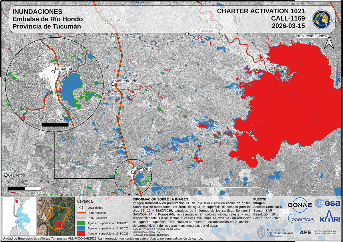
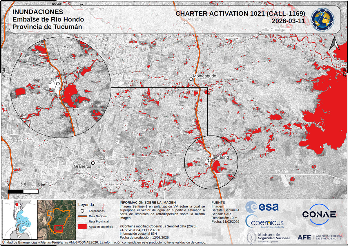
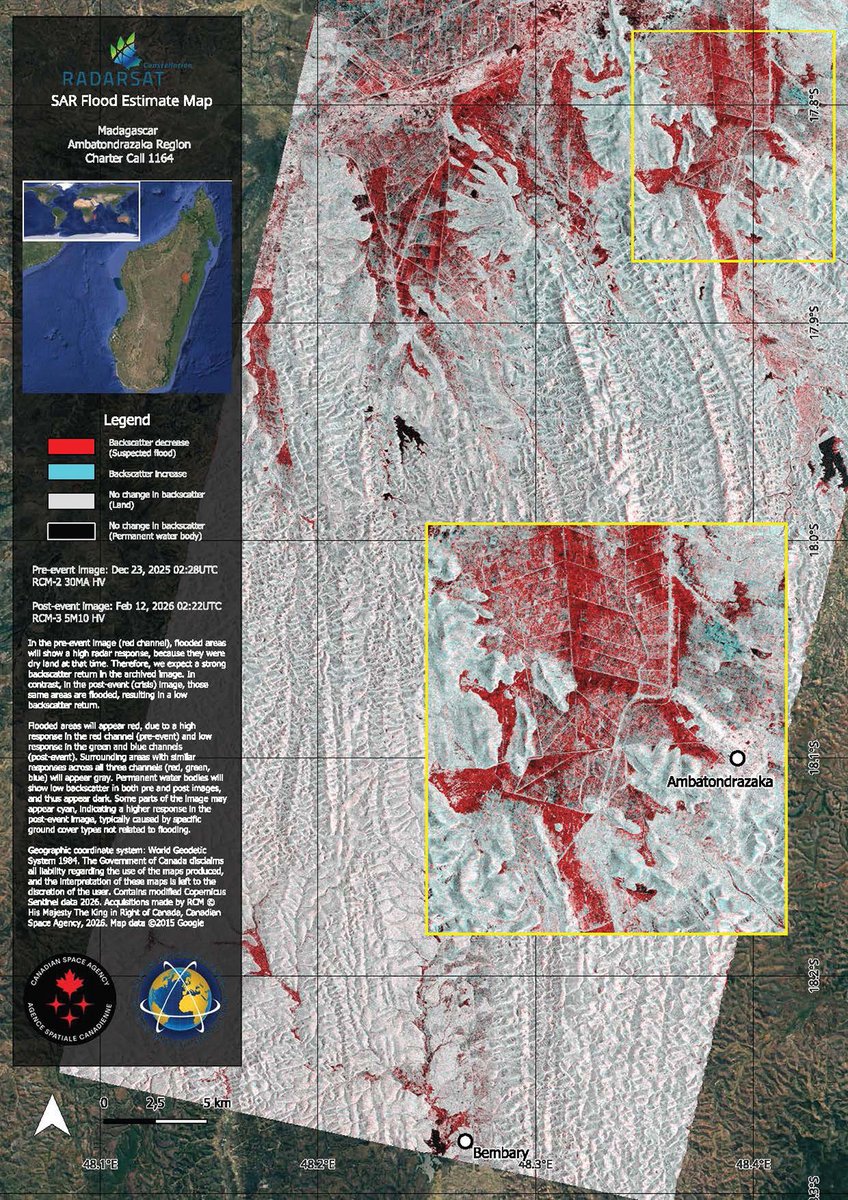
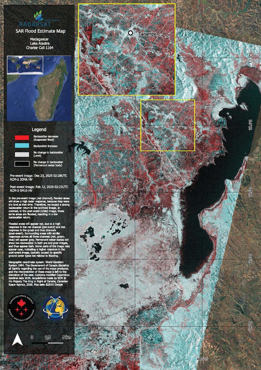
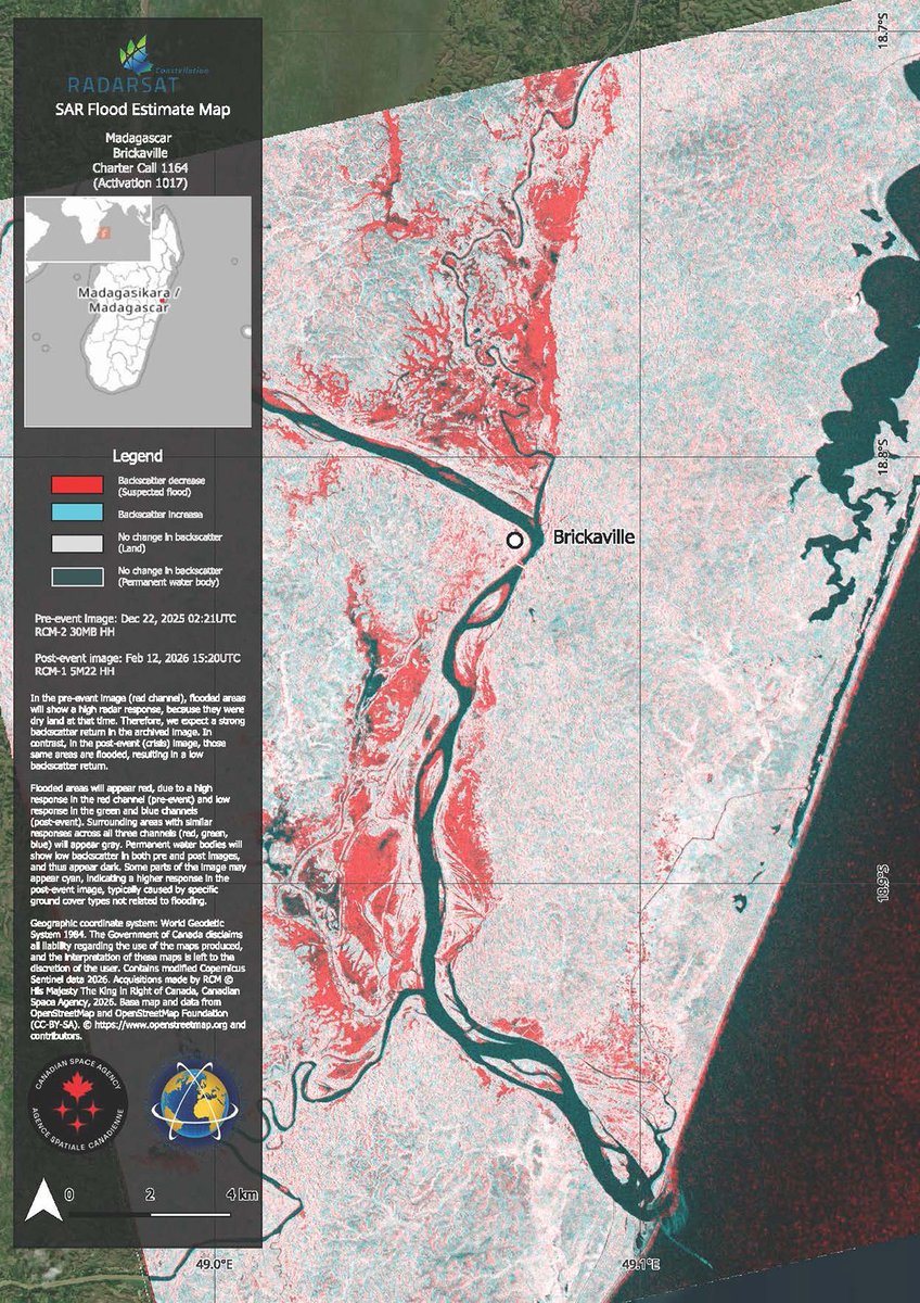
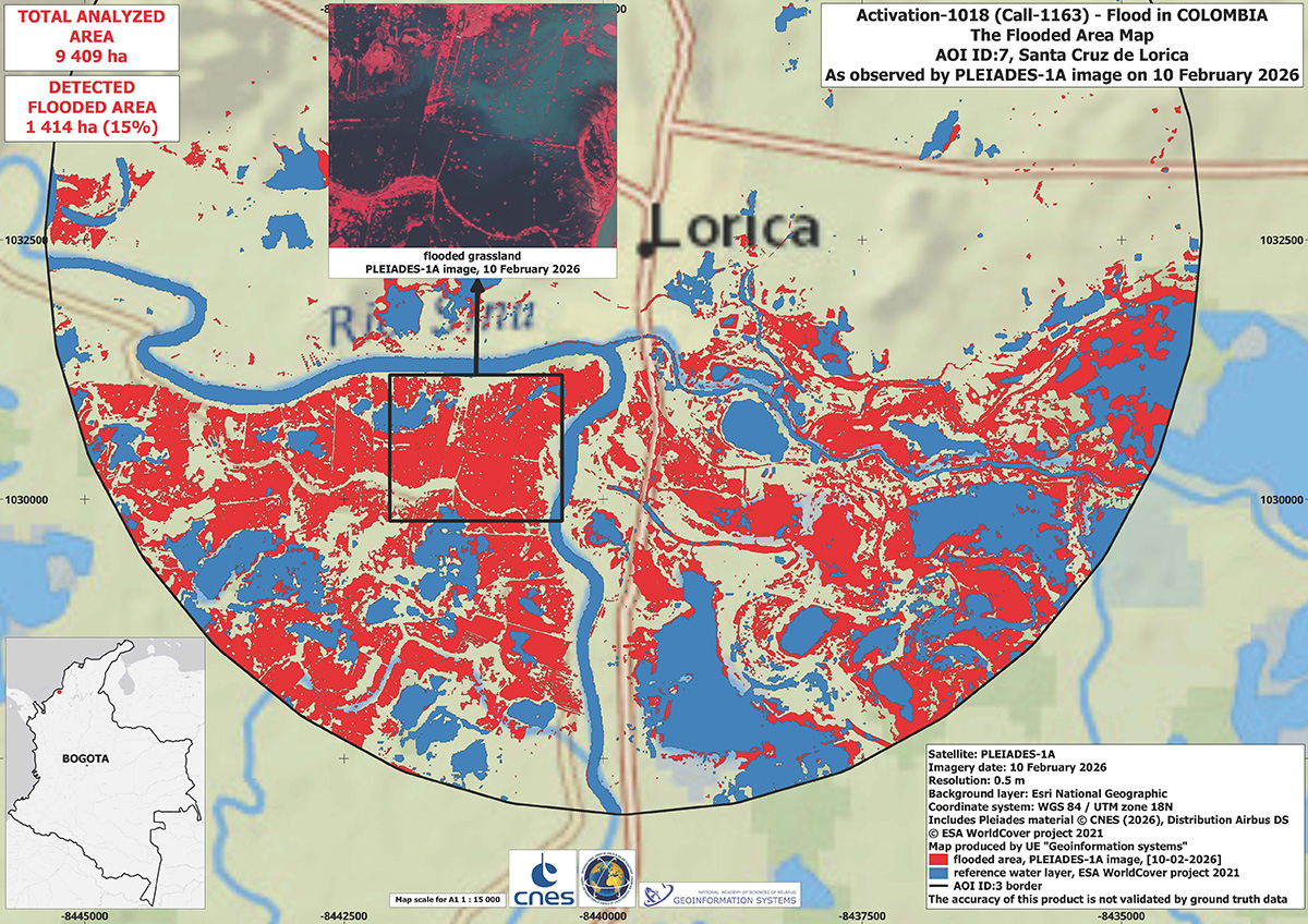
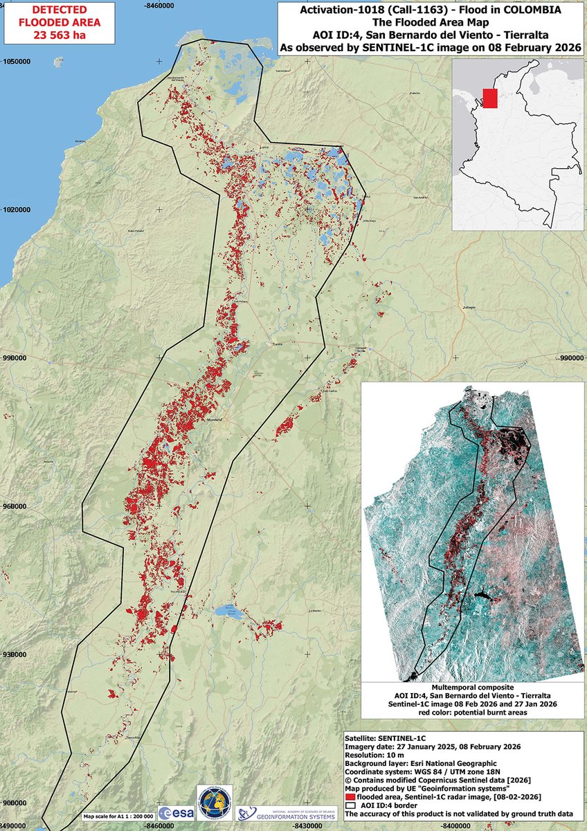
These maps use radar data from RADARSAT and #Sentinel1 to estimate the extent of flooding along the Dulce River at Santiago del Estero in Argentina: bit.ly/4dmYIv9


English
Disasters Charter
4.3K posts

@DisastersChart
Satellite data to support disaster response worldwide