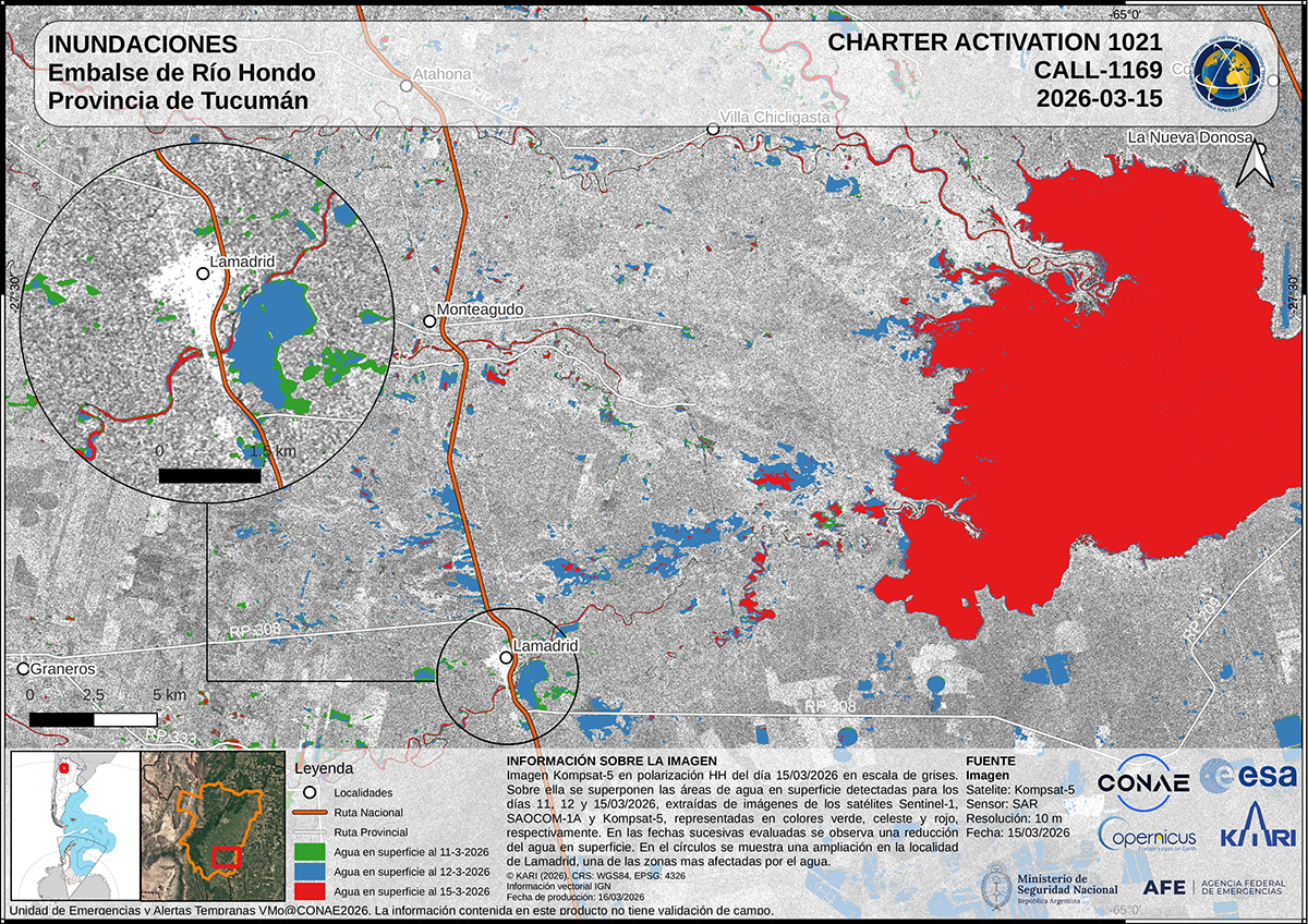
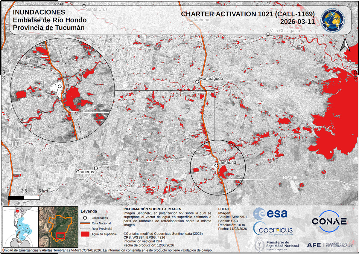
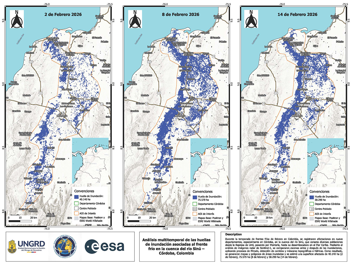
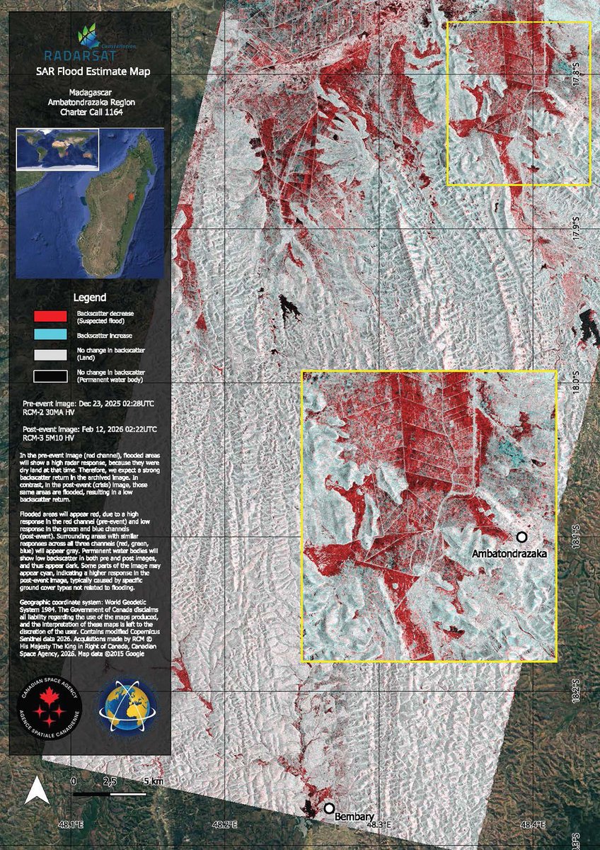
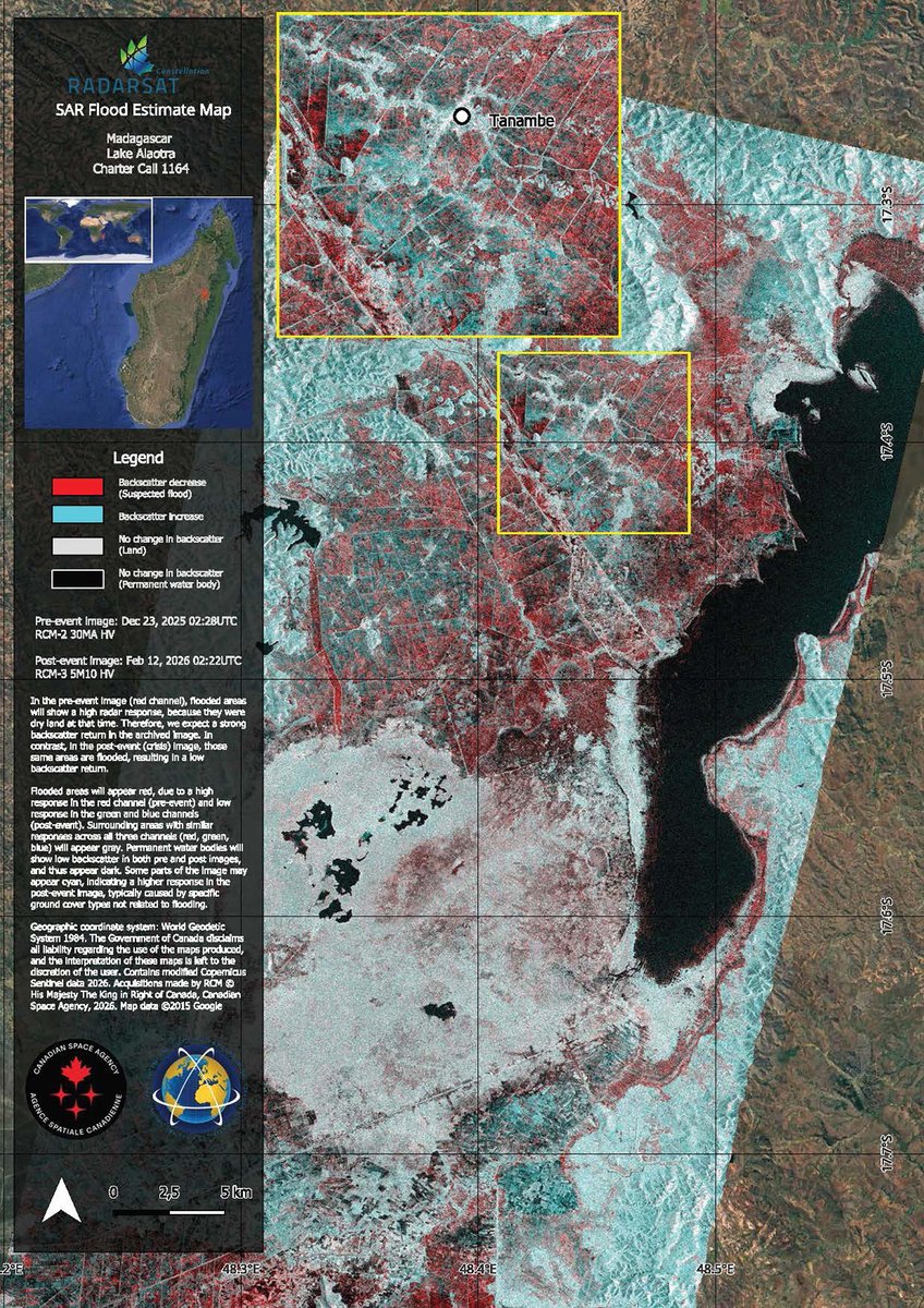
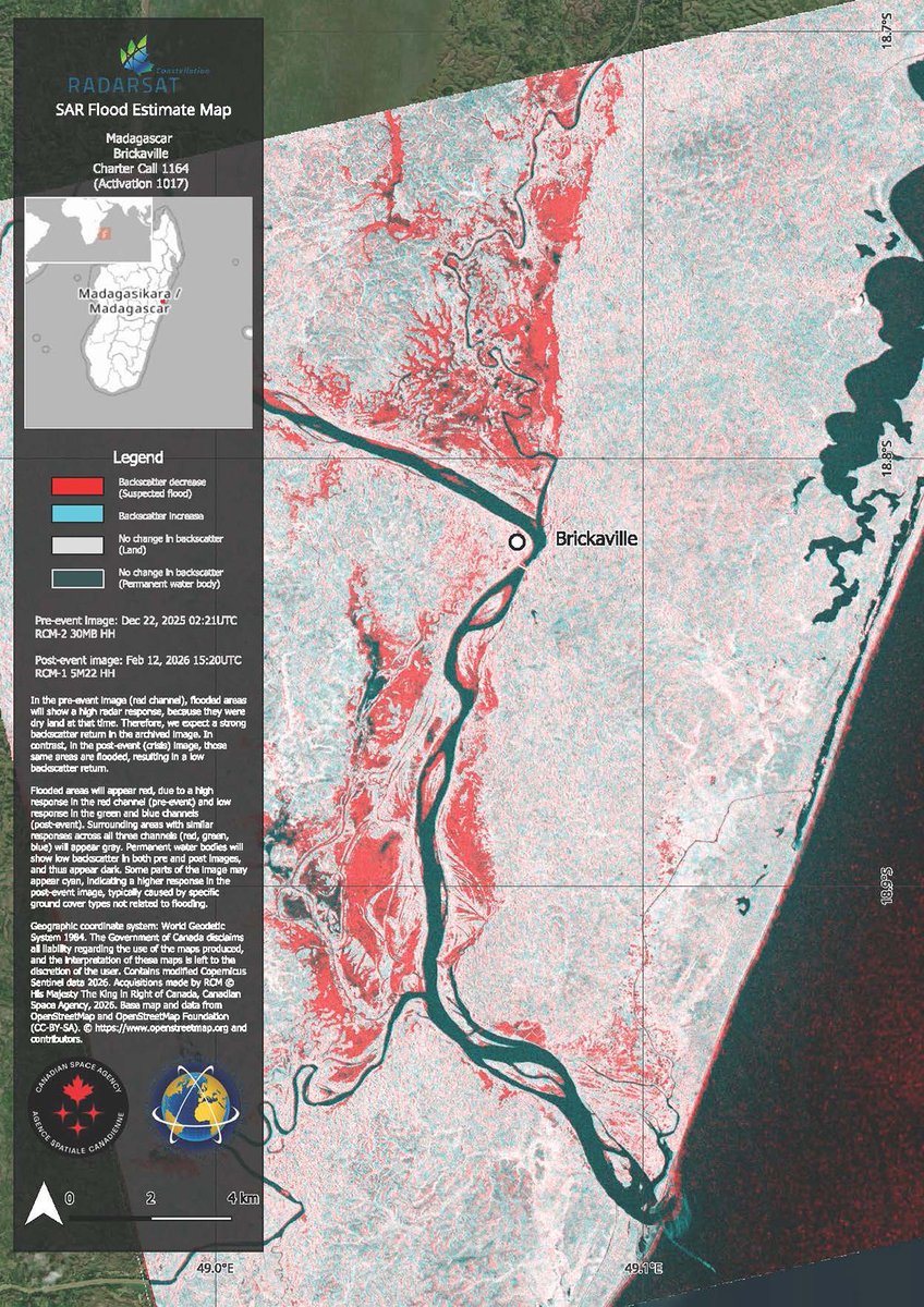
Disasters Charter retweetledi

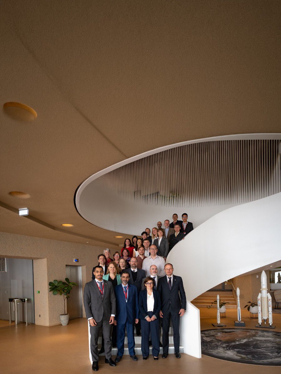
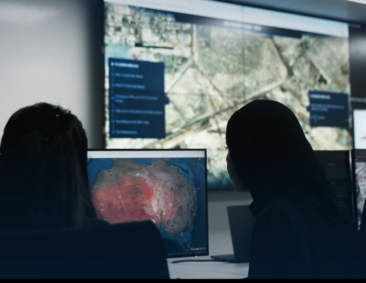
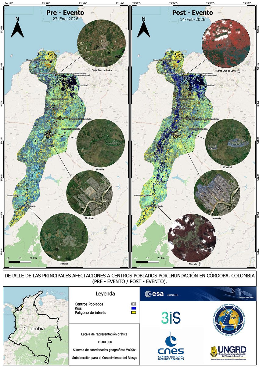
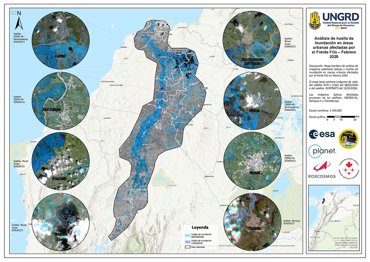
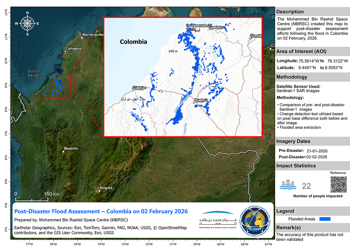
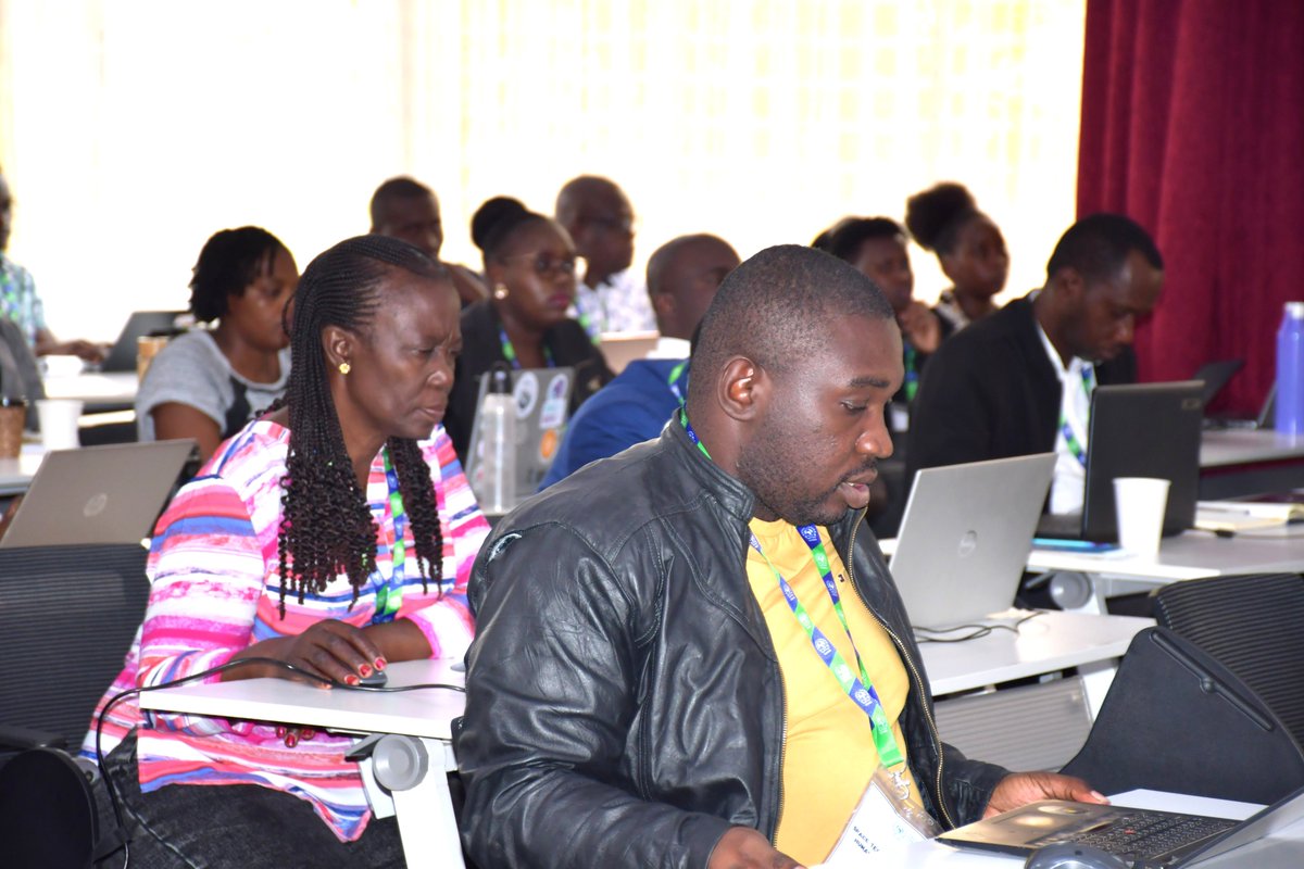
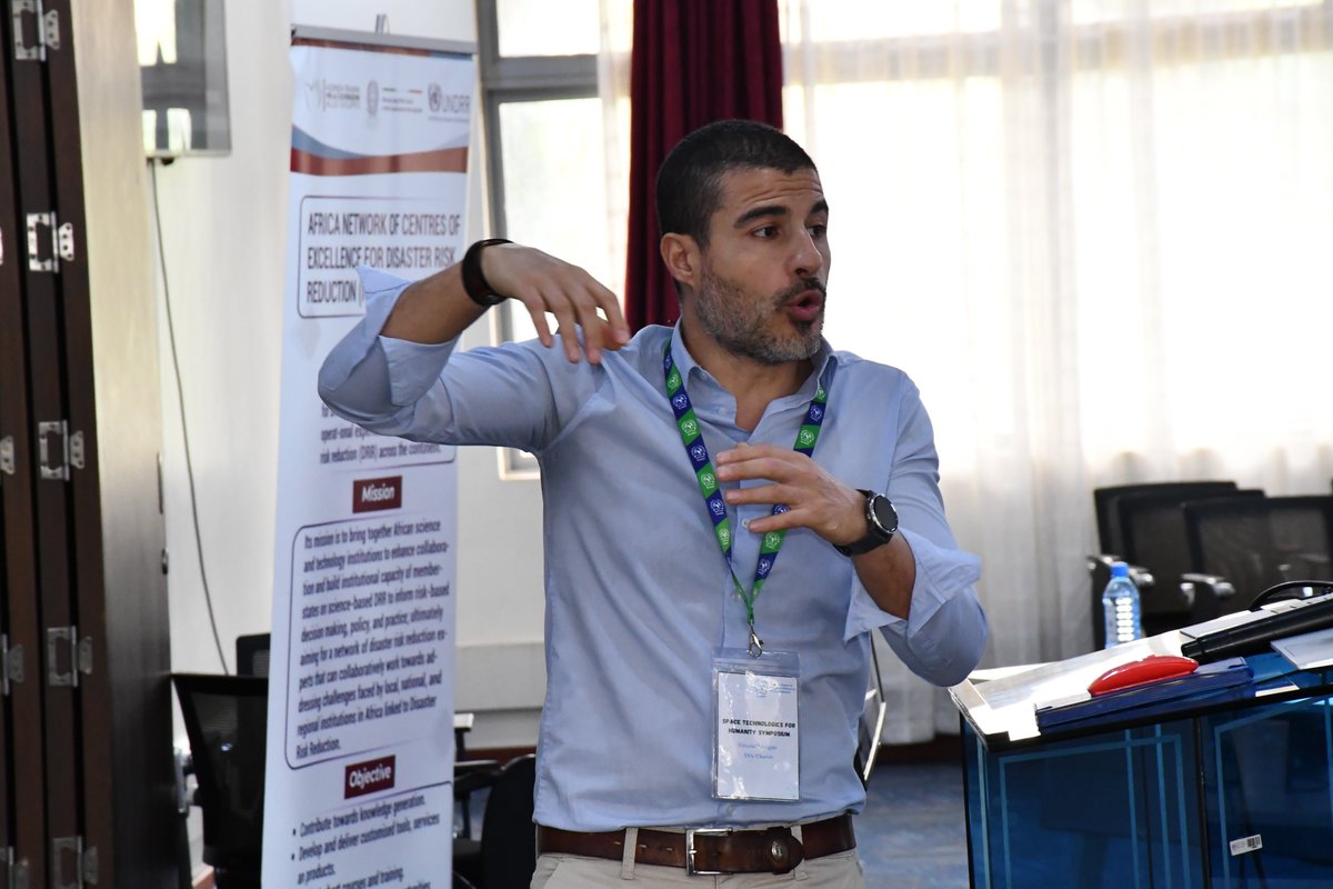
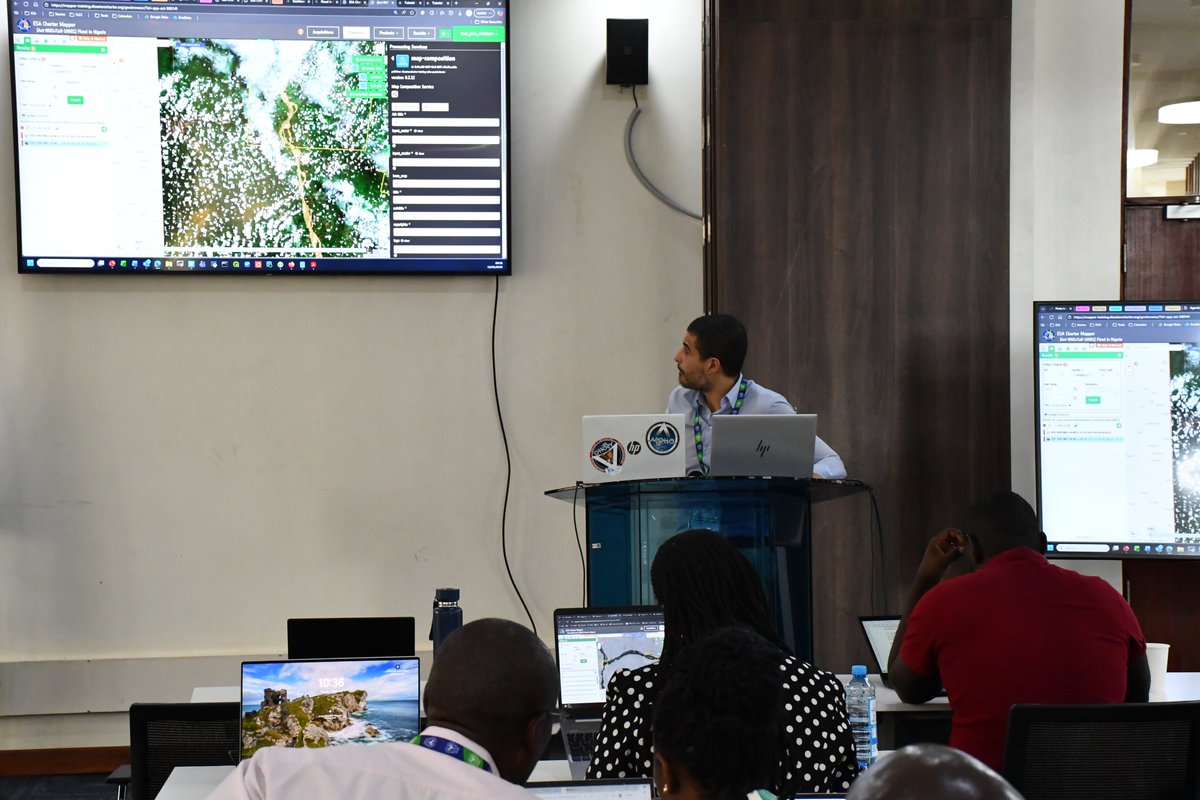
اختتمت وكالة الإمارات للفضاء البرنامج التدريبي الخاص بـ"الميثاق الدولي للفضاء والكوارث الكبرى" في جامعة زايد – أبوظبي، والذي جمع نخبة من الشركاء والخبراء من مختلف الجهات في الدولة، بهدف تعزيز التنسيق ورفع الجاهزية التشغيلية وتطوير توظيف بيانات الأقمار الصناعية في دعم الاستجابة للكوارث.
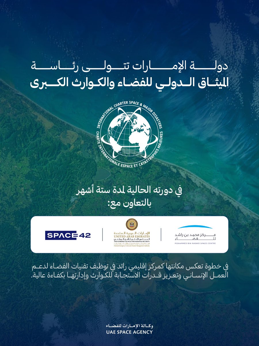
ويأتي هذا البرنامج بالتزامن مع تولي الوكالة رئاسة الميثاق الدولي للفضاء والكوارث الكبرى لمدة ستة أشهر، وبالتعاون مع شركائها الوطنيين: الهيئة الوطنية لإدارة الطوارئ والأزمات والكوارث، ومركز محمد بن راشد للفضاء، وشركة «سبيس 42».
The UAE Space Agency has concluded its training program on the International Charter: Space And Major Disasters at Zayed University in Abu Dhabi. The program convened leading partners and experts from across the UAE to strengthen coordination, enhance operational readiness, and advance the use of satellite data in disaster response efforts.
This initiative comes as the Agency assumes the presidency of the International Charter for Space and Major Disasters for a six-month term, and is delivered in collaboration with its national partners: the National Emergency, Crisis and Disaster Management Authority, the Mohammed bin Rashid Space Centre, and Space42.
العربية