MyRadar Weather@MyRadarWX
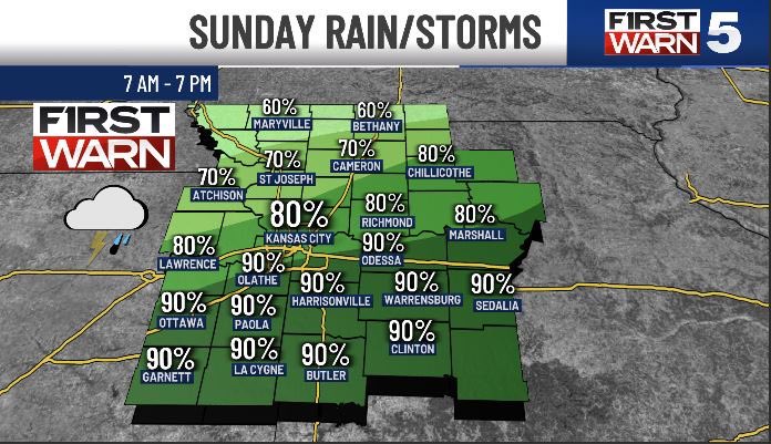
A busy stretch and a pain-in-the-you-know-what forecast. For multiple days, we'll be dealing with a juiced-up atmosphere BUT weak triggers. That's especially true in Texas, Oklahoma and Kansas.
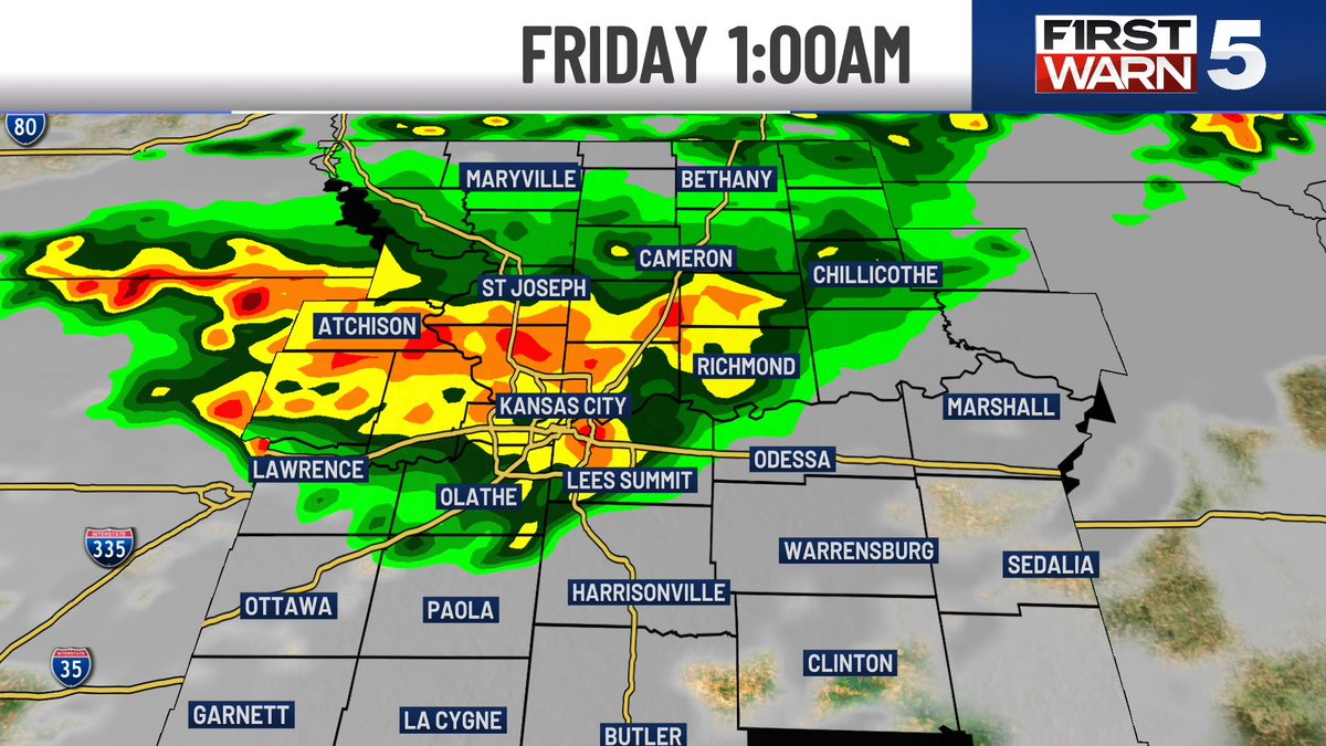
Confidence is greatest in some storms Monday/Tuesday across the Corn Belt and Upper Midwest. These will accompany a lifting warm front. A couple tornadoes are possible, along with hail and maybe a few wind gusts.
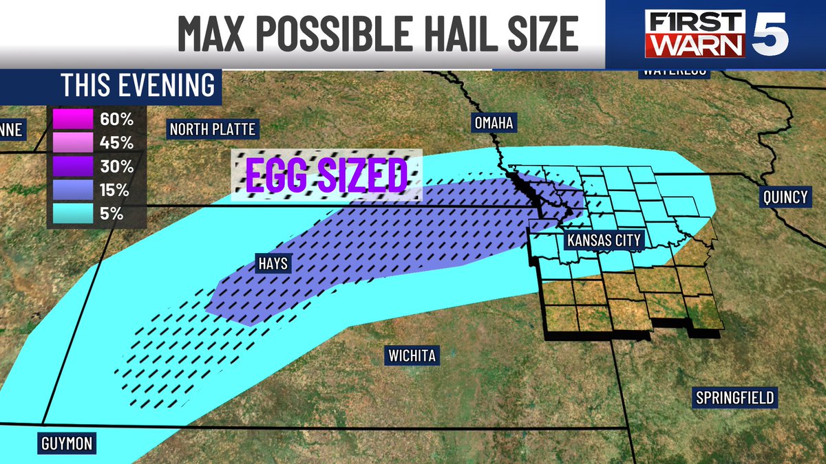
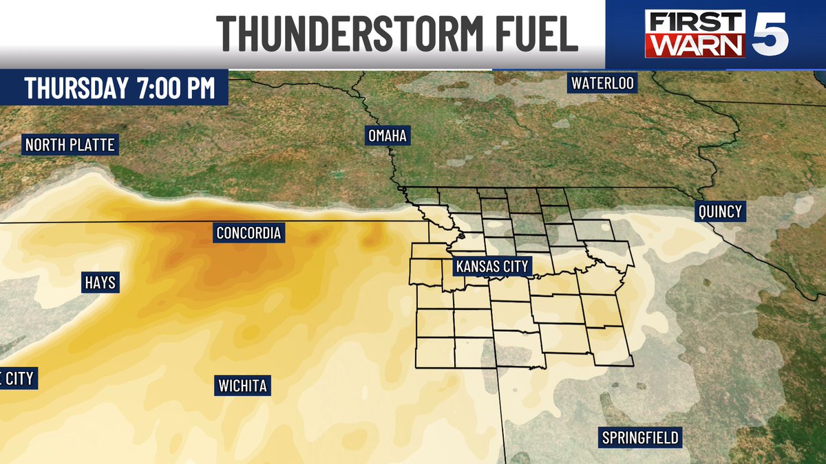
But across the central/southern Plains, we have an impressive "parameter space" but not much "forcing." In other words, we have the storm fuel (instability) AND we have the spin (shear). But will storms form?
A cap, or lid of hot, dry air a mile above the ground, will work to suppress thunderstorm development by preventing surface air to rise. In MOST spots, this will win out. However, it's possible (especially Sunday/Monday) that smaller-scale features help to kick up isolated supercells. Any isolated supercells would be able to take advantage of a higher-end environment and produce significant severe weather, including baseball hail, tornadoes and damaging gusts.
90% of the area won't see much. 10% of the area could see significant impacts. These "conditional" all-or-nothing risks are difficult to communicate. Legitimately, it will be mostly sunny with a slight chance of tornadoes.
Weather models also struggle to handle these sorts of events. We won't be able to sniff out "mesoscale" details (tiny smaller-scale forcing mechanisms) until the night before.
Stay tuned!