Angehefteter Tweet
Tomasral
688 posts

Tomasral
@tomasral
Geographer and cartographer 🗺
Asturies Beigetreten Ağustos 2009
647 Folgt169 Follower
Tomasral retweetet

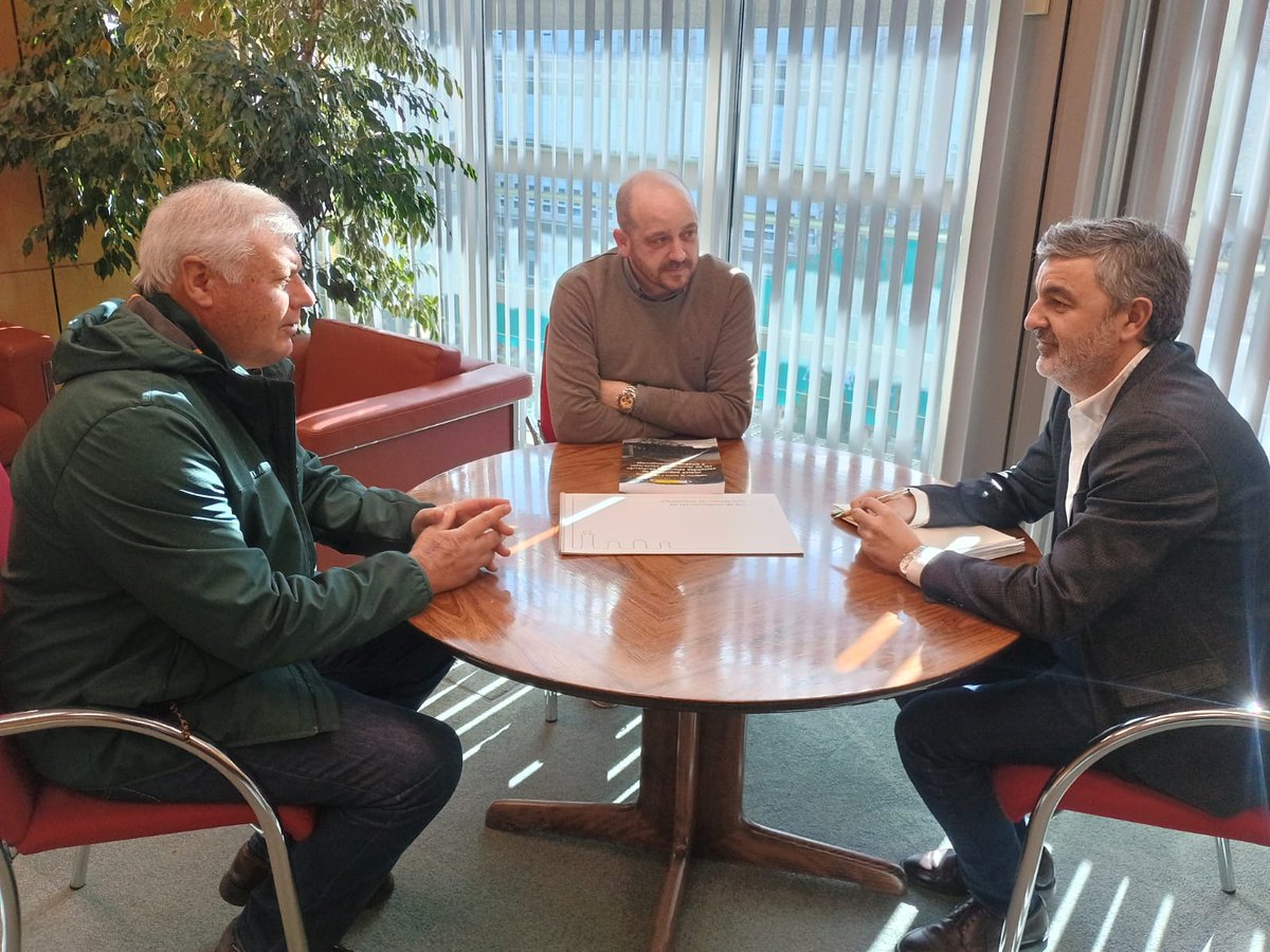
El consejero de Fomento, Alejandro Calvo, se reunió con los representantes de CarreterAstur, Adrián Costales y Jorge Rodríguez, quienes le presentaron el Catálogo de Elementos de Interés Histórico en las Carreteras del Principado de Asturias que ha elaborado por este colectivo
Español

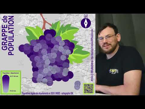
I've published the final #MapperDiaries video reviewing the art-like contributions of #30DayMapChallenge
youtube.com/watch?v=Hk5STO…
YouTube
English
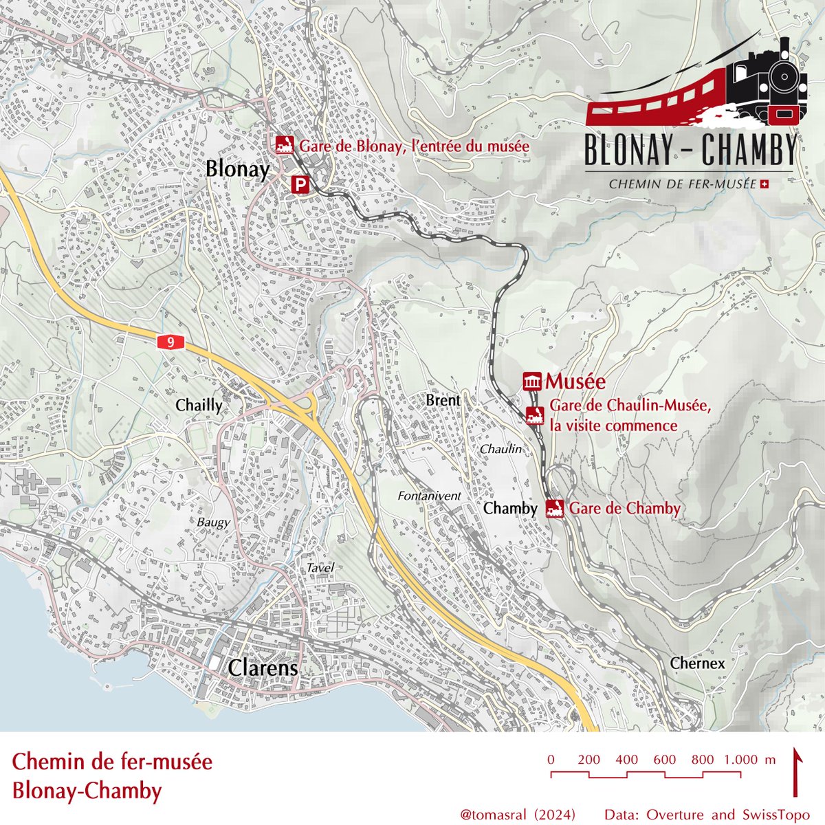
Day 29: Overture. Chemin de fer-musée Blonay-Chamby. Data: @OvertureMaps and @swisstopo
#30DayMapChallenge #Map #GIS #QGIS
Français
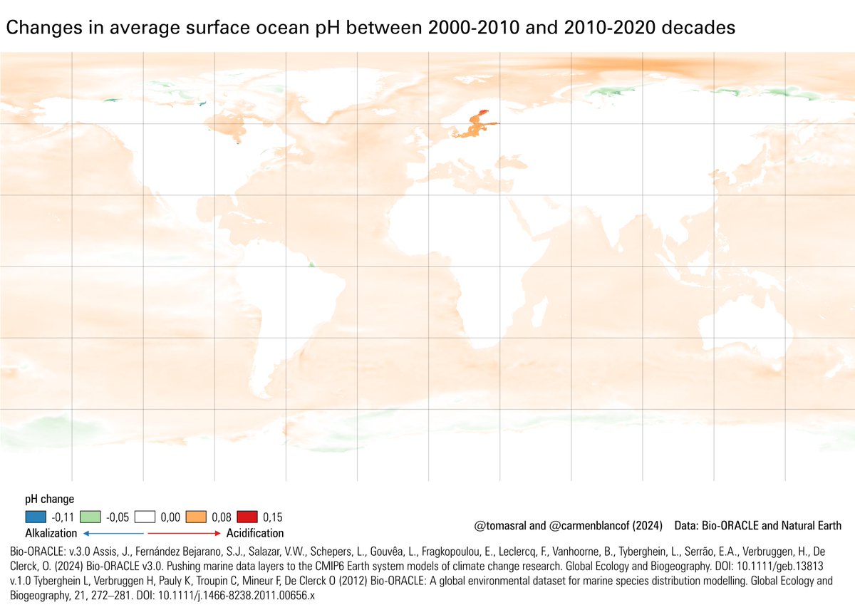
Day 28: The Blue Planet. Changes in average surface ocean pH between 2000-2010 and 2010-2020 decades. Thanks to @carmenblancof.bsky.social for helping me with this topic. Data: Bio-ORACLE. #30DayMapChallenge #Map #GIS #QGIS
English
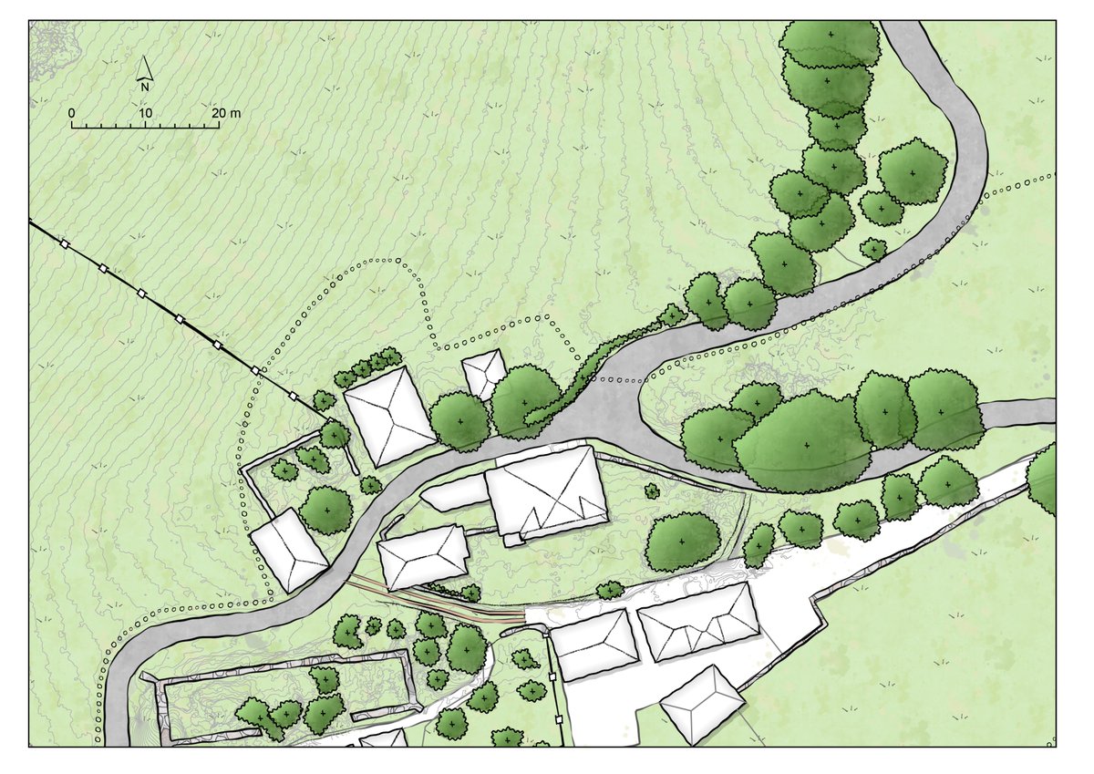
Day 27: Micromapping. A Farm mapped using drone imagery and Warren Davison styles (esri.com/about/newsro...)
#30DayMapChallenge #Map #GIS #ArcGISPro
English
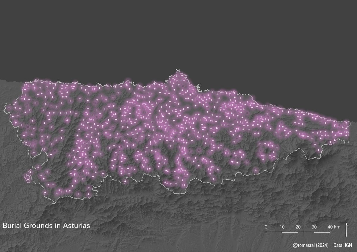
Day 20: OSM. Distance from residential buildings to grocery stores. Data: @openstreetmap
#30DayMapChallenge #Map #GIS #QGIS
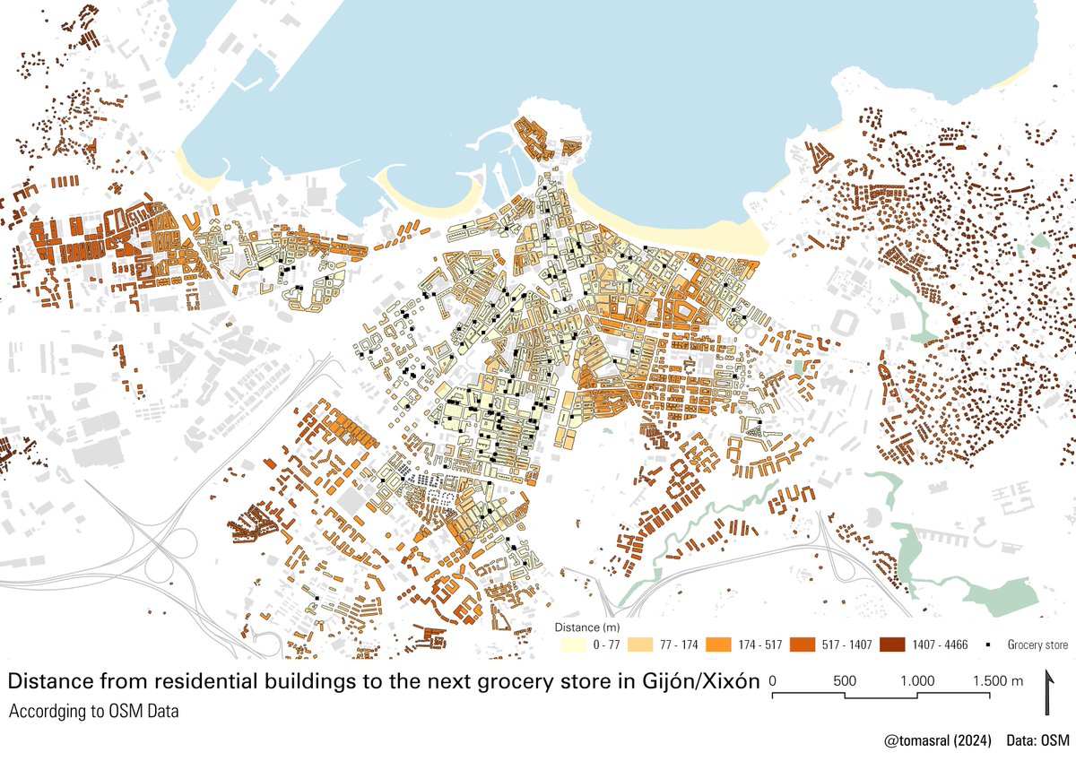
English

English
Day 18: 3D. 3D printed LiDAR generated DSM. Data: @IGNSpain Printed by @pablomr_23
#30DayMapChallenge #Map #GIS

English
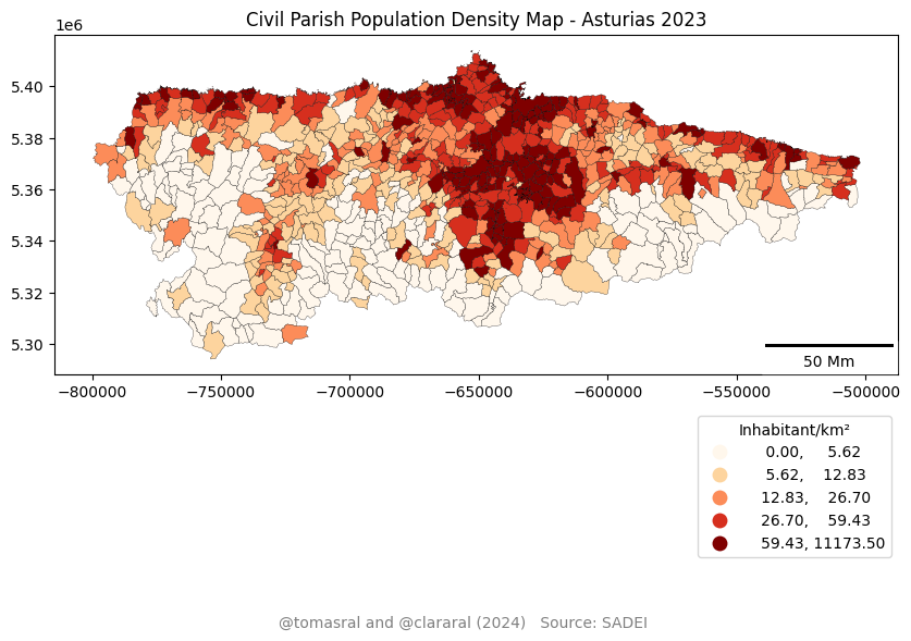
Day 17: A Collaborative Map. Made with my sister @clararal on Google Colab with Python and @Geopandas. Civil Parish Population Density (2023). Data:
@sadeiasturias
#30DayMapChallenge #Map #GIS #Python #Geopandas
English
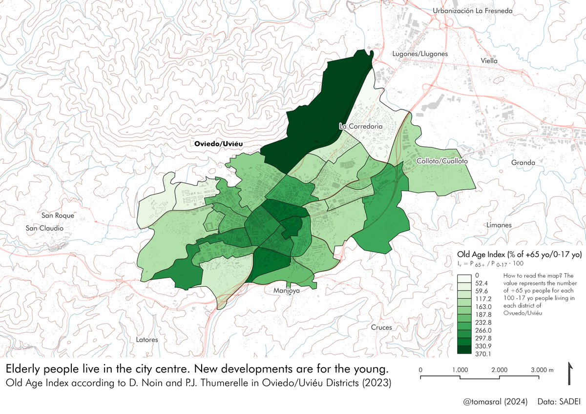
Day 16: Choropleths. Old Age Index according to D. Noin and P.J. Thumerelle in Oviedo/Uviéu Districts (2023). Data: @sadeiasturias
#30DayMapChallenge #Map #GIS #QGIS
English