Tweet fijado

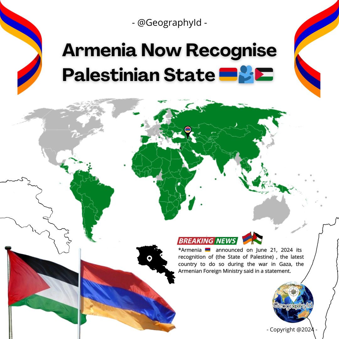
THE HUMAN RIGHTS IS NOT FOR MUSLIM PEOPLE !
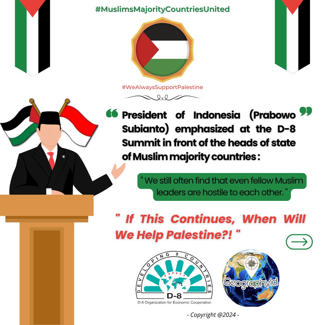
President Prabowo emphasized at D-8 Summit in front of the heads of state of Muslim majority countries
" We still often find that even fellow Muslim leaders are hostile to each Other "
If this continues, when will we help Palestine?!
Cairo, Egypt 🇪🇬 English