
Def Mon रीट्वीट किया
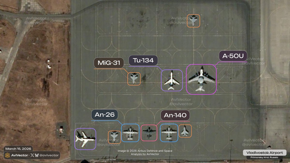
Confirmation of the presence of an A-50U (RF-50606, Red 51) and 4 MiG-31s at Vladivostok Airport on March 18. Three out of the four MiG-31s are equipped with Kh-47M2 missiles.
Four MiG-31s left the airport between March 18 and 19, but the A-50U remains here today and may participate in other joint exercises.

AviVector@avivector
🔻 Satellite images of 🇷🇺 Vladivostok Airport as of March 15, 02:05 UTC The air base housed 1 A-50U (Mainstay), 4 MiG-31 (Foxhound), 4 An-26 (Curl), 1 An-140, and 2 Tu-134 (Crusty). Today, an A-50U (RF-50606, Red 51) from Vladivostok Airport conducted a training mission over the Sea of Japan and returned at 08:15. Two MiG-31K (one of which is RF-95215, Red 90) from Vladivostok Airport conducted a training mission and were escorted by two Su-30. Two Il-78Ms (one of which is RF-94288, Blue 83) from Ukrainka Air Base provided refueling support during the exercises and returned at 03:00.
English