@clickshaber She'll be a single mom in a few weeks statistically. The pattern continues
English
casual_flex
1.6K posts


Monday. Still a ways out and tons of details to sort out. But MAN. Look at that potential. Location: Wichita, KS


THE MOST ACTIVE PATTERN FOR TORNADOES SINCE 2011 AHEAD A historically active April for severe weather and #tornado outbreaks appears possible this month across the central ant southern Great Plains. This active stretch will begin Friday/Saturday across the Texas Panhandle and southern Plains on Sunday, then ejecting northeast on Monday. A train of large scale troughs are upstream fed by the positive North Pacific Oscillation that has persisted since 2023. Round after round of severe weather and tornadoes appears likely through much of the month of April 2026.


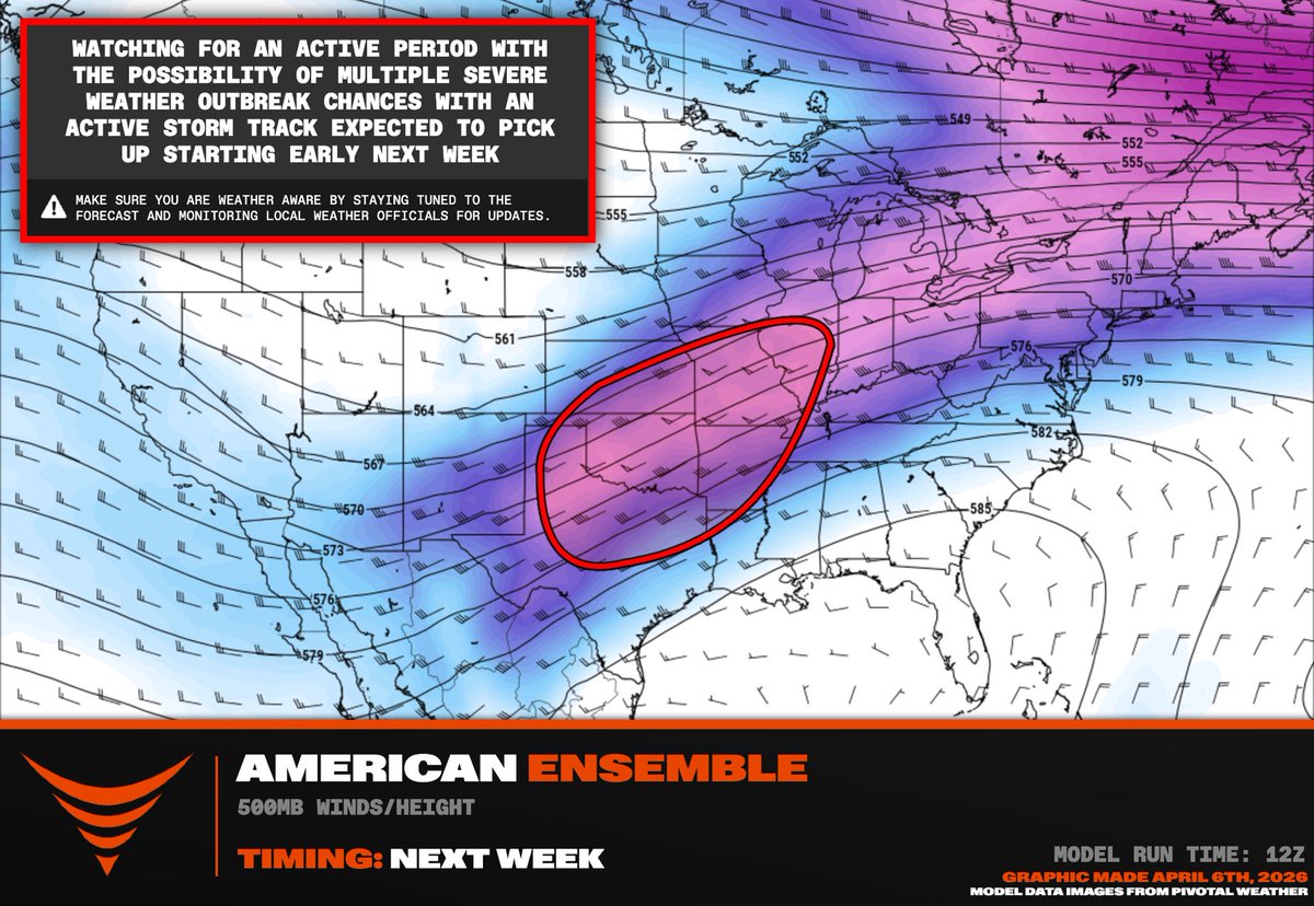

THE MOST ACTIVE PATTERN FOR TORNADOES SINCE 2011 AHEAD A historically active April for severe weather and #tornado outbreaks appears possible this month across the central ant southern Great Plains. This active stretch will begin Friday/Saturday across the Texas Panhandle and southern Plains on Sunday, then ejecting northeast on Monday. A train of large scale troughs are upstream fed by the positive North Pacific Oscillation that has persisted since 2023. Round after round of severe weather and tornadoes appears likely through much of the month of April 2026.

@FitzyMoPena Rank New England states?


@ChrisMartzWX Except chemtrails ARE real. Maybe the conspiracy got stretched too far by some( maybe not) They just prefer to call chemtrails "atmospheric aerosol injections"