Lessrian
2.1K posts


Lessrian
@LessrianYT
photographer and Weather Hobbyist | Saint Paul, MN | 🌌: 11 🌪️: 👀 🧊: 3
Minnesota, USA Bergabung Haziran 2014
437 Mengikuti213 Pengikut


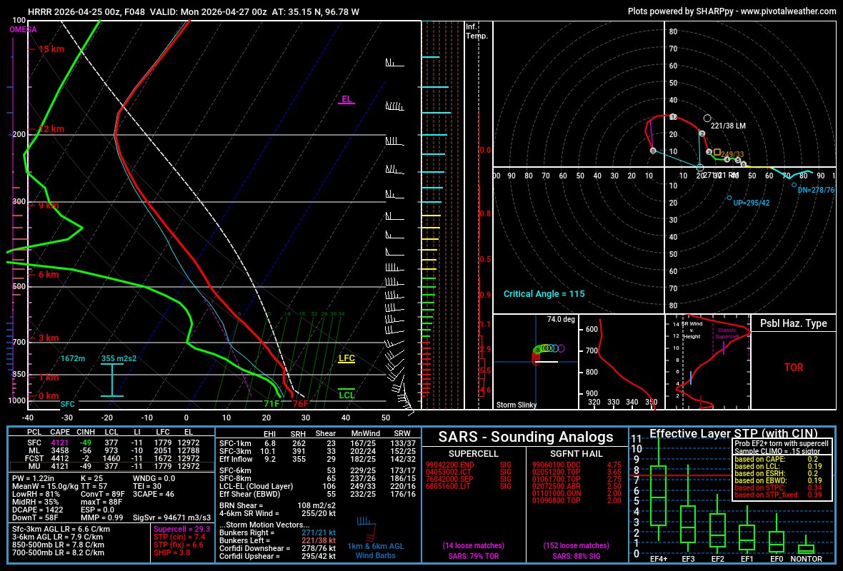
@CameronJNixon little idea make a playlist on the YouTube channel called “How to Sounding” and put the skew-t and hodograph video in it 😄
English
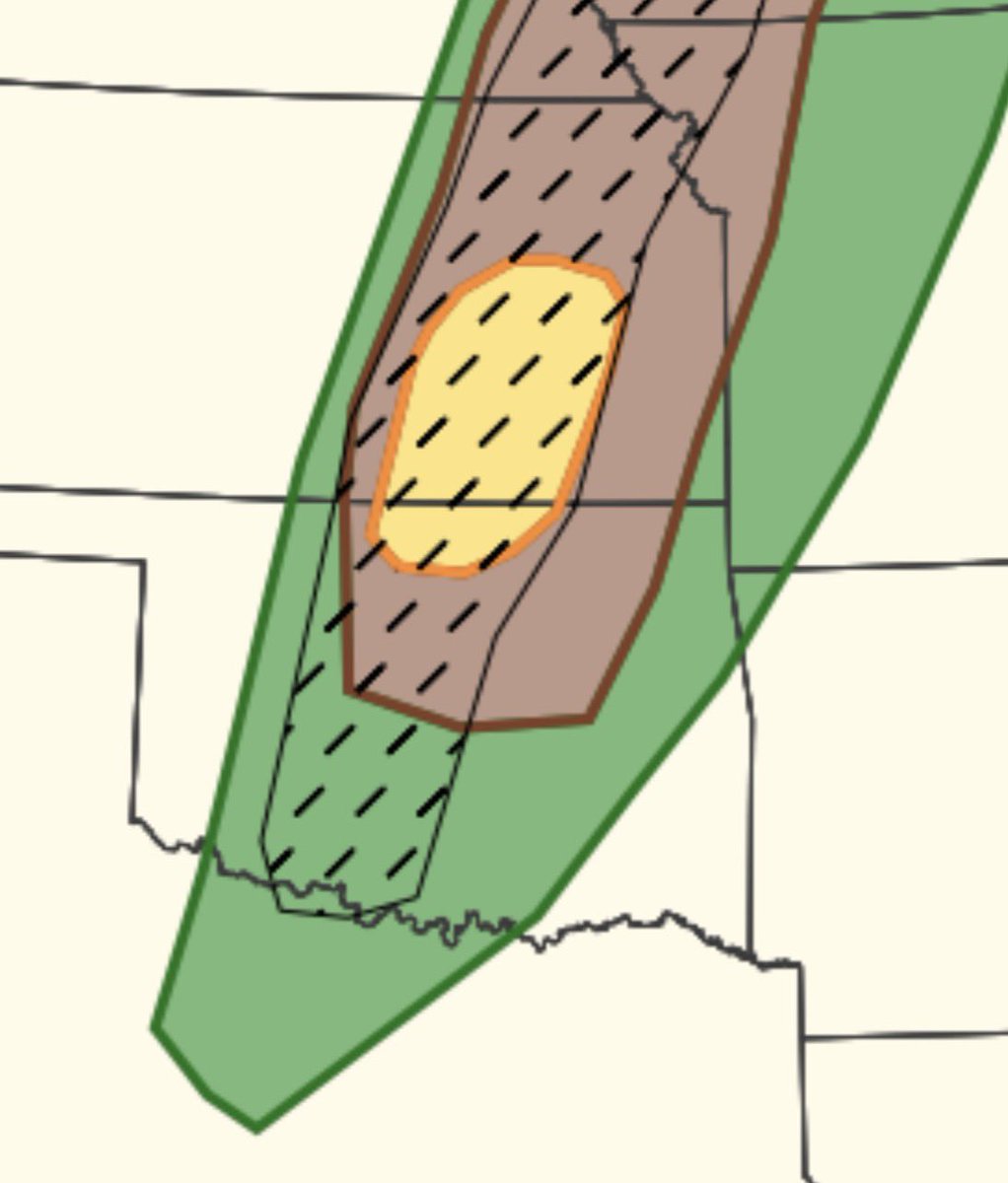
@oldscarf1stweek @wxmann I thought one of the purposes of the cig system was to acknowledge and highlight risks like this that are conditional, but if it was to go it would be big time risks?
English

Can someone with or without a degree explain the lack of Cig2 risk today on the dryline from Wichita to Lawton, is it just the uncertainty?
English
@DGUniverseCraft Lowkey someone make that tornado warning graphic real in the top left it looks so clean
English

Tried this out myself and yeah, this is insane.

Zarhle@SteinerZach
Holy crap. AI image generation is getting a lot better. ChatGPT just released their 2.0 update for image gen and wow. It used to make an incoherent mess when I’d try to generate fake outlooks or radar imagery. It wouldn’t be remotely good. There’s still issues but this is wild.
English
@WickyDubs2 I wonder if the “how will you help promote executive orders” question is still in the application 😭
English

I hear rumblings of a large amount of NWS jobs being posted this summer 👀
English
@damian_natzel Imagine if the parameter space was better in actuality. Better srh and better off venting
English

@CameronJNixon Can’t wait to watch but I was wondering and this is a question for everyone, besides Convective chronicles who are other good resources for Synoptics and learning about troughs, fronts, upper level flows etc?
English

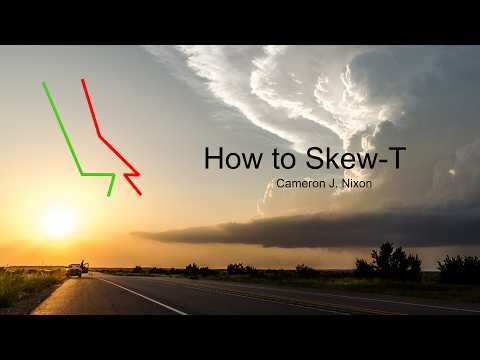
NEW video: youtube.com/watch?v=rfNJ7i…
In How to Skew-T, I take a deep dive into how to use skew-Ts for forecasting convective storms, their hazards, behavior and even appearance
YouTube
English
@EASsirenVids01 @ryanhallyall I’ve only ever seen this version what’s the crappy one lol
English

@LessrianYT @ryanhallyall OH MY GOD I HAVEN'T SEEN THIS EXTENDED VERSION I'VE ONLY SEEN THE CRAPPY VERSION LMFAOOO
English

@damian_natzel I’m questionable with the model outputs of instability, gfs, euro, etc seem really weak.
English


Actually a ton of really useful subsets now. That's really cool

Isaiah Montgomery@GumryWX
I did not know that the SPC was separating tornadoes from landspouts now. This is really neat for landspout research, especially
English
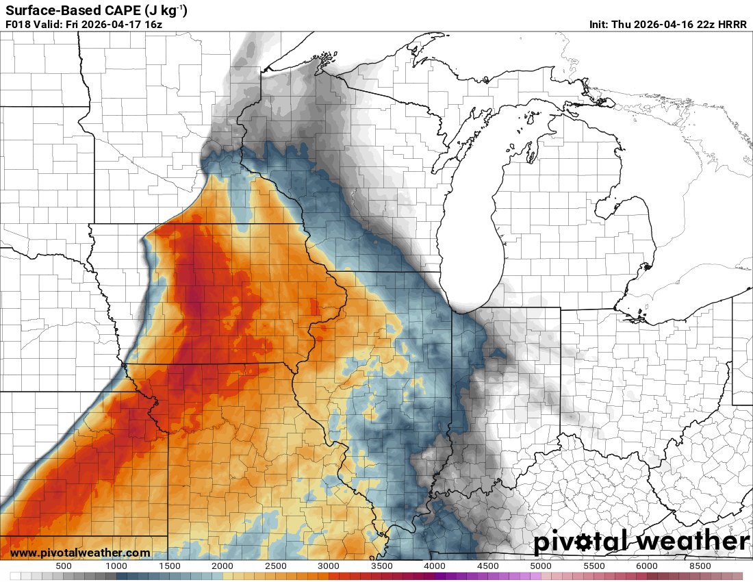
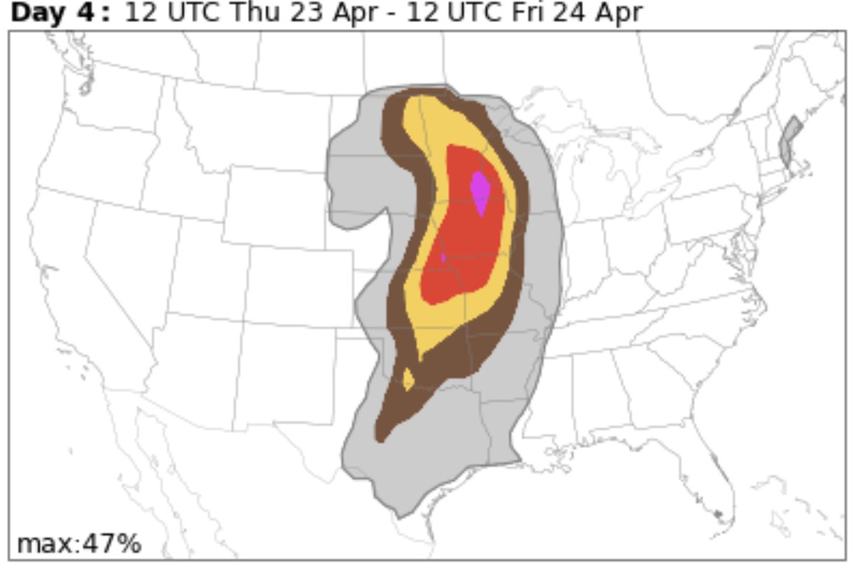
Based off the 12Z guidance from ensembles and deterministic models our low pressure seems to really want to progress into Canada by Thursday. I can see a slight risk being extended into eastern MN and W/Central Wisconsin by Day 4. Maybe some NW IL as well.
Chris Wicklund@WickyDubs2
Just wait this circle will be in Illinois by day 3
English
@damian_natzel @tydeanwx At least this time we don’t get casted into 3 days of 30-40s 😭
English


@StormNetWx @dalesamsWx Rochester to Minneapolis 😏
Im never not chasing a MN target again!
English


@dalesamsWx @NWSSPC @hellohannav Do you think it’s possible Minnesota could get in on a higher than mrg?
English

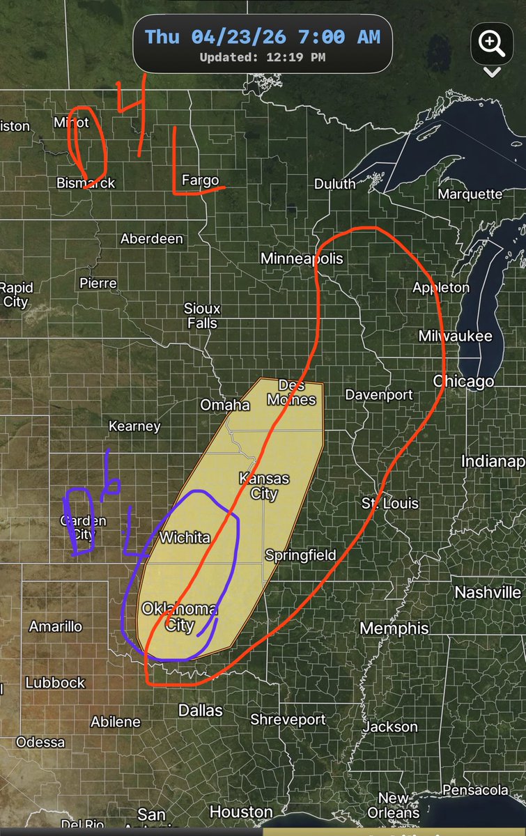
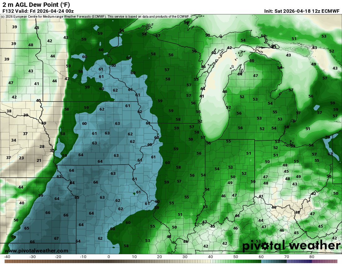
|GFS+GEFS MSLP+Dew Point // Thursday PM| @NWSSPC @hellohannav #NOAA #SevereWx
(1/3): 𝐎𝐯𝐞𝐫𝐯𝐢𝐞𝐰: A decent severe weather setup is increasing Thursday across central/southern plains.


Independence, MO 🇺🇸 English
@Tornado_Steejo Nope western / central Minnesota needs to cook first
English
Alright Midwest, it’s time to let the Southern Plains have some fun. Oklahoma is gonna show who is 👑 of V-Tors🌪️ soon.
GIF
English

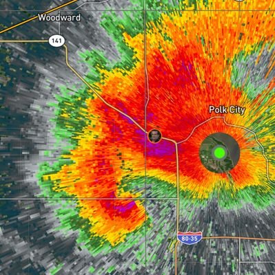
Tornado surveys for this event gonna be completed in August at this rate holy cow this is a wild outbreak.
English

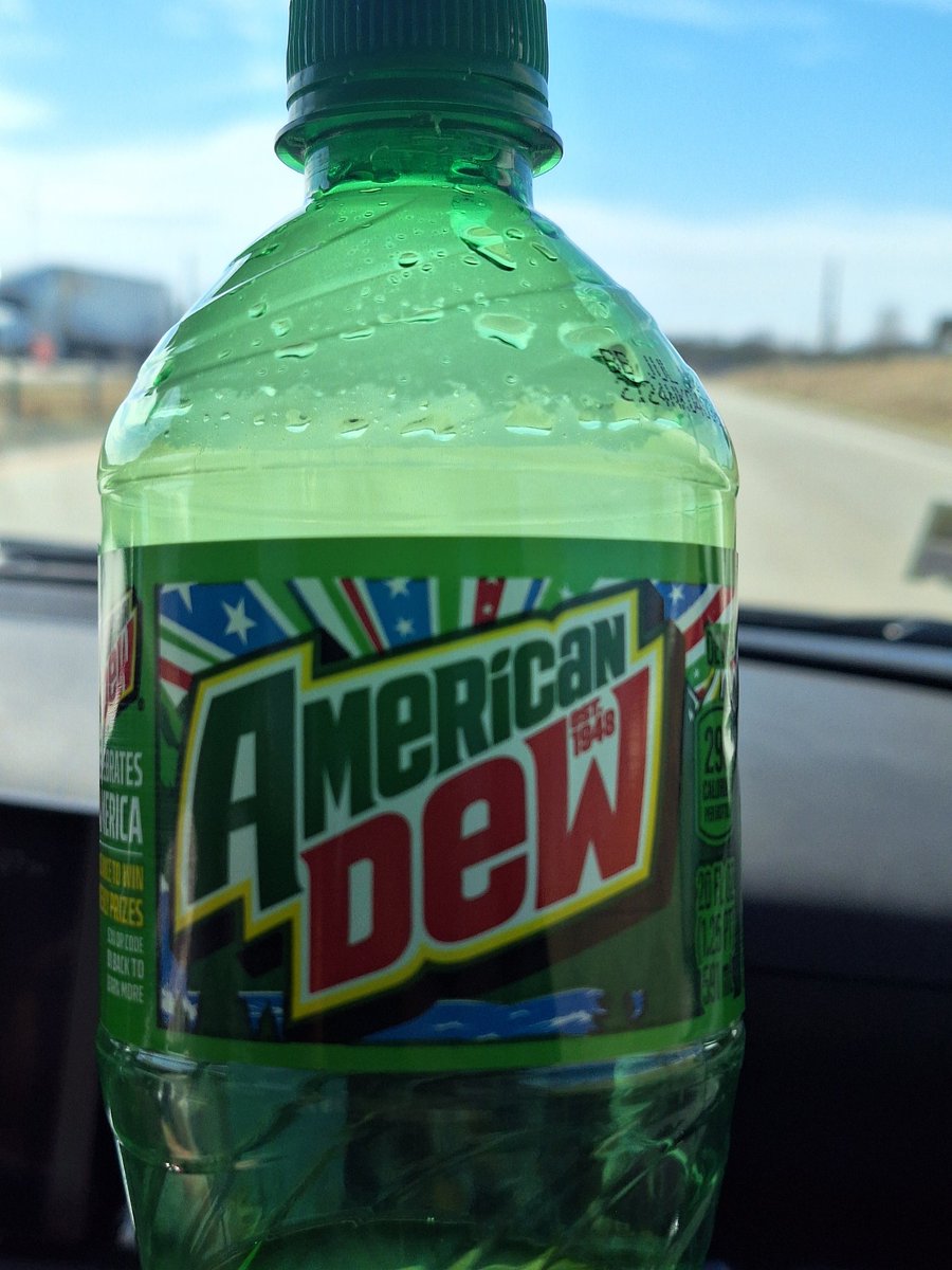
Mountains are WOKE.
I only drink AMERICAN dew
CAN I GET A HELL YEAH 🦅🦅🦅🦅🦅🦅🦅🦅🇺🇲🇺🇲🇺🇲🇺🇲🇺🇲🇺🇲
English