固定されたツイート

The TorCAST Methodology Overview (v10) is available— physics engine, ML correction layer, regional calibration, all of it.
No black boxes.
torcast.pro - > Click Methodology in the header

English
Brandon Walls
598 posts
@TorCASTWX
Founder @TorCASTWX - modeling the ceiling of what a storm environment can produce before radar sees it. By trade: CISO & Chief Broadcast Engineer.


Grok 4.5 is not yet using our internally developed C/C++ inference software that exact maps to the GB300 hardware. Doubling or more of the current speed is probably achievable.


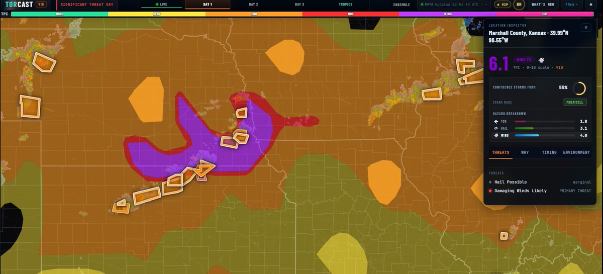
Things are quiet this morning but both SPC and TorCAST are showing it won’t stay that way. SPC has an Enhanced Risk from central Nebraska into western Iowa for large hail and wind damage, with a Slight Risk extending east across the Midwest and into the Ohio Valley. TorCAST has the strongest signal on the Iowa side of that Enhanced area. Always follow official guidance, TorCAST is a supplemental tool. Farther south, SPC keeps northern Georgia and the TN Valley under Marginal mainly for wet downbursts. TorCAST is still showing 2.5-3.5 TPI through that marginal zone though. Main threat is the NE/IA corridor, but we are watching all the notable TorCAST areas today. Happy day before the 4th! *TorCAST image reflects the DAY 1 Max Potential ceiling. It does not show probability of storms initiating. #GAwx #KYwx #OHwx #IAwx #NEwx