Andrew Labit

151 posts

Andrew Labit banner
Andrew Labit

Andrew Labit

@AndrewLabitWX

@Mizzou Meteorologist 23’ 🐯 | Former Meteorologist @komunews 🌦️

Missouri, USA 가입일 Ekim 2015
86 팔로잉158 팔로워
고정된 트윗
Andrew Labit
Andrew Labit@AndrewLabitWX·
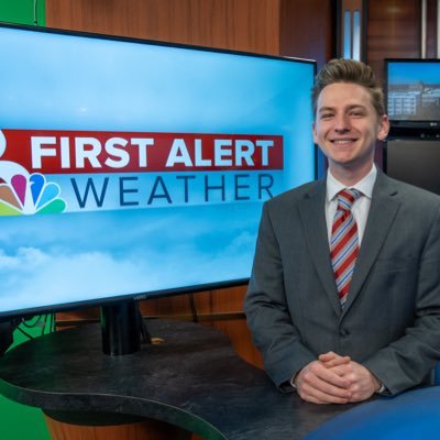
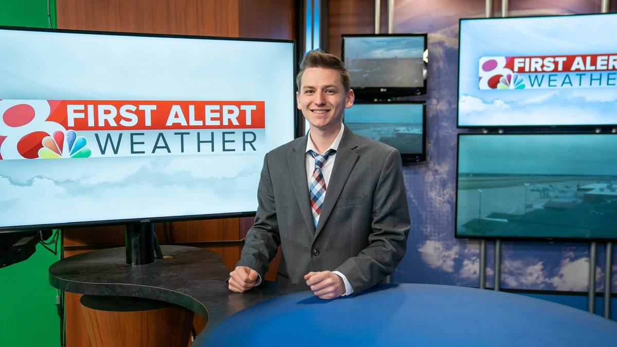
I’m officially a weathercaster (and soon to be #meteorologist) for @KOMUnews! I’ll be getting my Masters Degree from @Mizzou this next school year! I kinda forgot to “officially” post about it! 😁
Andrew Labit tweet media
English
3
0
46
3.5K
Andrew Labit 리트윗함
NWS St. Louis
NWS St. Louis@NWSStLouis·
A strong EF-2 tornado developed near Villa Ridge and moved northeast for over 13 miles to just north of Fox Creek Friday evening. Maximum estimated wind speeds were 130 mph. Storm surveys are continuing. #stlwx #mowx
NWS St. Louis tweet media
English
5
71
300
33.3K
Andrew Labit 리트윗함
NWS St. Louis
NWS St. Louis@NWSStLouis·
Damage surveys have confirmed an EF-1 tornado that occured Thursday evening, from Elmont, MO to the southern outskirts of Union, MO in Franklin County. Damage surveys for several other possible tornadoes continue today, and likely several more days. #MOwx #ILwx #STLwx
NWS St. Louis tweet media
English
6
45
175
21.7K
Andrew Labit 리트윗함
Matt Devitt
Matt Devitt@MattDevittWX·
NEW VIDEO: I’m in Pensacola, Florida, near the border. Already at 2” and it’s still snowing heavy. This is a truly historic event. #Snow #Florida @spann @stormhour
English
2.6K
10.7K
66.6K
8.1M
Andrew Labit 리트윗함
NWS St. Louis
NWS St. Louis@NWSStLouis·
A range of winter precipitation types are expected across the region late Saturday, Sunday and early Monday. Details are expected to become clearer through the day Friday. Travel should be avoided Sunday, if at all possible. #mowx #ilwx #stlwx
NWS St. Louis tweet media
English
2
34
148
26.3K
Ryan Hall, Y’all
Ryan Hall, Y’all@ryanhallyall·
We’ve invested significantly in our production control room to implement features that allow us to go live more often & with less prep time while still offering top of the line coverage. The goal is to always be there when we need to be, even on somewhat lower risk & last minute events, without reducing quality. I’ve got a forecast video going up in a few hours & then after that I’ll be going LIVE for members only discussing the new updates with @BradArnoldWX who is visiting the wx house!
English
141
171
3K
129.1K
Andrew Labit
Andrew Labit@AndrewLabitWX·
@NHC_Atlantic Wow. First one and it’s a cat 5…truly terrifying and incredible
English
0
0
11
1.9K
National Hurricane Center
National Hurricane Center@NHC_Atlantic·
Hurricane #Beryl Advisory 14: Beryl Becomes a Potentially Catastrophic Category 5 Hurricane In the Eastern Caribbean. Expected to Bring Life-Threatening Winds and Storm Surge To Jamaica Later This Week. hurricanes.gov
English
146
2.2K
5.1K
1M
Andrew Labit
Andrew Labit@AndrewLabitWX·
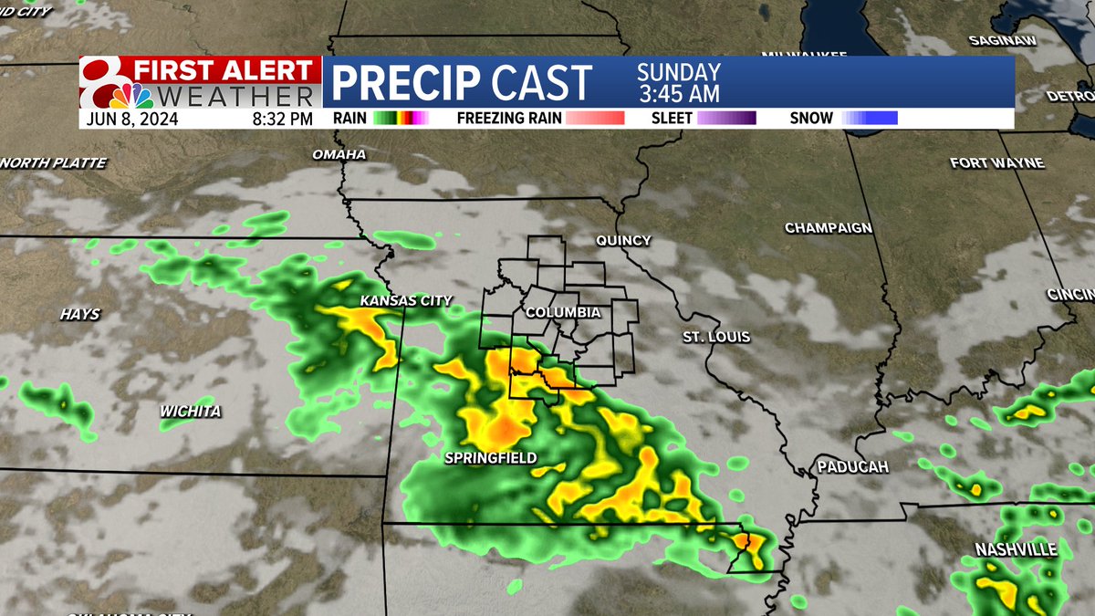
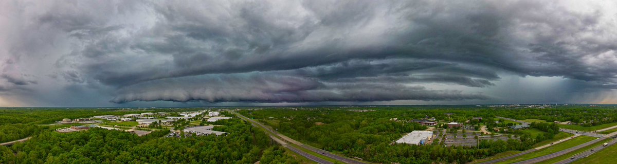
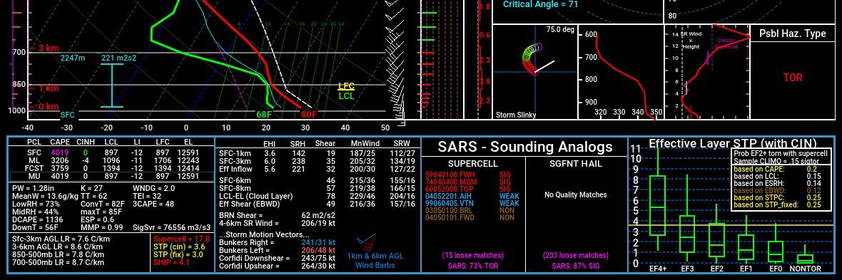
A severe thunderstorm watch has been issued across southern parts of central Missouri. These storms look to be very isolated so many of us will be staying dry (especially if you're north of I-70). Full detail at 6pm and @MicahStevensWx has you for 9 & 10!
Andrew Labit tweet media
English
1
3
7
1.4K
Andrew Labit
Andrew Labit@AndrewLabitWX·
Awesome to meet and talk to ya @ReedTimmerUSA! You and your team are freakin awesome! Crazy to meet you in Sidney, ND of all places. Now time to go chase some photogenic 🌪️
Andrew Labit tweet media
English
0
0
10
286
Andrew Labit 리트윗함
Kesley Kobielusz
Kesley Kobielusz@kesley_wx·
For the first time since September 30, 2023, COU has reached above 90 degrees (that's 257 days with temps below 90)! Temps in the 90s will stick around through the next week. #midmowx #midmo #Mowx
Kesley Kobielusz tweet media
English
1
5
5
1.2K
Andrew Labit
Andrew Labit@AndrewLabitWX·
@KOMUnews Camden, Morgan, Miller, and Maries county should expect the largest amount of rainfall. Showers expected to continue heading into early Sunday morning!
Andrew Labit tweet media
English
0
2
3
404
Andrew Labit
Andrew Labit@AndrewLabitWX·
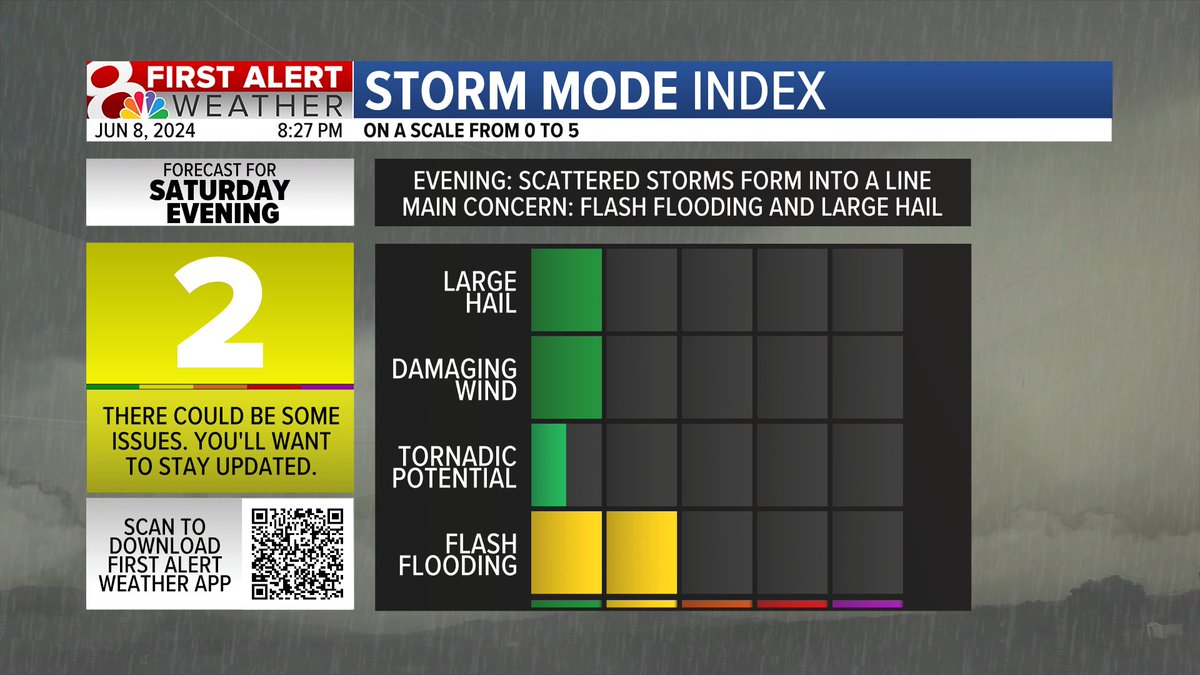
Watching for overnight thunderstorm chances south of I-70! Mainly worried about flash flooding due to thunderstorms rolling over the same area throughout the night. Can't rule out some hail or strong wind gusts. #mowx #midmowx
Andrew Labit tweet media
English
1
3
7
2.3K
Andrew Labit
Andrew Labit@AndrewLabitWX·
@MrBeast Getting 2 million subscribers in a single day is insane. He just passed some YouTube channels entire lifetime in 24hrs
English
0
0
1
29
MrBeast
MrBeast@MrBeast·
Yesterday was the most subscribers we’ve ever gotten in a day 😮
MrBeast tweet media
English
2.2K
2K
90.4K
5M
MrBeast
MrBeast@MrBeast·
After 6 years we have finally avenged Pewdiepie 🥹
MrBeast tweet media
English
15.4K
52.1K
835.1K
46.3M
Andrew Labit
Andrew Labit@AndrewLabitWX·
Strong to severe storms expected to make an entrance late Saturday night into early Sunday morning. We're in Storm Mode 2 for large hail, damaging winds, and flooding concerns as the primary threats. Lots of lighting with these storms too..maybe not the best night to go camping🏕️
Andrew Labit tweet media
English
0
0
2
102
Andrew Labit 리트윗함
Matt Beckwith
Matt Beckwith@KOMUMatt·
Storm Mode: 11PM Monday- 5AM Tuesday. A line of storms will bring the potential for damaging wind gusts and possibly a few tornado, especially over western Missouri. Have a way to get warnings tonight that will wake you up! #MidMoWx #MoWx #MidMo @KOMUnews
Matt Beckwith tweet media
English
1
3
10
1.9K
Andrew Labit 리트윗함
NWS St. Louis
NWS St. Louis@NWSStLouis·
An EF-1 tornado formed shortly before 11pm on Saturday, 4/27 northeast of Tipton, MO along Alexander Rd, causing damage to both structures and trees before dissipating a minute later. #mowx #midmowx
NWS St. Louis tweet media
English
0
25
80
12.7K
Andrew Labit 리트윗함
Micah Stevens
Micah Stevens@MicahStevensWx·
View from Columbia! @NWSStLouis
Micah Stevens tweet media
Missouri, USA 🇺🇸 English
2
2
9
705