
James Spann
336.5K posts
James Spann
@spann
AMS Certified Broadcast Meteorologist. WeatherBrains host. Instagram: spannwx
The Deep South Katılım Haziran 2008
48K Takip Edilen552K Takipçiler


The man, the myth, the weather legend took Madison by storm this weekend, throwing out the ceremonial first pitch for the Rocket City Trash Pandas.
@spann stood on the pitcher’s mound at Toyota Field Saturday night, a little over a month after the original event — James Spann Bobblehead Night — was postponed due to weather. Ironically.
Read full story: yellowhammernews.com/james-spann-th…
#Alabama #Spann #TrashPandas

English
James Spann retweetledi


Showers rotating through Alabama this evening will fade away tonight…
English
Another good example of a scud cloud today.
Scud clouds (also called fractus) form beneath rain showers or thunderstorms when warm, humid air is drawn upward into the storm. They often appear ragged and can rise rapidly. A scud cloud like this can exhibit some spinning or twisting because of turbulent air or localized wind shear. This rotation is usually shallow, disorganized, and does not indicate a tornado is forming.
Remember, motion alone doesn’t make a tornado. Rotation alone doesn’t make a tornado. You need persistent, organized rotation associated with the storm’s updraft before tornado development becomes a concern.
Video from Dillyn Chancey
English
James Spann retweetledi


James Spann retweetledi


James Spann retweetledi

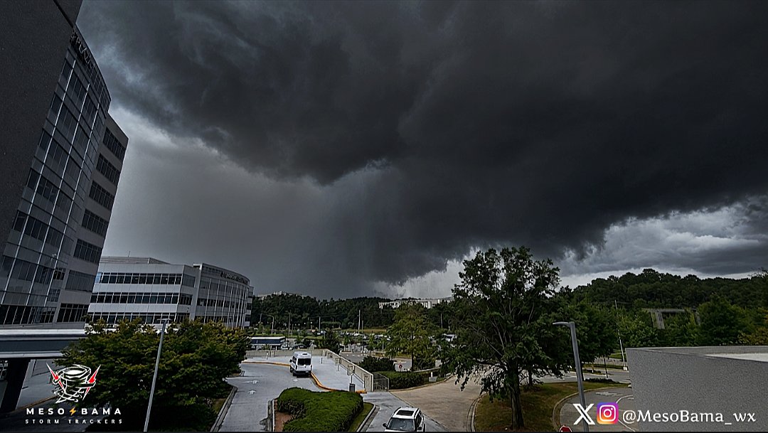
Ominous looking storm over Birmingham Metro seen from Grandview Medical Center. #ALwx @spann @CarlynsWx @AlabamaWXNet @rblackwell_wx @weswyattweather @TaylorSaralloWX @mattdanielwx @Dave_Nussbaum
English
Showers and a few thunderstorms continue across Alabama this evening… Nothing severe, but a few spots are getting heavy rain.
English
James Spann retweetledi

@spann watching World Cup on cruise ship in Greece with tons of Spain and France fans is really something else!


English
Afternoon showers/storms should be fewer in number across Alabama over the latter half of the week... get forecast details on today's afternoon briefing: youtube.com/live/POPXoZhF2…

YouTube
English
Showers and a few thunderstorms are rotating around an upper low over MS/AL this afternoon. No risk of severe storms, but a few spots are seeing heavy rain.
English
James Spann retweetledi

James Spann retweetledi


Showers and a few thunderstorms will continue to develop across Alabama over the next several hours…
English
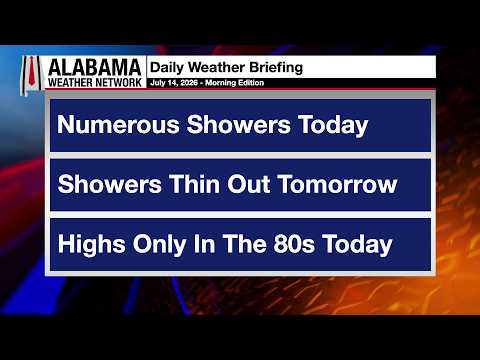
Scattered to numerous showers/storms are likely across Alabama again today; they will thin out over the latter half of the week. Forecast details are on today's morning briefing: youtube.com/live/4vtyCRoF9…
YouTube
English
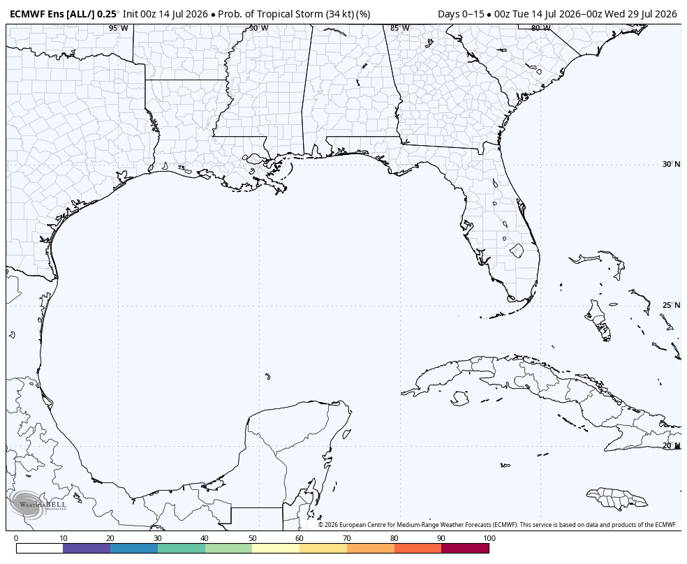
TROPICS: Tropical storm formation is not expected at least for the next seven days. Models have totally backed off on the idea of a broad tropical low in the northern Gulf next week.

English
James Spann retweetledi


Showers and a few thunderstorms continue to rotate around the upper low over Alabama tonight…
English
James Spann retweetledi

Looking south from Charlestown, IN… after sunset illumination of storm clouds in Kentucky. @MarcWeinbergWX @WLKYJayCardosi @BenPeineWeather @BGoodeWAVE3 @TawanaAndrew @spann @jloganwxguy @WeatherNation @WLKYMoRose @WLKYSusanneH @BryceJonesWx

English
James Spann retweetledi

No 90s anywhere in Alabama today thanks to clouds and rain. Expect more scattered showers and storms tomorrow, nothing severe, then rain chances back off Wednesday and Thursday. By Friday through Sunday, highs return to the lower 90s statewide with the typical summer pattern #alwx #alabamaweather #wx #forecast
English