HarvardMapCollection

4.1K posts

HarvardMapCollection

HarvardMapCollection

@HarvardMapColl

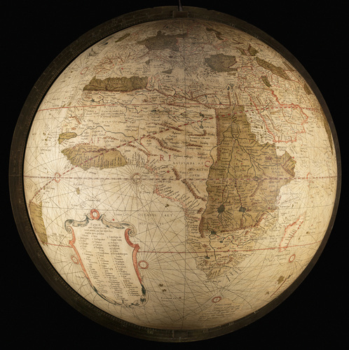
Founded in 1818, the Harvard Map Collection holds over 500k antiquarian & modern maps, and provides gis data and support. Check out our instagram: harvardmaps

Cambridge, Massachusetts, USA 가입일 Nisan 2011
788 팔로잉8.9K 팔로워
HarvardMapCollection 리트윗함
Harvard Library
Harvard Library@HarvardLibrary·
If you’ve ever wished your favorite fictional universe was real, a new @HarvardMapColl exhibition is for you. “From Academieland to Zelda” explores fictional maps from movies, books, video games, and more. Come check it out in-person: buff.ly/3X1M6zn
English
0
5
12
2.8K
HarvardMapCollection
HarvardMapCollection@HarvardMapColl·
The Harvard Map Collection is hiring a Map Librarian. If you enjoy teaching and helping with patron research, check out the job description: bit.ly/HMCMapLibraria…
English
0
4
10
2.9K
HarvardMapCollection
HarvardMapCollection@HarvardMapColl·
@bibliomolly The best place to go is the Academic Technology Group. They have a couple printers and are good with them.
English
0
0
1
0
HarvardMapCollection
HarvardMapCollection@HarvardMapColl·
The #NileRiverDelta, a detail from a large (182 x 110 cm.) multi-sheet 1743 #map by Richard Pococke of #Egypt, which was "Recently Subjected to His Faithful Eyes, Illustrated by His Travels: Adapted to the Norm of Ancient as well as Modern Choreography." #HarvardLibrary
HarvardMapCollection tweet media
English
0
5
17
0
HarvardMapCollection
HarvardMapCollection@HarvardMapColl·
A chart by John Seller from his Atlas Maritimus (circa 1675) depicting all the "narrow seas" that surround the British Isles, along with a sea monster riding merman (Neptune?) hoisting the King's Colours on his bident. #maps #HarvardLibrary
HarvardMapCollection tweet media
English
0
6
30
0
HarvardMapCollection
HarvardMapCollection@HarvardMapColl·
@NV5Geospatial I'm not sure. It's copyright Rand McNally so it's probably in one of their atlases. This is a loose sheet in a folder of unprocessed Raisz material
English
0
0
1
0
HarvardMapCollection
HarvardMapCollection@HarvardMapColl·
Erwin Raisz's "United States and Canada - Physiography" with 6 colors showing different kinds of rock and his signature pictorial method for illustrating landforms #HarvardLibrary #maps
HarvardMapCollection tweet media
English
2
9
50
0