Danielle Lebourgeois 리트윗함
How do rivers actually shape our planet—at a global scale?
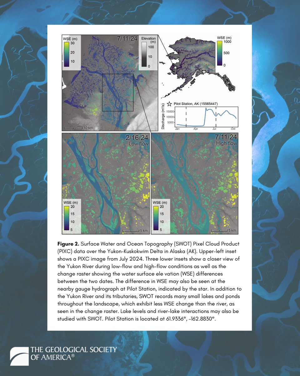
A new study published in GSA Today is changing the way scientists answer that question—using data from NASA’s SWOT satellite to track how rivers erode, transport sediment, and reshape landscapes across Earth.
Traditionally, studying rivers meant detailed (but localized) fieldwork. Now, this research shows how we can monitor river dynamics worldwide—from shifting channels and sediment transport to knickpoints, floods, and even dam failures—all in near real time.
In this new era of fluvial geomorphology where we can connect local river processes to global patterns, we can also better understand risks to infrastructure, ecosystems, and communities.
This work is already gaining broader attention and has been featured in MSN and Yahoo News—but the full story and the science behind it starts with the original paper: geosociety.co/Stroud_et_al
#NASA #RemoteSensing #Geomorphology

English